Sibley is a city in Barnes County, North Dakota, United States. The population was 19 at the 2020 census. Sibley was founded in 1959.
| Name: | Sibley city |
|---|---|
| LSAD Code: | 25 |
| LSAD Description: | city (suffix) |
| State: | North Dakota |
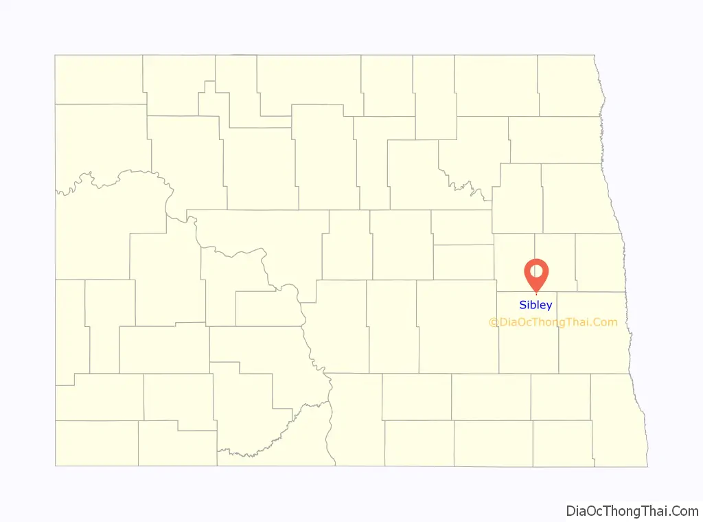
| County: | Barnes County |
| Founded: | 1959 |
| Elevation: | 1,273 ft (388 m) |
| Total Area: | 0.04 sq mi (0.12 km²) |
| Land Area: | 0.04 sq mi (0.12 km²) |
| Water Area: | 0.00 sq mi (0.00 km²) |
| Total Population: | 19 |
| Population Density: | 422.22/sq mi (163.23/km²) |
| ZIP code: | 58429 |
| Area code: | 701 |
| FIPS code: | 3872820 |
| GNISfeature ID: | 1032073 |
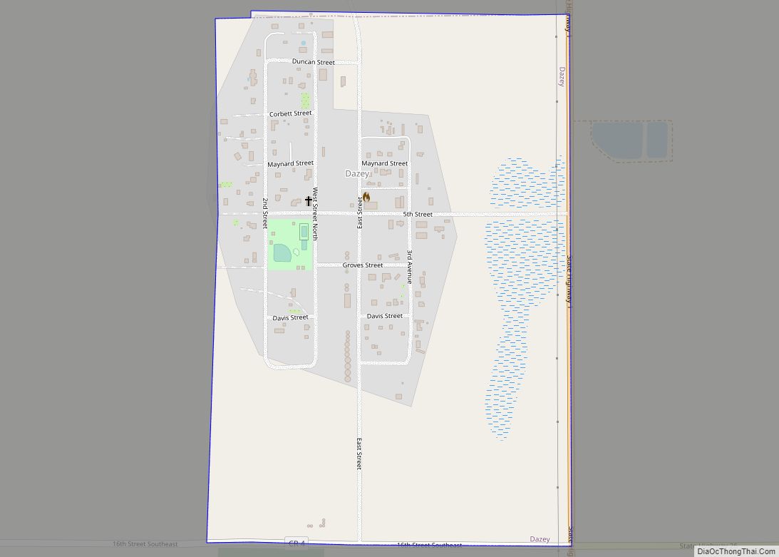
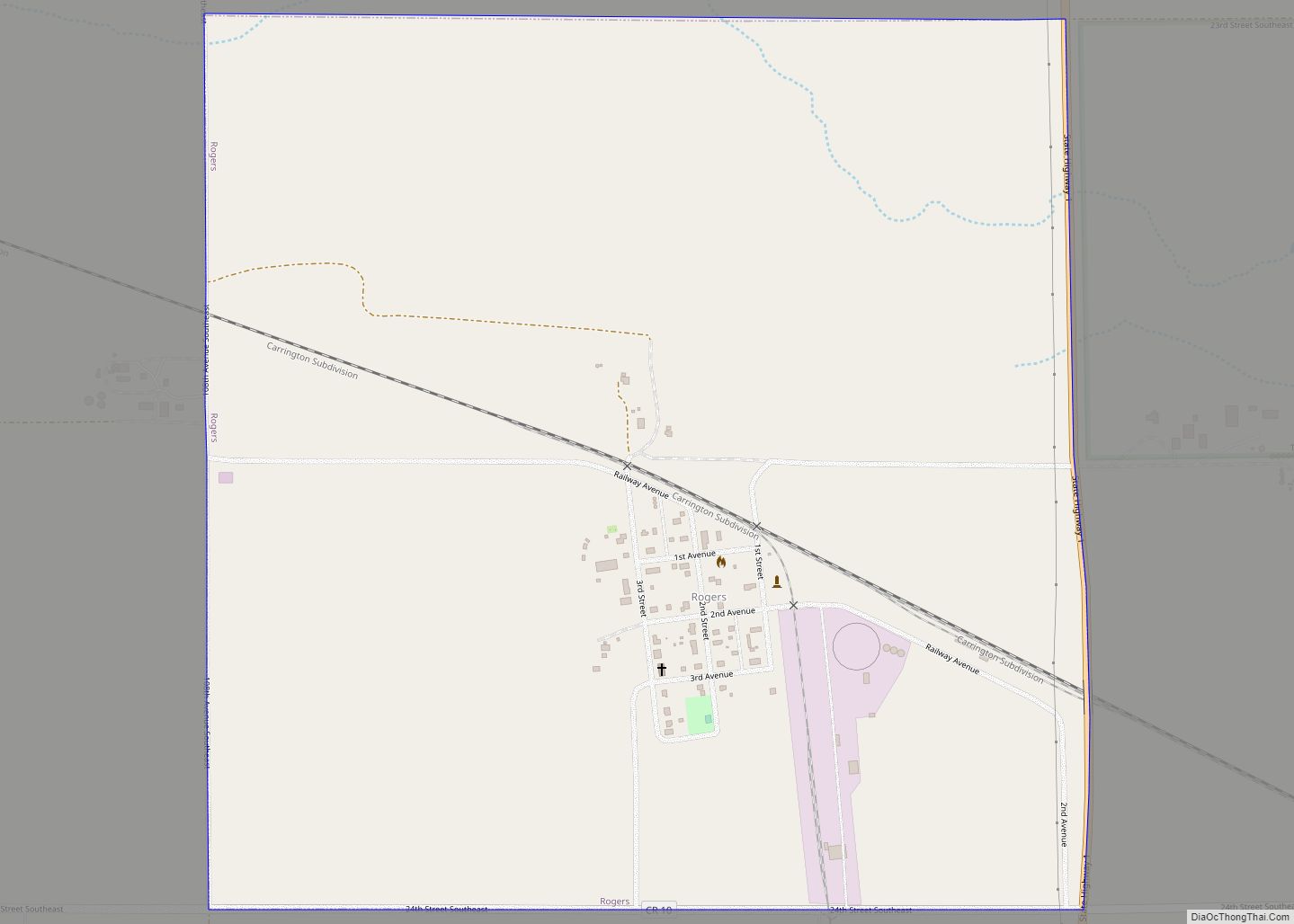
Online Interactive Map
Click on ![]() to view map in "full screen" mode.
to view map in "full screen" mode.
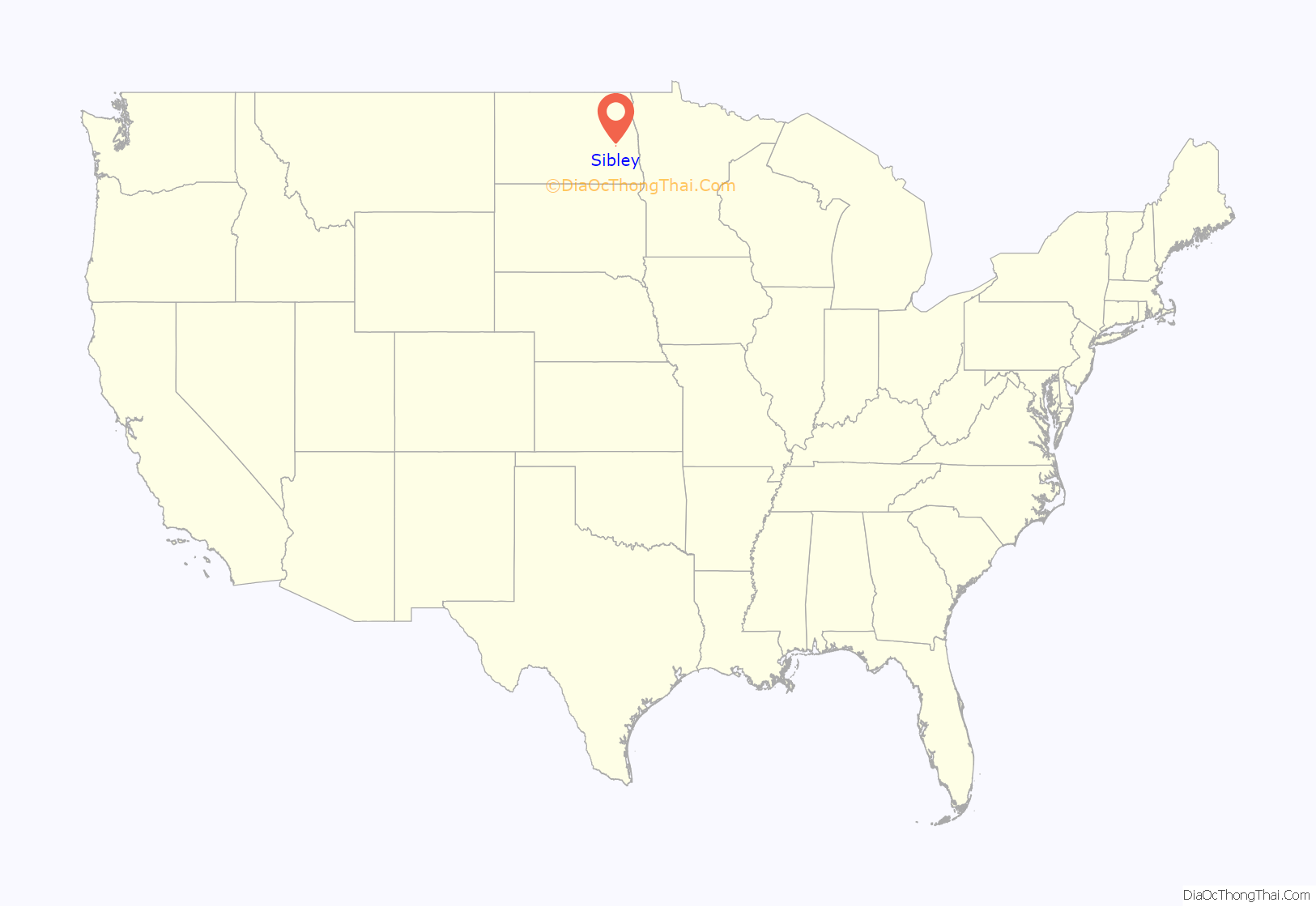
Sibley location map. Where is Sibley city?
History
Sibley was created by Eddie and Edythe Hagglund beginning in 1954, when they observed the popularity of the nearby Lake Ashtabula and decided that a hamburger restaurant would be profitable. Therefore, they purchased some land near the lake and began to erect buildings: a dance hall, the restaurant, and many others. The city was incorporated after a dispute with authorities of Sibley Trail Township: although the Hagglunds wanted a liquor license, the township authorities would not grant one, so the Hagglunds incorporated the city. It was named after Henry Hastings Sibley, a general and the first Governor of Minnesota.
In the 1970s, the Hagglunds sold the majority of the city to others, keeping the core businesses. They retained the business core of the city for many years, even after Eddie’s death, but in 2007, Edythe announced the upcoming sale of the remaining parts of the city at auction.
Sibley Road Map
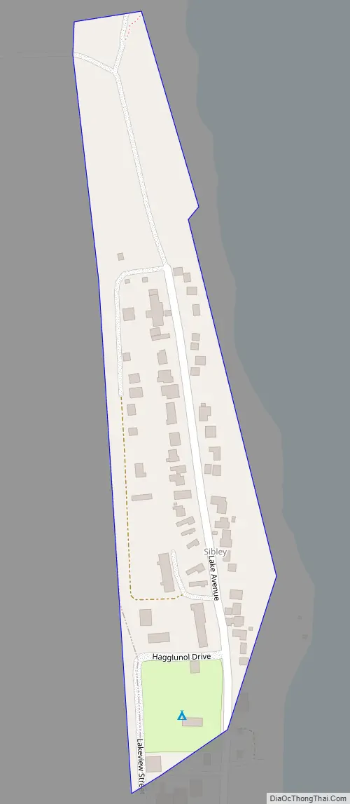
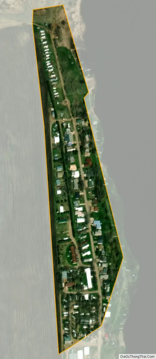
Sibley city Satellite Map
Geography
Sibley is located at 47°12′53″N 97°57′55″W / 47.21472°N 97.96528°W / 47.21472; -97.96528 (47.214858, -97.965218).
According to the United States Census Bureau, the city has a total area of 0.04 square miles (0.10 km), all land.
See also
Map of North Dakota State and its subdivision:- Adams
- Barnes
- Benson
- Billings
- Bottineau
- Bowman
- Burke
- Burleigh
- Cass
- Cavalier
- Dickey
- Divide
- Dunn
- Eddy
- Emmons
- Foster
- Golden Valley
- Grand Forks
- Grant
- Griggs
- Hettinger
- Kidder
- Lamoure
- Logan
- McHenry
- McIntosh
- McKenzie
- McLean
- Mercer
- Morton
- Mountrail
- Nelson
- Oliver
- Pembina
- Pierce
- Ramsey
- Ransom
- Renville
- Richland
- Rolette
- Sargent
- Sheridan
- Sioux
- Slope
- Stark
- Steele
- Stutsman
- Towner
- Traill
- Walsh
- Ward
- Wells
- Williams
- Alabama
- Alaska
- Arizona
- Arkansas
- California
- Colorado
- Connecticut
- Delaware
- District of Columbia
- Florida
- Georgia
- Hawaii
- Idaho
- Illinois
- Indiana
- Iowa
- Kansas
- Kentucky
- Louisiana
- Maine
- Maryland
- Massachusetts
- Michigan
- Minnesota
- Mississippi
- Missouri
- Montana
- Nebraska
- Nevada
- New Hampshire
- New Jersey
- New Mexico
- New York
- North Carolina
- North Dakota
- Ohio
- Oklahoma
- Oregon
- Pennsylvania
- Rhode Island
- South Carolina
- South Dakota
- Tennessee
- Texas
- Utah
- Vermont
- Virginia
- Washington
- West Virginia
- Wisconsin
- Wyoming