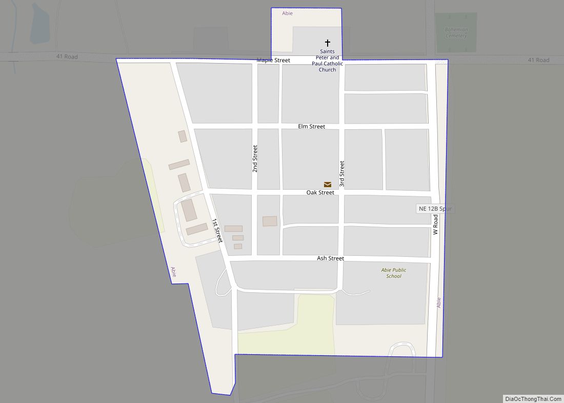
Abie is a village in Butler County, Nebraska, United States. The population was 69 at the 2010 census.
| Name: | Abie village |
|---|---|
| LSAD Code: | 47 |
| LSAD Description: | village (suffix) |
| State: | Nebraska |
| County: | Butler County |
| Elevation: | 1,463 ft (446 m) |
| Total Area: | 0.09 sq mi (0.24 km²) |
| Land Area: | 0.09 sq mi (0.24 km²) |
| Water Area: | 0.00 sq mi (0.00 km²) |
| Total Population: | 65 |
| Population Density: | 698.92/sq mi (270.01/km²) |
| ZIP code: | 68001 |
| Area code: | 402 |
| FIPS code: | 3100205 |
| GNISfeature ID: | 0826891 |
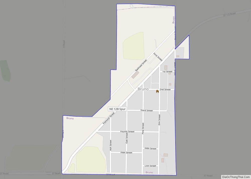
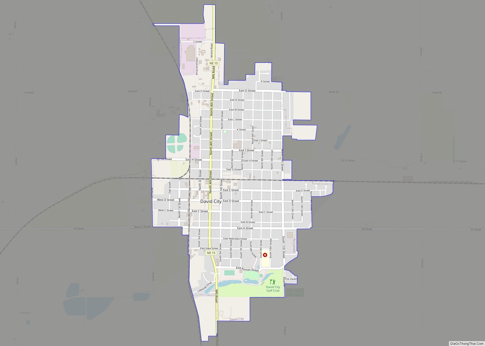
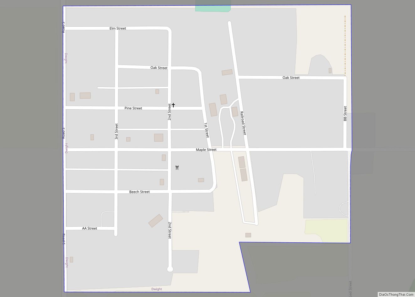
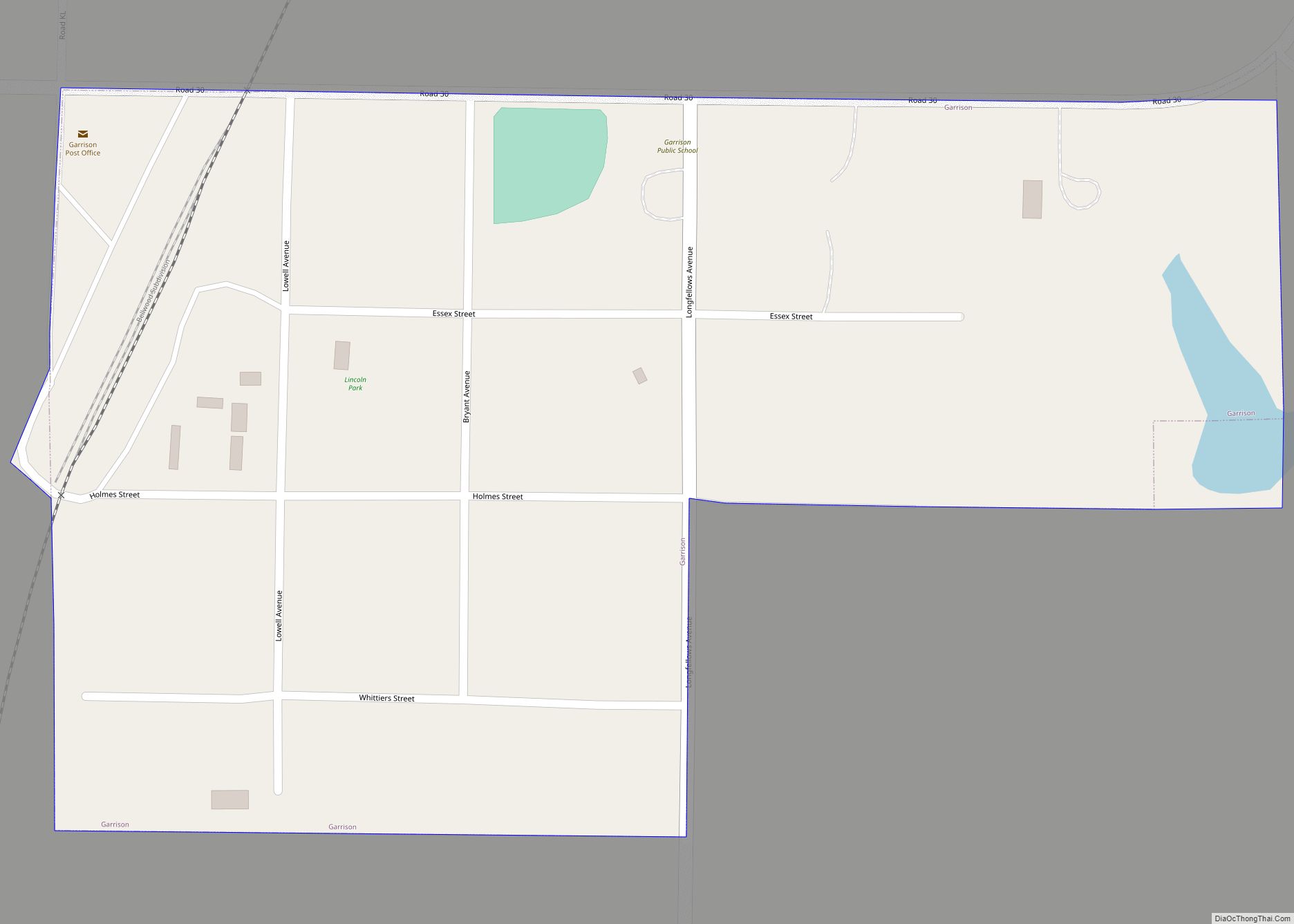
Online Interactive Map
Click on ![]() to view map in "full screen" mode.
to view map in "full screen" mode.
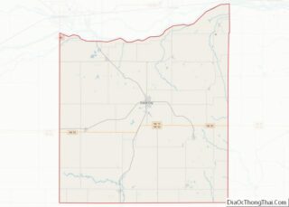
Abie location map. Where is Abie village?


History
The book Butler County Nebraska History records that the first settlers in the area were “Yankees”. When the Yankees moved out, the German people moved in. They too left to find more level ground. The Czech immigrants first went to Linwood, then to Abie. A wagon train of 13 families came to Nebraska from Spillville, IA arriving in July 1869. Abie was platted in 1877. Czech people organized their reading and dramatic clubs shortly after their arrival, and many older people still speak Czech. The applicant for the post office, Charles “Yankee” Stevens, successfully petitioned to have the post office named for his wife, Abigail Stevens. Stevens was postmaster of Abie from 1878 to 1888. The Rural Free Delivery was installed in Abie in 1905 with John O. Hasik as carrier. T.B. Semrad succeeded Hasik on April 1, 1940. He carried the mail on that route until July 15, 1945 when it was consolidated with the Linwood route. The first railroad, The Chicago Northwestern was built in Abie in 1887 at which time the old settlement was moved south three-quarters of a mile to the present location in order to be nearer to the railroad. The new village was laid out by the Western Townsite Co. in July 1887. The Catholic cemetery stands in the spot where Abie was originally settled. The railroad started a boom in the area which did not end until 1928, although there were a few periods of hard times.
The boom years lasted until 1928. In this time, Abie grew and was quite a business town. There were two general stores, a meat market, hardware-implement business, two grain elevators, two lumber yards, two blacksmith shops, a livery stable and dray service. Later on there were two service garages, a trucking firm, a bulk oil agency, two taverns, a barbershop and a beauty shop.
The Bank was built in 1904. The first school was built in 1877 but was replaced by a larger building in 1905. Abie’s school has since closed and is now home to Abie’s Place, a small town cafe serving up Czech meals and baking. The Abie milling company was also incorporated in 1905. They manufactured the White Lily and Pride of Nebraska wheat flours and Rye Flours. The Abie Flour was known for its high standard of quality and its use exclusively in the area. The flour was also marketed in Omaha, Fremont, Schuyler, Howells, Prague and other surrounding cities and towns. The city hall was built in 1912. The Parish Hall was built in 1923. Ted Sokol Hall was built in 1924. The Church was built in 1918. The Ted Sokol organization was started in about 1921. This is a group that teaches gymnastics and Czech dances to young people. The Sokol Auditorium was dedicated in June 1923. It served as a community center until it closed in 2017. The building still stands but is no longer available for activities.
Despite a few fires and floods in the past. Abie has maintained a large number of its historic structures. These were surveyed in 1980 by the Nebraska State Historical Society. Despite the loss of the railroad in 1962, the local elevator and a few Abie businesses continue to operate.
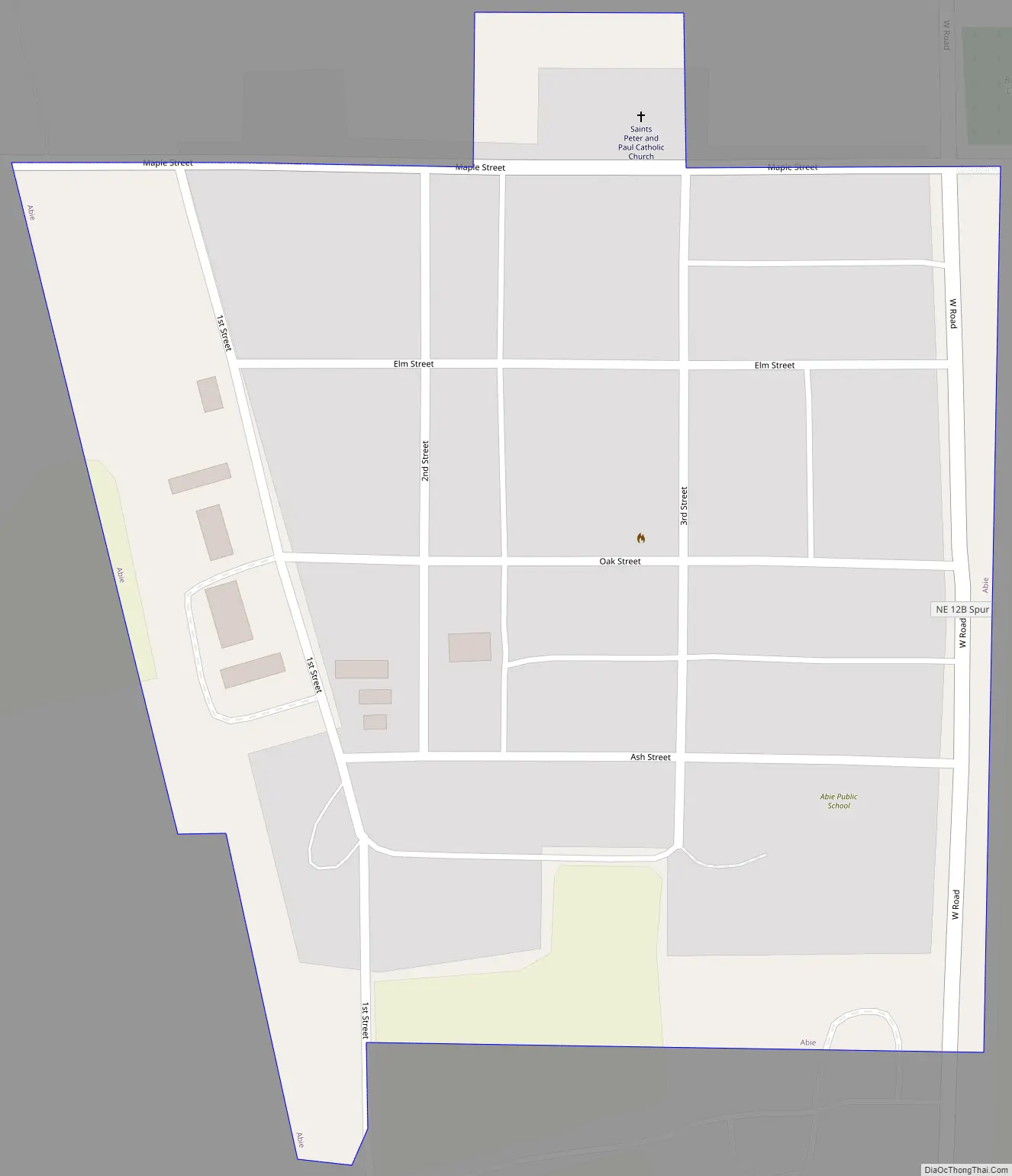
Abie Road Map
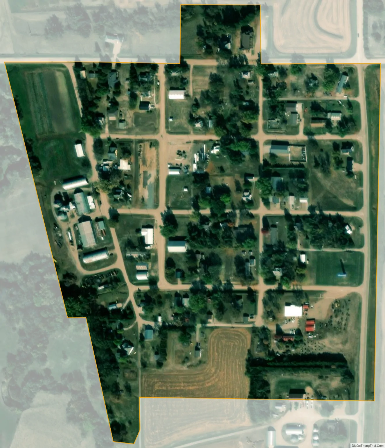
Abie city Satellite Map
Geography
Abie is located at 41°20′5″N 96°56′59″W / 41.33472°N 96.94972°W / 41.33472; -96.94972 (41.334744, -96.949657).
According to the United States Census Bureau, the village has a total area of 0.11 square miles (0.28 km), all land.
See also
Map of Nebraska State and its subdivision:- Adams
- Antelope
- Arthur
- Banner
- Blaine
- Boone
- Box Butte
- Boyd
- Brown
- Buffalo
- Burt
- Butler
- Cass
- Cedar
- Chase
- Cherry
- Cheyenne
- Clay
- Colfax
- Cuming
- Custer
- Dakota
- Dawes
- Dawson
- Deuel
- Dixon
- Dodge
- Douglas
- Dundy
- Fillmore
- Franklin
- Frontier
- Furnas
- Gage
- Garden
- Garfield
- Gosper
- Grant
- Greeley
- Hall
- Hamilton
- Harlan
- Hayes
- Hitchcock
- Holt
- Hooker
- Howard
- Jefferson
- Johnson
- Kearney
- Keith
- Keya Paha
- Kimball
- Knox
- Lancaster
- Lincoln
- Logan
- Loup
- Madison
- McPherson
- Merrick
- Morrill
- Nance
- Nemaha
- Nuckolls
- Otoe
- Pawnee
- Perkins
- Phelps
- Pierce
- Platte
- Polk
- Red Willow
- Richardson
- Rock
- Saline
- Sarpy
- Saunders
- Scotts Bluff
- Seward
- Sheridan
- Sherman
- Sioux
- Stanton
- Thayer
- Thomas
- Thurston
- Valley
- Washington
- Wayne
- Webster
- Wheeler
- York
- Alabama
- Alaska
- Arizona
- Arkansas
- California
- Colorado
- Connecticut
- Delaware
- District of Columbia
- Florida
- Georgia
- Hawaii
- Idaho
- Illinois
- Indiana
- Iowa
- Kansas
- Kentucky
- Louisiana
- Maine
- Maryland
- Massachusetts
- Michigan
- Minnesota
- Mississippi
- Missouri
- Montana
- Nebraska
- Nevada
- New Hampshire
- New Jersey
- New Mexico
- New York
- North Carolina
- North Dakota
- Ohio
- Oklahoma
- Oregon
- Pennsylvania
- Rhode Island
- South Carolina
- South Dakota
- Tennessee
- Texas
- Utah
- Vermont
- Virginia
- Washington
- West Virginia
- Wisconsin
- Wyoming