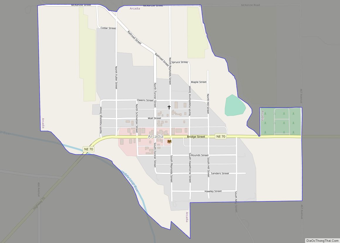
Arcadia is a village in Valley County, Nebraska, United States. The population was 311 at the 2010 census.
| Name: | Arcadia village |
|---|---|
| LSAD Code: | 47 |
| LSAD Description: | village (suffix) |
| State: | Nebraska |
| County: | Valley County |
| Elevation: | 2,162 ft (659 m) |
| Total Area: | 0.57 sq mi (1.48 km²) |
| Land Area: | 0.57 sq mi (1.48 km²) |
| Water Area: | 0.00 sq mi (0.00 km²) |
| Total Population: | 283 |
| Population Density: | 495.62/sq mi (191.31/km²) |
| ZIP code: | 68815 |
| Area code: | 308 |
| FIPS code: | 3101850 |
| GNISfeature ID: | 0827040 |
Online Interactive Map
Click on ![]() to view map in "full screen" mode.
to view map in "full screen" mode.
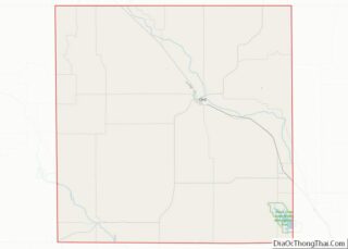
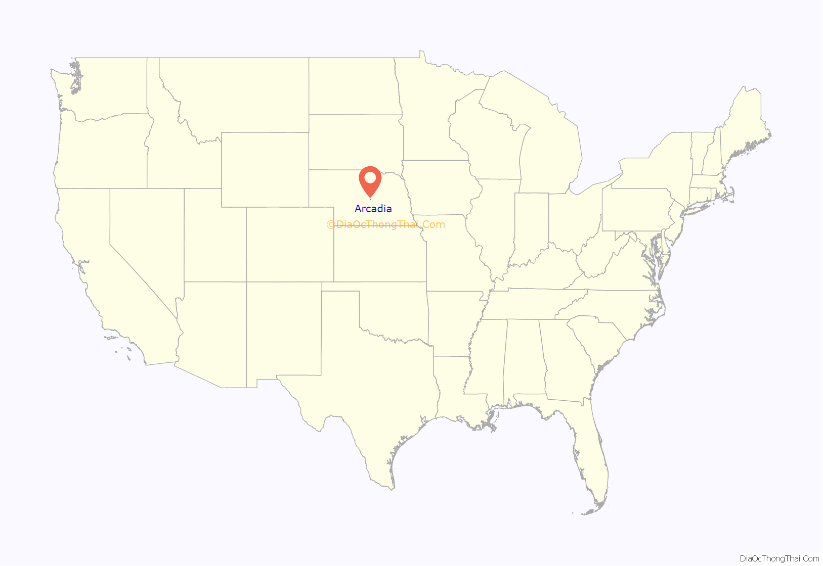
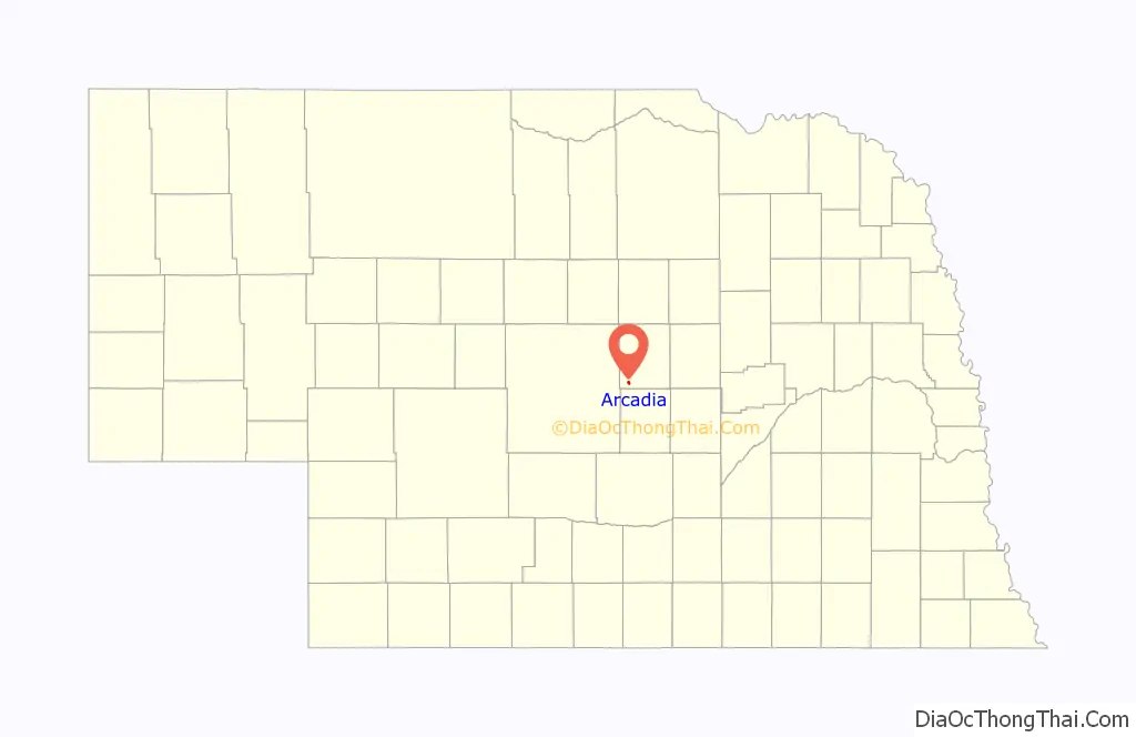
Arcadia location map. Where is Arcadia village?
History
Arcadia was platted in 1885 when it was certain that the railroad would soon be extended to that point. The name was apparently chosen by the postmaster, Sarah Coulter Hawthorne, in 1874 in reference to the wild roses which were common to the area as she mistakenly believed the name to mean “feast of flowers.”
Arcadia Road Map
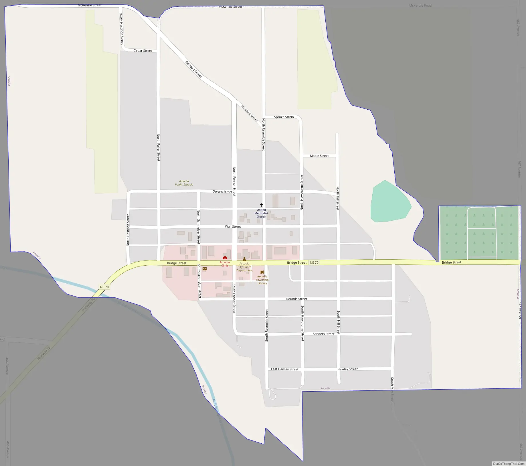
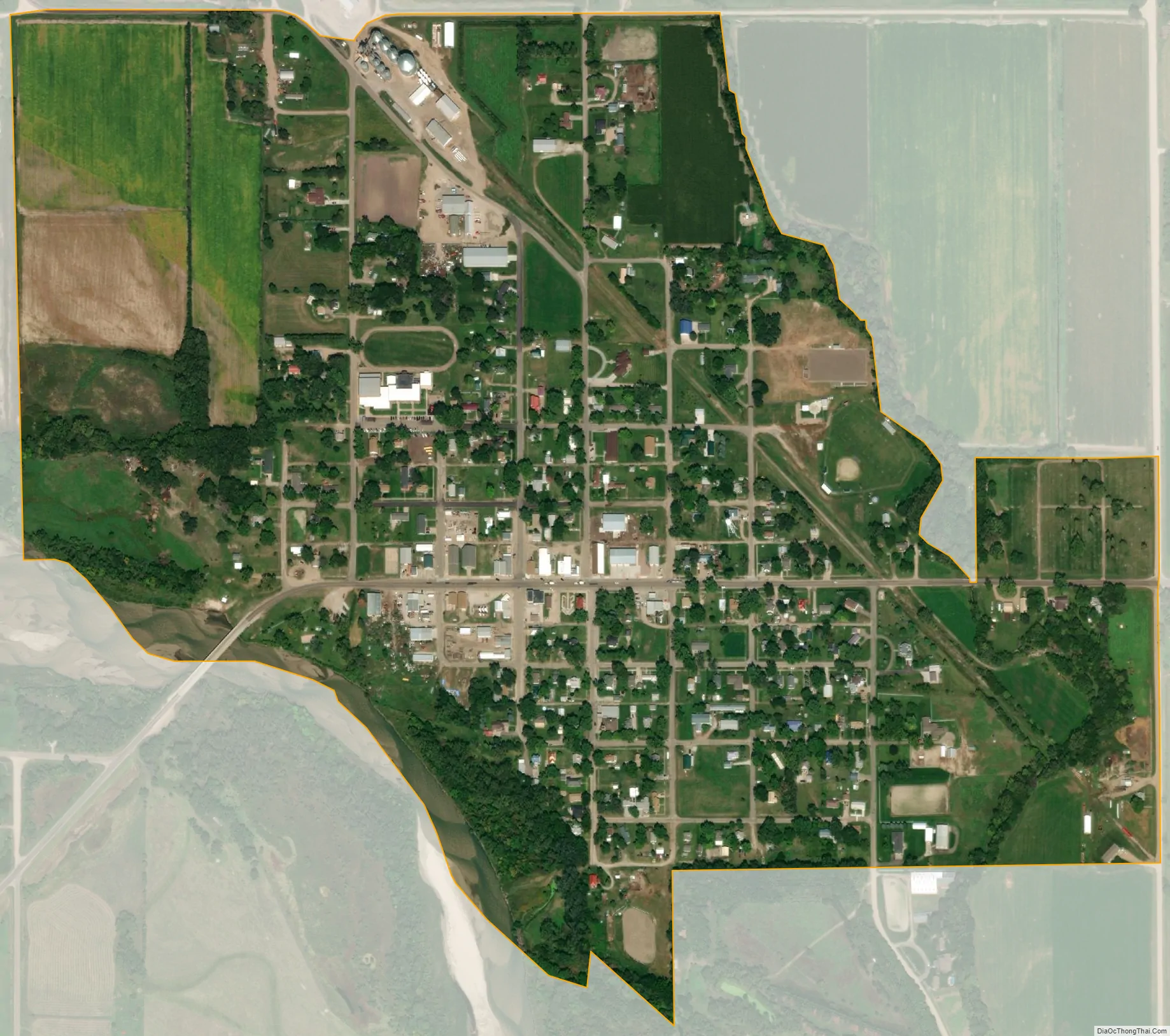
Arcadia city Satellite Map
Geography
Arcadia is located at 41°25′26″N 99°7′29″W / 41.42389°N 99.12472°W / 41.42389; -99.12472 (41.423839, -99.124752). According to the United States Census Bureau, the village has a total area of 0.57 square miles (1.48 km), all of it land.
See also
Map of Nebraska State and its subdivision:- Adams
- Antelope
- Arthur
- Banner
- Blaine
- Boone
- Box Butte
- Boyd
- Brown
- Buffalo
- Burt
- Butler
- Cass
- Cedar
- Chase
- Cherry
- Cheyenne
- Clay
- Colfax
- Cuming
- Custer
- Dakota
- Dawes
- Dawson
- Deuel
- Dixon
- Dodge
- Douglas
- Dundy
- Fillmore
- Franklin
- Frontier
- Furnas
- Gage
- Garden
- Garfield
- Gosper
- Grant
- Greeley
- Hall
- Hamilton
- Harlan
- Hayes
- Hitchcock
- Holt
- Hooker
- Howard
- Jefferson
- Johnson
- Kearney
- Keith
- Keya Paha
- Kimball
- Knox
- Lancaster
- Lincoln
- Logan
- Loup
- Madison
- McPherson
- Merrick
- Morrill
- Nance
- Nemaha
- Nuckolls
- Otoe
- Pawnee
- Perkins
- Phelps
- Pierce
- Platte
- Polk
- Red Willow
- Richardson
- Rock
- Saline
- Sarpy
- Saunders
- Scotts Bluff
- Seward
- Sheridan
- Sherman
- Sioux
- Stanton
- Thayer
- Thomas
- Thurston
- Valley
- Washington
- Wayne
- Webster
- Wheeler
- York
- Alabama
- Alaska
- Arizona
- Arkansas
- California
- Colorado
- Connecticut
- Delaware
- District of Columbia
- Florida
- Georgia
- Hawaii
- Idaho
- Illinois
- Indiana
- Iowa
- Kansas
- Kentucky
- Louisiana
- Maine
- Maryland
- Massachusetts
- Michigan
- Minnesota
- Mississippi
- Missouri
- Montana
- Nebraska
- Nevada
- New Hampshire
- New Jersey
- New Mexico
- New York
- North Carolina
- North Dakota
- Ohio
- Oklahoma
- Oregon
- Pennsylvania
- Rhode Island
- South Carolina
- South Dakota
- Tennessee
- Texas
- Utah
- Vermont
- Virginia
- Washington
- West Virginia
- Wisconsin
- Wyoming