Battle Creek is a city in Madison County, Nebraska, United States. It is part of the Norfolk, Nebraska Micropolitan Statistical Area. The population was 1,207 at the 2010 census.
| Name: | Battle Creek city |
|---|---|
| LSAD Code: | 25 |
| LSAD Description: | city (suffix) |
| State: | Nebraska |
| County: | Madison County |
| Elevation: | 1,588 ft (484 m) |
| Total Area: | 0.71 sq mi (1.83 km²) |
| Land Area: | 0.71 sq mi (1.83 km²) |
| Water Area: | 0.00 sq mi (0.00 km²) |
| Total Population: | 1,194 |
| Population Density: | 1,691.22/sq mi (653.40/km²) |
| ZIP code: | 68715 |
| Area code: | 402 |
| FIPS code: | 3103250 |
| GNISfeature ID: | 0827218 |
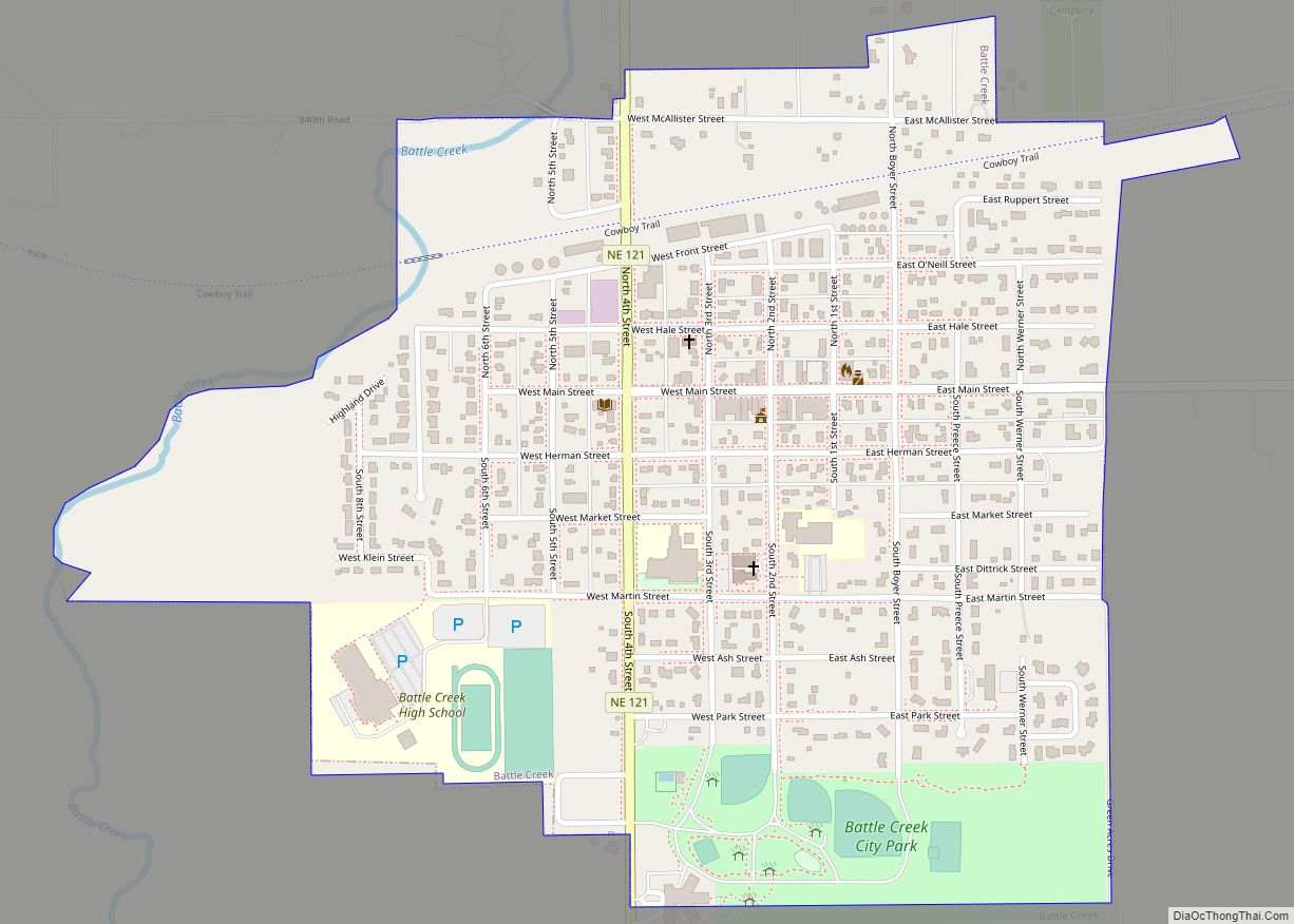
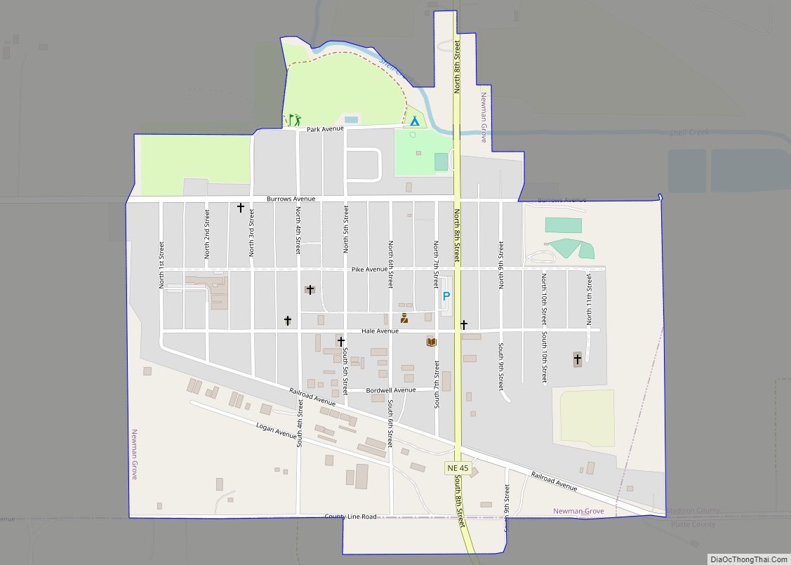
Online Interactive Map
Click on ![]() to view map in "full screen" mode.
to view map in "full screen" mode.
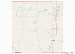
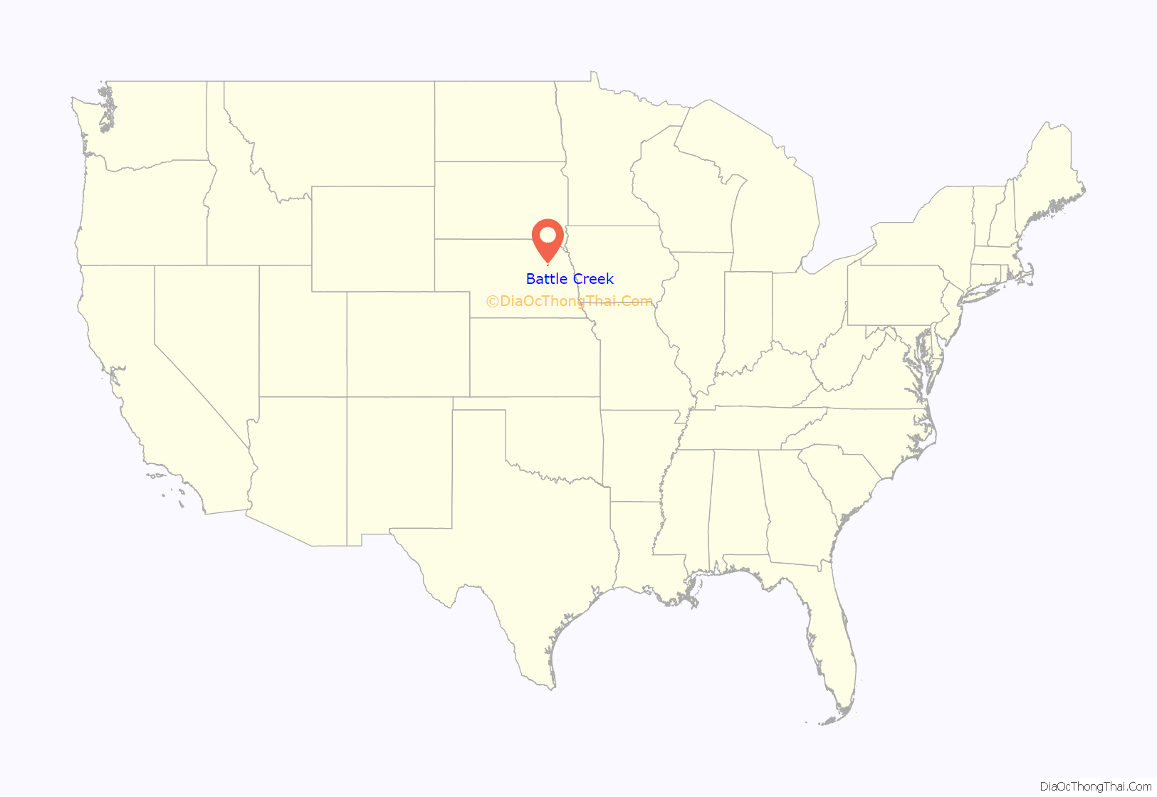
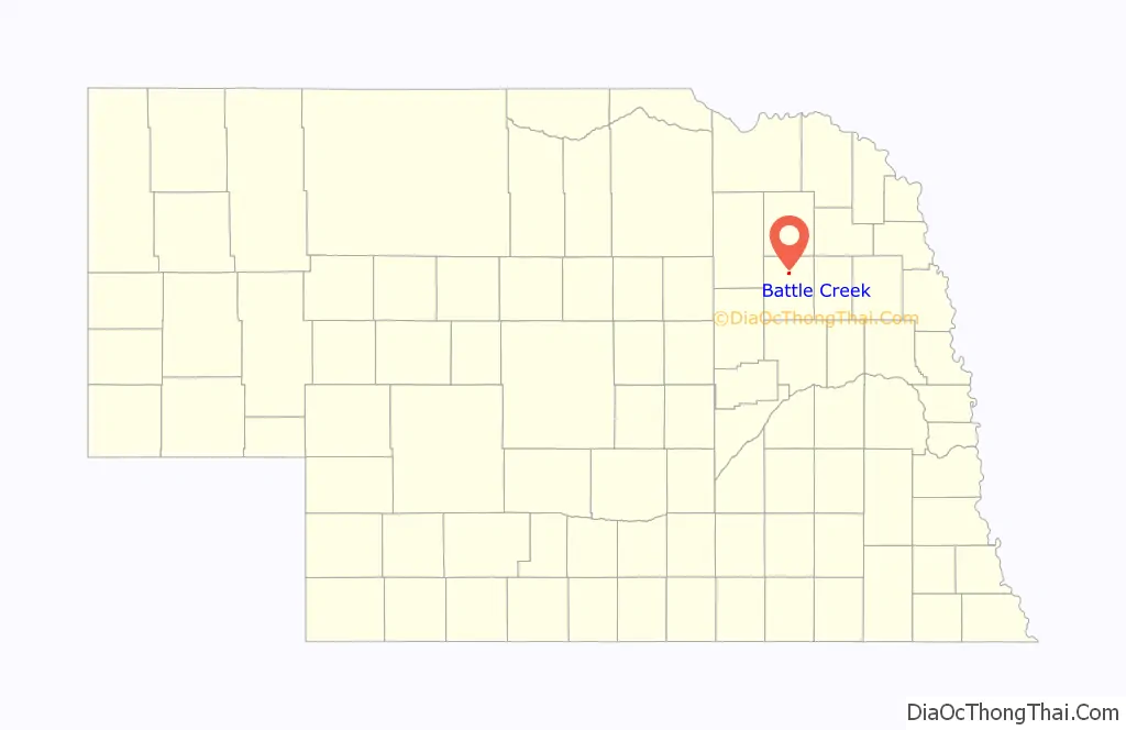
Battle Creek location map. Where is Battle Creek city?
History
In 1859, following complaints of Pawnee depredations against settlers in the Elkhorn River valley, a combined force of Nebraska Territorial Militia under the command of General John Milton Thayer and 2nd U.S. Army Dragoons under Lieutenant Beverly Holcombe Robertson prepared to attack a Pawnee village. Rather than fighting, the Pawnees surrendered before the attack could be launched. Chief Petalesharu draped an American flag over his shoulders and held a peace pipe while confronting the soldiers to stop the fight from taking place, ending the Pawnee War of 1859. Although no battle occurred, the nearby stream was dubbed Battle Creek. The town founded in the area in 1867 took the creek’s name for itself.
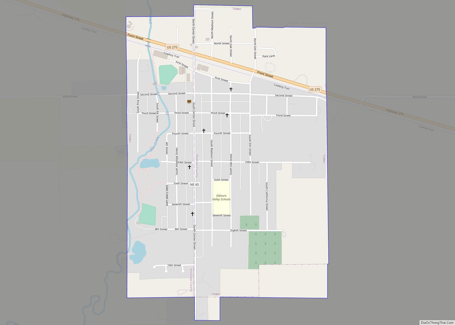
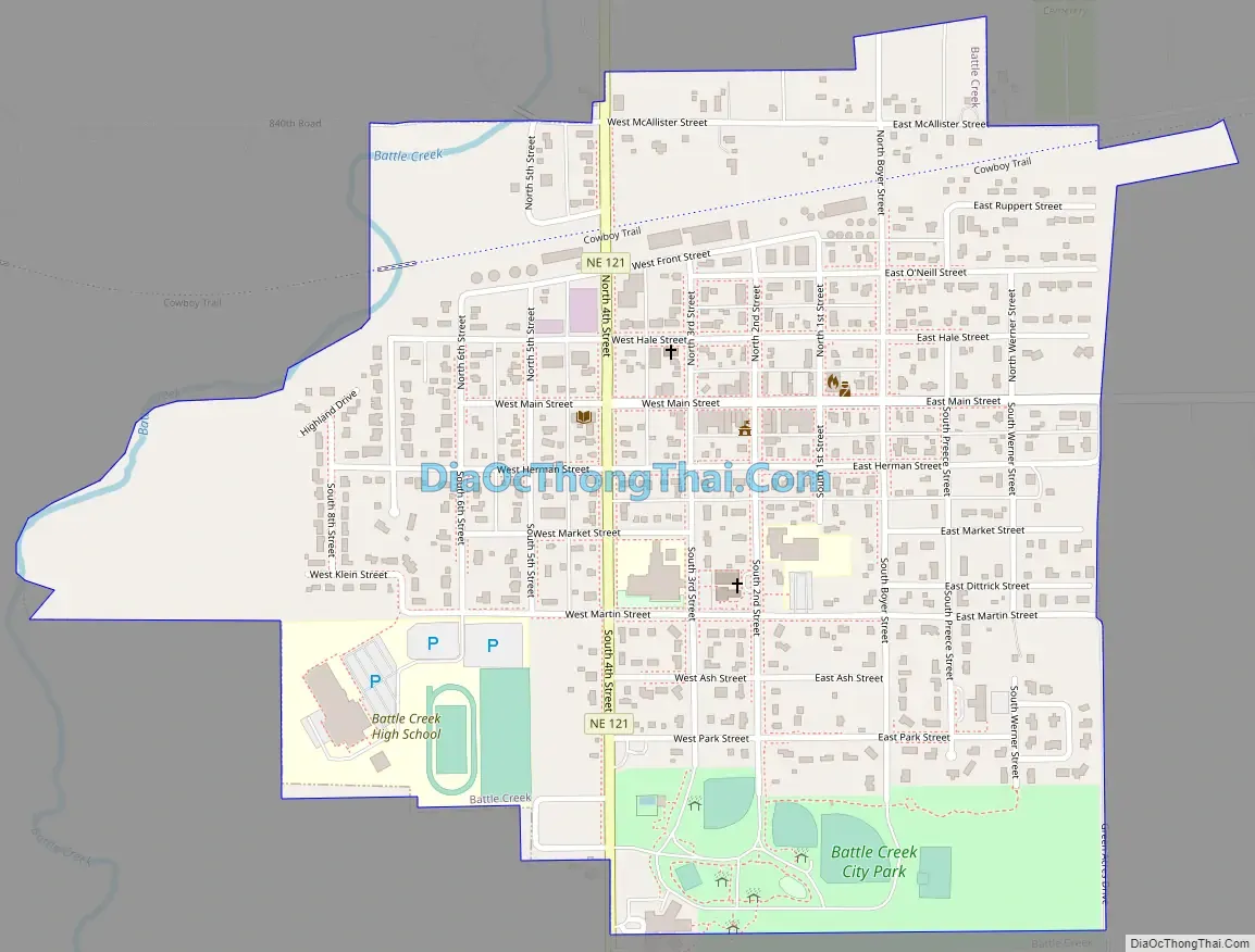
Battle Creek Road Map
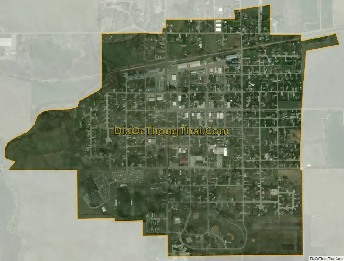
Battle Creek city Satellite Map
Geography
Battle Creek is located at 41°59′57″N 97°35′56″W / 41.99917°N 97.59889°W / 41.99917; -97.59889 (41.999047, -97.599005).
According to the United States Census Bureau, the city has a total area of 0.71 square miles (1.84 km), all land.
See also
Map of Nebraska State and its subdivision:- Adams
- Antelope
- Arthur
- Banner
- Blaine
- Boone
- Box Butte
- Boyd
- Brown
- Buffalo
- Burt
- Butler
- Cass
- Cedar
- Chase
- Cherry
- Cheyenne
- Clay
- Colfax
- Cuming
- Custer
- Dakota
- Dawes
- Dawson
- Deuel
- Dixon
- Dodge
- Douglas
- Dundy
- Fillmore
- Franklin
- Frontier
- Furnas
- Gage
- Garden
- Garfield
- Gosper
- Grant
- Greeley
- Hall
- Hamilton
- Harlan
- Hayes
- Hitchcock
- Holt
- Hooker
- Howard
- Jefferson
- Johnson
- Kearney
- Keith
- Keya Paha
- Kimball
- Knox
- Lancaster
- Lincoln
- Logan
- Loup
- Madison
- McPherson
- Merrick
- Morrill
- Nance
- Nemaha
- Nuckolls
- Otoe
- Pawnee
- Perkins
- Phelps
- Pierce
- Platte
- Polk
- Red Willow
- Richardson
- Rock
- Saline
- Sarpy
- Saunders
- Scotts Bluff
- Seward
- Sheridan
- Sherman
- Sioux
- Stanton
- Thayer
- Thomas
- Thurston
- Valley
- Washington
- Wayne
- Webster
- Wheeler
- York
- Alabama
- Alaska
- Arizona
- Arkansas
- California
- Colorado
- Connecticut
- Delaware
- District of Columbia
- Florida
- Georgia
- Hawaii
- Idaho
- Illinois
- Indiana
- Iowa
- Kansas
- Kentucky
- Louisiana
- Maine
- Maryland
- Massachusetts
- Michigan
- Minnesota
- Mississippi
- Missouri
- Montana
- Nebraska
- Nevada
- New Hampshire
- New Jersey
- New Mexico
- New York
- North Carolina
- North Dakota
- Ohio
- Oklahoma
- Oregon
- Pennsylvania
- Rhode Island
- South Carolina
- South Dakota
- Tennessee
- Texas
- Utah
- Vermont
- Virginia
- Washington
- West Virginia
- Wisconsin
- Wyoming