Madison is a city in and the county seat of Madison County, Nebraska, United States. The population was 2,283 at the 2020 census.
| Name: | Madison city |
|---|---|
| LSAD Code: | 25 |
| LSAD Description: | city (suffix) |
| State: | Nebraska |
| County: | Madison County |
| Elevation: | 1,585 ft (483 m) |
| Total Area: | 1.18 sq mi (3.04 km²) |
| Land Area: | 1.18 sq mi (3.04 km²) |
| Water Area: | 0.00 sq mi (0.00 km²) |
| Total Population: | 2,283 |
| Population Density: | 1,942.98/sq mi (749.88/km²) |
| ZIP code: | 68748 |
| Area code: | 402 |
| FIPS code: | 3130240 |
| GNISfeature ID: | 0830991 |
| Website: | madison-ne.com |
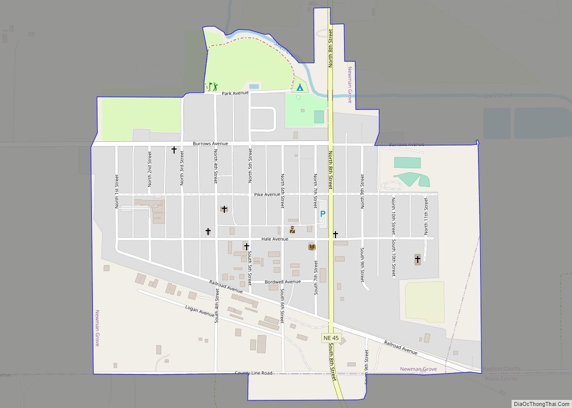
Online Interactive Map
Click on ![]() to view map in "full screen" mode.
to view map in "full screen" mode.
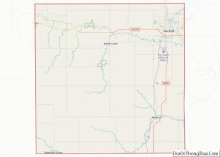
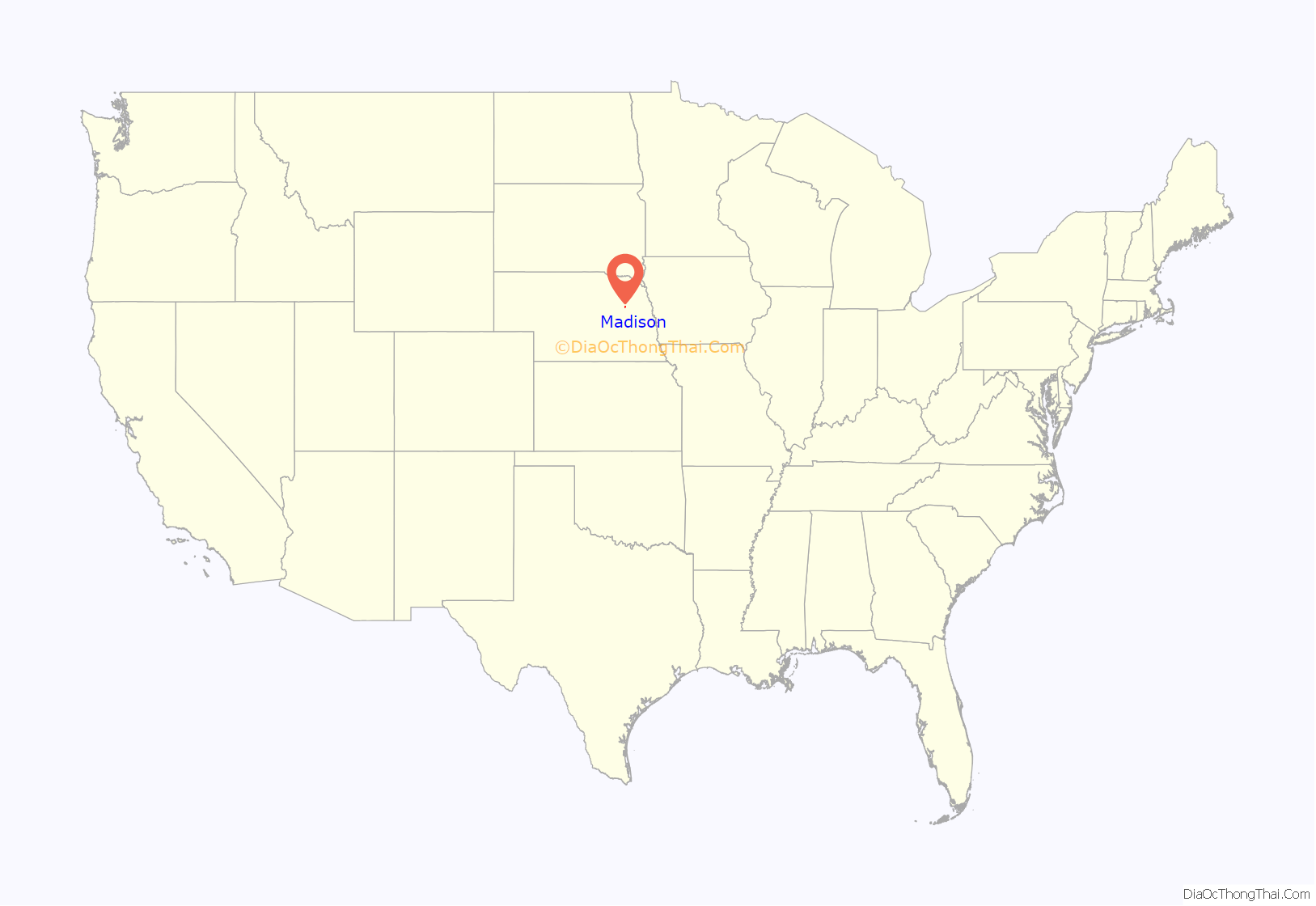
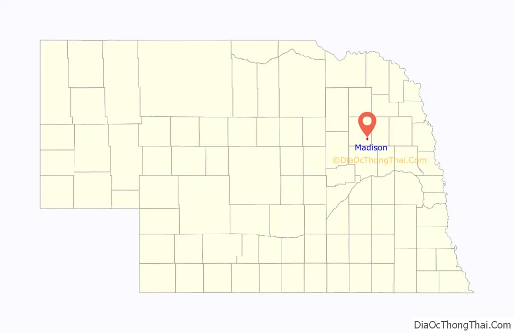
Madison location map. Where is Madison city?
History
Madison was founded in 1867. It was named from Madison County. Madison was designated county seat in 1875.
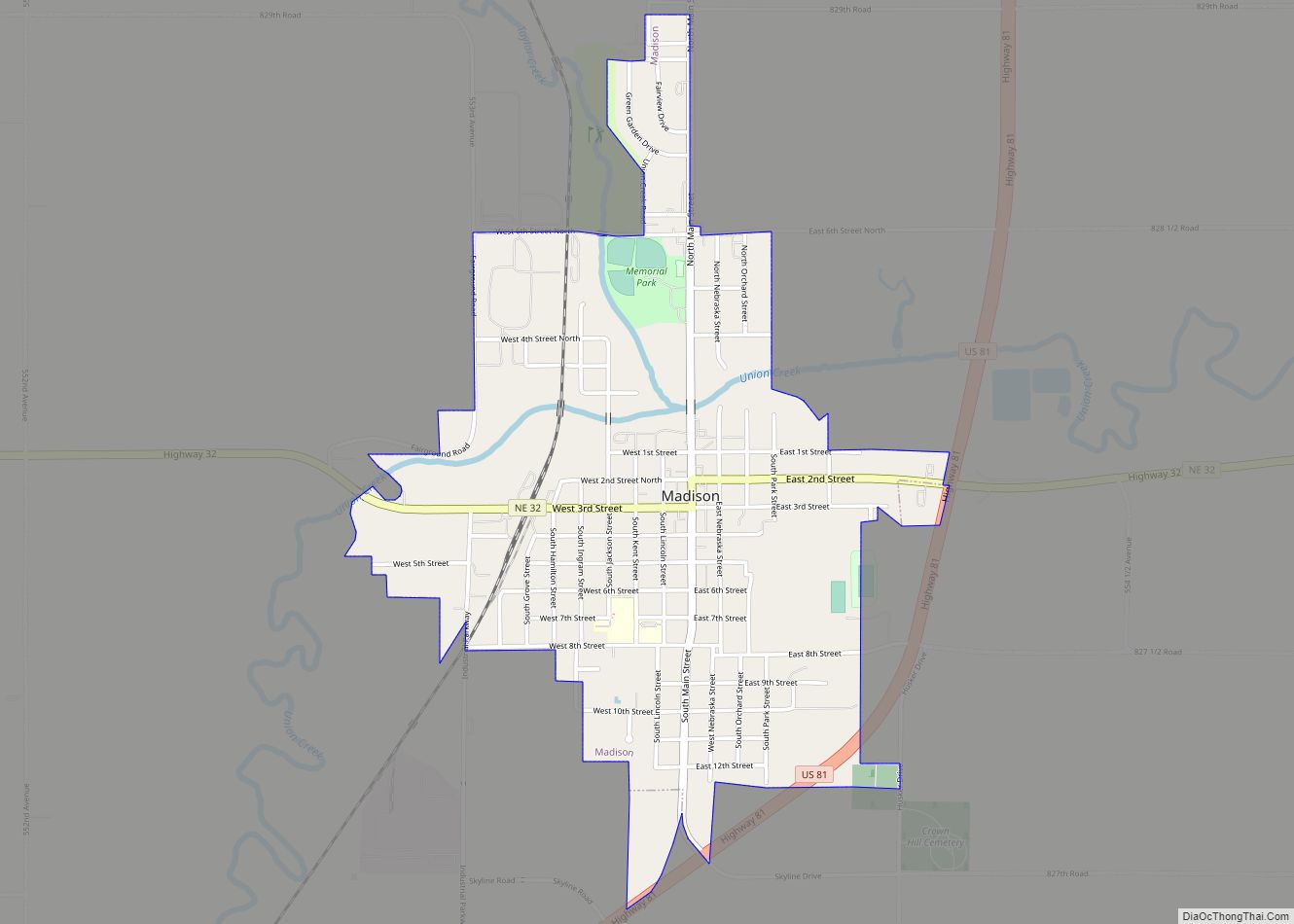
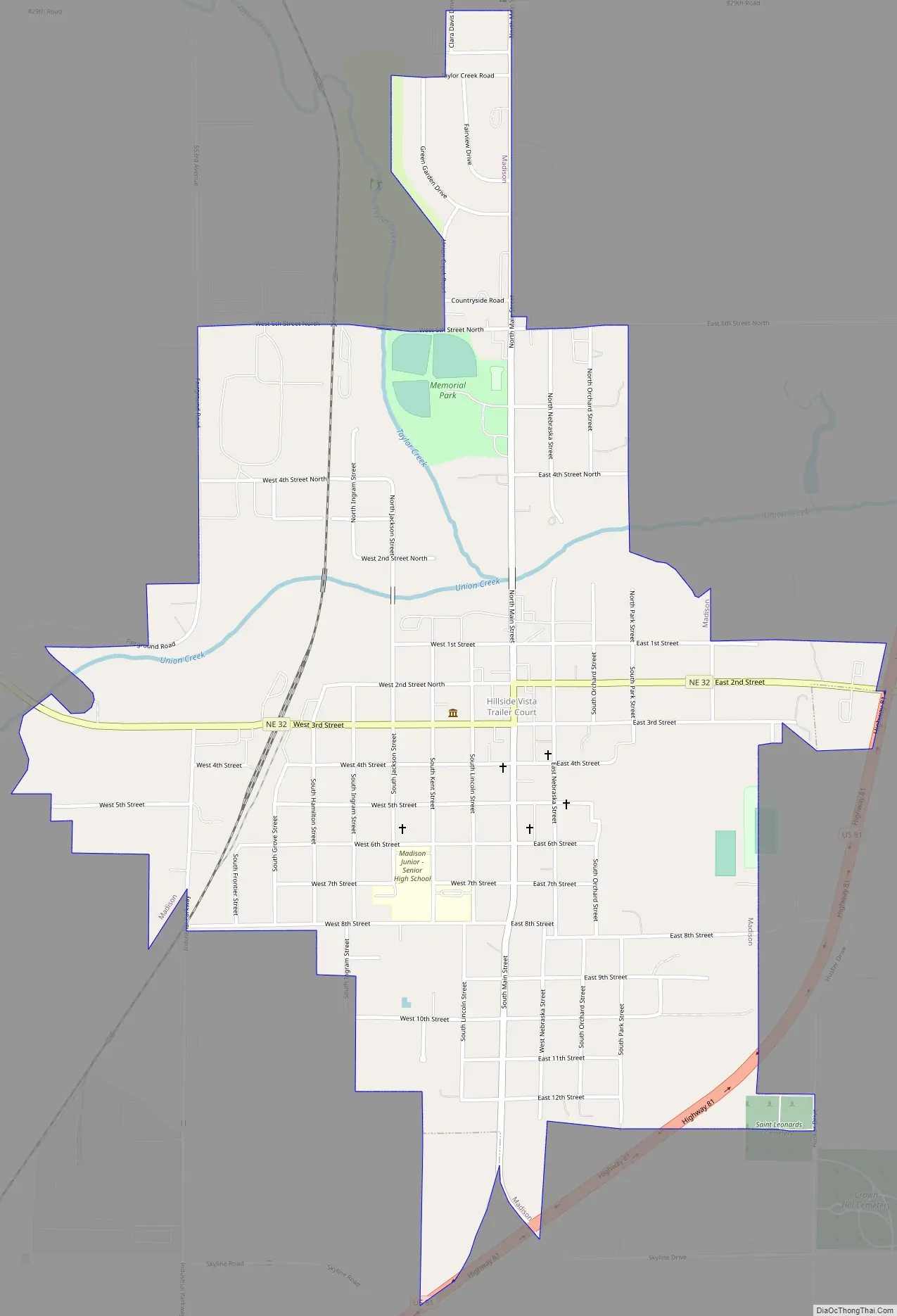
Madison Road Map
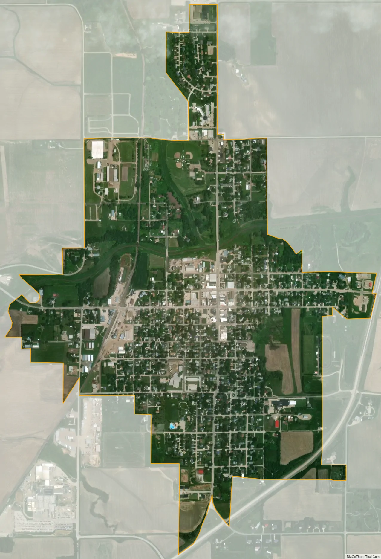
Madison city Satellite Map
Geography
Madison is located at 41°49′39″N 97°27′25″W / 41.82750°N 97.45694°W / 41.82750; -97.45694 (41.827527, -97.456875), just west of the junction of U.S. Route 81 and Nebraska Highway 32.
According to the United States Census Bureau, the city has a total area of 1.15 square miles (2.98 km), all land.
Madison lies at an elevation of 1580 ft (482 m) above sea level.
See also
Map of Nebraska State and its subdivision:- Adams
- Antelope
- Arthur
- Banner
- Blaine
- Boone
- Box Butte
- Boyd
- Brown
- Buffalo
- Burt
- Butler
- Cass
- Cedar
- Chase
- Cherry
- Cheyenne
- Clay
- Colfax
- Cuming
- Custer
- Dakota
- Dawes
- Dawson
- Deuel
- Dixon
- Dodge
- Douglas
- Dundy
- Fillmore
- Franklin
- Frontier
- Furnas
- Gage
- Garden
- Garfield
- Gosper
- Grant
- Greeley
- Hall
- Hamilton
- Harlan
- Hayes
- Hitchcock
- Holt
- Hooker
- Howard
- Jefferson
- Johnson
- Kearney
- Keith
- Keya Paha
- Kimball
- Knox
- Lancaster
- Lincoln
- Logan
- Loup
- Madison
- McPherson
- Merrick
- Morrill
- Nance
- Nemaha
- Nuckolls
- Otoe
- Pawnee
- Perkins
- Phelps
- Pierce
- Platte
- Polk
- Red Willow
- Richardson
- Rock
- Saline
- Sarpy
- Saunders
- Scotts Bluff
- Seward
- Sheridan
- Sherman
- Sioux
- Stanton
- Thayer
- Thomas
- Thurston
- Valley
- Washington
- Wayne
- Webster
- Wheeler
- York
- Alabama
- Alaska
- Arizona
- Arkansas
- California
- Colorado
- Connecticut
- Delaware
- District of Columbia
- Florida
- Georgia
- Hawaii
- Idaho
- Illinois
- Indiana
- Iowa
- Kansas
- Kentucky
- Louisiana
- Maine
- Maryland
- Massachusetts
- Michigan
- Minnesota
- Mississippi
- Missouri
- Montana
- Nebraska
- Nevada
- New Hampshire
- New Jersey
- New Mexico
- New York
- North Carolina
- North Dakota
- Ohio
- Oklahoma
- Oregon
- Pennsylvania
- Rhode Island
- South Carolina
- South Dakota
- Tennessee
- Texas
- Utah
- Vermont
- Virginia
- Washington
- West Virginia
- Wisconsin
- Wyoming