Berea is an unincorporated community and census-designated place in Box Butte County, in the northwestern part of the state of Nebraska in the Midwestern United States. It had a population of 41 at the 2010 census.
| Name: | Berea CDP |
|---|---|
| LSAD Code: | 57 |
| LSAD Description: | CDP (suffix) |
| State: | Nebraska |
| County: | Box Butte County |
| Elevation: | 4,144 ft (1,263 m) |
| Total Area: | 1.19 sq mi (3.09 km²) |
| Land Area: | 1.19 sq mi (3.09 km²) |
| Water Area: | 0.00 sq mi (0.00 km²) |
| Total Population: | 49 |
| Population Density: | 41.07/sq mi (15.86/km²) |
| ZIP code: | 69301 |
| Area code: | 308 |
| FIPS code: | 3104545 |
Online Interactive Map
Click on ![]() to view map in "full screen" mode.
to view map in "full screen" mode.
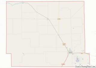
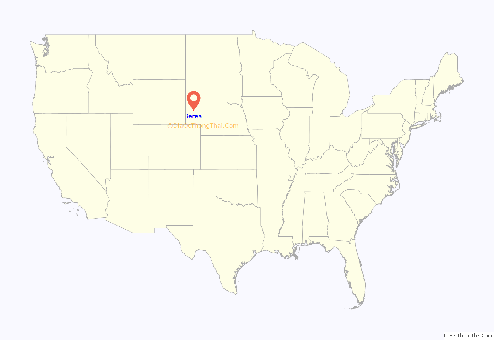
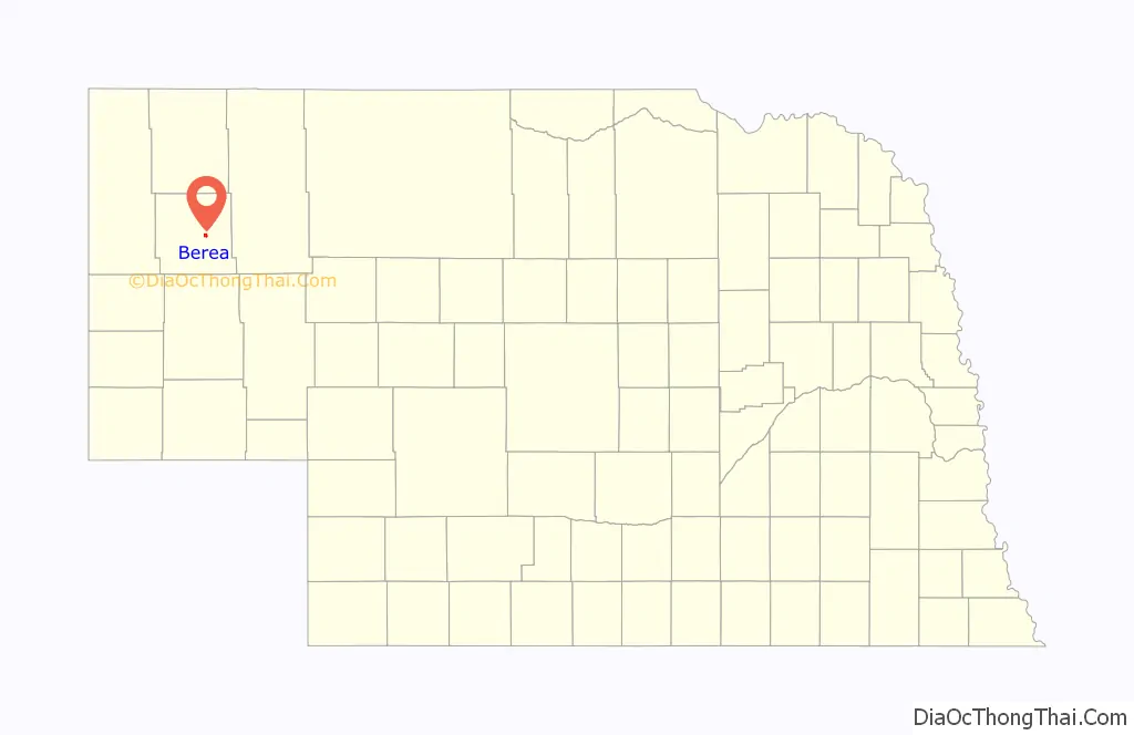
Berea location map. Where is Berea CDP?
History
The Burlington Railroad reached the area of Berea in 1889, and railroad support facilities, including a water tower and section house, were built on the site. The town was founded by a group of settlers, originally from Ohio, who named their new home after Berea, Ohio.
In 1890-91, the town had a population of 50, and a general store, newspaper, and post office; five years later, a school and community hall had been added.
The population of Berea fluctuated over the next century. The town was of some local importance as a shipping stop along the railroad, although it never developed many commercial enterprises. A garage opened in 1921, repairing both automobiles and farm machinery. In 1925, when the population was estimated at 35, the post office was re-opened; it closed again a year later. A refinery was operated in the town in 1935 by the Utility Petroleum Company of Chadron.
In 1960, a population of 75 was reported for Berea. The District 39 school was closed in 2007, at which time it had nine students enrolled. In 2009, the town’s population was estimated to be 50.
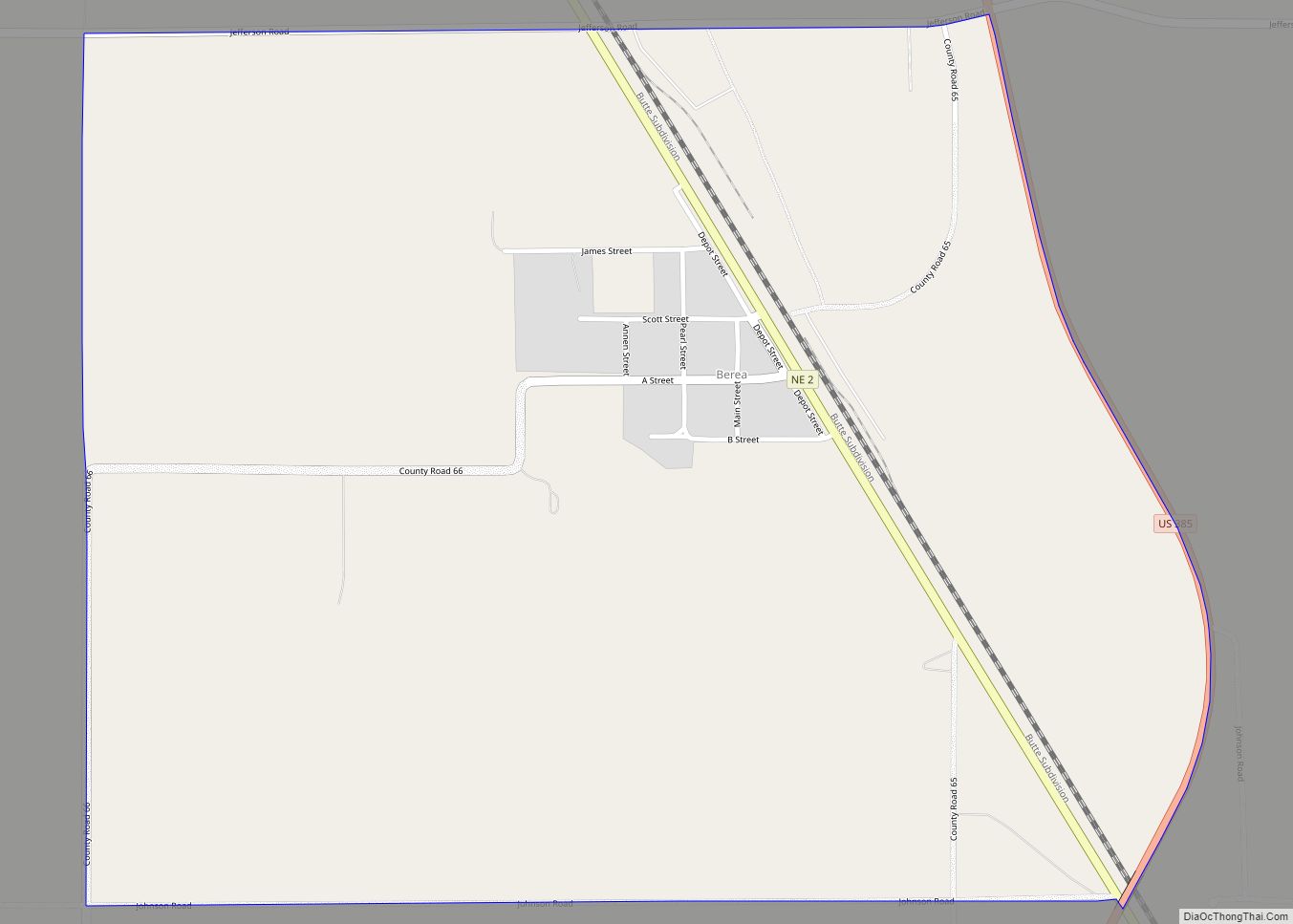
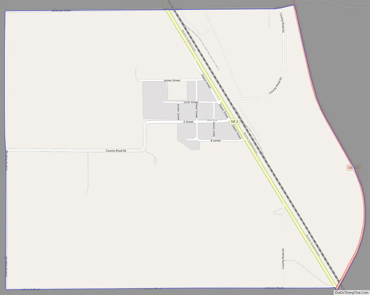
Berea Road Map
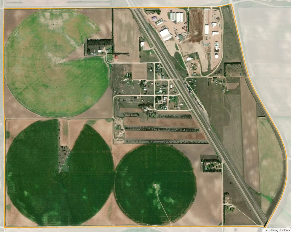
Berea city Satellite Map
Geography
Berea is approximately 10 miles (16 km) northwest of Alliance, the county seat of Box Butte County. It lies along the west side of the BNSF Railway tracks, and of Nebraska Highway 2 near its junction with U.S. Route 385.
See also
Map of Nebraska State and its subdivision:- Adams
- Antelope
- Arthur
- Banner
- Blaine
- Boone
- Box Butte
- Boyd
- Brown
- Buffalo
- Burt
- Butler
- Cass
- Cedar
- Chase
- Cherry
- Cheyenne
- Clay
- Colfax
- Cuming
- Custer
- Dakota
- Dawes
- Dawson
- Deuel
- Dixon
- Dodge
- Douglas
- Dundy
- Fillmore
- Franklin
- Frontier
- Furnas
- Gage
- Garden
- Garfield
- Gosper
- Grant
- Greeley
- Hall
- Hamilton
- Harlan
- Hayes
- Hitchcock
- Holt
- Hooker
- Howard
- Jefferson
- Johnson
- Kearney
- Keith
- Keya Paha
- Kimball
- Knox
- Lancaster
- Lincoln
- Logan
- Loup
- Madison
- McPherson
- Merrick
- Morrill
- Nance
- Nemaha
- Nuckolls
- Otoe
- Pawnee
- Perkins
- Phelps
- Pierce
- Platte
- Polk
- Red Willow
- Richardson
- Rock
- Saline
- Sarpy
- Saunders
- Scotts Bluff
- Seward
- Sheridan
- Sherman
- Sioux
- Stanton
- Thayer
- Thomas
- Thurston
- Valley
- Washington
- Wayne
- Webster
- Wheeler
- York
- Alabama
- Alaska
- Arizona
- Arkansas
- California
- Colorado
- Connecticut
- Delaware
- District of Columbia
- Florida
- Georgia
- Hawaii
- Idaho
- Illinois
- Indiana
- Iowa
- Kansas
- Kentucky
- Louisiana
- Maine
- Maryland
- Massachusetts
- Michigan
- Minnesota
- Mississippi
- Missouri
- Montana
- Nebraska
- Nevada
- New Hampshire
- New Jersey
- New Mexico
- New York
- North Carolina
- North Dakota
- Ohio
- Oklahoma
- Oregon
- Pennsylvania
- Rhode Island
- South Carolina
- South Dakota
- Tennessee
- Texas
- Utah
- Vermont
- Virginia
- Washington
- West Virginia
- Wisconsin
- Wyoming