Brewster is a village in, and the county seat of, Blaine County, Nebraska, United States. The population was 17 at the 2010 census.
| Name: | Brewster village |
|---|---|
| LSAD Code: | 47 |
| LSAD Description: | village (suffix) |
| State: | Nebraska |
| County: | Blaine County |
| Elevation: | 2,493 ft (760 m) |
| Total Area: | 0.09 sq mi (0.23 km²) |
| Land Area: | 0.09 sq mi (0.23 km²) |
| Water Area: | 0.00 sq mi (0.00 km²) |
| Total Population: | 12 |
| Population Density: | 134.83/sq mi (52.35/km²) |
| ZIP code: | 68821 |
| Area code: | 308 |
| FIPS code: | 3106260 |
| GNISfeature ID: | 0827637 |
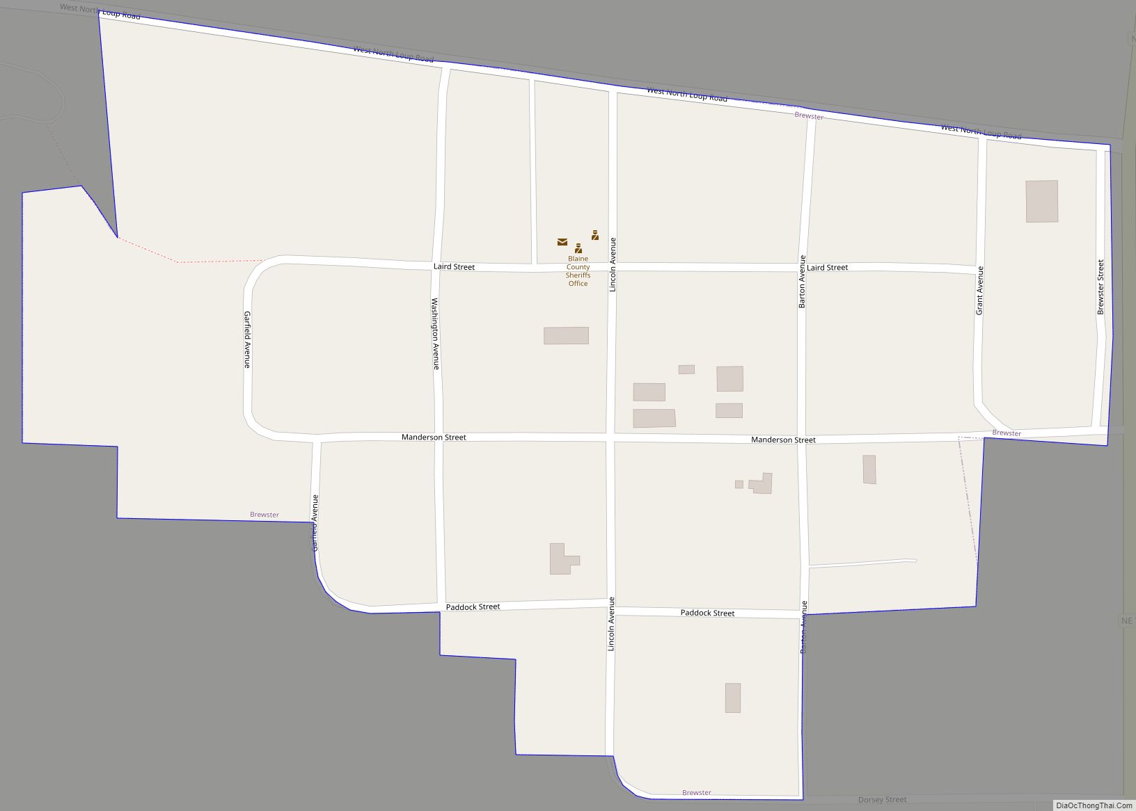
Online Interactive Map
Click on ![]() to view map in "full screen" mode.
to view map in "full screen" mode.
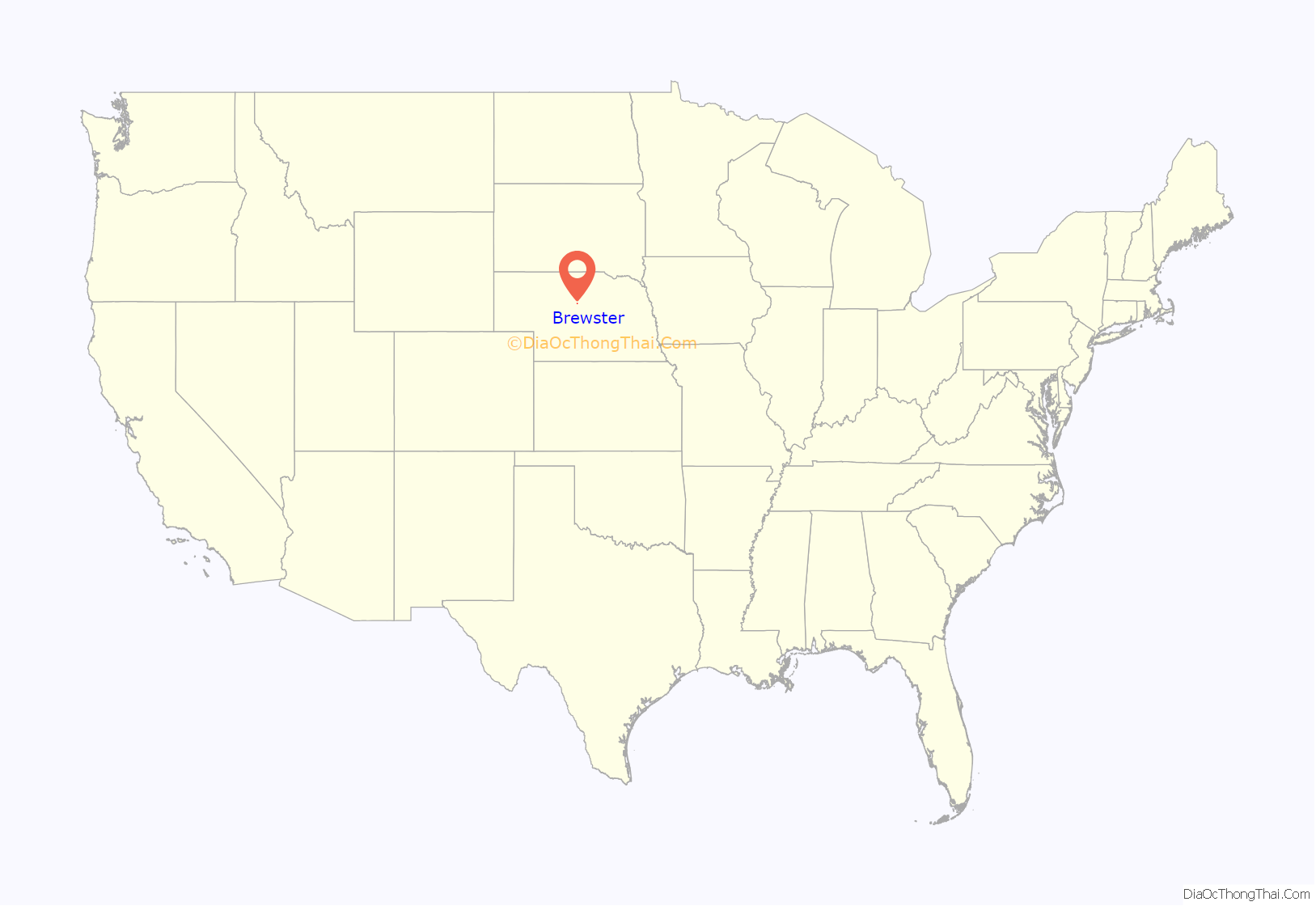
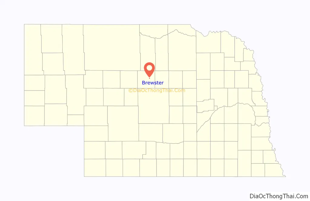
Brewster location map. Where is Brewster village?
History
The town was laid out in 1884 by George Washington Brewster who had homesteaded the land there. It was named for one of his ancestors, William Brewster, who had arrived in America on the Mayflower. The community was named the county seat in 1887 after George Washington Brewster offered to build the required buildings. According to town lore, Brewster had expected the state capitol to be located in the community because of its central location.
In 1887 the outlaw D.C.”Doc” Middleton opened a saloon in the community.
Brewster almost became a railhead, when the Chicago, Burlington and Quincy Railroad graded a line from Sargent in 1897. The line would have had an intermediate station at Moulton.
Following the 2010 census Brewster became the smallest incorporated county seat in the United States replacing Amidon, North Dakota for the title. Amidon had 26 people in 2000 and Brewster had 29. In the 2010 census Brewster had 17 while Amidon had 20.
There are two other unincorporated county seats in the same range — Mentone, Texas (population 19), the county seat of Loving County and Gann Valley, South Dakota (population 14), the county seat of Buffalo County, South Dakota.
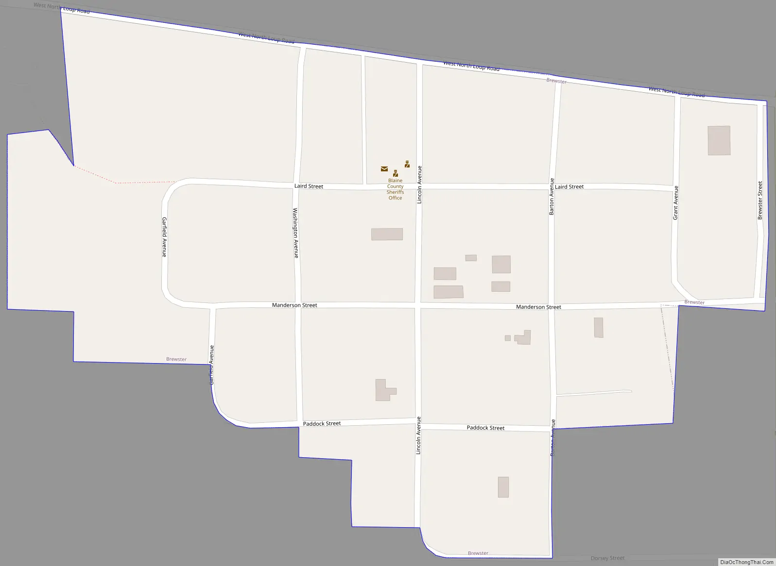
Brewster Road Map
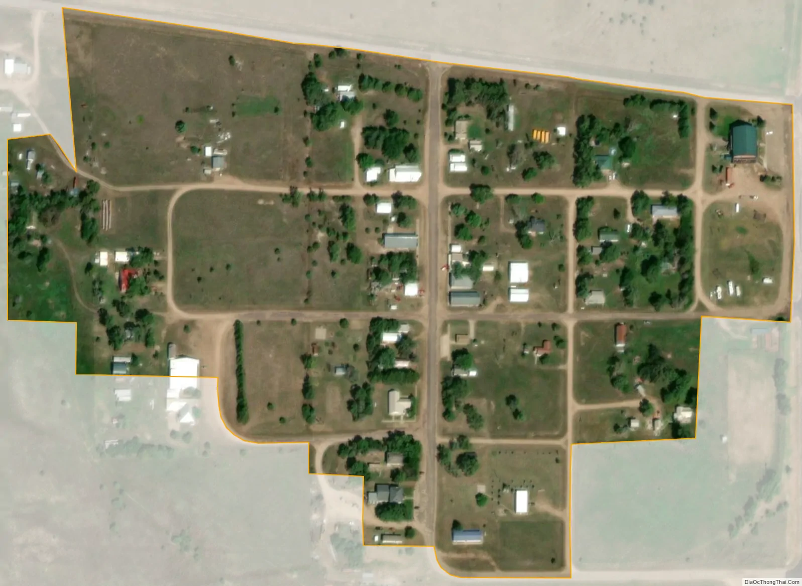
Brewster city Satellite Map
Geography
Brewster is located at 41°56′18″N 99°51′56″W / 41.93833°N 99.86556°W / 41.93833; -99.86556 (41.938374, -99.865492). According to the United States Census Bureau, the village has a total area of 0.09 square miles (0.23 km), all land.
Climate
Brewster has a subhumid continental climate (Köppen Dfa/Dwa/Dfb/Dwb) with summers featuring hot afternoons, comfortable mornings, and occasional heavy rain, and winters that are generally freezing but vary from mild with chinook winds to frigid Arctic conditions.
See also
Map of Nebraska State and its subdivision:- Adams
- Antelope
- Arthur
- Banner
- Blaine
- Boone
- Box Butte
- Boyd
- Brown
- Buffalo
- Burt
- Butler
- Cass
- Cedar
- Chase
- Cherry
- Cheyenne
- Clay
- Colfax
- Cuming
- Custer
- Dakota
- Dawes
- Dawson
- Deuel
- Dixon
- Dodge
- Douglas
- Dundy
- Fillmore
- Franklin
- Frontier
- Furnas
- Gage
- Garden
- Garfield
- Gosper
- Grant
- Greeley
- Hall
- Hamilton
- Harlan
- Hayes
- Hitchcock
- Holt
- Hooker
- Howard
- Jefferson
- Johnson
- Kearney
- Keith
- Keya Paha
- Kimball
- Knox
- Lancaster
- Lincoln
- Logan
- Loup
- Madison
- McPherson
- Merrick
- Morrill
- Nance
- Nemaha
- Nuckolls
- Otoe
- Pawnee
- Perkins
- Phelps
- Pierce
- Platte
- Polk
- Red Willow
- Richardson
- Rock
- Saline
- Sarpy
- Saunders
- Scotts Bluff
- Seward
- Sheridan
- Sherman
- Sioux
- Stanton
- Thayer
- Thomas
- Thurston
- Valley
- Washington
- Wayne
- Webster
- Wheeler
- York
- Alabama
- Alaska
- Arizona
- Arkansas
- California
- Colorado
- Connecticut
- Delaware
- District of Columbia
- Florida
- Georgia
- Hawaii
- Idaho
- Illinois
- Indiana
- Iowa
- Kansas
- Kentucky
- Louisiana
- Maine
- Maryland
- Massachusetts
- Michigan
- Minnesota
- Mississippi
- Missouri
- Montana
- Nebraska
- Nevada
- New Hampshire
- New Jersey
- New Mexico
- New York
- North Carolina
- North Dakota
- Ohio
- Oklahoma
- Oregon
- Pennsylvania
- Rhode Island
- South Carolina
- South Dakota
- Tennessee
- Texas
- Utah
- Vermont
- Virginia
- Washington
- West Virginia
- Wisconsin
- Wyoming