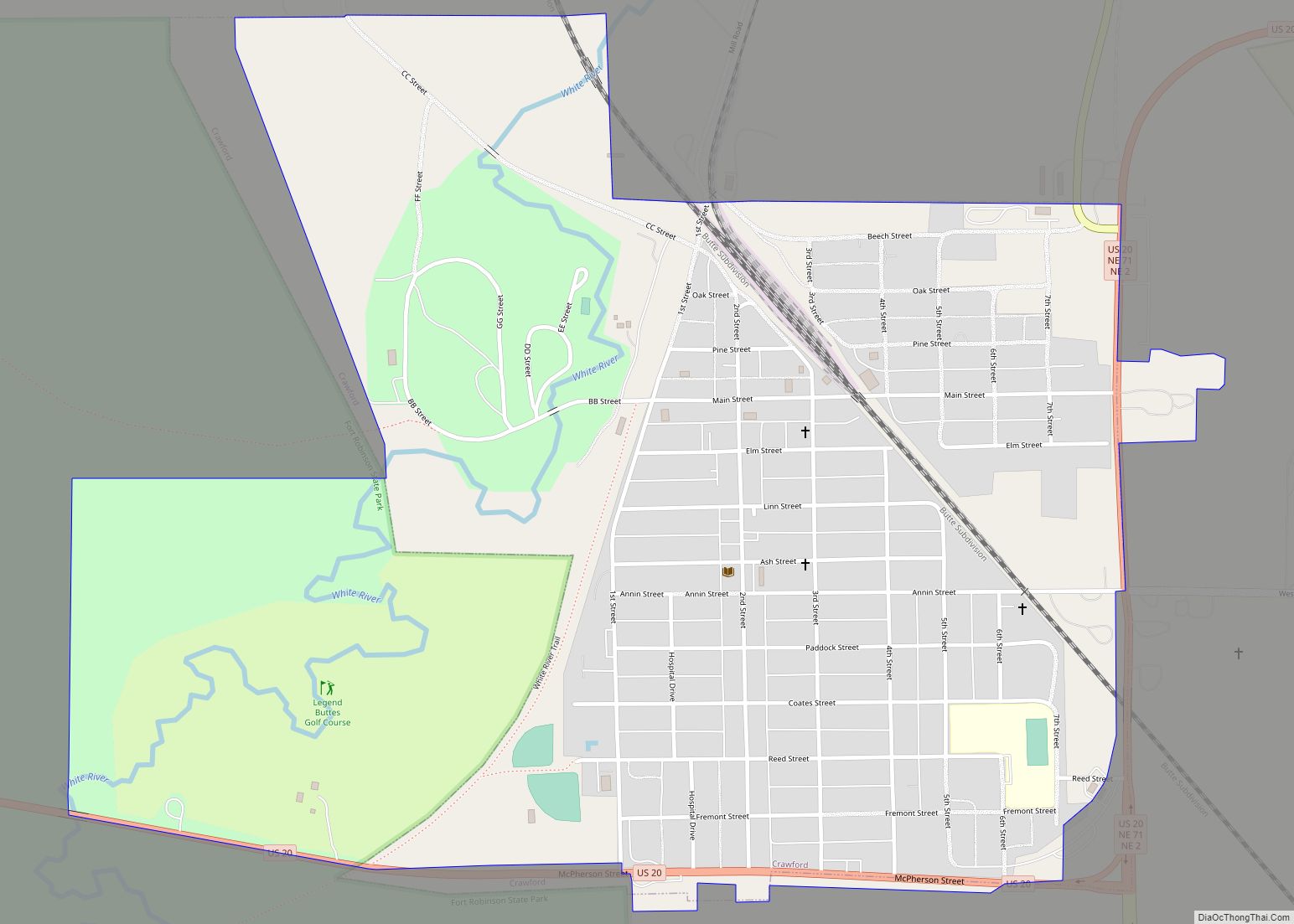
Crawford is a city in Dawes County, in the northwestern part of the state of Nebraska, in the Great Plains region of the United States. The population was 997 at the 2010 census. It was incorporated in 1886 and was named for the late Captain Emmet Crawford, who had been stationed at nearby Fort Robinson.
| Name: | Crawford city |
|---|---|
| LSAD Code: | 25 |
| LSAD Description: | city (suffix) |
| State: | Nebraska |
| County: | Dawes County |
| Elevation: | 3,678 ft (1,121 m) |
| Total Area: | 1.17 sq mi (3.04 km²) |
| Land Area: | 1.17 sq mi (3.04 km²) |
| Water Area: | 0.00 sq mi (0.00 km²) |
| Total Population: | 840 |
| Population Density: | 715.50/sq mi (276.26/km²) |
| ZIP code: | 69339 |
| Area code: | 308 |
| FIPS code: | 3111195 |
| GNISfeature ID: | 0835534 |
| Website: | http://www.crawfordnebraska.net/ |
Online Interactive Map
Click on ![]() to view map in "full screen" mode.
to view map in "full screen" mode.
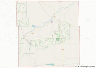
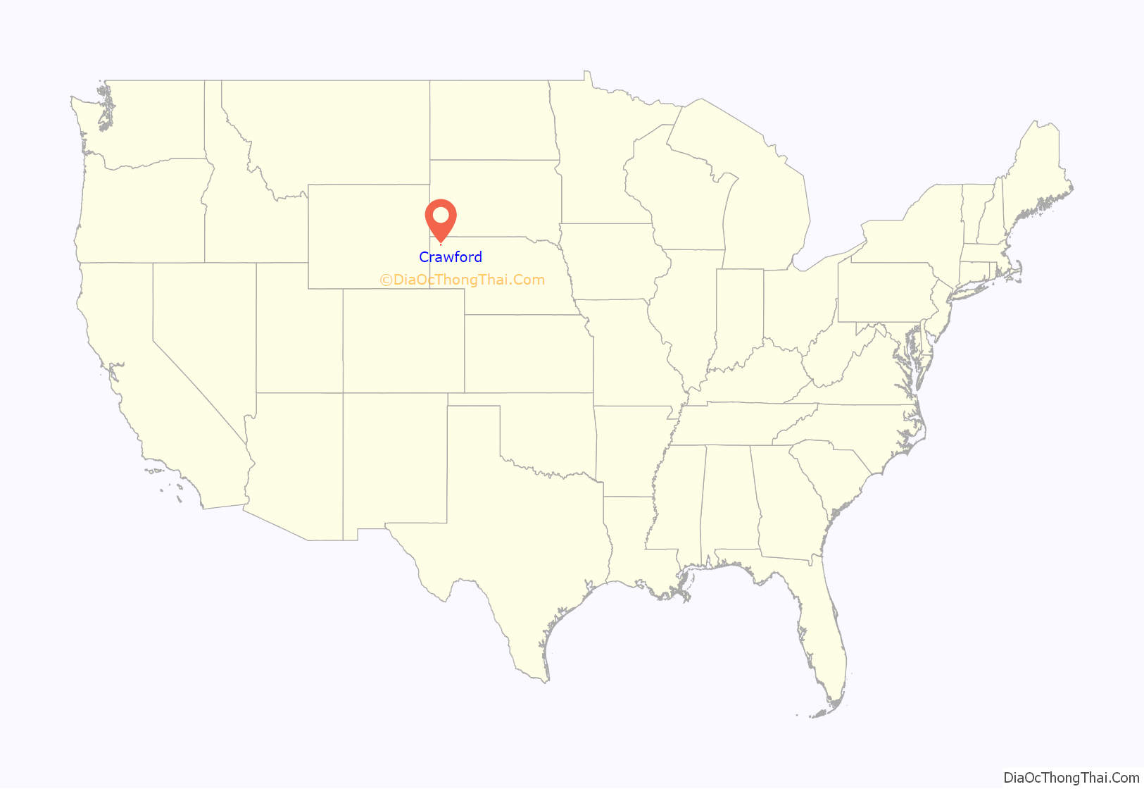
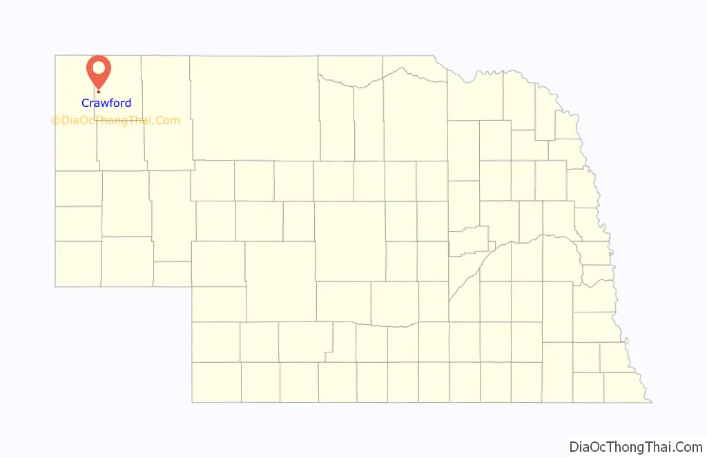
Crawford location map. Where is Crawford city?
History
The Fremont, Elkhorn and Missouri Valley Railroad reached Fort Robinson in 1886 on its way to Wyoming. Several miles east of the Fort, the railroad passed through a tree claim belonging to William Annin (also spelled “Annon”), who sold his claim for a new townsite. The “tent city” that sprang up around the railroad was named after Lt. Emmet Crawford, who had been formerly stationed at Fort Robinson but was killed in Mexico in January 1886.
The town’s original plat was filed on June 21, 1886 by the Western Townsite Company. E.A. Thompson and William D. Edger (editor of the original Crawford Clipper) circulated a petition for Crawford to become a village, but upon getting only 69 of the 200 needed signatures, secured the remaining signatures from willing soldiers at Fort Robinson. Crawford was incorporated in August 1886.
Seeking entertainment, the soldiers kept the town supplied with much business during its early years. Crawford was a very wild frontier town, and was home to many saloons and brothels. Calamity Jane came to Crawford from Deadwood, South Dakota with ten dancing girls and set up a tent south of town. Several murders took place in Crawford, most involving soldiers from Fort Robinson.
A second railroad, the Chicago, Burlington and Quincy, reached Crawford in 1889, providing an additional boost to the community. In 1907 Crawford became a city, and by 1911 Crawford had the seventh-most business volume in Nebraska. Through the following years, the town had a variety of industries, including a brick works, mica mill, pickle factory, and a Nash Finch Company warehouse. Crawford lobbied for a state normal school, but the state decided to place the school (now Chadron State College) in nearby Chadron. The state thought that Crawford’s proximity to Fort Robinson would not be good for the school’s young women students.
The Elite Theater was established about 1910 in a converted saloon. The theater was owned and operated by Mrs. Georgianna Higgins, thought to be the first woman theater owner in the United States.
Crawford’s population peaked at 2,536 in 1910, largely because of the Kinkaid Act. It attracted many new settlers to western Nebraska who could claim public land for homesteading. But many found it impossible to successfully conduct dry-land farming on the 640-acre plots made available, and began to sell out to ranchers. The population of Crawford reflected that change and dropped to 1,646 by 1920. Businesses declined with the loss of customers. The town made some minor recovery, and the population was 1,845 in 1940. Because of urbanization and people seeking jobs, and the decline of family agriculture on the Great Plains, the population has been steadily decreasing since.
In the Lakota language, Crawford is known as oglíyotake otȟúŋwahe, or “Return and Settle City”.
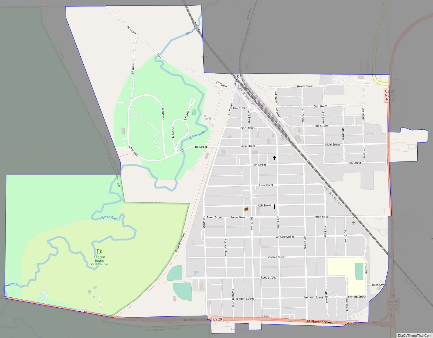
Crawford Road Map
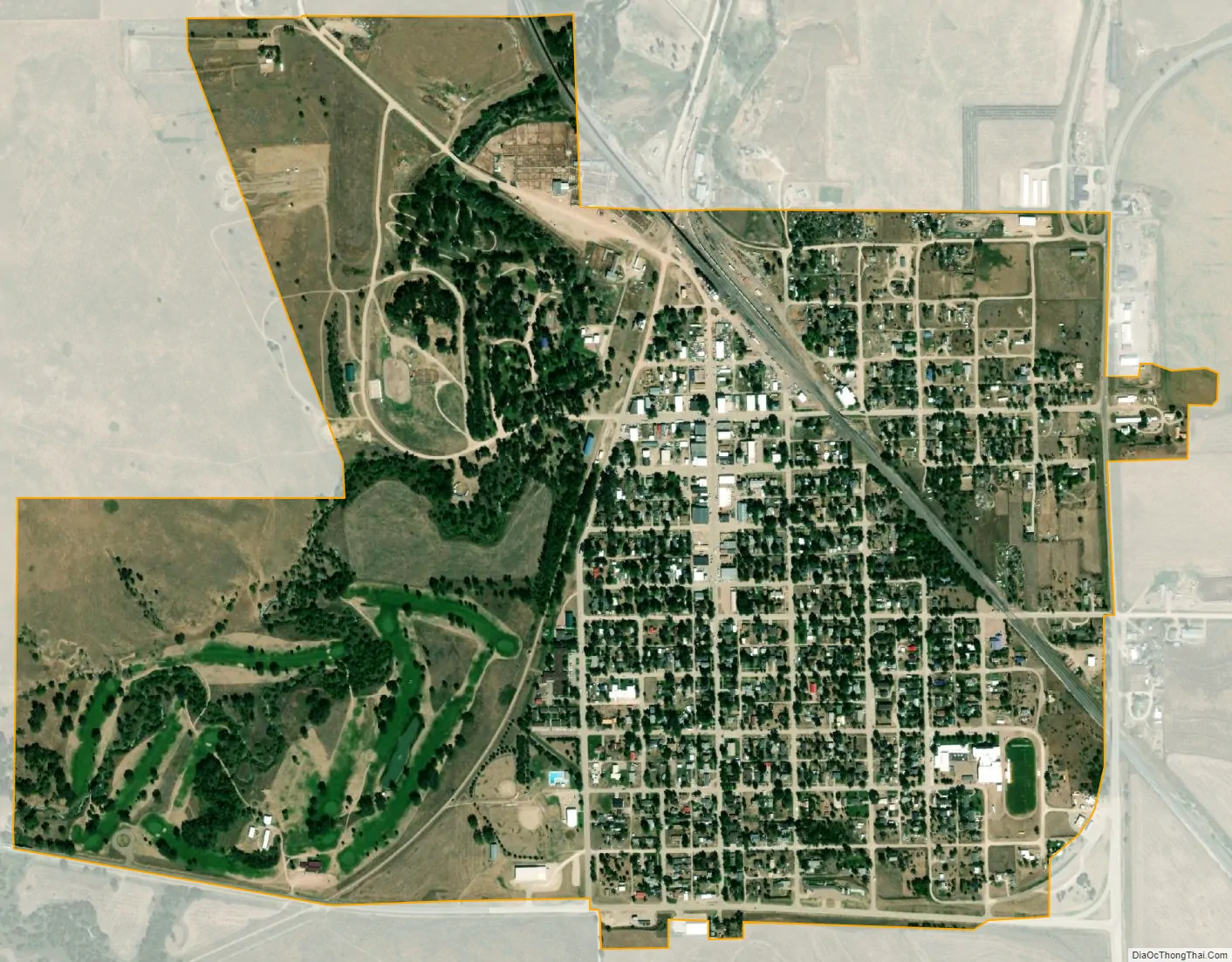
Crawford city Satellite Map
Geography
Crawford is located at 42°41′1″N 103°24′44″W / 42.68361°N 103.41222°W / 42.68361; -103.41222 (42.683617, -103.412297). According to the United States Census Bureau, the city has a total area of 1.18 square miles (3.06 km), all land. It is situated on the White River. Crawford sits 3,675 feet above sea level, and the surrounding area is rolling, with bluffs and low hills. The soils include sandy dirt and “gumbo” clay.
See also
Map of Nebraska State and its subdivision:- Adams
- Antelope
- Arthur
- Banner
- Blaine
- Boone
- Box Butte
- Boyd
- Brown
- Buffalo
- Burt
- Butler
- Cass
- Cedar
- Chase
- Cherry
- Cheyenne
- Clay
- Colfax
- Cuming
- Custer
- Dakota
- Dawes
- Dawson
- Deuel
- Dixon
- Dodge
- Douglas
- Dundy
- Fillmore
- Franklin
- Frontier
- Furnas
- Gage
- Garden
- Garfield
- Gosper
- Grant
- Greeley
- Hall
- Hamilton
- Harlan
- Hayes
- Hitchcock
- Holt
- Hooker
- Howard
- Jefferson
- Johnson
- Kearney
- Keith
- Keya Paha
- Kimball
- Knox
- Lancaster
- Lincoln
- Logan
- Loup
- Madison
- McPherson
- Merrick
- Morrill
- Nance
- Nemaha
- Nuckolls
- Otoe
- Pawnee
- Perkins
- Phelps
- Pierce
- Platte
- Polk
- Red Willow
- Richardson
- Rock
- Saline
- Sarpy
- Saunders
- Scotts Bluff
- Seward
- Sheridan
- Sherman
- Sioux
- Stanton
- Thayer
- Thomas
- Thurston
- Valley
- Washington
- Wayne
- Webster
- Wheeler
- York
- Alabama
- Alaska
- Arizona
- Arkansas
- California
- Colorado
- Connecticut
- Delaware
- District of Columbia
- Florida
- Georgia
- Hawaii
- Idaho
- Illinois
- Indiana
- Iowa
- Kansas
- Kentucky
- Louisiana
- Maine
- Maryland
- Massachusetts
- Michigan
- Minnesota
- Mississippi
- Missouri
- Montana
- Nebraska
- Nevada
- New Hampshire
- New Jersey
- New Mexico
- New York
- North Carolina
- North Dakota
- Ohio
- Oklahoma
- Oregon
- Pennsylvania
- Rhode Island
- South Carolina
- South Dakota
- Tennessee
- Texas
- Utah
- Vermont
- Virginia
- Washington
- West Virginia
- Wisconsin
- Wyoming