Daykin is a village in Jefferson County, Nebraska, United States. The population was 157 at the 2020 census.
| Name: | Daykin village |
|---|---|
| LSAD Code: | 47 |
| LSAD Description: | village (suffix) |
| State: | Nebraska |
| County: | Jefferson County |
| Elevation: | 1,532 ft (467 m) |
| Total Area: | 0.16 sq mi (0.43 km²) |
| Land Area: | 0.16 sq mi (0.43 km²) |
| Water Area: | 0.00 sq mi (0.00 km²) |
| Total Population: | 157 |
| Population Density: | 980/sq mi (370/km²) |
| ZIP code: | 68338 |
| Area code: | 402 |
| FIPS code: | 3112455 |
| GNISfeature ID: | 0828609 |
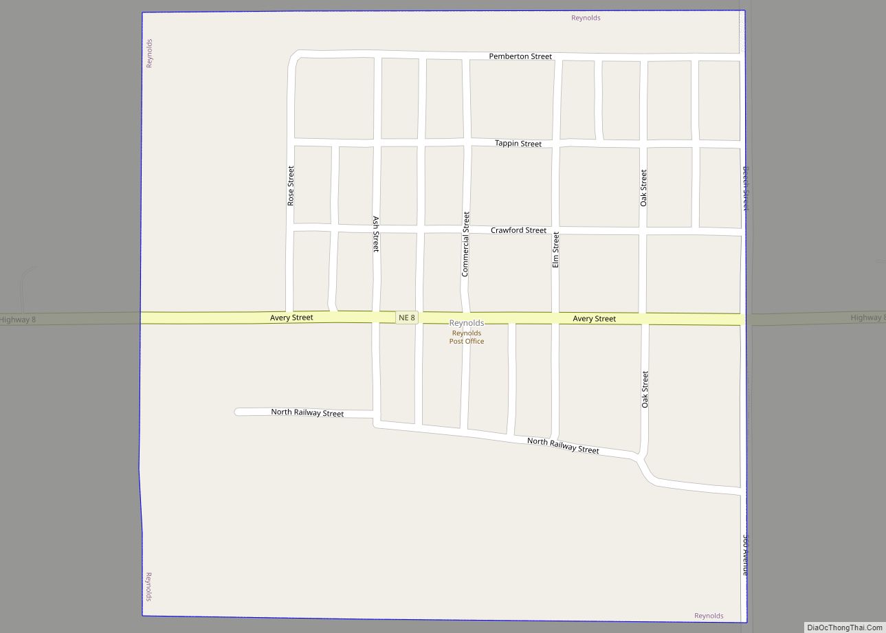
Online Interactive Map
Click on ![]() to view map in "full screen" mode.
to view map in "full screen" mode.
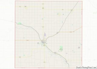
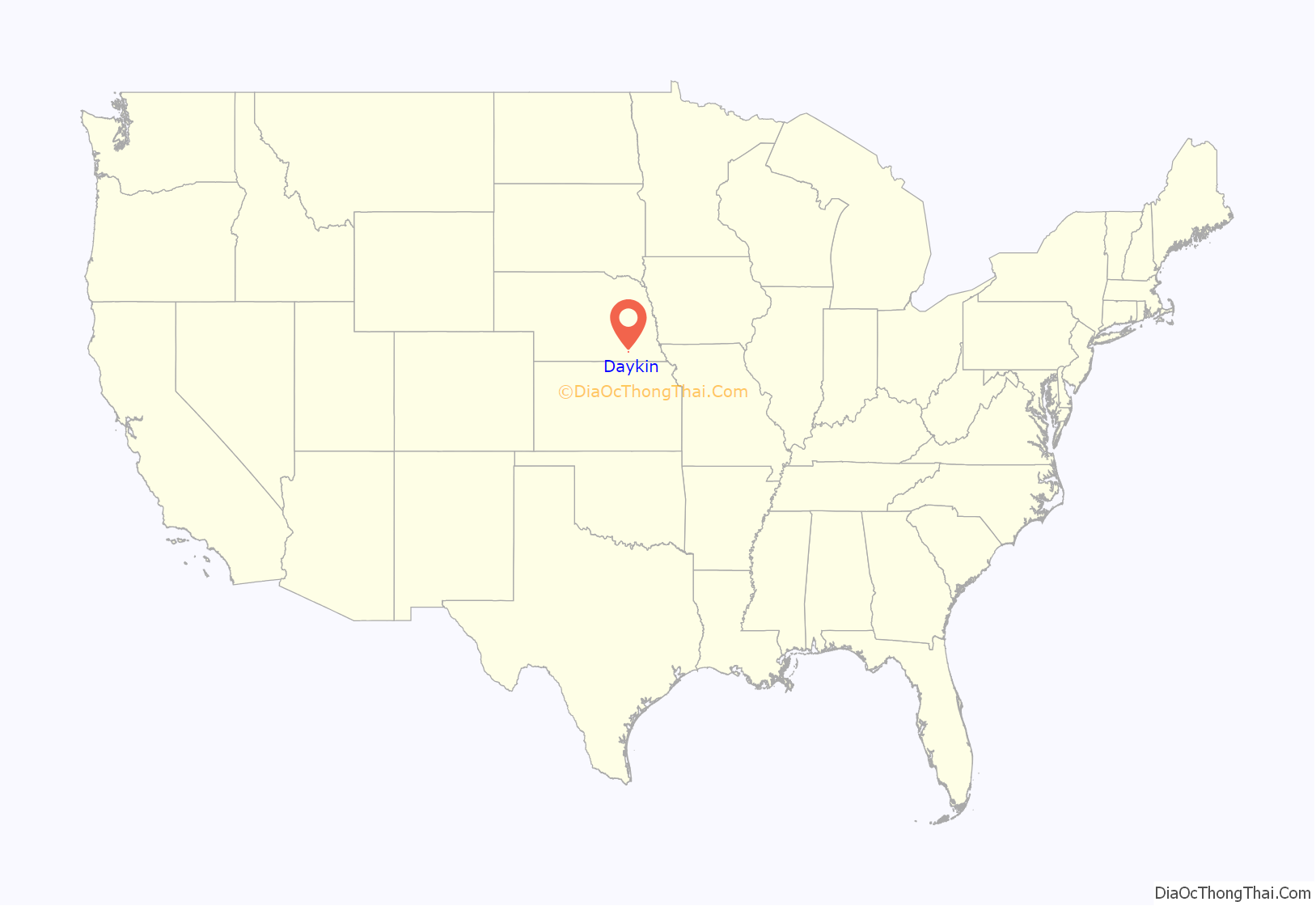
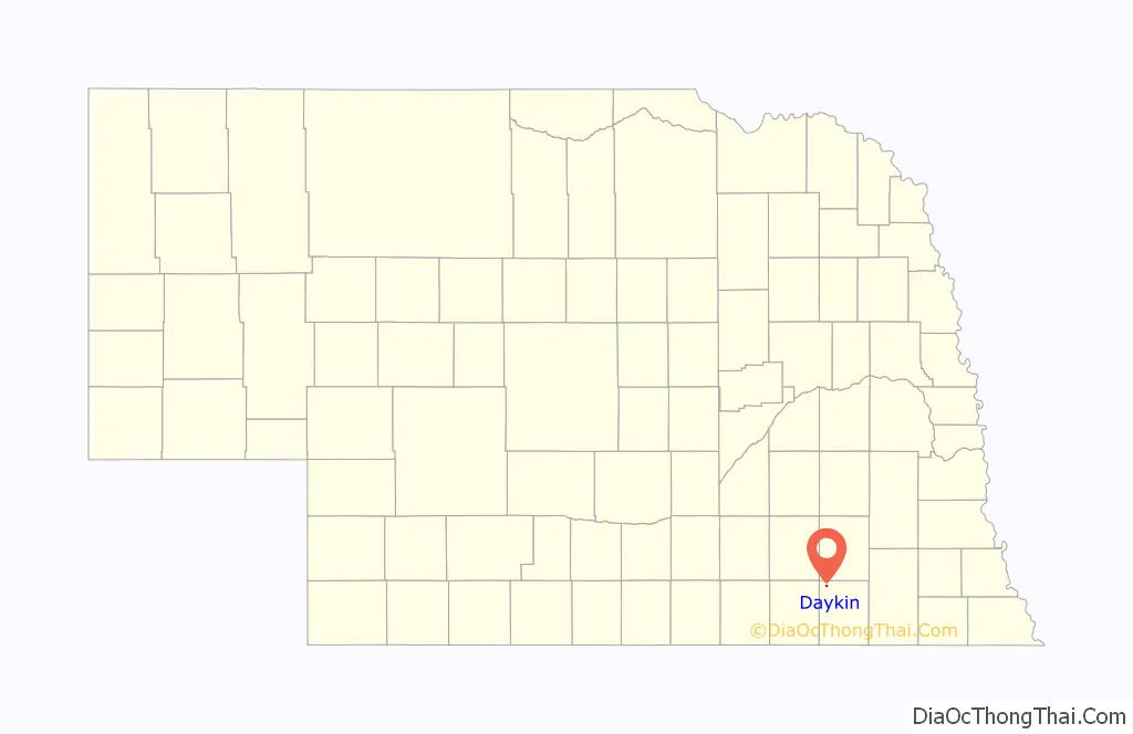
Daykin location map. Where is Daykin village?
History
Daykin was founded by John Daykin, a train conductor and stonemason from Illinois. In 1869, John Daykin purchased land in Jefferson County, Nebraska that would later become Daykin. Besides founding the town, he remains most recognized for conducting the train that returned Abraham Lincoln’s body to Springfield, Illinois.
Daykin at one point had a population that reached near 300 people. The town held businesses such as a doctor’s office, a butcher, laundromat, veterinarian, hotel, blacksmith, furniture store, jewelry store and many more. Currently Daykin has a Farmers CO-OP Branch, Daykin Country Store, Daykin Lumber Yard (Division of Kwint Inc.), Blue Skies Photography, Daykin Hardware, Hair Razors Salon, Craig’s Automotive, Kenny’s Bar and Grill, a Bed and Breakfast, and the Daykin Post Office. The Jefferson County Bank was built in 1887, and has been in continuous operation since then, surviving the market crash of the 1930s.
The former Daykin Public School was held in the present day Daykin Community Building after its erection in 1935. The Daykin Schools became a 12 grade system in 1926. Most of the original 1935 building structure remains, with the lower elementary class buildings being moved and the gym being minimized after a restoration. Today students attend Meridian School. Meridian consist of the residents of Daykin, Fairbury, Western, Alexandria, and Tobias, creating the 303 Nebraska School District.
Two churches are located within Daykin, St. John’s Lutheran Church, and St. John’s United Methodist Church. The Daykin Immanuel Church is a few miles outside of Daykin. Both churches were created in 1888.
Daykin is known as the “Windmill Town”. In the 1930s Daykin was featured in Ripley’s Believe It or Not, as having more windmills per capita than any other town in Nebraska. In 1949, a water tower was built. It replaced all but one windmill, which now stands on the lawn in front of the Daykin Community Building as reminder of Daykin’s history.
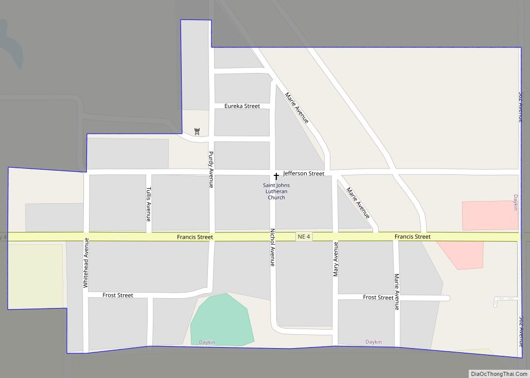
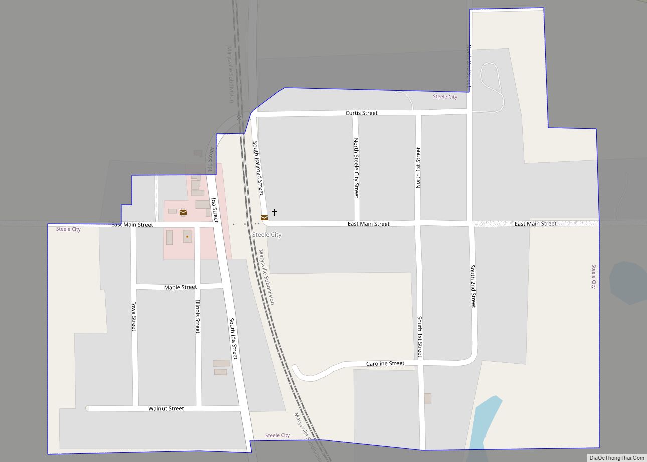
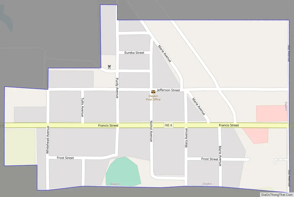
Daykin Road Map
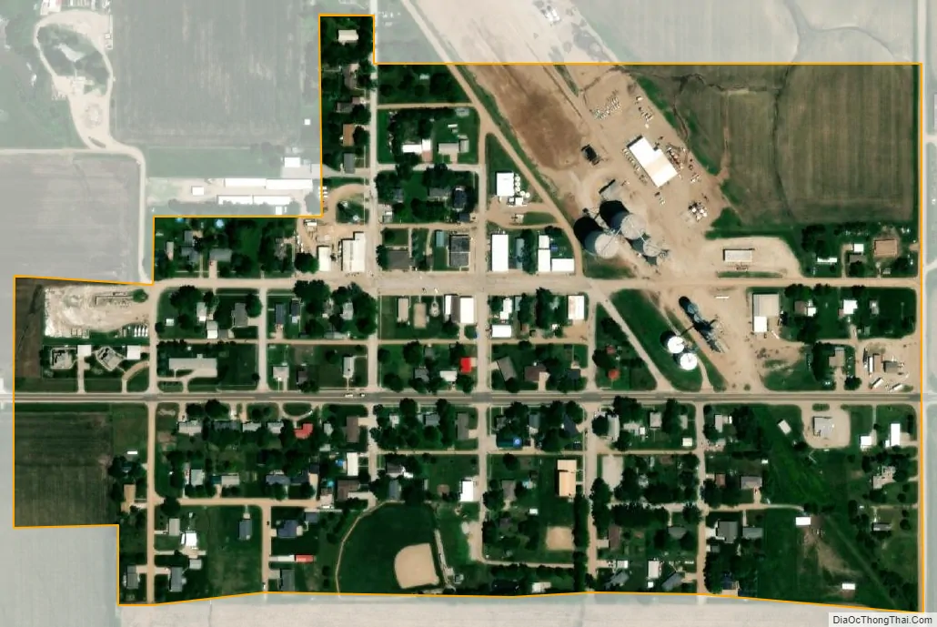
Daykin city Satellite Map
Geography
Daykin is located at 40°19′19″N 97°17′56″W / 40.321817°N 97.299009°W / 40.321817; -97.299009 (40.321817, -97.299009).
According to the United States Census Bureau, the village has a total area of 0.16 square miles (0.41 km), all land.
See also
Map of Nebraska State and its subdivision:- Adams
- Antelope
- Arthur
- Banner
- Blaine
- Boone
- Box Butte
- Boyd
- Brown
- Buffalo
- Burt
- Butler
- Cass
- Cedar
- Chase
- Cherry
- Cheyenne
- Clay
- Colfax
- Cuming
- Custer
- Dakota
- Dawes
- Dawson
- Deuel
- Dixon
- Dodge
- Douglas
- Dundy
- Fillmore
- Franklin
- Frontier
- Furnas
- Gage
- Garden
- Garfield
- Gosper
- Grant
- Greeley
- Hall
- Hamilton
- Harlan
- Hayes
- Hitchcock
- Holt
- Hooker
- Howard
- Jefferson
- Johnson
- Kearney
- Keith
- Keya Paha
- Kimball
- Knox
- Lancaster
- Lincoln
- Logan
- Loup
- Madison
- McPherson
- Merrick
- Morrill
- Nance
- Nemaha
- Nuckolls
- Otoe
- Pawnee
- Perkins
- Phelps
- Pierce
- Platte
- Polk
- Red Willow
- Richardson
- Rock
- Saline
- Sarpy
- Saunders
- Scotts Bluff
- Seward
- Sheridan
- Sherman
- Sioux
- Stanton
- Thayer
- Thomas
- Thurston
- Valley
- Washington
- Wayne
- Webster
- Wheeler
- York
- Alabama
- Alaska
- Arizona
- Arkansas
- California
- Colorado
- Connecticut
- Delaware
- District of Columbia
- Florida
- Georgia
- Hawaii
- Idaho
- Illinois
- Indiana
- Iowa
- Kansas
- Kentucky
- Louisiana
- Maine
- Maryland
- Massachusetts
- Michigan
- Minnesota
- Mississippi
- Missouri
- Montana
- Nebraska
- Nevada
- New Hampshire
- New Jersey
- New Mexico
- New York
- North Carolina
- North Dakota
- Ohio
- Oklahoma
- Oregon
- Pennsylvania
- Rhode Island
- South Carolina
- South Dakota
- Tennessee
- Texas
- Utah
- Vermont
- Virginia
- Washington
- West Virginia
- Wisconsin
- Wyoming