Gering is a city in and the county seat of Scotts Bluff County, in the Panhandle region of Nebraska, United States. The population was 8,564 at the 2020 census.
| Name: | Gering city |
|---|---|
| LSAD Code: | 25 |
| LSAD Description: | city (suffix) |
| State: | Nebraska |
| County: | Scotts Bluff County |
| Founded: | 1887 |
| Elevation: | 3,911 ft (1,192 m) |
| Total Area: | 5.55 sq mi (14.37 km²) |
| Land Area: | 5.55 sq mi (14.37 km²) |
| Water Area: | 0.00 sq mi (0.00 km²) |
| Total Population: | 8,564 |
| Population Density: | 1,543.34/sq mi (595.86/km²) |
| ZIP code: | 69341 |
| Area code: | 308 |
| FIPS code: | 3118580 |
| GNISfeature ID: | 0829493 |
| Website: | gering.org |
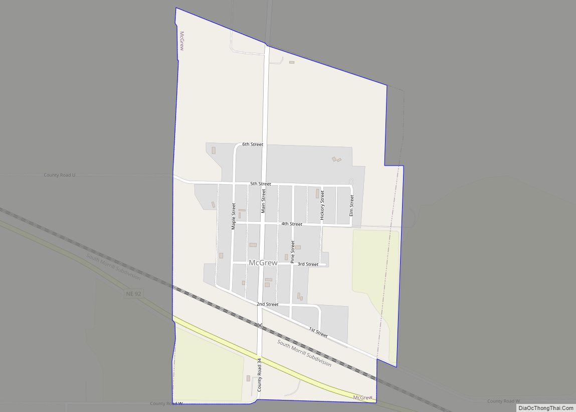
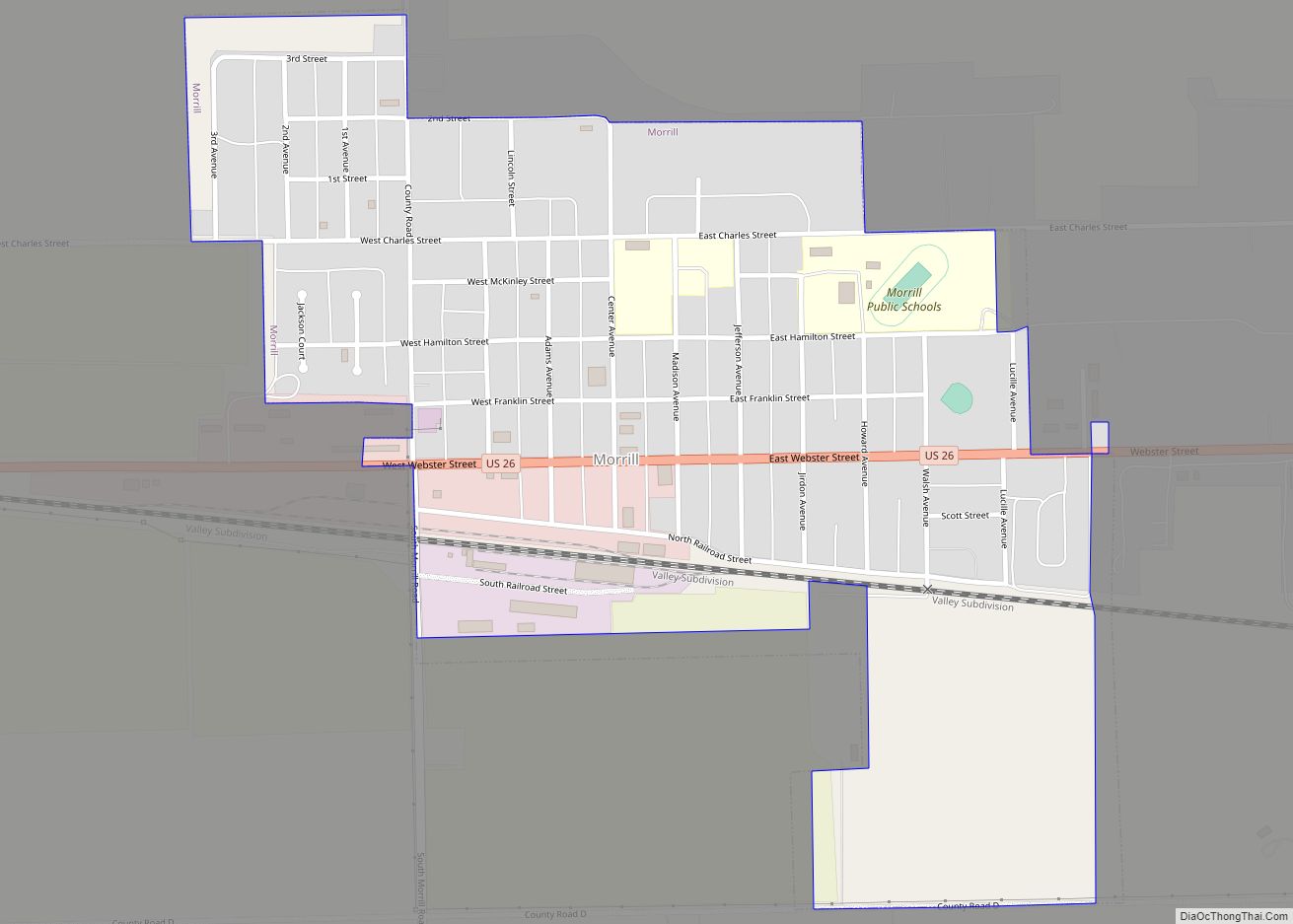
Online Interactive Map
Click on ![]() to view map in "full screen" mode.
to view map in "full screen" mode.
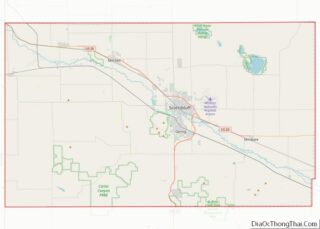
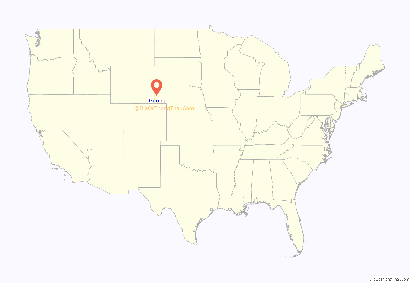
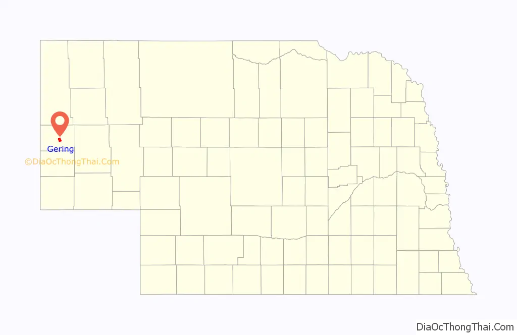
Gering location map. Where is Gering city?
History
Gering was officially founded on March 7, 1887, being located at the base of the bluff that is now the center of Scotts Bluff National Monument. Although settled in 1886, Gering officially became a town in 1887 by a corporation headed by Oscar Gardner of Broken Bow, Nebraska and named for Martin Gering, a pioneer merchant with whom Gardner started the first dry goods store. Gardner, who was also a lawyer and Gering’s first notary public, started the post office 1887, becoming Gering’s first Postmaster. Union Pacific Railroad platted the town in 1887, but did not lay any track until 1910. In November 1888, Scottsbluff county split from Cheyenne County, and Gering became the new county seat. The city of Scottsbluff was founded across the North Platte River from the bluff in 1899, by a subsidiary of the Burlington Railroad, and had track and a makeshift depot by 1900. Separated only by the river, the two cities have since grown together and now form the 7th largest urban area in Nebraska.
Gering has been served since its founding by the Gering Courier newspaper.
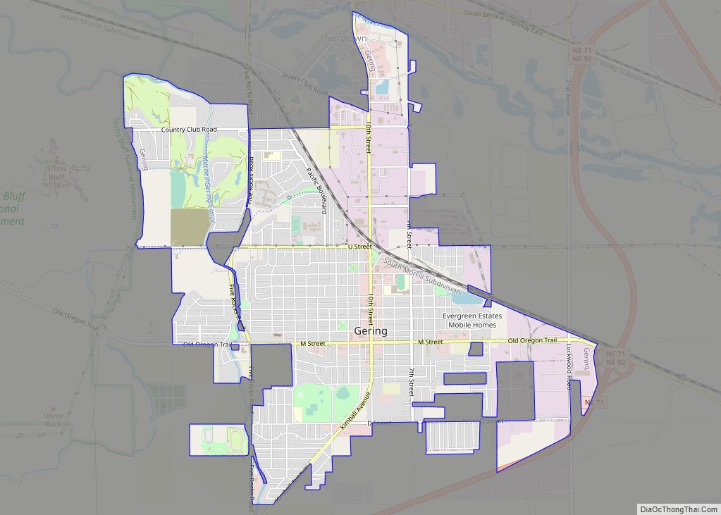
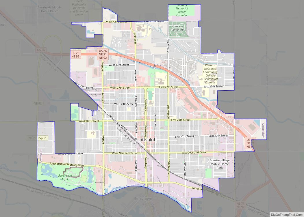
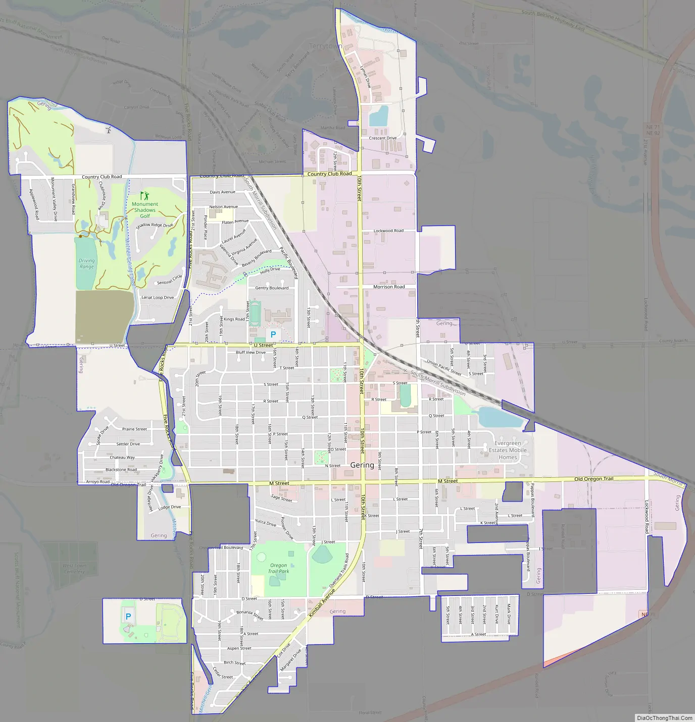
Gering Road Map
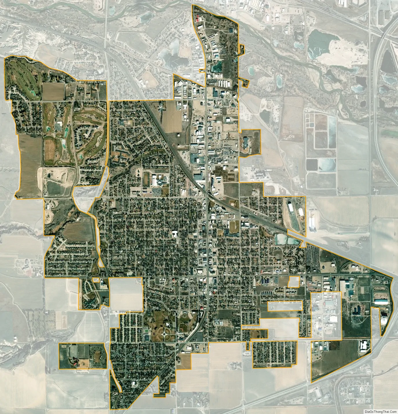
Gering city Satellite Map
Geography
Gering is located at 41°49′27″N 103°39′54″W / 41.82417°N 103.66500°W / 41.82417; -103.66500 (41.824251, -103.665009). According to the United States Census Bureau, the city has a total area of 4.30 square miles (11.14 km), all of it land.
See also
Map of Nebraska State and its subdivision:- Adams
- Antelope
- Arthur
- Banner
- Blaine
- Boone
- Box Butte
- Boyd
- Brown
- Buffalo
- Burt
- Butler
- Cass
- Cedar
- Chase
- Cherry
- Cheyenne
- Clay
- Colfax
- Cuming
- Custer
- Dakota
- Dawes
- Dawson
- Deuel
- Dixon
- Dodge
- Douglas
- Dundy
- Fillmore
- Franklin
- Frontier
- Furnas
- Gage
- Garden
- Garfield
- Gosper
- Grant
- Greeley
- Hall
- Hamilton
- Harlan
- Hayes
- Hitchcock
- Holt
- Hooker
- Howard
- Jefferson
- Johnson
- Kearney
- Keith
- Keya Paha
- Kimball
- Knox
- Lancaster
- Lincoln
- Logan
- Loup
- Madison
- McPherson
- Merrick
- Morrill
- Nance
- Nemaha
- Nuckolls
- Otoe
- Pawnee
- Perkins
- Phelps
- Pierce
- Platte
- Polk
- Red Willow
- Richardson
- Rock
- Saline
- Sarpy
- Saunders
- Scotts Bluff
- Seward
- Sheridan
- Sherman
- Sioux
- Stanton
- Thayer
- Thomas
- Thurston
- Valley
- Washington
- Wayne
- Webster
- Wheeler
- York
- Alabama
- Alaska
- Arizona
- Arkansas
- California
- Colorado
- Connecticut
- Delaware
- District of Columbia
- Florida
- Georgia
- Hawaii
- Idaho
- Illinois
- Indiana
- Iowa
- Kansas
- Kentucky
- Louisiana
- Maine
- Maryland
- Massachusetts
- Michigan
- Minnesota
- Mississippi
- Missouri
- Montana
- Nebraska
- Nevada
- New Hampshire
- New Jersey
- New Mexico
- New York
- North Carolina
- North Dakota
- Ohio
- Oklahoma
- Oregon
- Pennsylvania
- Rhode Island
- South Carolina
- South Dakota
- Tennessee
- Texas
- Utah
- Vermont
- Virginia
- Washington
- West Virginia
- Wisconsin
- Wyoming