Gibbon is a city in Buffalo County, Nebraska, United States. It is part of the Kearney, Nebraska Micropolitan Statistical Area. The population was 1,833 at the 2010 census.
| Name: | Gibbon city |
|---|---|
| LSAD Code: | 25 |
| LSAD Description: | city (suffix) |
| State: | Nebraska |
| County: | Buffalo County |
| Elevation: | 2,060 ft (628 m) |
| Total Area: | 0.87 sq mi (2.25 km²) |
| Land Area: | 0.87 sq mi (2.25 km²) |
| Water Area: | 0.00 sq mi (0.00 km²) |
| Total Population: | 1,878 |
| Population Density: | 2,161.10/sq mi (834.83/km²) |
| ZIP code: | 68840 |
| Area code: | 308 |
| FIPS code: | 3118615 |
| GNISfeature ID: | 0829509 |
| Website: | www.cityofgibbon.org |
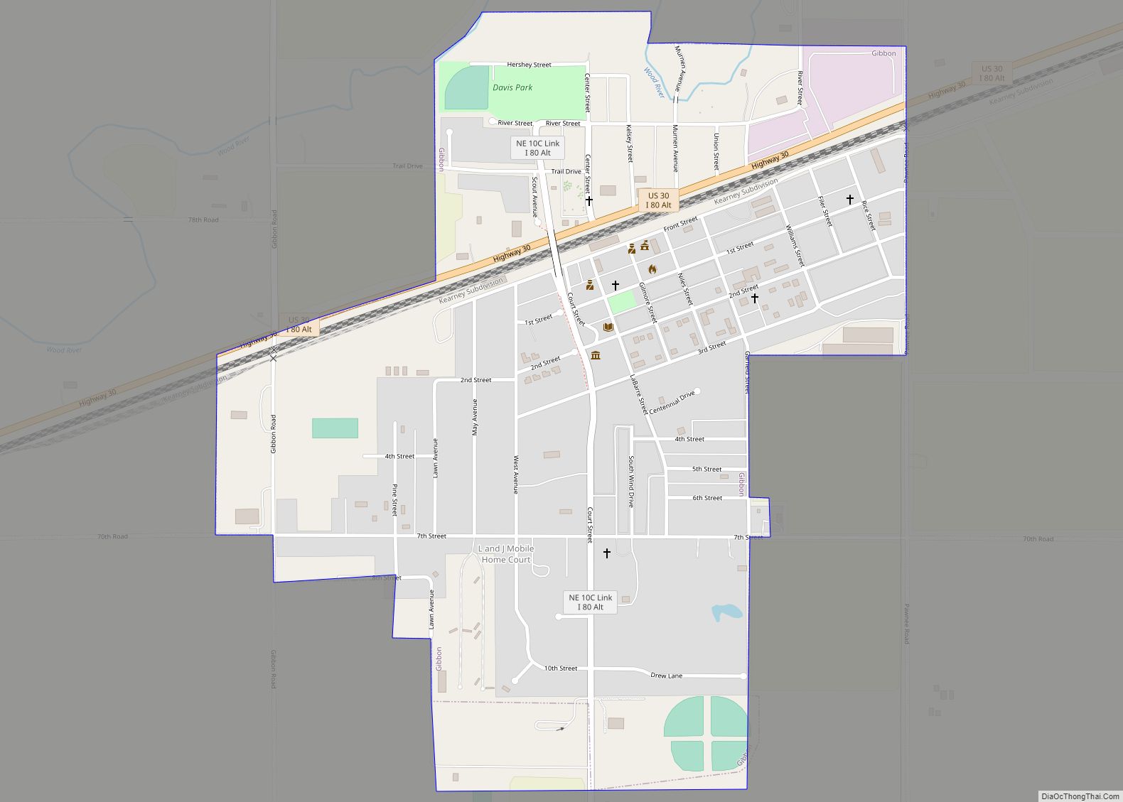
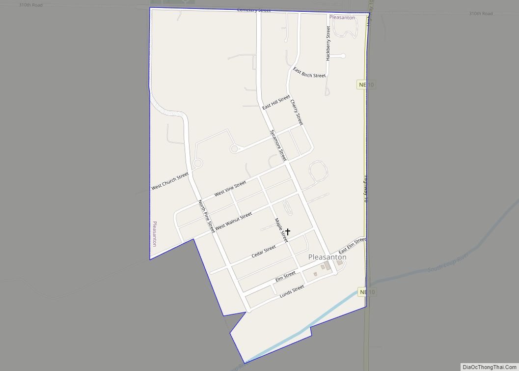
Online Interactive Map
Click on ![]() to view map in "full screen" mode.
to view map in "full screen" mode.
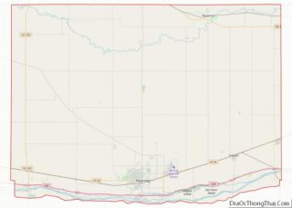
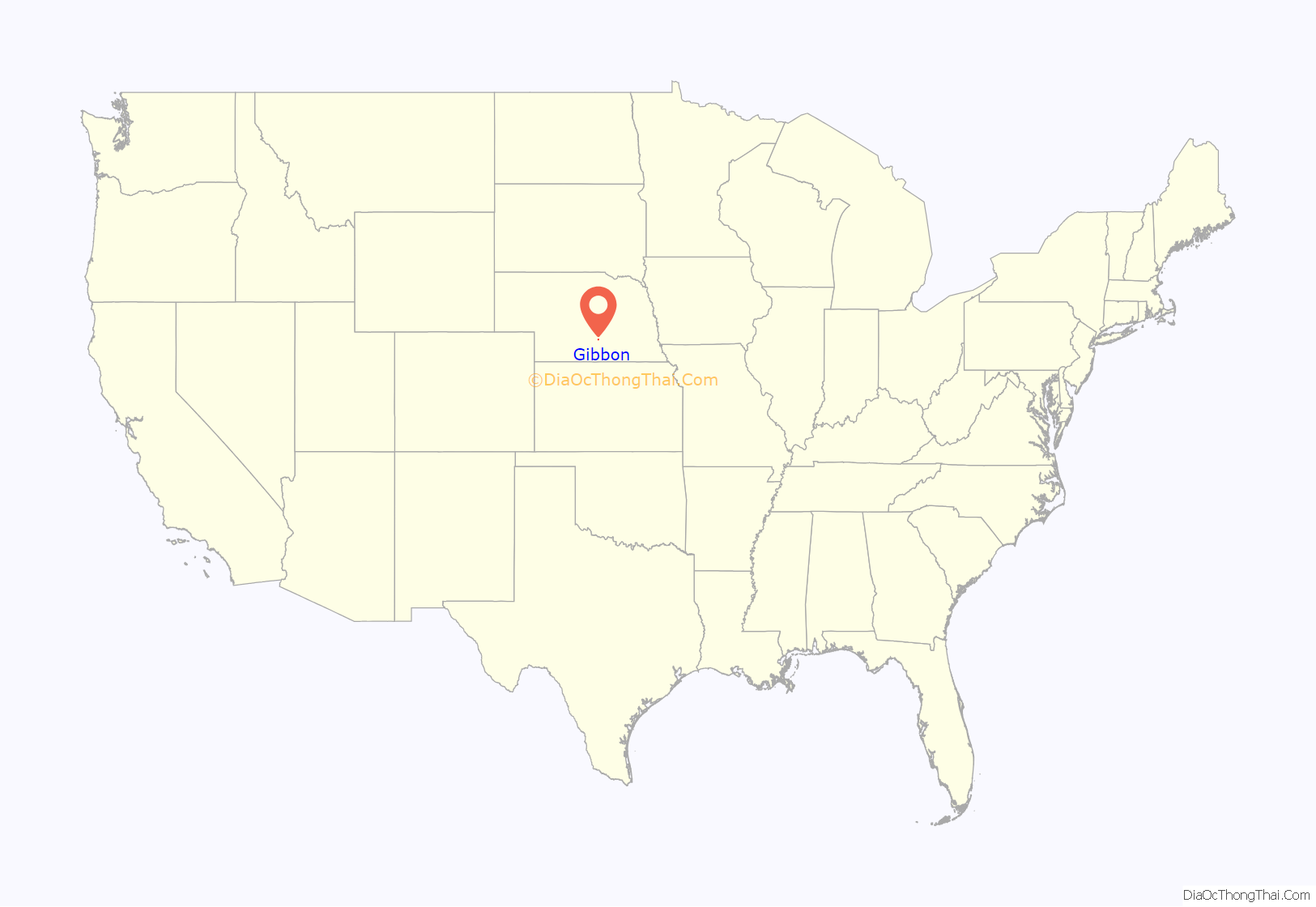
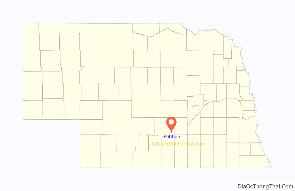
Gibbon location map. Where is Gibbon city?
History
Gibbon was founded in 1871 by a group of settlers consisting of many Civil War veterans. It was named for Major General John Gibbon. It was the former county seat of Buffalo County until Kearney was voted the seat in 1874.
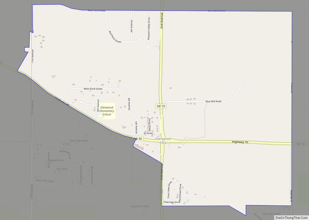
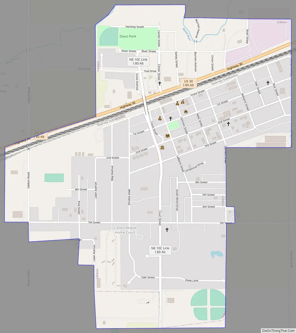
Gibbon Road Map
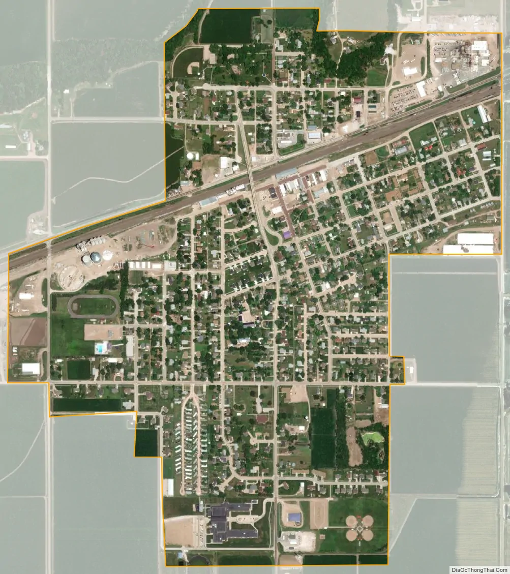
Gibbon city Satellite Map
Geography
Gibbon is located at 40°44′52″N 98°50′40″W / 40.74778°N 98.84444°W / 40.74778; -98.84444 (40.747656, -98.844381).
According to the United States Census Bureau, the city has a total area of 0.87 square miles (2.25 km), all land.
Gibbon is a few miles north of Interstate 80 and U.S. Route 30 passes through it.
See also
Map of Nebraska State and its subdivision:- Adams
- Antelope
- Arthur
- Banner
- Blaine
- Boone
- Box Butte
- Boyd
- Brown
- Buffalo
- Burt
- Butler
- Cass
- Cedar
- Chase
- Cherry
- Cheyenne
- Clay
- Colfax
- Cuming
- Custer
- Dakota
- Dawes
- Dawson
- Deuel
- Dixon
- Dodge
- Douglas
- Dundy
- Fillmore
- Franklin
- Frontier
- Furnas
- Gage
- Garden
- Garfield
- Gosper
- Grant
- Greeley
- Hall
- Hamilton
- Harlan
- Hayes
- Hitchcock
- Holt
- Hooker
- Howard
- Jefferson
- Johnson
- Kearney
- Keith
- Keya Paha
- Kimball
- Knox
- Lancaster
- Lincoln
- Logan
- Loup
- Madison
- McPherson
- Merrick
- Morrill
- Nance
- Nemaha
- Nuckolls
- Otoe
- Pawnee
- Perkins
- Phelps
- Pierce
- Platte
- Polk
- Red Willow
- Richardson
- Rock
- Saline
- Sarpy
- Saunders
- Scotts Bluff
- Seward
- Sheridan
- Sherman
- Sioux
- Stanton
- Thayer
- Thomas
- Thurston
- Valley
- Washington
- Wayne
- Webster
- Wheeler
- York
- Alabama
- Alaska
- Arizona
- Arkansas
- California
- Colorado
- Connecticut
- Delaware
- District of Columbia
- Florida
- Georgia
- Hawaii
- Idaho
- Illinois
- Indiana
- Iowa
- Kansas
- Kentucky
- Louisiana
- Maine
- Maryland
- Massachusetts
- Michigan
- Minnesota
- Mississippi
- Missouri
- Montana
- Nebraska
- Nevada
- New Hampshire
- New Jersey
- New Mexico
- New York
- North Carolina
- North Dakota
- Ohio
- Oklahoma
- Oregon
- Pennsylvania
- Rhode Island
- South Carolina
- South Dakota
- Tennessee
- Texas
- Utah
- Vermont
- Virginia
- Washington
- West Virginia
- Wisconsin
- Wyoming