Harrisburg is a rural small town in, and the county seat of, Banner County, Nebraska, United States. The population was 100 at the 2010 census.
| Name: | Harrisburg CDP |
|---|---|
| LSAD Code: | 57 |
| LSAD Description: | CDP (suffix) |
| State: | Nebraska |
| County: | Banner County |
| Elevation: | 4,491 ft (1,369 m) |
| Total Area: | 6.47 sq mi (16.76 km²) |
| Land Area: | 6.47 sq mi (16.76 km²) |
| Water Area: | 0.00 sq mi (0.00 km²) |
| Total Population: | 99 |
| Population Density: | 15.30/sq mi (5.91/km²) |
| ZIP code: | 69345 |
| Area code: | 308 |
| FIPS code: | 3121030 |
| GNISfeature ID: | 0829823 |
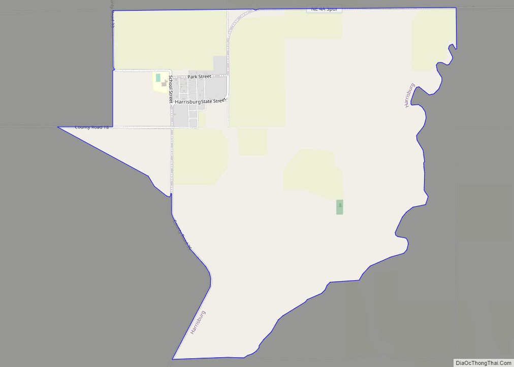
Online Interactive Map
Click on ![]() to view map in "full screen" mode.
to view map in "full screen" mode.
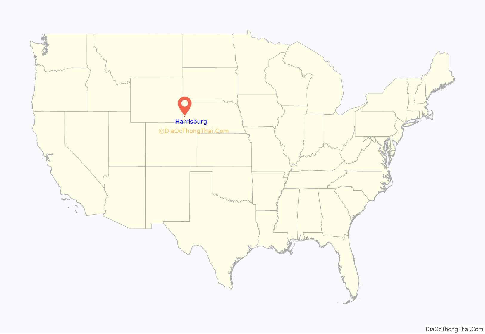
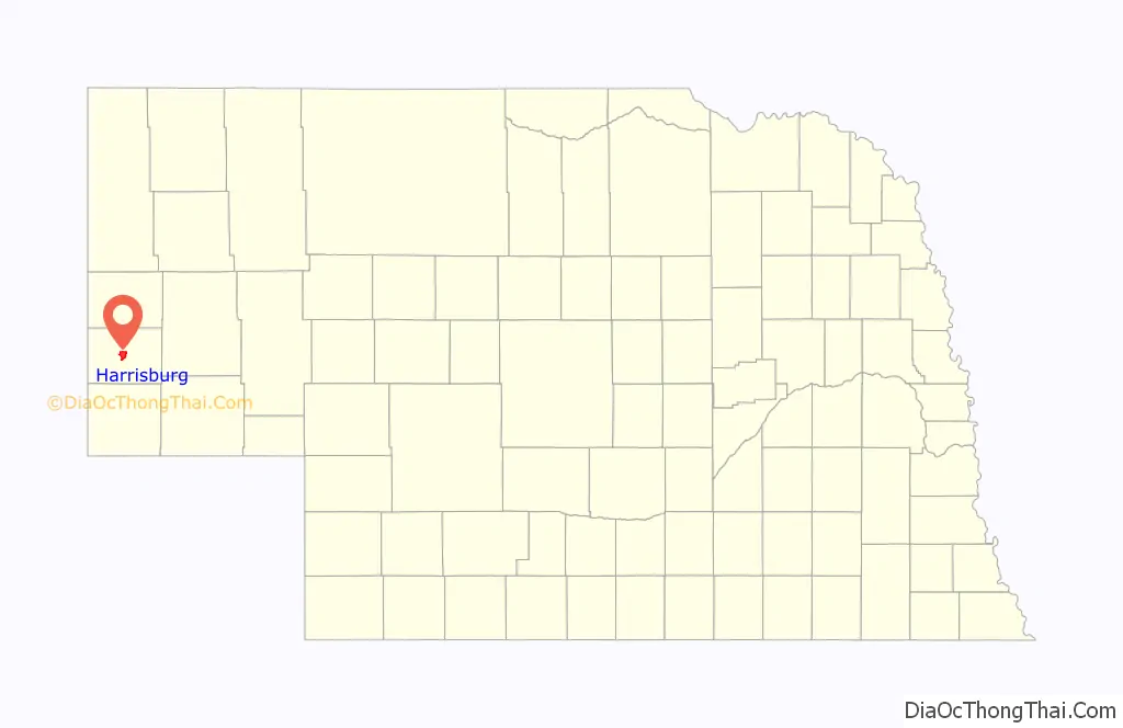
Harrisburg location map. Where is Harrisburg CDP?
History
Harrisburg, and all of Banner County, were originally part of Cheyenne County and began with a homestead in 1884. A settlement, at first called Randall and then Centropolis, developed around this and neighboring homesteads. In November, 1888, Cheyenne County subdivided into five counties, and the settlement was included in the territory which became Banner County. Its county seat was originally located at Ashford, a few miles northeast. However, in 1889 Charles Schooley, a settler, donated part of his land for the development of a formal town. A migrant being from Harrisburg, Pennsylvania caused the name to be selected.
Because of its central location, Harrisburg became the home base for stagecoach and mail carrier lines in the county, and the county government moved its operations from Ashford in mid-1891. By 1892, Harrisburg had two hotels, two livery stables, a brickwork, a cheese factory, two banks and three newspapers. It was the principal community for the county, which was almost entirely devoted to wheat farming and cattle ranching. In 1951, oil (which had first been discovered in 1919) became the county’s third commodity.
Harrisburg’s fortunes rose and fell with the county’s. The lack of a railroad line for shipping eventually drew the larger farm and ranch houses to the north, while the 1960s routing of Interstate Highway 80 through Kimball brought the removal of other businesses to the south. Other small hamlets in Banner County collapsed as people moved either north or south, or consolidated their activities around Harrisburg. This movement has allowed Harrisburg to flourish into the 21st century, despite its low resident population.
Harrisburg Road Map
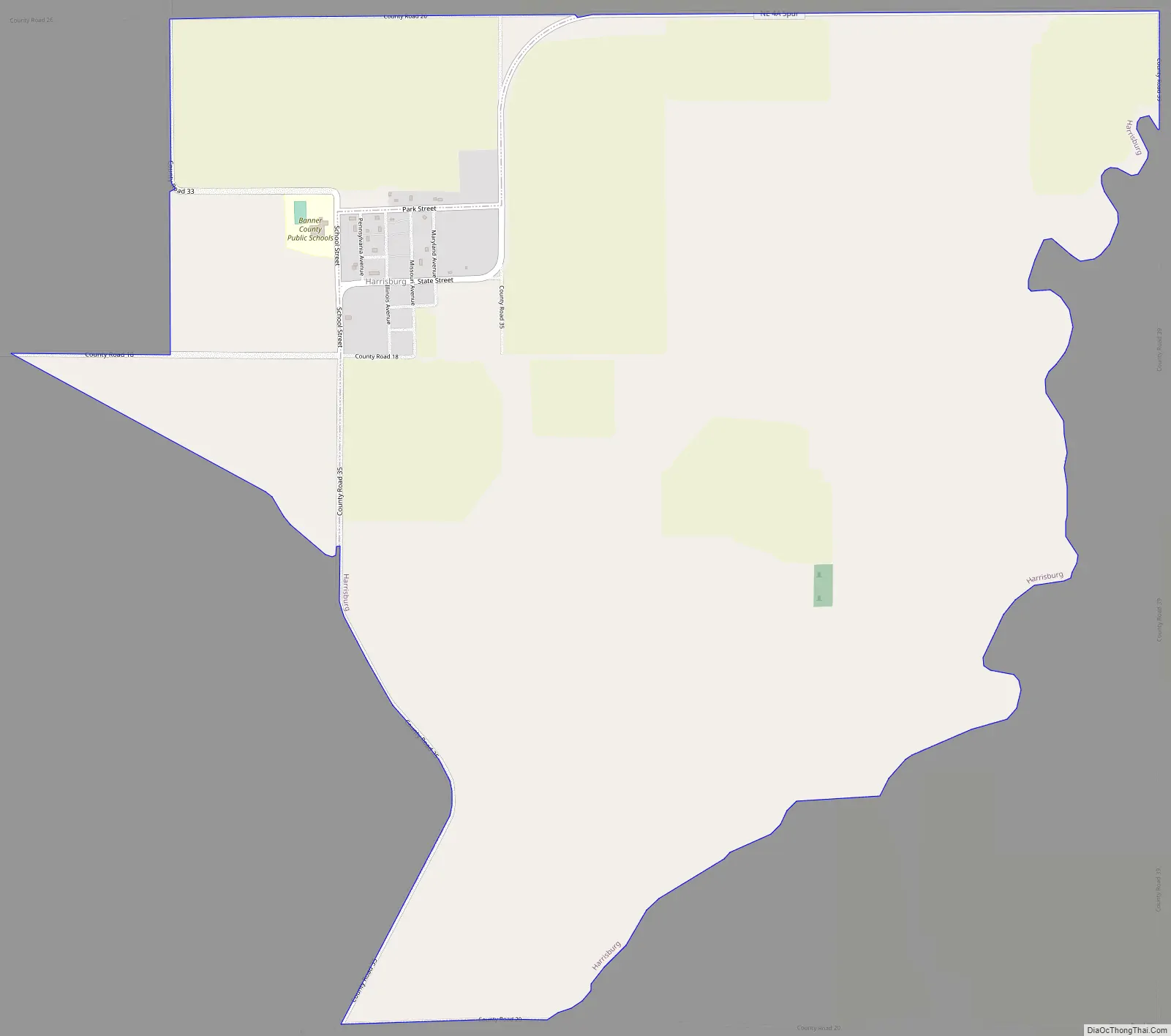
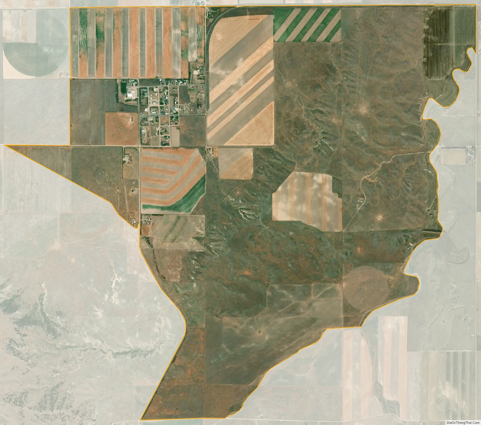
Harrisburg city Satellite Map
Geography
Harrisburg is located at 41°33′16″N 103°44′25″W / 41.55444°N 103.74028°W / 41.55444; -103.74028 (41.554553, -103.740379). According to the United States Census Bureau, the CDP has a total area of 5.3 square miles (14 km), all land.
See also
Map of Nebraska State and its subdivision:- Adams
- Antelope
- Arthur
- Banner
- Blaine
- Boone
- Box Butte
- Boyd
- Brown
- Buffalo
- Burt
- Butler
- Cass
- Cedar
- Chase
- Cherry
- Cheyenne
- Clay
- Colfax
- Cuming
- Custer
- Dakota
- Dawes
- Dawson
- Deuel
- Dixon
- Dodge
- Douglas
- Dundy
- Fillmore
- Franklin
- Frontier
- Furnas
- Gage
- Garden
- Garfield
- Gosper
- Grant
- Greeley
- Hall
- Hamilton
- Harlan
- Hayes
- Hitchcock
- Holt
- Hooker
- Howard
- Jefferson
- Johnson
- Kearney
- Keith
- Keya Paha
- Kimball
- Knox
- Lancaster
- Lincoln
- Logan
- Loup
- Madison
- McPherson
- Merrick
- Morrill
- Nance
- Nemaha
- Nuckolls
- Otoe
- Pawnee
- Perkins
- Phelps
- Pierce
- Platte
- Polk
- Red Willow
- Richardson
- Rock
- Saline
- Sarpy
- Saunders
- Scotts Bluff
- Seward
- Sheridan
- Sherman
- Sioux
- Stanton
- Thayer
- Thomas
- Thurston
- Valley
- Washington
- Wayne
- Webster
- Wheeler
- York
- Alabama
- Alaska
- Arizona
- Arkansas
- California
- Colorado
- Connecticut
- Delaware
- District of Columbia
- Florida
- Georgia
- Hawaii
- Idaho
- Illinois
- Indiana
- Iowa
- Kansas
- Kentucky
- Louisiana
- Maine
- Maryland
- Massachusetts
- Michigan
- Minnesota
- Mississippi
- Missouri
- Montana
- Nebraska
- Nevada
- New Hampshire
- New Jersey
- New Mexico
- New York
- North Carolina
- North Dakota
- Ohio
- Oklahoma
- Oregon
- Pennsylvania
- Rhode Island
- South Carolina
- South Dakota
- Tennessee
- Texas
- Utah
- Vermont
- Virginia
- Washington
- West Virginia
- Wisconsin
- Wyoming