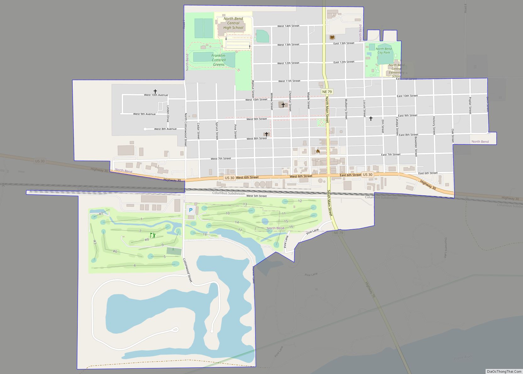
North Bend is a city in Dodge County, Nebraska, United States. The population was 1,177 at the 2010 census.
| Name: | North Bend city |
|---|---|
| LSAD Code: | 25 |
| LSAD Description: | city (suffix) |
| State: | Nebraska |
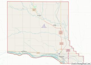
| County: | Dodge County |
| Elevation: | 1,273 ft (388 m) |
| Total Area: | 1.20 sq mi (3.10 km²) |
| Land Area: | 1.12 sq mi (2.90 km²) |
| Water Area: | 0.07 sq mi (0.19 km²) |
| Total Population: | 1,279 |
| Population Density: | 1,141.96/sq mi (440.72/km²) |
| ZIP code: | 68649 |
| Area code: | 402 |
| FIPS code: | 3134720 |
| GNISfeature ID: | 0831653 |
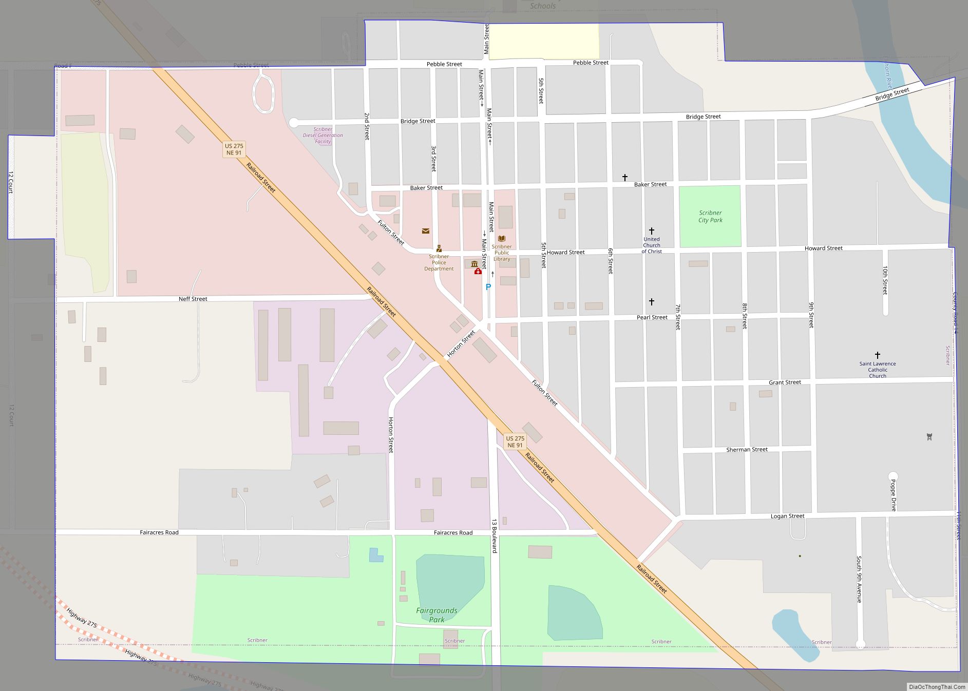
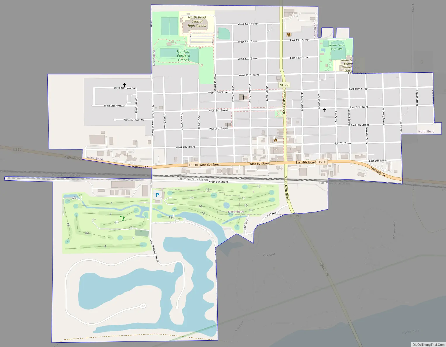
Online Interactive Map
Click on ![]() to view map in "full screen" mode.
to view map in "full screen" mode.
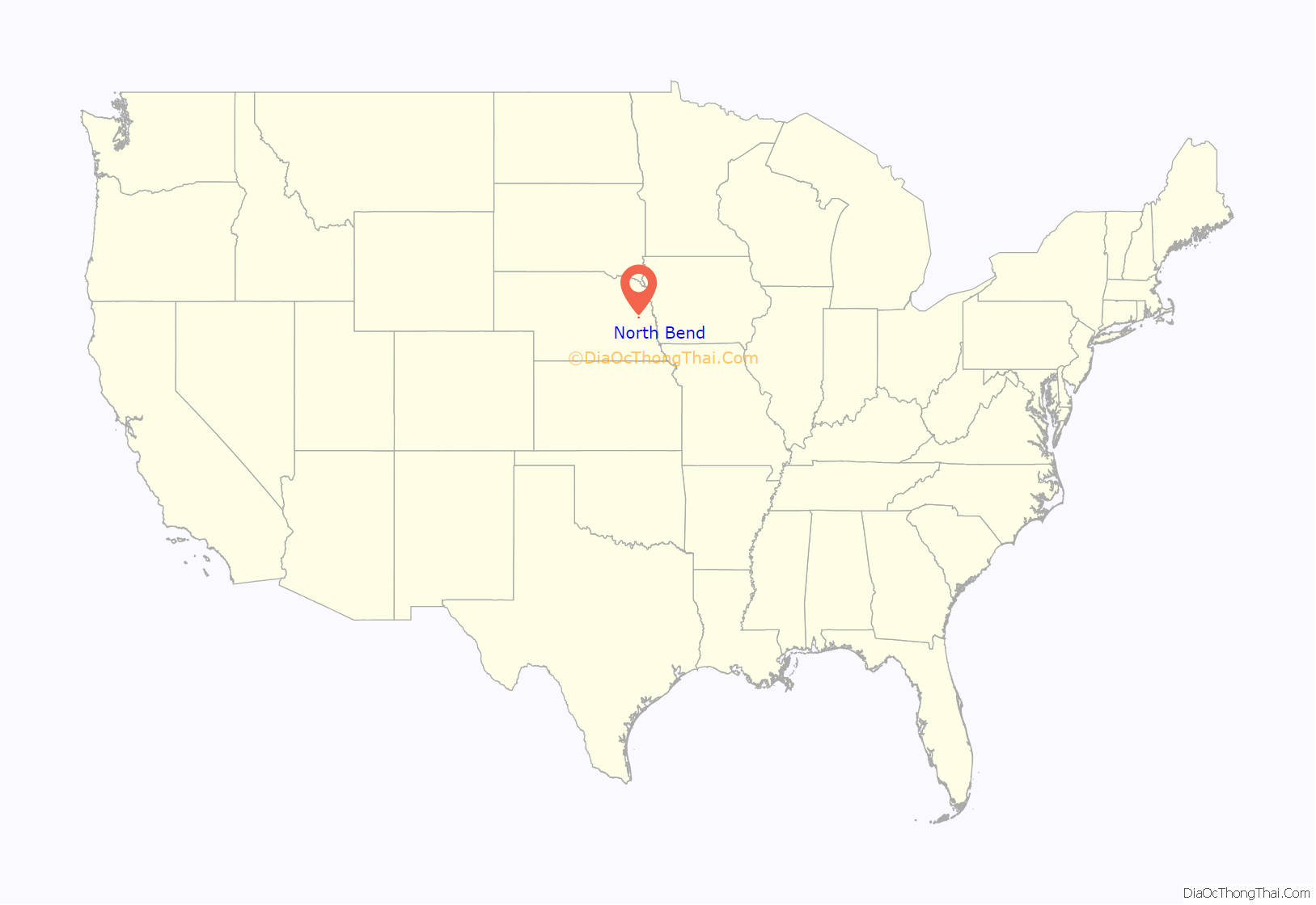
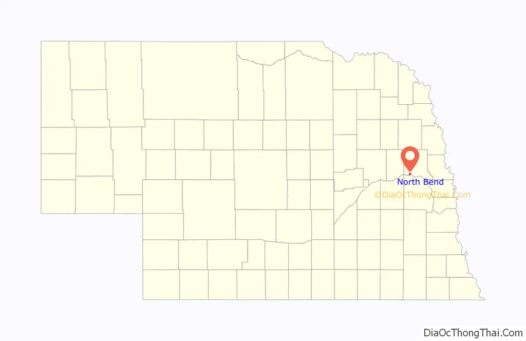
North Bend location map. Where is North Bend city?
History
The site of North Bend was settled in 1856 by a party of Scottish immigrants. En route from Lake Zurich, Illinois to Kansas, they stopped at a bend at the northernmost point of the Platte River, where they were invited to an impromptu Fourth of July celebration at a newly founded townsite named Emerson. Finding the site congenial, and concerned about the “Border War” in Kansas, they opted to remain there, founding a nearby townsite that they named Franklin.
The site grew with the arrival of new parties of settlers. One such party brought a steam-powered sawmill and meal-grinder, the first steam mill in Dodge County. In 1858, Emerson’s name was changed to Wallace, after a Philadelphia philanthropist who had offered to build a library in any town taking his name. In the 1860s, the town had a pontoon bridge across the Platte River allowing for trade with the farms to the south of the river making into the local grain market, a prime business opportunity for the incoming Union Pacific Railroad.
The combined townsite arrived at its present name in 1864, when the Union Pacific (UP) Railroad bought a piece of ground for a depot on the proposed transcontinental railroad. For many years, surveys had showed the town’s location as “the north bend” and was the northernmost point of the UP in the state of Nebraska. The residents and UP officials agreed on North Bend as the name for the town.
The first train arrived in North Bend in 1866, and the town was platted by the railroad in 1867. By 1876, the population had reached 250; there were 21 businesses, a school, and two churches. The city’s first newspaper, the Independent, was founded in 1879.
Growth continued steadily. In 1890, the population reached 897; a city building was constructed. By 1920, North Bend had electricity, a waterworks, and paved streets; the population was 1,087. The town continued to grow through much of the 20th century, with its population reaching a peak of 1,368 in 1980.
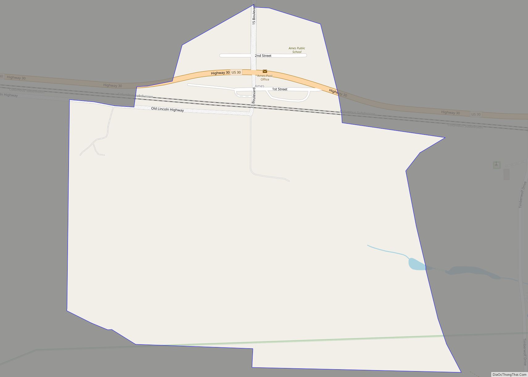
North Bend Road Map
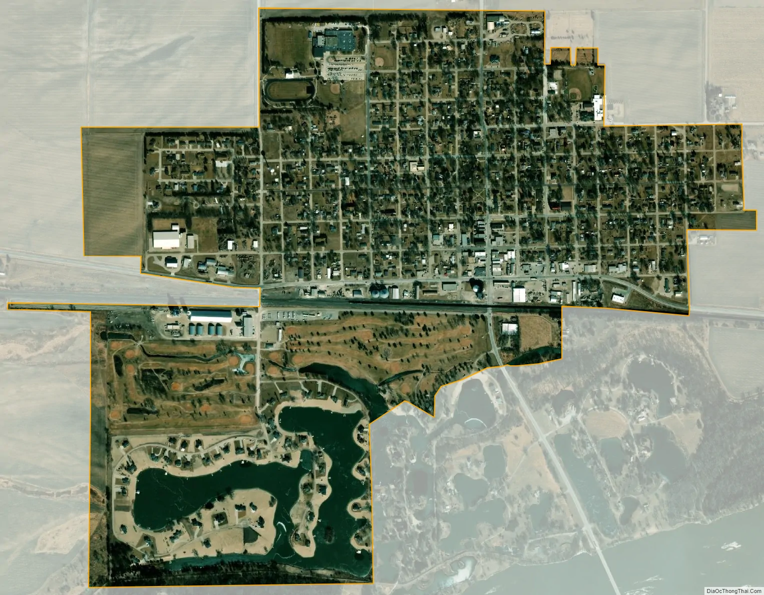
North Bend city Satellite Map
Geography
North Bend is located at 41°27′51″N 96°46′51″W / 41.46417°N 96.78083°W / 41.46417; -96.78083 (41.464285, -96.780874). It lies on the north bank of the Platte River, at the intersection of U.S. Route 30 and Nebraska Highway 79. The main east–west line of the Union Pacific Railroad passes through the city.
According to the United States Census Bureau, the city has a total area of 0.79 square miles (2.05 km), all land.
See also
Map of Nebraska State and its subdivision:- Adams
- Antelope
- Arthur
- Banner
- Blaine
- Boone
- Box Butte
- Boyd
- Brown
- Buffalo
- Burt
- Butler
- Cass
- Cedar
- Chase
- Cherry
- Cheyenne
- Clay
- Colfax
- Cuming
- Custer
- Dakota
- Dawes
- Dawson
- Deuel
- Dixon
- Dodge
- Douglas
- Dundy
- Fillmore
- Franklin
- Frontier
- Furnas
- Gage
- Garden
- Garfield
- Gosper
- Grant
- Greeley
- Hall
- Hamilton
- Harlan
- Hayes
- Hitchcock
- Holt
- Hooker
- Howard
- Jefferson
- Johnson
- Kearney
- Keith
- Keya Paha
- Kimball
- Knox
- Lancaster
- Lincoln
- Logan
- Loup
- Madison
- McPherson
- Merrick
- Morrill
- Nance
- Nemaha
- Nuckolls
- Otoe
- Pawnee
- Perkins
- Phelps
- Pierce
- Platte
- Polk
- Red Willow
- Richardson
- Rock
- Saline
- Sarpy
- Saunders
- Scotts Bluff
- Seward
- Sheridan
- Sherman
- Sioux
- Stanton
- Thayer
- Thomas
- Thurston
- Valley
- Washington
- Wayne
- Webster
- Wheeler
- York
- Alabama
- Alaska
- Arizona
- Arkansas
- California
- Colorado
- Connecticut
- Delaware
- District of Columbia
- Florida
- Georgia
- Hawaii
- Idaho
- Illinois
- Indiana
- Iowa
- Kansas
- Kentucky
- Louisiana
- Maine
- Maryland
- Massachusetts
- Michigan
- Minnesota
- Mississippi
- Missouri
- Montana
- Nebraska
- Nevada
- New Hampshire
- New Jersey
- New Mexico
- New York
- North Carolina
- North Dakota
- Ohio
- Oklahoma
- Oregon
- Pennsylvania
- Rhode Island
- South Carolina
- South Dakota
- Tennessee
- Texas
- Utah
- Vermont
- Virginia
- Washington
- West Virginia
- Wisconsin
- Wyoming