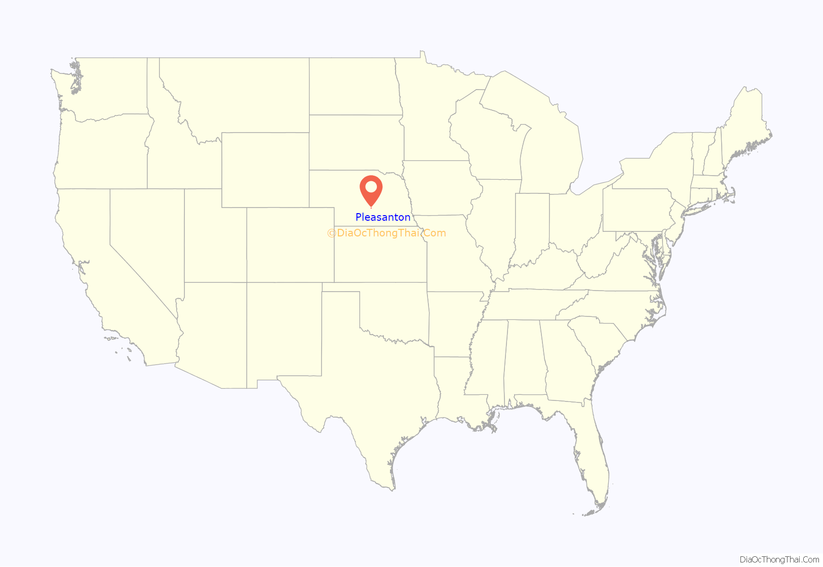
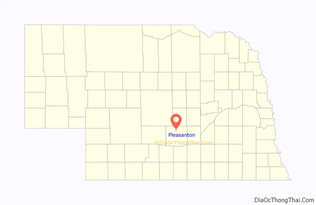
Pleasanton is a village in Buffalo County in the state of Nebraska in the Midwestern United States. At the 2010 census, its population was 341.
Pleasanton was platted in 1890 when the Union Pacific railroad was extended to that point. It got its name from its location in the Pleasant Valley of the Loup River. Pleasanton was incorporated as a village in 1894.
| Name: | Pleasanton village |
|---|---|
| LSAD Code: | 47 |
| LSAD Description: | village (suffix) |
| State: | Nebraska |
| County: | Buffalo County |
| Elevation: | 2,083 ft (635 m) |
| Total Area: | 0.35 sq mi (0.92 km²) |
| Land Area: | 0.35 sq mi (0.92 km²) |
| Water Area: | 0.00 sq mi (0.00 km²) |
| Total Population: | 361 |
| Population Density: | 1,016.90/sq mi (392.31/km²) |
| ZIP code: | 68866 |
| Area code: | 308 |
| FIPS code: | 3139450 |
| GNISfeature ID: | 0832267 |
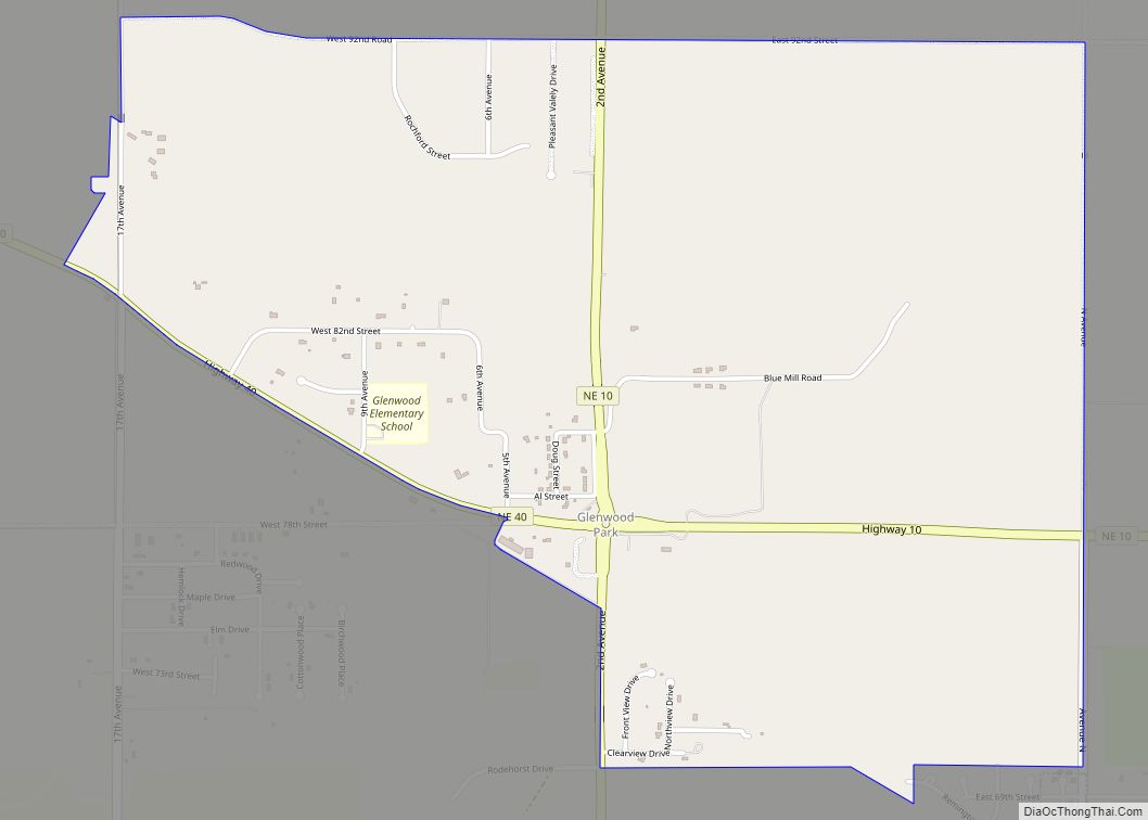
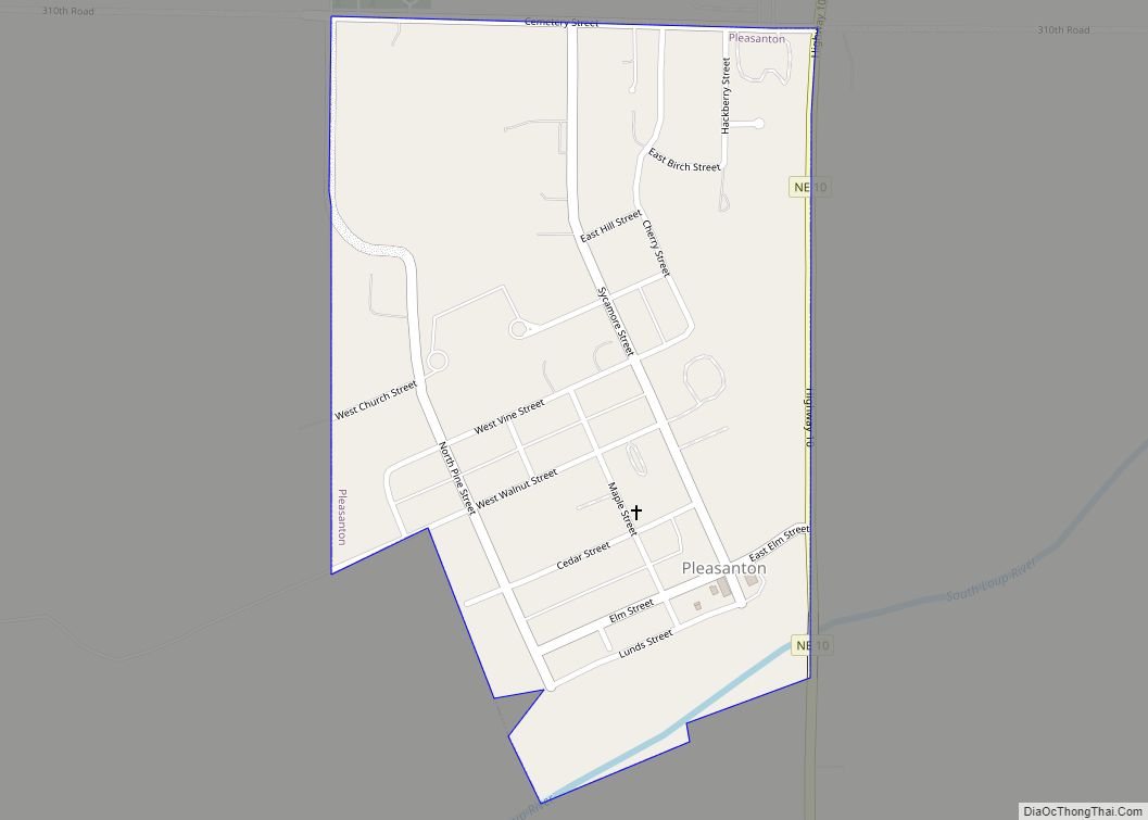
Online Interactive Map
Click on ![]() to view map in "full screen" mode.
to view map in "full screen" mode.
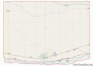
Pleasanton location map. Where is Pleasanton village?
History
The village was platted in April 1890 when the Union Pacific constructed a branch line of railroad, the Omaha and Republican Valley Railway, from Boelus in Howard County through Ravenna and on to Pleasant Valley. The village was a terminus station for the branch line of railroad located on the north side of the South Loup River called Pleasant Valley. This was also the location of an early settlement called Peters’ Bridge. The Peters family was one of the first settlers to the area when they constructed and operated the bridge. Peters’ Bridge was the location of a station on the stagecoach and freight line that went north with supplies. A post office was located in an area called South Loup, near the bridge. This area of section 35 of the Loup Township was previously known as Riverview, when the post office was established in 1883. James Hunter became the first postmaster of Riverview. The first regularly scheduled train arrived to the town on March 1, 1890. Local businesses and buildings were quickly constructed at the crossroads. The village schoolhouse was constructed on the south side of the South Loup River. This location served the town of Pleasanton until 1907 when an ice-jam clogged the river and backed the water up into the school. In 1909 a brick schoolhouse was built on top of the hill, above the flood plain. The flood was first of many disasters the village of Pleasanton has endured in its history. The disasters continued when a cyclone occurred in 1890, three fires burned parts of the town between 1892 and 1894, and two major floods occurred in 1924 and 1947. The 1947 flood washed out the railroad tracks that were responsible for the creation of the village. The village went through a growing spurt in the 1970s where 40 new homes were built.
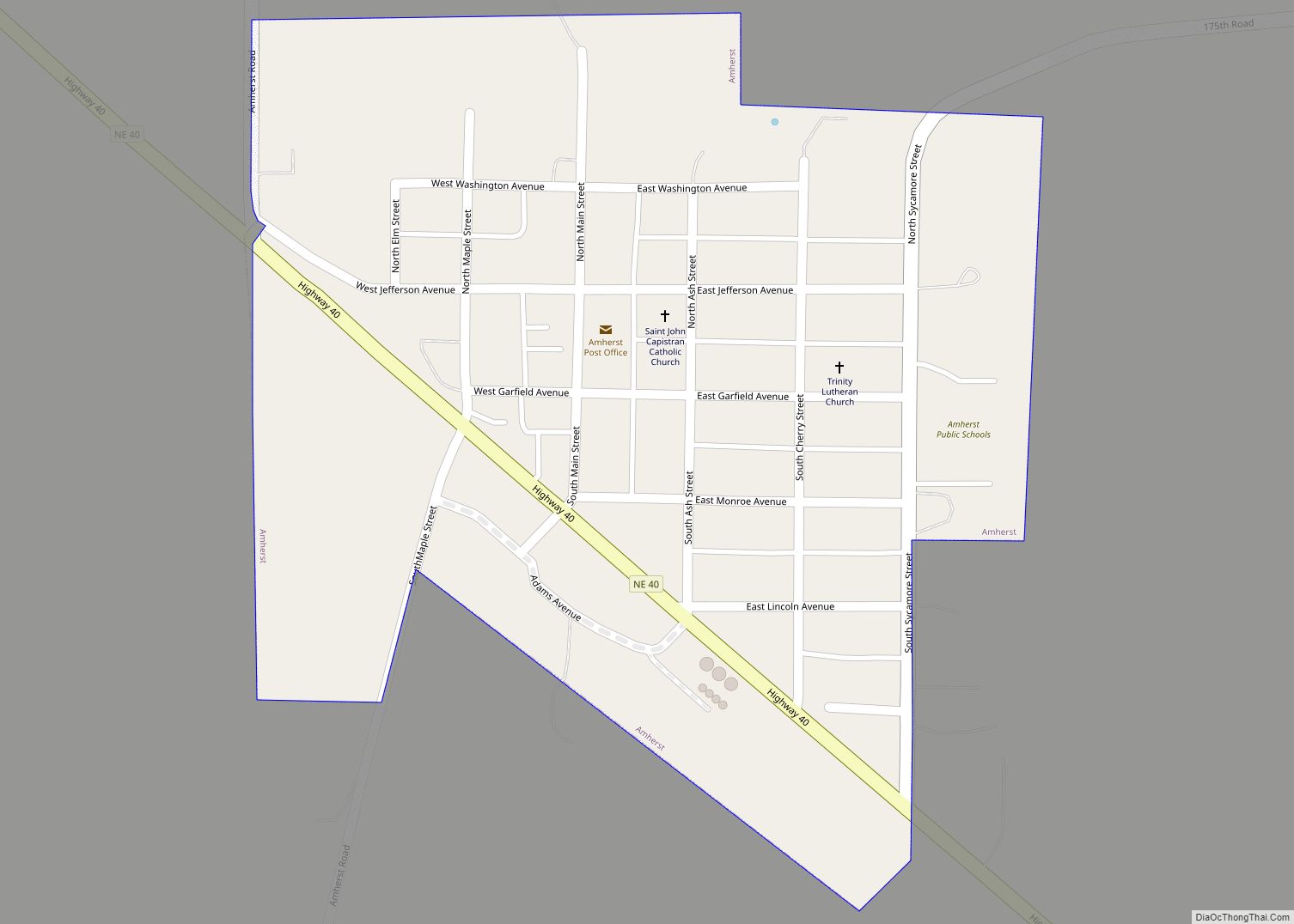
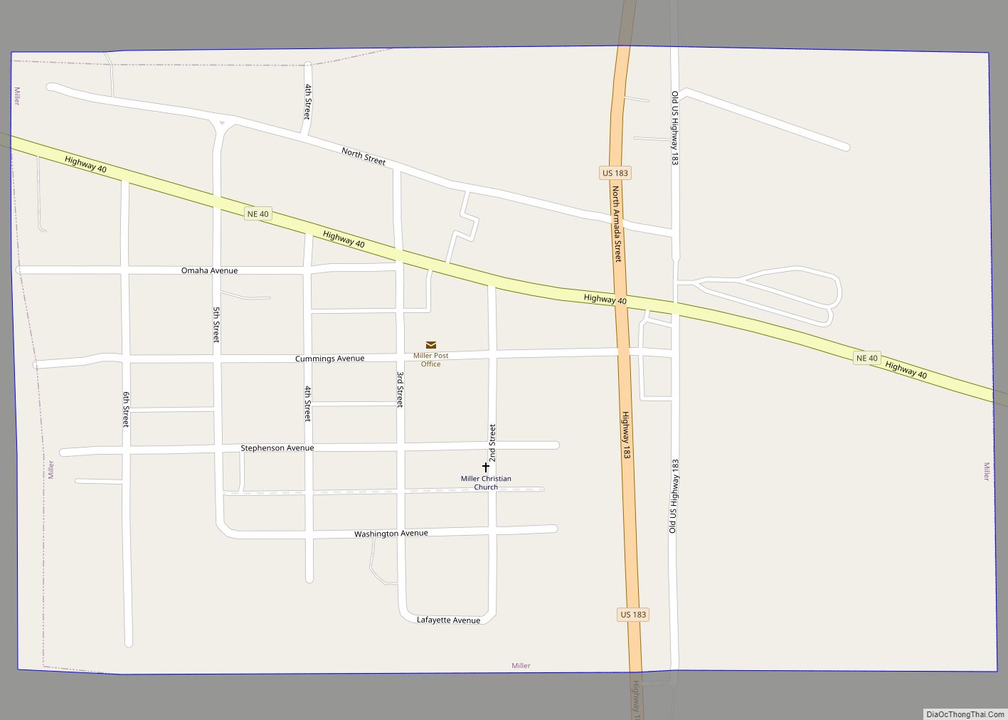
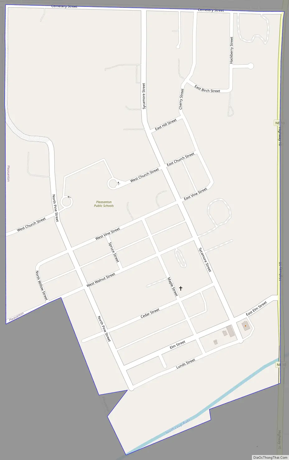
Pleasanton Road Map
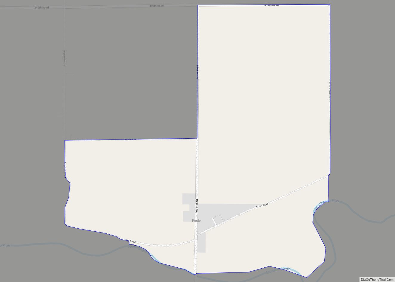
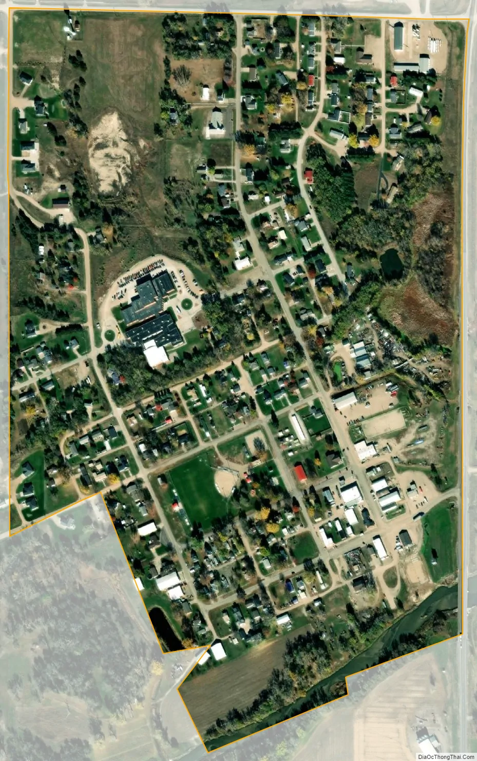
Pleasanton city Satellite Map
Geography
Pleasanton is located at 40°58′7″N 99°5′17″W / 40.96861°N 99.08806°W / 40.96861; -99.08806 (40.968612, -99.088086).
According to the United States Census Bureau, the village has a total area of 0.34 square miles (0.88 km), all land.
See also
Map of Nebraska State and its subdivision:- Adams
- Antelope
- Arthur
- Banner
- Blaine
- Boone
- Box Butte
- Boyd
- Brown
- Buffalo
- Burt
- Butler
- Cass
- Cedar
- Chase
- Cherry
- Cheyenne
- Clay
- Colfax
- Cuming
- Custer
- Dakota
- Dawes
- Dawson
- Deuel
- Dixon
- Dodge
- Douglas
- Dundy
- Fillmore
- Franklin
- Frontier
- Furnas
- Gage
- Garden
- Garfield
- Gosper
- Grant
- Greeley
- Hall
- Hamilton
- Harlan
- Hayes
- Hitchcock
- Holt
- Hooker
- Howard
- Jefferson
- Johnson
- Kearney
- Keith
- Keya Paha
- Kimball
- Knox
- Lancaster
- Lincoln
- Logan
- Loup
- Madison
- McPherson
- Merrick
- Morrill
- Nance
- Nemaha
- Nuckolls
- Otoe
- Pawnee
- Perkins
- Phelps
- Pierce
- Platte
- Polk
- Red Willow
- Richardson
- Rock
- Saline
- Sarpy
- Saunders
- Scotts Bluff
- Seward
- Sheridan
- Sherman
- Sioux
- Stanton
- Thayer
- Thomas
- Thurston
- Valley
- Washington
- Wayne
- Webster
- Wheeler
- York
- Alabama
- Alaska
- Arizona
- Arkansas
- California
- Colorado
- Connecticut
- Delaware
- District of Columbia
- Florida
- Georgia
- Hawaii
- Idaho
- Illinois
- Indiana
- Iowa
- Kansas
- Kentucky
- Louisiana
- Maine
- Maryland
- Massachusetts
- Michigan
- Minnesota
- Mississippi
- Missouri
- Montana
- Nebraska
- Nevada
- New Hampshire
- New Jersey
- New Mexico
- New York
- North Carolina
- North Dakota
- Ohio
- Oklahoma
- Oregon
- Pennsylvania
- Rhode Island
- South Carolina
- South Dakota
- Tennessee
- Texas
- Utah
- Vermont
- Virginia
- Washington
- West Virginia
- Wisconsin
- Wyoming