Strang is a village in Fillmore County, Nebraska, United States. The population was 34 at the 2020 census.
| Name: | Strang village |
|---|---|
| LSAD Code: | 47 |
| LSAD Description: | village (suffix) |
| State: | Nebraska |
| County: | Fillmore County |
| Elevation: | 1,621 ft (494 m) |
| Total Area: | 0.12 sq mi (0.32 km²) |
| Land Area: | 0.12 sq mi (0.32 km²) |
| Water Area: | 0.00 sq mi (0.00 km²) |
| Total Population: | 34 |
| Population Density: | 280/sq mi (110/km²) |
| ZIP code: | 68444 |
| Area code: | 402 |
| FIPS code: | 3147360 |
| GNISfeature ID: | 0833854 |
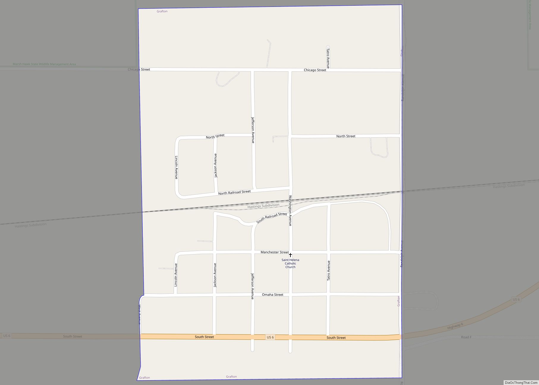
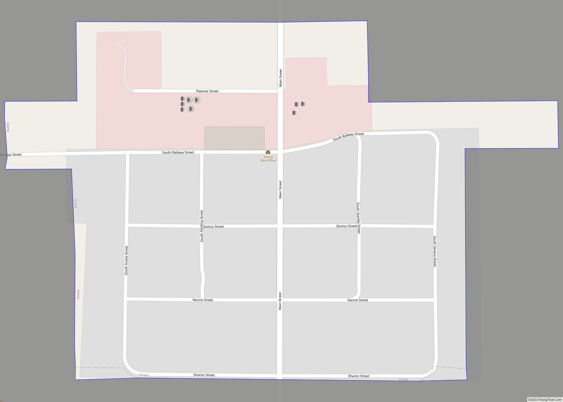
Online Interactive Map
Click on ![]() to view map in "full screen" mode.
to view map in "full screen" mode.
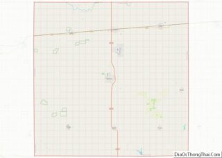
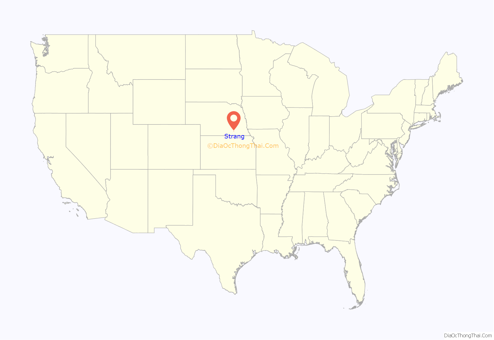
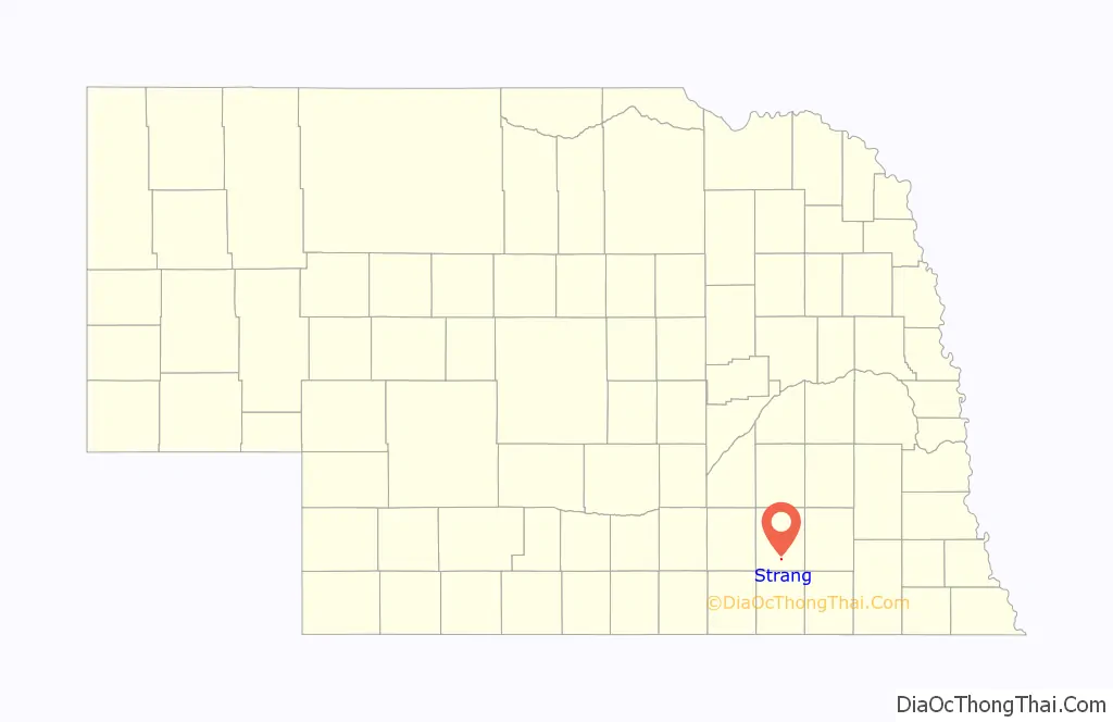
Strang location map. Where is Strang village?
History
Strang had its start in the 1880s by the building of the Burlington & Missouri River Railroad through that territory.
Strang was first settled in 1886, and was known as Media. About a month later, it became known as Bixby because it was thought that Media sounded like too many other towns in the area. In April 1886, the settlement was renamed Strang after A. L. Strang donated a windmill and water pump to the town. That windmill still stands today in downtown Strang, on Main Street. Around the turn of the century, fires ravaged the town. The two largest and most destructive fires occurred on October 10, 1899, and July 12, 1934. The fire of 1934 consumed one town block, including the post office, grocery store, cafe, and a residence.
Historic sites
The following buildings are on the National Register of Historic Places:
- Strang Town Hall/jail juilding
- Belle Prairie Township Hall Building
- Strang Public School
Strang Road Map
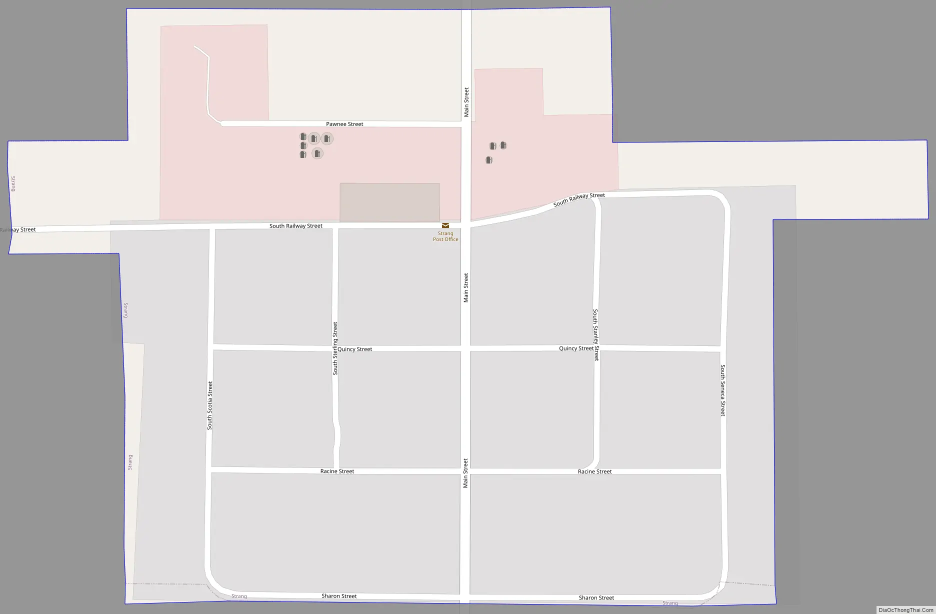
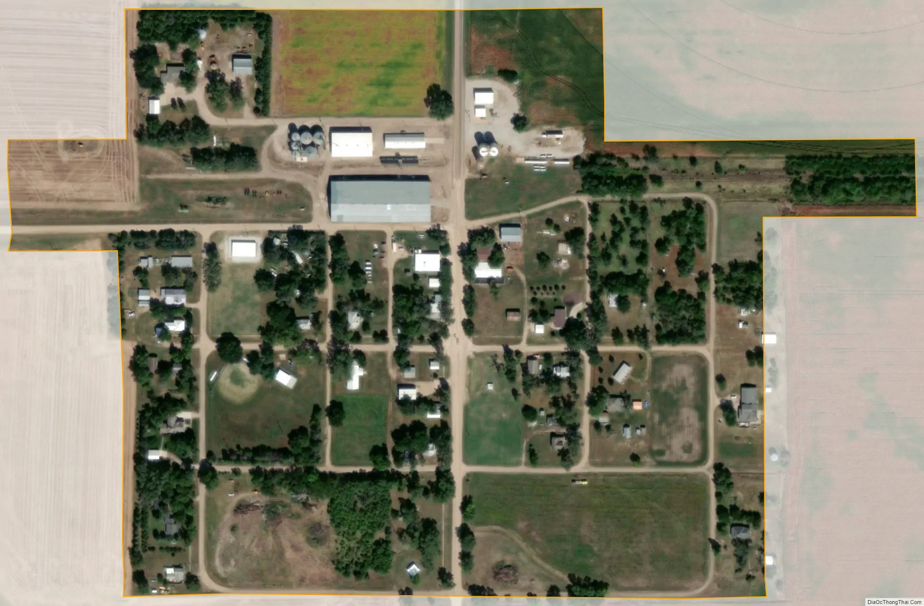
Strang city Satellite Map
Geography
Strang is located at 40°24′51″N 97°35′15″W / 40.41417°N 97.58750°W / 40.41417; -97.58750 (40.414114, -97.587435).
According to the United States Census Bureau, the village has a total area of 0.12 square miles (0.31 km), all land.
Strang is located along U.S. 81, and slightly south of Nebraska Highway 74. Nebraska Spur 30D, known locally as Main Street, passes through central Strang.
See also
Map of Nebraska State and its subdivision:- Adams
- Antelope
- Arthur
- Banner
- Blaine
- Boone
- Box Butte
- Boyd
- Brown
- Buffalo
- Burt
- Butler
- Cass
- Cedar
- Chase
- Cherry
- Cheyenne
- Clay
- Colfax
- Cuming
- Custer
- Dakota
- Dawes
- Dawson
- Deuel
- Dixon
- Dodge
- Douglas
- Dundy
- Fillmore
- Franklin
- Frontier
- Furnas
- Gage
- Garden
- Garfield
- Gosper
- Grant
- Greeley
- Hall
- Hamilton
- Harlan
- Hayes
- Hitchcock
- Holt
- Hooker
- Howard
- Jefferson
- Johnson
- Kearney
- Keith
- Keya Paha
- Kimball
- Knox
- Lancaster
- Lincoln
- Logan
- Loup
- Madison
- McPherson
- Merrick
- Morrill
- Nance
- Nemaha
- Nuckolls
- Otoe
- Pawnee
- Perkins
- Phelps
- Pierce
- Platte
- Polk
- Red Willow
- Richardson
- Rock
- Saline
- Sarpy
- Saunders
- Scotts Bluff
- Seward
- Sheridan
- Sherman
- Sioux
- Stanton
- Thayer
- Thomas
- Thurston
- Valley
- Washington
- Wayne
- Webster
- Wheeler
- York
- Alabama
- Alaska
- Arizona
- Arkansas
- California
- Colorado
- Connecticut
- Delaware
- District of Columbia
- Florida
- Georgia
- Hawaii
- Idaho
- Illinois
- Indiana
- Iowa
- Kansas
- Kentucky
- Louisiana
- Maine
- Maryland
- Massachusetts
- Michigan
- Minnesota
- Mississippi
- Missouri
- Montana
- Nebraska
- Nevada
- New Hampshire
- New Jersey
- New Mexico
- New York
- North Carolina
- North Dakota
- Ohio
- Oklahoma
- Oregon
- Pennsylvania
- Rhode Island
- South Carolina
- South Dakota
- Tennessee
- Texas
- Utah
- Vermont
- Virginia
- Washington
- West Virginia
- Wisconsin
- Wyoming