Stromsburg is a city in Polk County, Nebraska, United States. The population was 1,028 as per the 2020 census.
| Name: | Stromsburg city |
|---|---|
| LSAD Code: | 25 |
| LSAD Description: | city (suffix) |
| State: | Nebraska |
| County: | Polk County |
| Elevation: | 1,677 ft (511 m) |
| Total Area: | 1.03 sq mi (2.66 km²) |
| Land Area: | 1.02 sq mi (2.65 km²) |
| Water Area: | 0.00 sq mi (0.00 km²) |
| Total Population: | 1,028 |
| Population Density: | 1,115.12/sq mi (430.70/km²) |
| ZIP code: | 68666 |
| Area code: | 402 |
| FIPS code: | 3147465 |
| GNISfeature ID: | 0833862 |
| Website: | www.stromsburgnebraska.com |
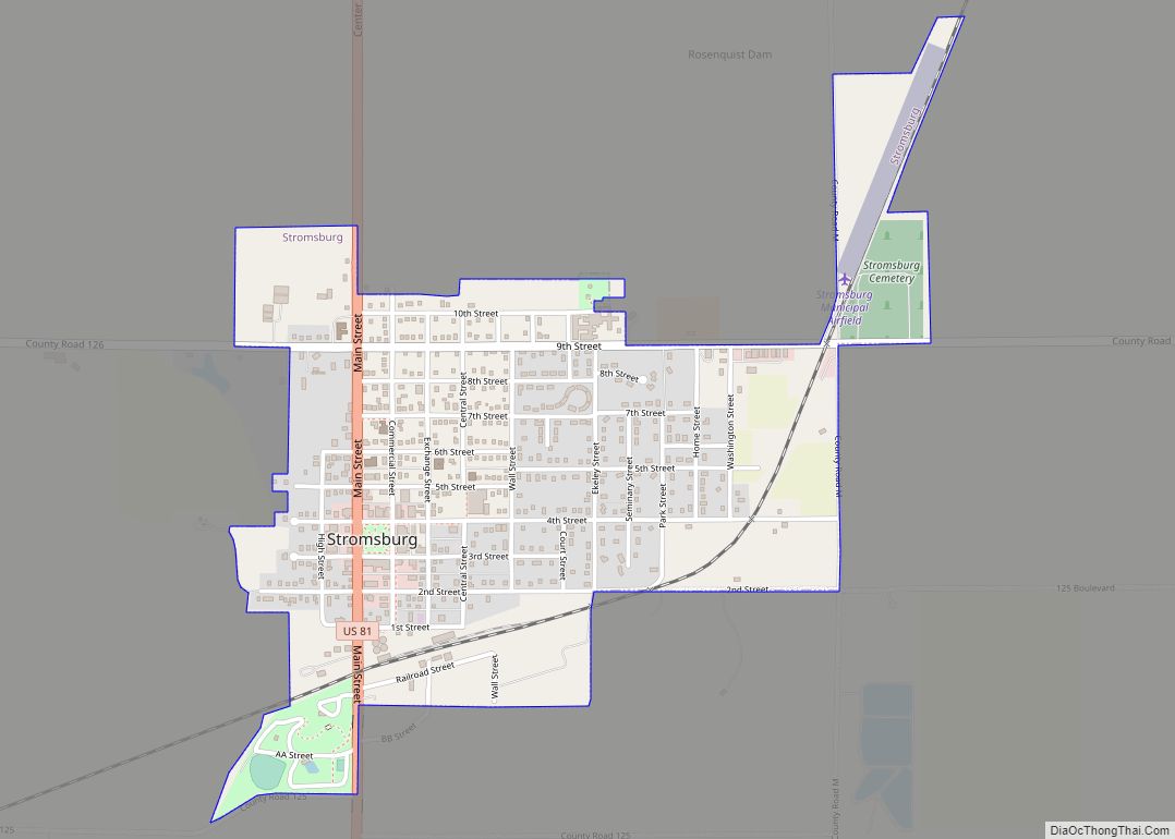
Online Interactive Map
Click on ![]() to view map in "full screen" mode.
to view map in "full screen" mode.
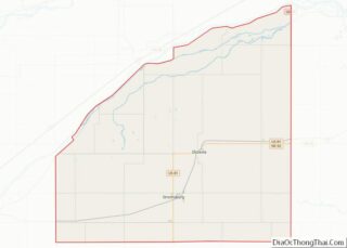
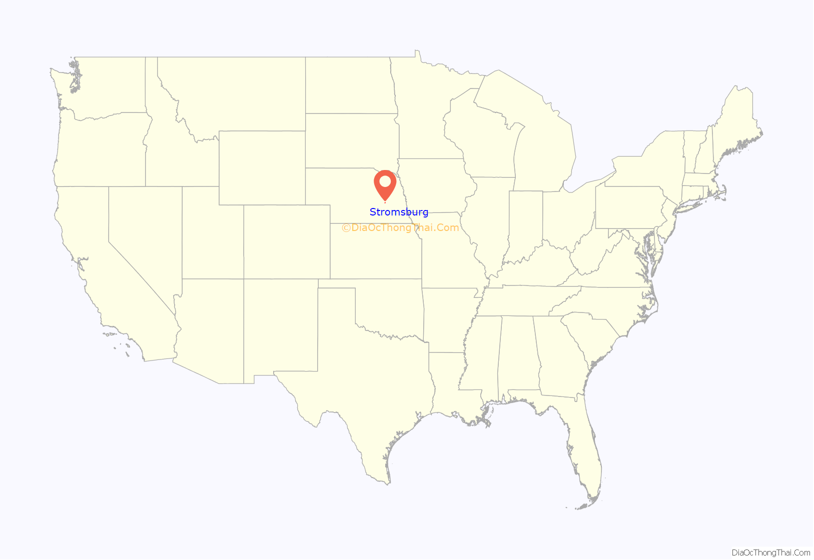
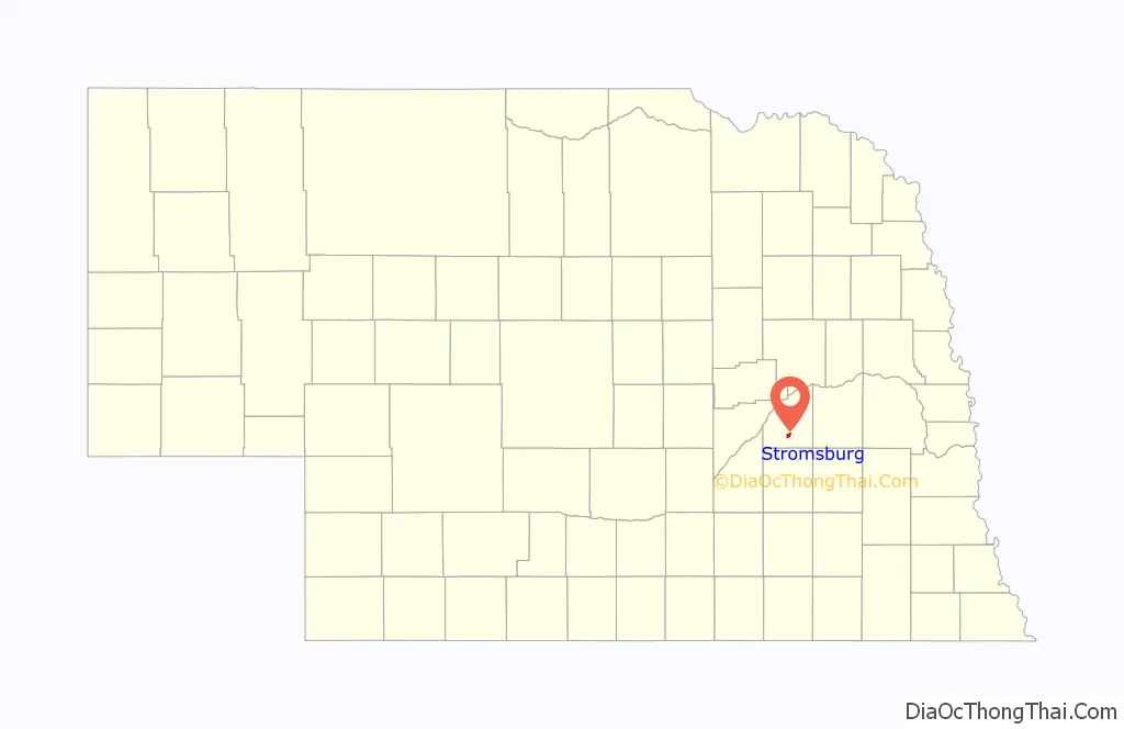
Stromsburg location map. Where is Stromsburg city?
History
Stromsburg was settled early in Nebraska history. A group of Swedish settlers from the town of Ockelbo arrived in the 1860s after several years in Illinois. This group was led by Lewis Headstrom, who was a real estate agent. Seeing some similarities to their old Swedish homeland the settlers formed what would be called Stromsburg, named after a section of Ockelbo, Sweden. By the 1880s two brickyards were in operation in the town. Many buildings constructed of ‘native’ brick still stand, including the Viking Center, now a community center that was originally The Opera House; the Cornerstone Bank; two businesses on the east side of the square; and several homes. Brick streets still surround the city square in Stromsburg. A brick Carnegie library was built in Stromsburg in 1918. The downtown area of Stromsburg has a town square in its center. This square forms a park, with lawns and mature trees, where festivals and events are held. In the center of the square is a two-story Swedish style building made of brick with decorative toll painting and the phrase “Välkommen” (Swedish for “Welcome”).
Stromsburg was given the title of the “Swede Capital of Nebraska” by Governor Frank B. Morrison in 1966 at the Swedish Festival. The Swedish festival is held in June each year and showcases Stromburg’s Swedish heritage.
Stromsburg Public School was established in 1887. It operated until 2002, when the Stromsburg district consolidated with Benedict, Nebraska to form Cross County Community School.
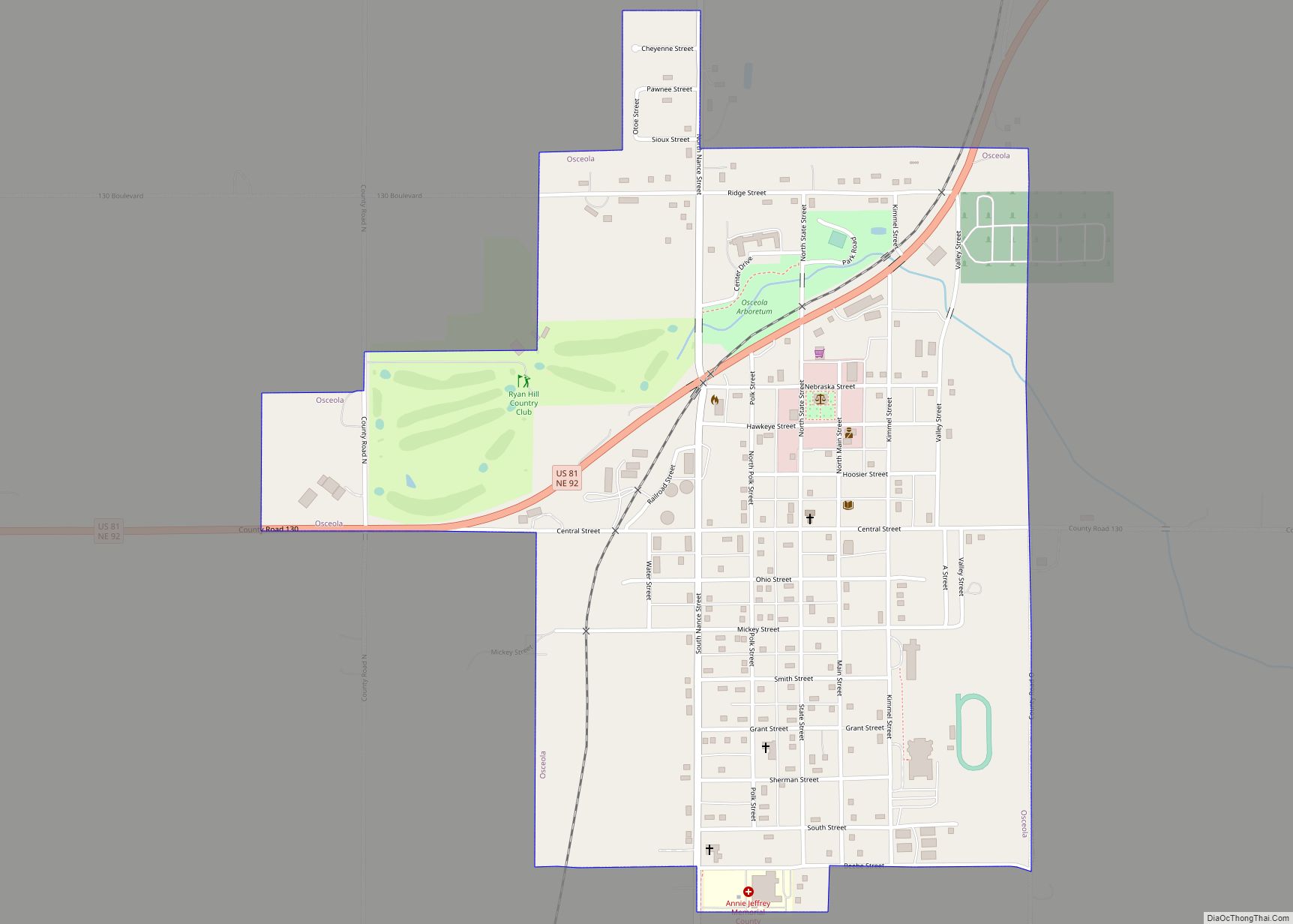
Stromsburg Road Map
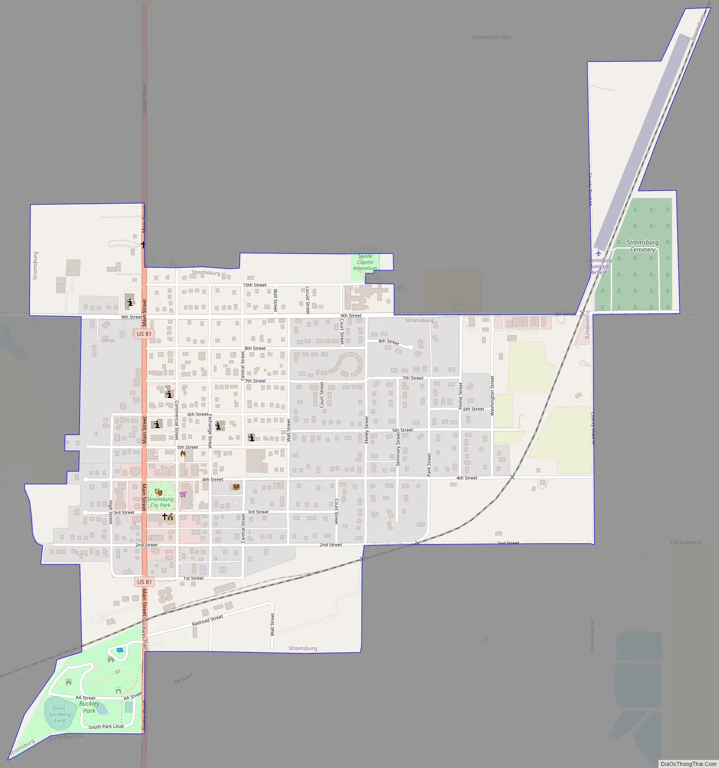
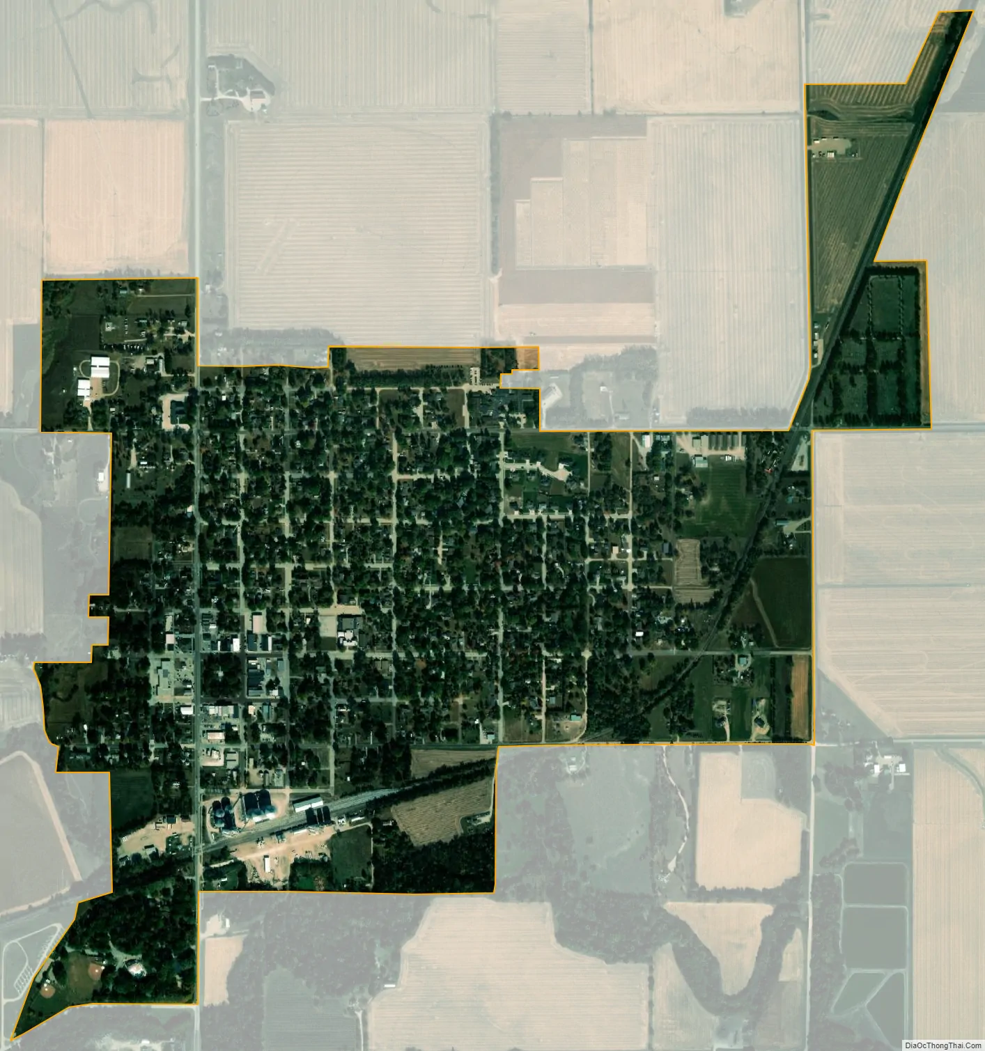
Stromsburg city Satellite Map
Geography
Stromsburg is located at 41°6′56″N 97°35′37″W / 41.11556°N 97.59361°W / 41.11556; -97.59361 (41.115580, -97.593551).
According to the United States Census Bureau, the city has a total area of 1.01 square miles (2.62 km), all land.
See also
Map of Nebraska State and its subdivision:- Adams
- Antelope
- Arthur
- Banner
- Blaine
- Boone
- Box Butte
- Boyd
- Brown
- Buffalo
- Burt
- Butler
- Cass
- Cedar
- Chase
- Cherry
- Cheyenne
- Clay
- Colfax
- Cuming
- Custer
- Dakota
- Dawes
- Dawson
- Deuel
- Dixon
- Dodge
- Douglas
- Dundy
- Fillmore
- Franklin
- Frontier
- Furnas
- Gage
- Garden
- Garfield
- Gosper
- Grant
- Greeley
- Hall
- Hamilton
- Harlan
- Hayes
- Hitchcock
- Holt
- Hooker
- Howard
- Jefferson
- Johnson
- Kearney
- Keith
- Keya Paha
- Kimball
- Knox
- Lancaster
- Lincoln
- Logan
- Loup
- Madison
- McPherson
- Merrick
- Morrill
- Nance
- Nemaha
- Nuckolls
- Otoe
- Pawnee
- Perkins
- Phelps
- Pierce
- Platte
- Polk
- Red Willow
- Richardson
- Rock
- Saline
- Sarpy
- Saunders
- Scotts Bluff
- Seward
- Sheridan
- Sherman
- Sioux
- Stanton
- Thayer
- Thomas
- Thurston
- Valley
- Washington
- Wayne
- Webster
- Wheeler
- York
- Alabama
- Alaska
- Arizona
- Arkansas
- California
- Colorado
- Connecticut
- Delaware
- District of Columbia
- Florida
- Georgia
- Hawaii
- Idaho
- Illinois
- Indiana
- Iowa
- Kansas
- Kentucky
- Louisiana
- Maine
- Maryland
- Massachusetts
- Michigan
- Minnesota
- Mississippi
- Missouri
- Montana
- Nebraska
- Nevada
- New Hampshire
- New Jersey
- New Mexico
- New York
- North Carolina
- North Dakota
- Ohio
- Oklahoma
- Oregon
- Pennsylvania
- Rhode Island
- South Carolina
- South Dakota
- Tennessee
- Texas
- Utah
- Vermont
- Virginia
- Washington
- West Virginia
- Wisconsin
- Wyoming