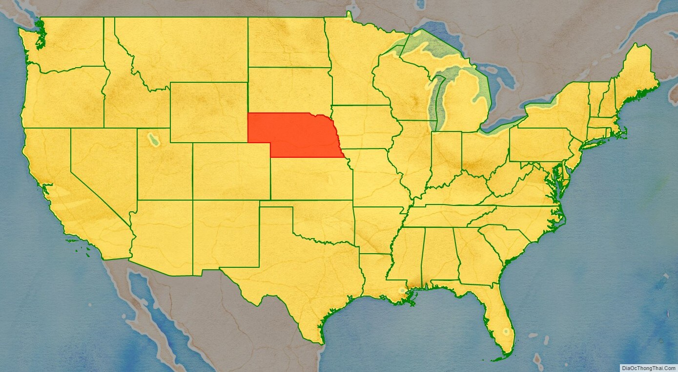
Nebraska (/nəˈbræskə/ (listen)) is a state in the Midwestern region of the United States. It is bordered by South Dakota to the north; Iowa to the east and Missouri to the southeast, both across the Missouri River; Kansas to the south; Colorado to the southwest; and Wyoming to the west. It is the only triply landlocked U.S. state.
Indigenous peoples, including Omaha, Missouria, Ponca, Pawnee, Otoe, and various branches of the Lakota (Sioux) tribes, lived in the region for thousands of years before European exploration. The state is crossed by many historic trails, including that of the Lewis and Clark Expedition.
Nebraska’s area is just over 77,220 square miles (200,000 km) with a population of over 1.9 million. Its capital is Lincoln, and its largest city is Omaha, which is on the Missouri River. Nebraska was admitted into the United States in 1867, two years after the end of the American Civil War. The Nebraska Legislature is unlike any other American legislature in that it is unicameral, and its members are elected without any official reference to political party affiliation.
Nebraska is composed of two major land regions: the Dissected Till Plains and the Great Plains. The Dissected Till Plains region consists of gently rolling hills and contains the state’s largest cities, Omaha and Lincoln. The Great Plains region, occupying most of western Nebraska, is characterized by treeless prairie. Nebraska has two major climatic zones. The eastern two-thirds of the state has a humid continental climate (Köppen climate classification Dfa); a unique warmer subtype considered “warm-temperate” exists near the southern plains, which is analogous to that in Kansas and Oklahoma, which have a predominantly humid subtropical climate. The Panhandle and adjacent areas bordering Colorado have a primarily semi-arid climate (Köppen BSk). The state has wide variations between winter and summer temperatures, variations that decrease moving south within the state. Violent thunderstorms and tornadoes occur primarily during spring and summer and sometimes in autumn. Chinook wind tends to warm the state significantly in the winter and early spring.
| Before statehood: | Nebraska Territory |
|---|---|
| Admitted to the Union: | March 1, 1867 (37th) |
| Capital: | Lincoln |
| Largest city: | Omaha |
| Largest metro and urban areas: | Omaha–Council Bluffs |
| Elevation: | 2,600 ft (790 m) |
| Total Area: | 77,358 sq mi (200,356 km) |
| Area Rank: | 16th |
| Total Population: | 1,961,504 |
| Population Rank: | 38th |
| Population Density: | 24.94/sq mi (9.62/km) |
| Population Density Rank: | 43rd |
| Median Household Income: | $59,970 |
| Income Rank: | 25th |
| Demonym(s): | Nebraskan |
| USPS abbreviation: | NE |
| ISO 3166 code: | US-NE |
| Website: | www.nebraska.gov |
Online Interactive Map
Click on ![]() to view map in "full screen" mode.
to view map in "full screen" mode.
Nebraska location map. Where is Nebraska state?
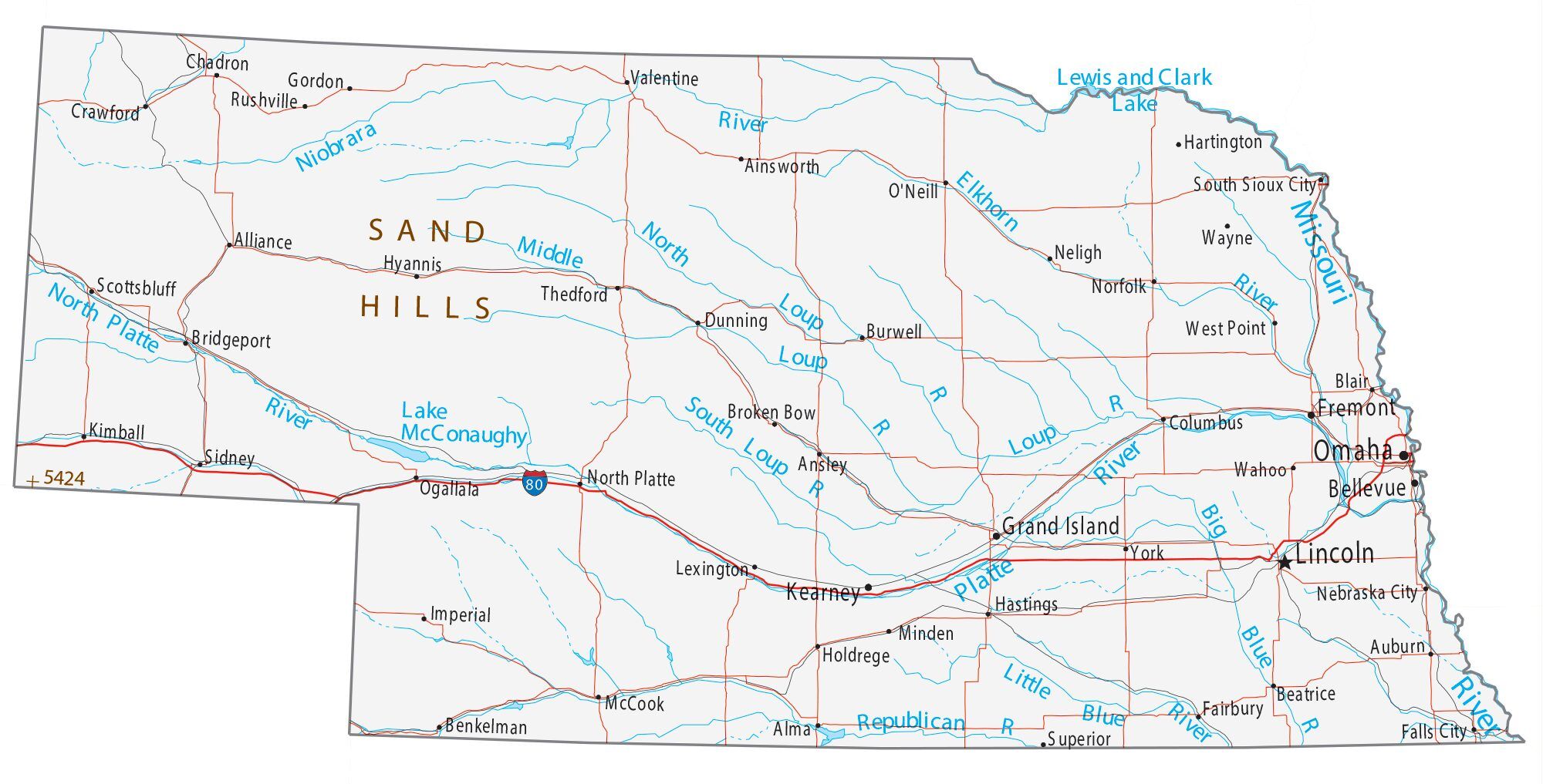
Nebraska Road Map
Nebraska Map – Roads & Cities
Nebraska Street Map
History
Indigenous peoples lived in the region of present-day Nebraska for thousands of years before European colonization. The historic tribes in the state included the Omaha, Missouria, Ponca, Pawnee, Otoe, and various branches of the Lakota (Sioux), some of which migrated from eastern areas into this region. When European exploration, trade, and settlement began, both Spain and France sought to control the region. In the 1690s, Spain established trade connections with the Apaches, whose territory then included western Nebraska. By 1703, France had developed a regular trade with the native peoples along the Missouri River in Nebraska, and by 1719 had signed treaties with several of these peoples. After war broke out between the two countries, Spain dispatched an armed expedition to Nebraska under Lieutenant General Pedro de Villasur in 1720. The party was attacked and destroyed near present-day Columbus by a large force of Pawnees and Otoes, both allied with the French. The massacre ended Spanish exploration of the area for the remainder of the 18th century.
In 1762, during the Seven Years’ War, France ceded the Louisiana territory to Spain. This left Britain and Spain competing for dominance along the Mississippi; by 1773, the British were trading with the native peoples of Nebraska. In response, Spain dispatched two trading expeditions up the Missouri in 1794 and 1795; the second, under James Mackay, established the first European settlement in Nebraska near the mouth of the Platte. Later that year, Mackay’s party built a trading post, dubbed Fort Carlos IV (Fort Charles), near present-day Homer.
In 1819, the United States established Fort Atkinson as the first U.S. Army post west of the Missouri River, just east of present-day Fort Calhoun. The army abandoned the fort in 1827 as migration moved further west. European-American settlement was scarce until 1848 and the California Gold Rush. On May 30, 1854, the US Congress created the Kansas and the Nebraska territories, divided by the Parallel 40° North, under the Kansas–Nebraska Act. The Nebraska Territory included parts of the current states of Colorado, North Dakota, South Dakota, Wyoming, and Montana. The territorial capital of Nebraska was Omaha.
In the 1860s, after the U.S. government forced many of the Native American tribes to cede their lands and settle on reservations, it opened large tracts of land to agricultural development by Europeans and Americans. Under the Homestead Act, thousands of settlers migrated into Nebraska to claim free land granted by the federal government. Because so few trees grew on the prairies, many of the first farming settlers built their homes of sod, as had Native Americans such as the Omaha. The first wave of settlement gave the territory a sufficient population to apply for statehood. Nebraska became the 37th state on March 1, 1867, and the capital was moved from Omaha to the center at Lancaster, later renamed Lincoln after the recently assassinated President of the United States, Abraham Lincoln. The battle of Massacre Canyon, on August 5, 1873, was the last major battle between the Pawnee and the Sioux.
During the 1870s to the 1880s, Nebraska experienced a large growth in population. Several factors contributed to attracting new residents. The first was that the vast prairie land was perfect for cattle grazing. This helped settlers to learn the unfamiliar geography of the area. The second factor was the invention of several farming technologies. New agricultural innovations such as barbed wire, windmills, and the steel plow, combined with fair weather, enabled settlers to transform Nebraska into prime farming land. By the 1880s, Nebraska’s population had soared to more than 450,000 people. The Arbor Day holiday was founded in Nebraska City by territorial governor J. Sterling Morton. The National Arbor Day Foundation is still headquartered in Nebraska City, with some offices in Lincoln.
In the late 19th century, African Americans migrated from the South to Nebraska as part of the Great Migration. Eventually, they lived primarily to Omaha which offered working-class jobs in meat packing, the railroads and other industries. Omaha has a long history of civil rights activism. Blacks encountered discrimination from other Americans in Omaha and especially from recent European immigrants, ethnic whites who were competing for the same jobs. In 1912, African Americans founded the Omaha chapter of the National Association for the Advancement of Colored People to work for improved conditions in the city and state.
Since the 1960s, Native American activism in the state has increased, both through open protest, activities to build alliances with state and local governments, and in the slower, more extensive work of building tribal institutions and infrastructure. Native Americans in federally recognized tribes have pressed for self-determination, sovereignty and recognition. They have created community schools to preserve their cultures, as well as tribal colleges and universities. Tribal politicians have also collaborated with state and county officials on regional issues.
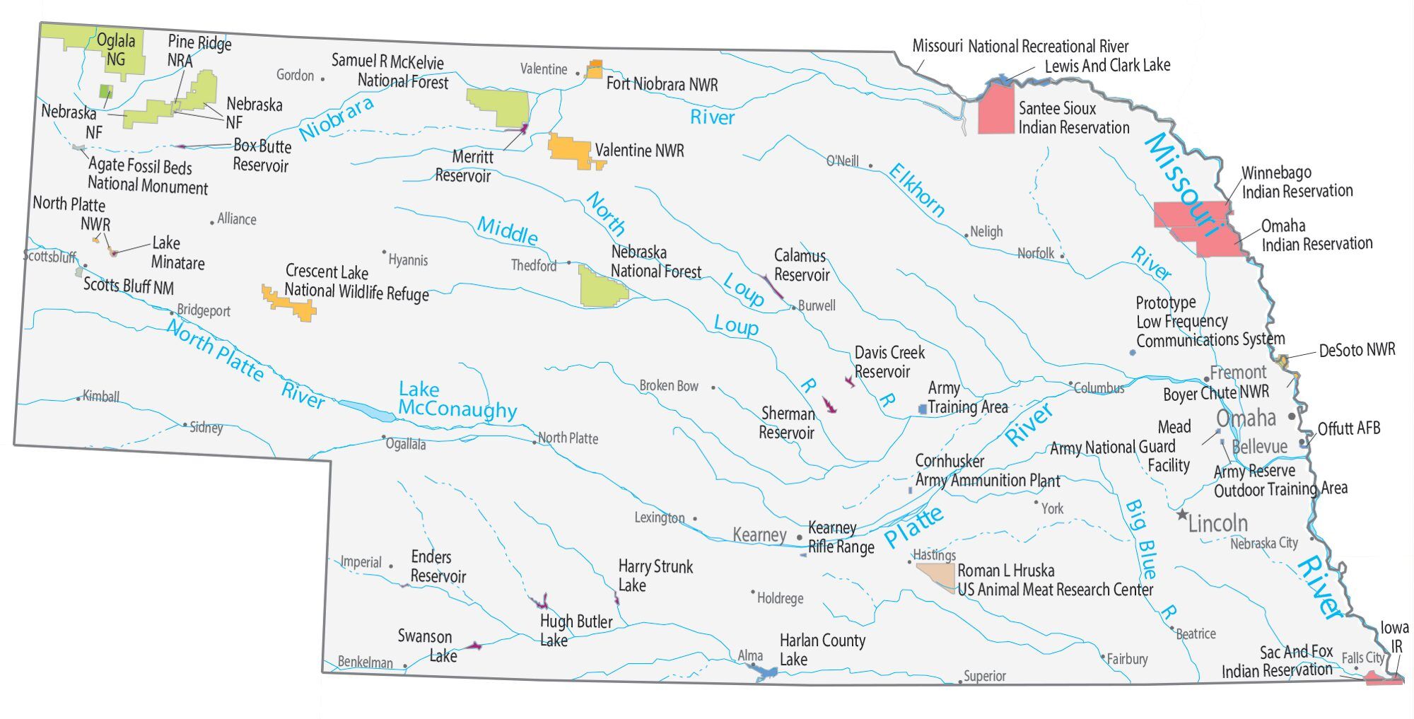
Nebraska State Map – Places and Landmarks
Nebraska Political Map
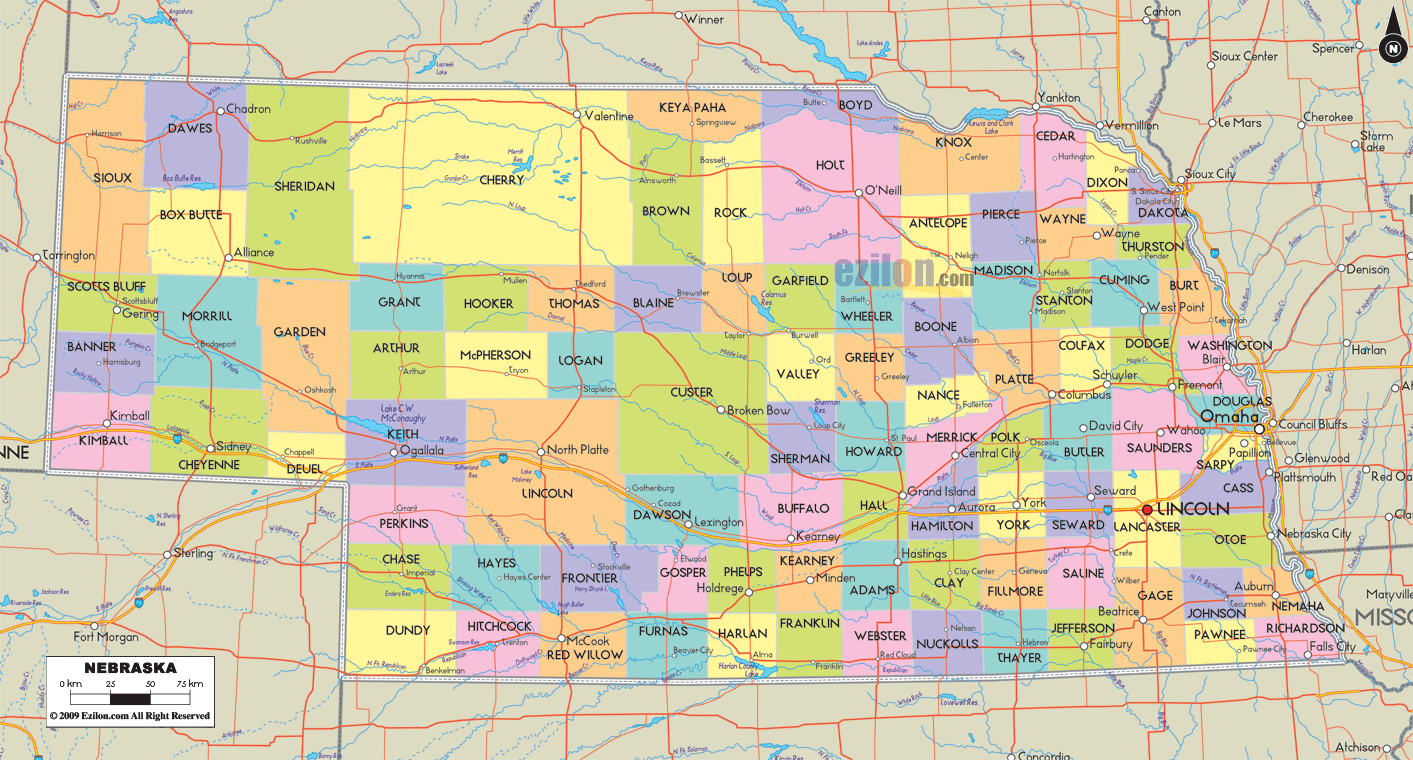
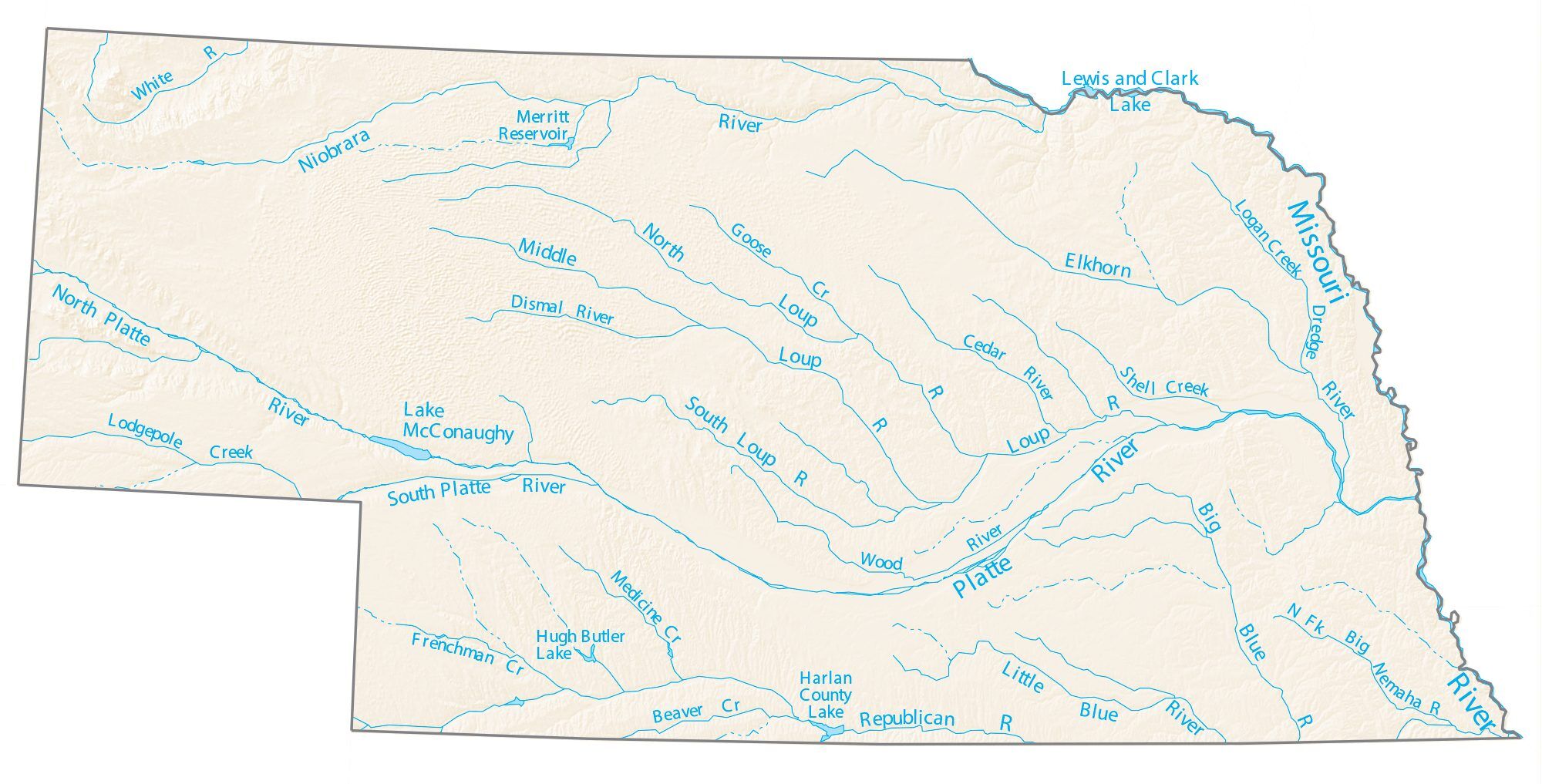
Nebraska Lakes and Rivers Map
Nebraska Physical Map
Nebraska Topographic Map
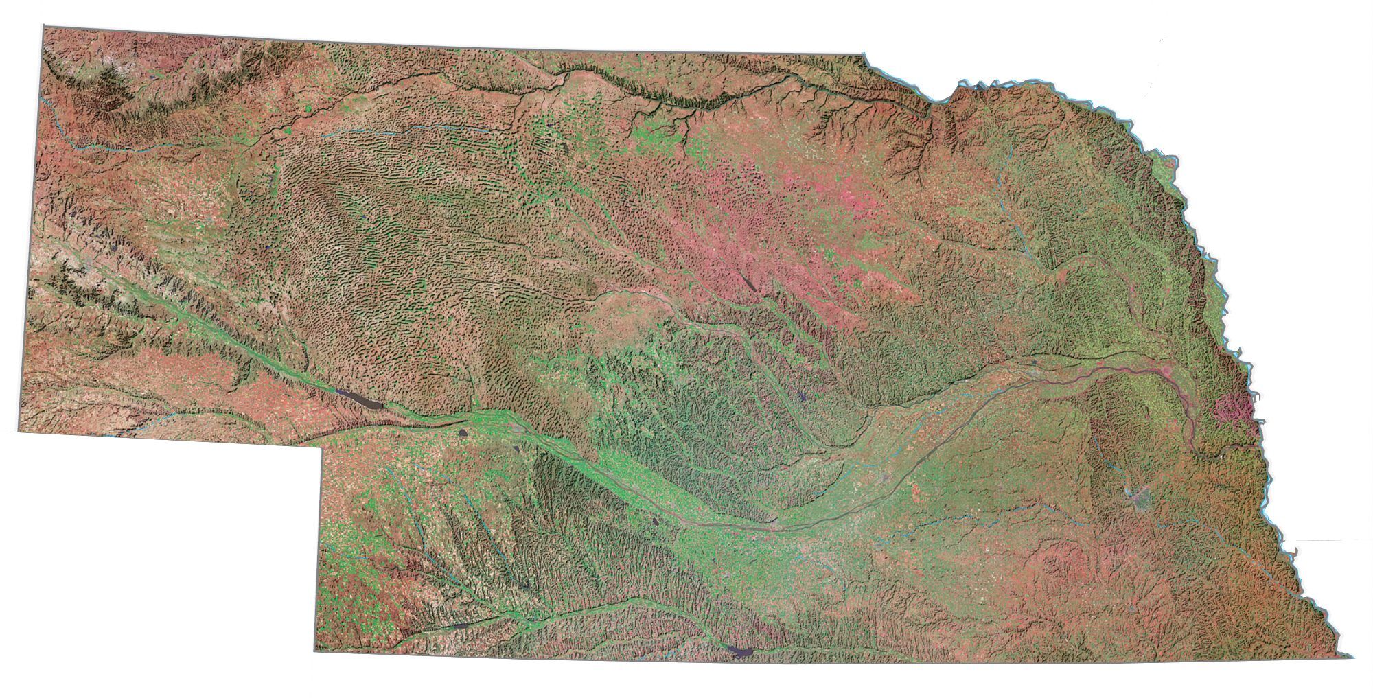
Nebraska Satellite Map
Others printable maps
Nebraska Outline Map
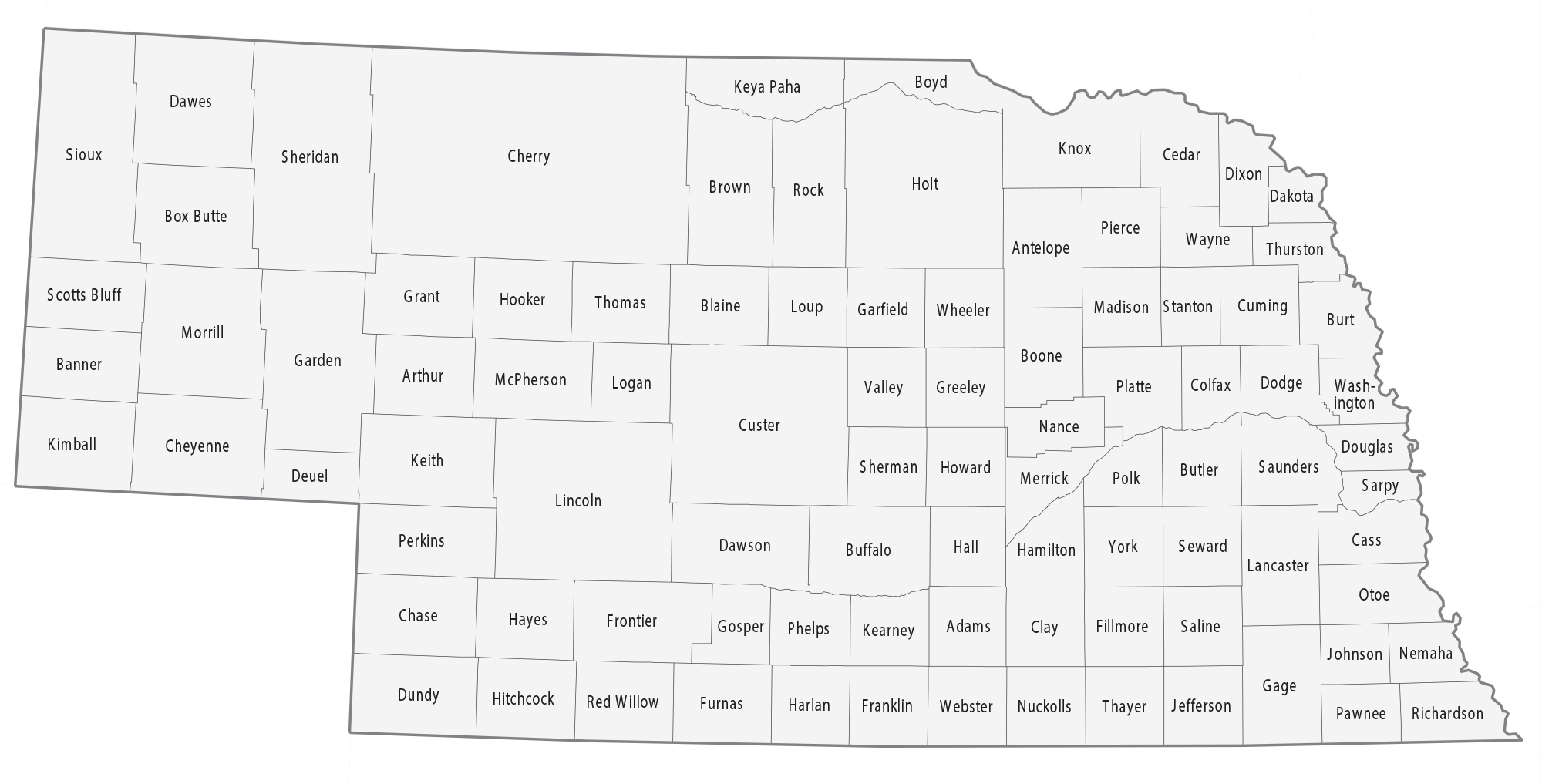
Blank Nebraska County Map
See also
Map of Nebraska State and its subdivision:- Adams
- Antelope
- Arthur
- Banner
- Blaine
- Boone
- Box Butte
- Boyd
- Brown
- Buffalo
- Burt
- Butler
- Cass
- Cedar
- Chase
- Cherry
- Cheyenne
- Clay
- Colfax
- Cuming
- Custer
- Dakota
- Dawes
- Dawson
- Deuel
- Dixon
- Dodge
- Douglas
- Dundy
- Fillmore
- Franklin
- Frontier
- Furnas
- Gage
- Garden
- Garfield
- Gosper
- Grant
- Greeley
- Hall
- Hamilton
- Harlan
- Hayes
- Hitchcock
- Holt
- Hooker
- Howard
- Jefferson
- Johnson
- Kearney
- Keith
- Keya Paha
- Kimball
- Knox
- Lancaster
- Lincoln
- Logan
- Loup
- Madison
- McPherson
- Merrick
- Morrill
- Nance
- Nemaha
- Nuckolls
- Otoe
- Pawnee
- Perkins
- Phelps
- Pierce
- Platte
- Polk
- Red Willow
- Richardson
- Rock
- Saline
- Sarpy
- Saunders
- Scotts Bluff
- Seward
- Sheridan
- Sherman
- Sioux
- Stanton
- Thayer
- Thomas
- Thurston
- Valley
- Washington
- Wayne
- Webster
- Wheeler
- York
- Alabama
- Alaska
- Arizona
- Arkansas
- California
- Colorado
- Connecticut
- Delaware
- District of Columbia
- Florida
- Georgia
- Hawaii
- Idaho
- Illinois
- Indiana
- Iowa
- Kansas
- Kentucky
- Louisiana
- Maine
- Maryland
- Massachusetts
- Michigan
- Minnesota
- Mississippi
- Missouri
- Montana
- Nebraska
- Nevada
- New Hampshire
- New Jersey
- New Mexico
- New York
- North Carolina
- North Dakota
- Ohio
- Oklahoma
- Oregon
- Pennsylvania
- Rhode Island
- South Carolina
- South Dakota
- Tennessee
- Texas
- Utah
- Vermont
- Virginia
- Washington
- West Virginia
- Wisconsin
- Wyoming
