Columbus is a city in and the county seat of Platte County, in the state of Nebraska in the Midwestern United States. The population was 24,028 at the 2020 census, making it the 10th largest city in Nebraska.
| Name: | Columbus city |
|---|---|
| LSAD Code: | 25 |
| LSAD Description: | city (suffix) |
| State: | Nebraska |
| County: | Platte County |
| Elevation: | 1,447 ft (441 m) |
| Total Area: | 10.60 sq mi (27.46 km²) |
| Land Area: | 10.34 sq mi (26.78 km²) |
| Water Area: | 0.26 sq mi (0.68 km²) |
| Total Population: | 24,028 |
| Population Density: | 2,323.79/sq mi (897.18/km²) |
| ZIP code: | 68601-68602 |
| Area code: | 402 |
| FIPS code: | 3110110 |
| GNISfeature ID: | 0828280 |
| Website: | columbusne.us |
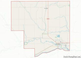
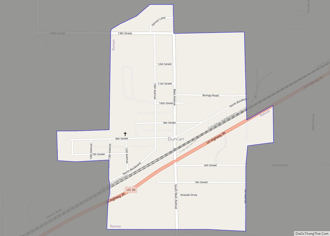
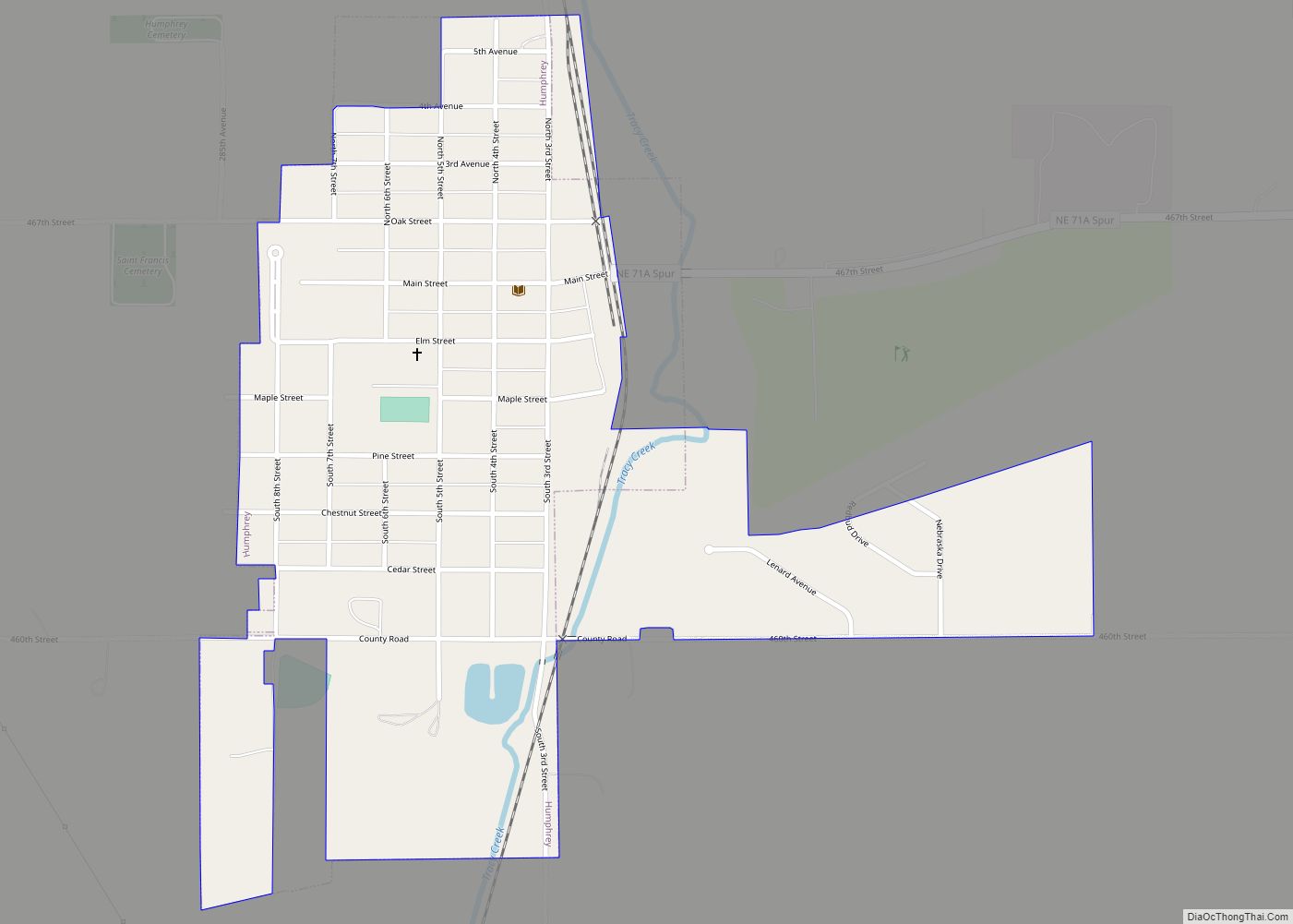
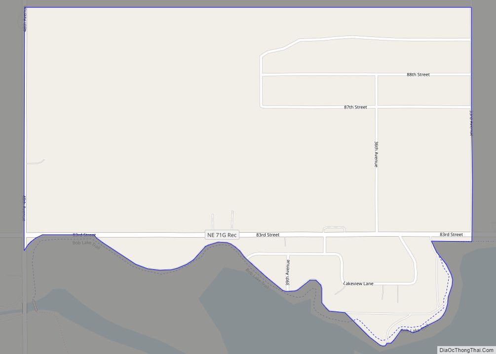
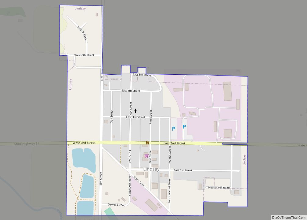
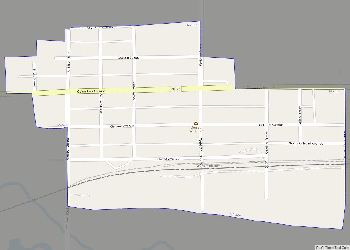
Online Interactive Map
Click on ![]() to view map in "full screen" mode.
to view map in "full screen" mode.
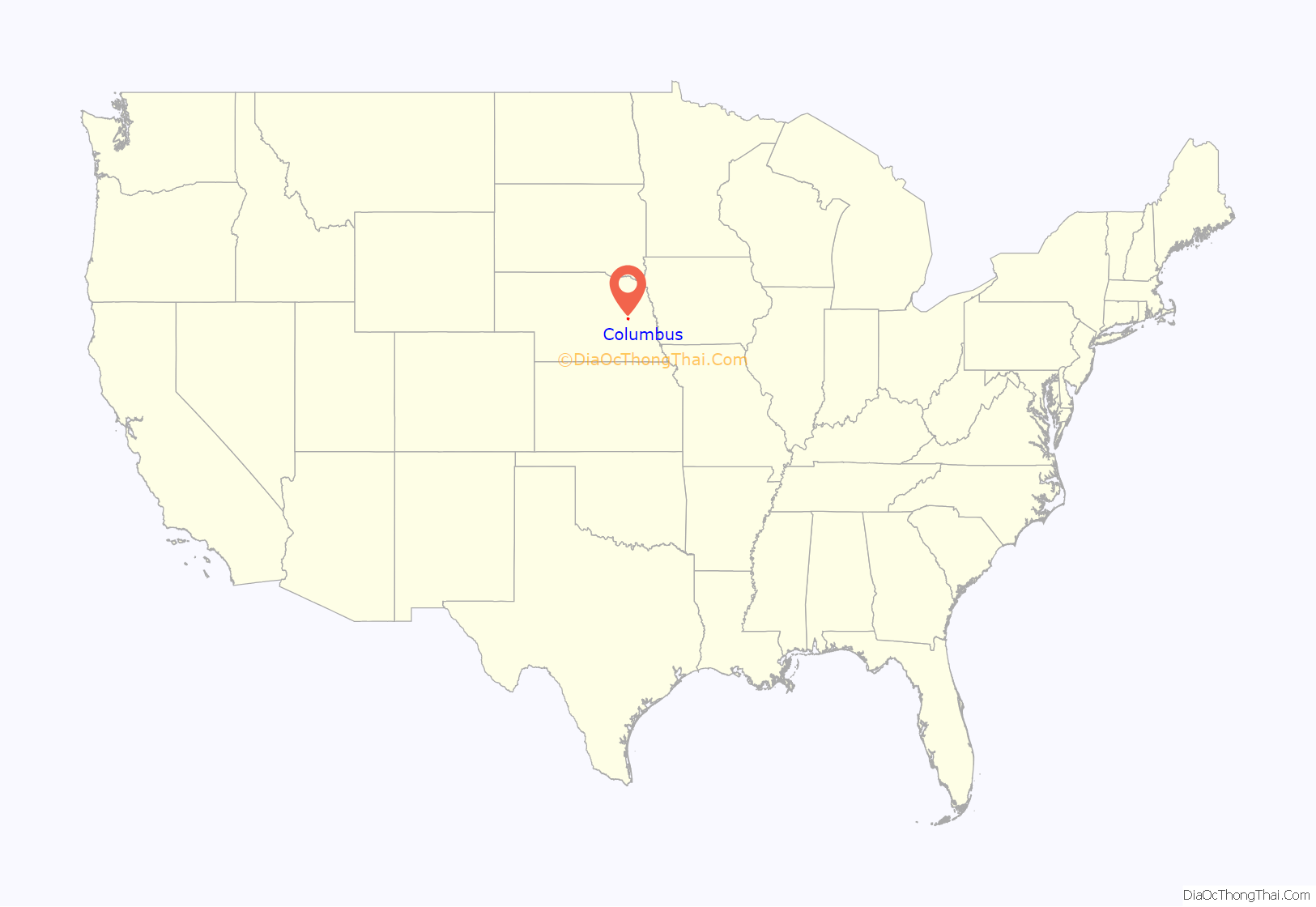
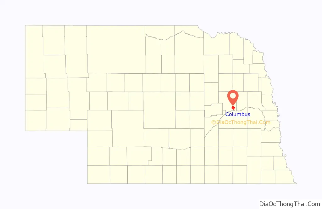
Columbus location map. Where is Columbus city?
History
Native Americans and Exploration
In the 18th century, the area around the confluence of the Platte and the Loup Rivers was used by a variety of Native American tribes, including Pawnee, Otoe, Ponca, and Omaha. The Pawnee are thought to have descended from the Protohistoric Lower Loup Culture; the Otoe had moved from central Iowa into the lower Platte Valley in the early 18th century; and the closely related Omaha and Ponca had moved from the vicinity of the Ohio River mouth, settling along the Missouri by the mid-18th century. In 1720, Pawnee and Otoe allied with the French massacred the Spanish force led by Pedro de Villasur just south of the present site of Columbus. In 1739, the French traders Pierre and Paul Mallet stayed at the Pani-Maha village near this site while making the first known French voyage to Spanish-ruled Santa Fe.
In the 19th century, the “Great Platte River Road”—the valley of the Platte and North Platte Rivers running from Fort Kearny to Fort Laramie— was the principal route of the westward expansion. For travellers following the north bank of the Platte, the Loup River, with its soft banks and quicksands, represented a major obstacle. In the absence of a ferry or a bridge, most of these followed the Loup for a considerable distance upstream before attempting a crossing: the first major wave of Mormon emigrants, for instance, continued up that river to a point about three miles downstream from present-day Fullerton.
Settlement and early history
The site of Columbus was settled by the Columbus Town Company on May 28, 1856. The group took its name from Columbus, Ohio, where most of the settlers had originally lived. The townsite was selected for its location on the proposed route of the transcontinental railroad.
Just west of the Columbus site, the Elk Horn and Loup Fork Bridge and Ferry Company, headed by James C. Mitchell, had laid out the townsite of Pawnee. In 1855, Mitchell had obtained from the First Nebraska Territorial Legislature the right to operate a ferry across the Loup River. The two companies consolidated in November 1856.
At the time of its initial settling, the land Columbus occupied still belonged to the Pawnee. However, in 1857, the Pawnee signed a treaty whereunder they gave up the bulk of their Nebraska lands, save for a reservation on what is now Nance County, Nebraska.
In 1858, the Platte County Commissioners passed an act of incorporation making Columbus a town; at this time there were 16 citizens. It became the county seat shortly thereafter. In that same year, at the recommendation of the U.S. Army, a ferry across the Loup was installed; contemporary documents suggest that the Mitchell company had failed to act on its right to operate such a ferry.
Railroads and growth
Growth of the town was slow until 1863. In that year, construction began in Omaha on the transcontinental railroad. The Homestead Act, passed the previous year, attracted a host of settlers to the Plains and gave rise to increased emigrant traffic business. The ferry across the Loup was replaced by a seasonal pontoon bridge, used in the summer and taken up in the winter. The railroad reached Columbus in June 1866, when the city’s population was about 75.
The energetic and eccentric promoter George Francis Train envisioned building “a magnificent highway of cities” from coast to coast along the Union Pacific route; Columbus was to be one of these. In 1865, he bought several hundred lots in the city. In the following year, seeing the nearby townsite of Cleveland as a threat to his plans for Columbus, he bought the only building on the site, a hotel, and moved it to Columbus. He renamed the building the Credit Foncier Hotel, after his land company, Credit Foncier of America; in it, he set aside a room permanently reserved for the President of the United States. Train believed that the capital of the United States should be in the geographic center of the nation, and promoted Columbus as “…the new center of the Union and quite probably the future capital of the U.S.A.”
Columbus grew and prospered during the 1870s, as a result of both expanding agriculture in Platte County and traffic on the railroad. During the decade, the population of the county grew threefold, and Columbus became the trade center for an eight-county area. The Black Hills Gold Rush in 1875 led the city’s merchants to promote it as a staging and outfitting area for gold seekers, who could ride the railroad to Columbus and then travel overland to the gold fields.
In 1879, Columbus became the focus of a war between railroad companies. The Burlington and Missouri proposed to develop a line from Lincoln through Columbus and into northwestern Nebraska, and urged the citizens of Platte County to vote a bond of $100,000 for construction expenses. Union Pacific financier Jay Gould, displeased at the prospect of competition, informed the voters of the county that if the measure passed, he would do his best to ruin Columbus. After a heated campaign, the measure passed despite Gould’s threats. The Burlington and Missouri built a line from Lincoln to Columbus, but stopped there; for their diagonal route across Nebraska, they chose one that crossed the Union Pacific at Grand Island rather than Columbus.
Gould sought to make good on his threat. When the Union Pacific developed its subsidiary Omaha, Niobrara and Black Hills Railroad, he directed that it cross the Loup River at Lost Creek, then run south to join the Union Pacific’s main line at Jackson (since renamed Duncan), bypassing Columbus. Fortunately for Columbus, an ice jam destroyed the Lost Creek bridge in the spring of 1881. Railroad officials agreed to reroute the line down the north bank of the Loup to Columbus in exchange for a $25,000 contribution from the city.
Automobile age
In 1911, the Meridian Highway project was launched with the formation of a Meridian Road association in Kansas. Later that same year, John Nicholson, originator of the highway, spoke at a meeting in Columbus, at which the Nebraska Meridian Road Association was organized. The proposed north–south transcontinental highway crossed the Platte and the Loup rivers at the Columbus bridges. In 1922, it was designated a state highway. The completion of the Meridian Bridge in 1924, replacing a seasonal ferry across the Missouri River at the Nebraska-South Dakota border, made the highway a year-round route from Canada to Mexico. In 1928, the route became U.S. Highway 81.
In 1913, the Lincoln Highway was established as an east–west transcontinental highway. It followed the Platte River route across Nebraska; ultimately, about half of its mileage was on the Union Pacific right-of-way. It also crossed the Loup on the bridge at Columbus. In 1926, the route became U.S. Highway 30.
Traffic on the two transcontinental auto routes through and near central Columbus spurred a burst of commercial construction. Hotels were expanded and new ones built; service garages were opened. To make the route through Columbus more attractive to motorists, the city undertook to illuminate and pave the downtown streets. By 1925, all of the city’s major commercial thoroughfares were paved, and almost every lot along 13th Street (the Lincoln Highway) between 23rd and 29th Avenues was occupied by a commercial building.
Rural Platte County suffered badly from the Great Depression. Grain and livestock prices had been high during World War I, engendering a bubble in farmland; to acquire additional acres, farmers had secured them with mortgages not only on the newly purchased land, but also on their older holdings. The fall in the prices of agricultural commodities, combined with drought-induced crop failures in 1934 and 1936, forced many such farmers to abandon their lands.
The civic and commercial leaders of Columbus aggressively sought federal and state funds for local construction projects during this time. In 1931, the Meridian Viaduct was completed, carrying the combined Meridian and Lincoln highways across the Union Pacific tracks and eliminating a grade-level crossing. In 1930–31, the aging and inadequate bridge across the Platte was replaced; in 1932–33, a new bridge was built at the Loup crossing.
Hydro power
The most expensive and ambitious of Columbus’s Depression-era public-works efforts was the construction of the Loup Project. This was a 35-mile (56 km) canal running from a diversion weir on the Loup River in Nance County to the Platte River about 1 mile (1.6 km) below the mouth of the Loup. The waters of the canal run through two hydroelectric generating stations: one north of Monroe with a capacity of 7,800 kW; and one at Columbus with a capacity of 45,600 kW.
Initially financed with a loan and grant of $7.3 million from the Public Works Administration, construction of the diversion structure, canal, and powerhouses began in August 1934 and was finished, apart from some final details, in September 1938. At its peak, in October 1936, the project directly employed 1,352 people.
To make payments on the Loup Project bonds, the Loup River Public Power District had to find a market for its electricity. Rural electrification was not expanding rapidly, and private power companies in Nebraska were only willing to buy a small fraction of the project’s power. Although the provisions of the Public Utility Holding Company Act of 1935 gave East Coast holding companies an incentive to sell off their Nebraska subsidiaries, bankers were unwilling to finance their sale to the Loup District because of its debts from the canal project.
In 1939, Consumers Public Power District was formed in Columbus. The new organization’s purpose was to buy power from the Loup Project and from the Tri-County and Sutherland projects on the Platte in central Nebraska, and to market it to consumers and municipal utilities. To this end, it was authorized to issue revenue bonds for the purchase of privately held power companies. By 1942, it had purchased all of the private electrical utilities in Nebraska outside of the immediate vicinity of Omaha; by 1949, the last of the private utilities had been bought up, making Nebraska the only state in the nation to be served entirely by public power.
World War II to 2000
With the arrival of World War II, Columbus’s boosters sought a war plant for Columbus. They persuaded the federal government to purchase 90 acres (36 ha) in northeastern Columbus, and to build a railroad line to the site. Before construction of the projected aluminum-extrusion plant could begin, however, it became clear that the war would end soon and that the plant would not be needed. The site was sold as surplus property to the Loup District for a fraction of its original cost; the district turned it into an industrial site. In 1946, Behlen Manufacturing built a factory on the site; the rest of the available land was occupied soon thereafter.
Columbus Public Schools in 1968 cut off non-resident students in order to become financially solvent, leaving students north of town without an education. In response, Lakeview Community Schools was formed. There are also several Catholic schools in Columbus, including Scotus Central Catholic High School.
Columbus made headlines in 1997 when 25 million pounds of beef from a Hudson Foods plant in the city were recalled. At the time, it was the largest recall in United States history.
In 1999, the East-Central District Health Department was formed as the Platte-Colfax County District Health Department. Platte County, including Columbus, is one of four counties served by the health department, which is located in Columbus along with the Good Neighbor Community Health Center.
2000-present
Over 20% of Columbus residents are Hispanic or Latino, as of the 2020 census. In 2009, Fernando Lopez, Karen Gomez and Maria Davila founded Columbus-based Centro Hispano Comunitario de Nebraska which provides immigration, education and business services in three counties.
A Columbus man died during the midwestern flooding in 2019. He had been trying to help someone stranded in the floodwaters when the bridge he was crossing collapsed.
During the COVID-19 pandemic, the Columbus City Council passed a mask mandate in a special meeting held in late November. The council voted four to four on the mandate and Mayor Jim Bulkley broke the tie in favor of the mandate. In January 2021, the council voted on an amended ordinance which required masks only if cases hit a certain level. The ordinance expired on Feb. 23, 2021.
Voters in the 2020 election approved a community building project, with space for a library, a potential children’s museum, an art gallery, coffee shop, community room and City Hall. A previous library ballot measure had failed in 2017. Demolition of the library began in May 2021.
A fire smoldered at the Columbus Archer Daniels Midland facility for several weeks in summer 2021. Columbus’ fire chief resigned less than a week after the public found out about the fire.
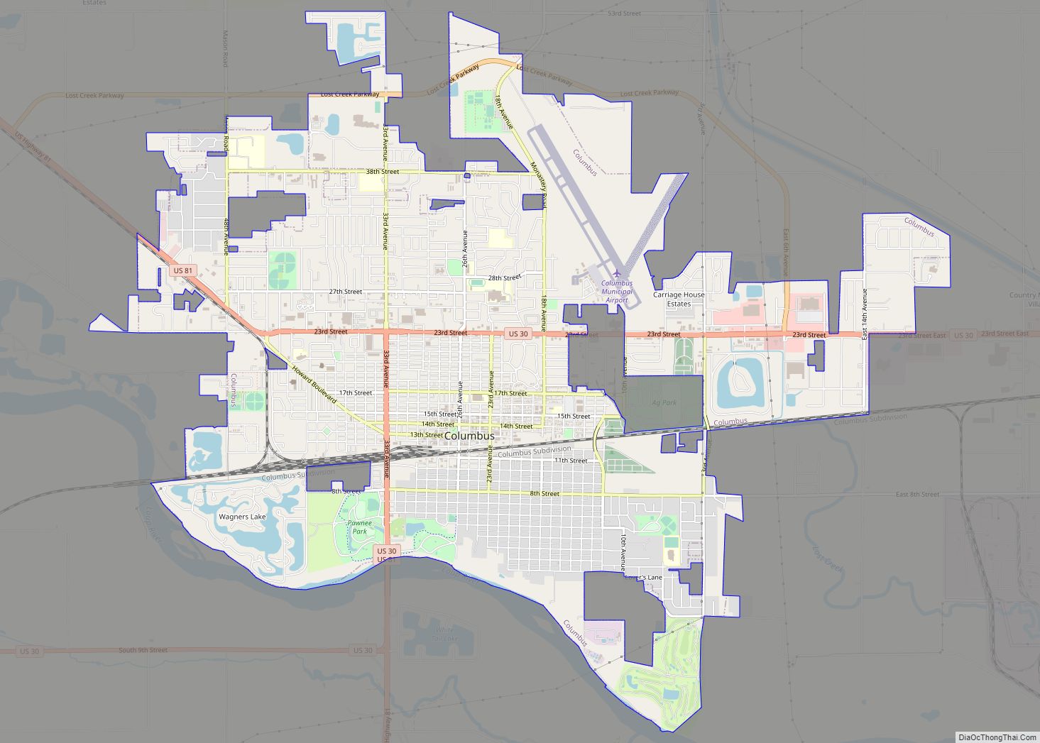
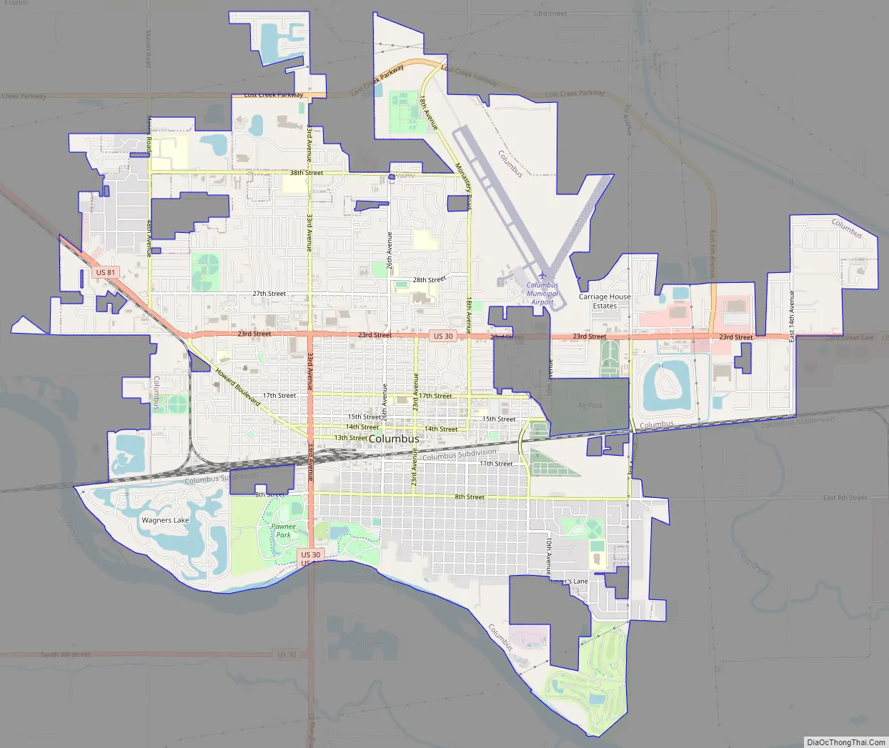
Columbus Road Map
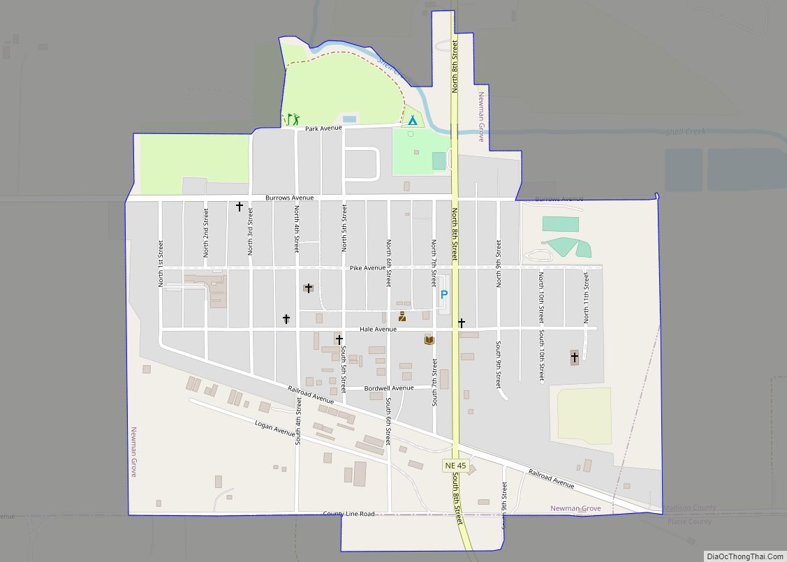
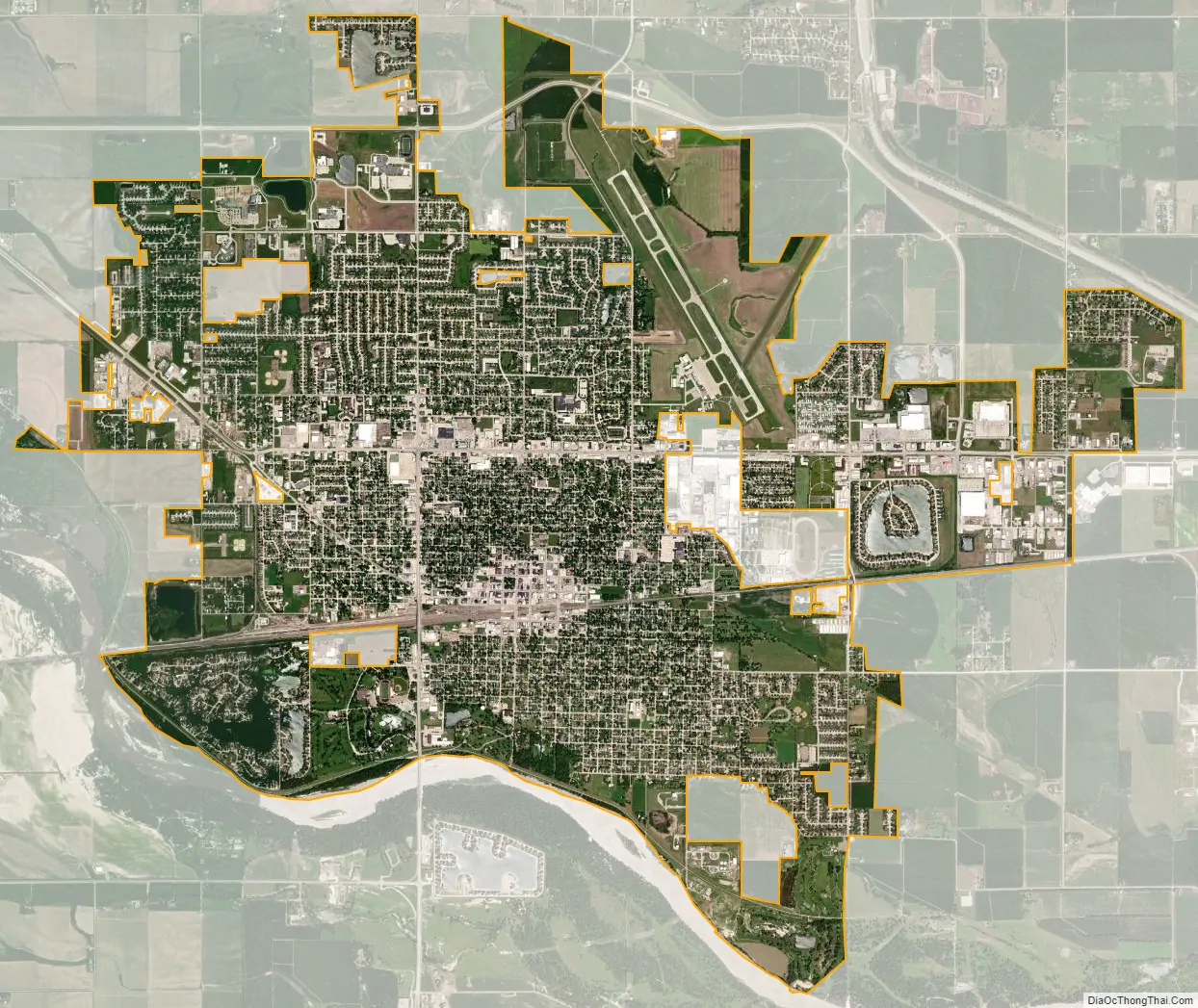
Columbus city Satellite Map
Geography
Columbus is located at 41°25′58″N 97°21′31″W / 41.43278°N 97.35861°W / 41.43278; -97.35861 (41.432785, -97.358530), 85 miles (137 km) west of Omaha and 75 miles (121 km) northwest of Lincoln. It is on the north side of the Loup River near its confluence with the Platte River. U.S. Highways 30 and 81 intersect in the city, and the main line of the Union Pacific railroad passes through it.
The city lies at an elevation of 1,447 feet (441 m). It is built on the flat terrain of the Platte River valley; rolling hills rise to the north of the city.
According to the United States Census Bureau, the city has a total area of 10.08 square miles (26.11 km), of which 9.85 square miles (25.51 km) is land and 0.23 square miles (0.60 km) is water.
Climate
Columbus has a humid continental climate (Köppen Dwa), with cold, dry winters and hot, humid summers. Precipitation is highest in the late spring and summer months, with an annual average of 26.87 in (682 mm).
See also
Map of Nebraska State and its subdivision:- Adams
- Antelope
- Arthur
- Banner
- Blaine
- Boone
- Box Butte
- Boyd
- Brown
- Buffalo
- Burt
- Butler
- Cass
- Cedar
- Chase
- Cherry
- Cheyenne
- Clay
- Colfax
- Cuming
- Custer
- Dakota
- Dawes
- Dawson
- Deuel
- Dixon
- Dodge
- Douglas
- Dundy
- Fillmore
- Franklin
- Frontier
- Furnas
- Gage
- Garden
- Garfield
- Gosper
- Grant
- Greeley
- Hall
- Hamilton
- Harlan
- Hayes
- Hitchcock
- Holt
- Hooker
- Howard
- Jefferson
- Johnson
- Kearney
- Keith
- Keya Paha
- Kimball
- Knox
- Lancaster
- Lincoln
- Logan
- Loup
- Madison
- McPherson
- Merrick
- Morrill
- Nance
- Nemaha
- Nuckolls
- Otoe
- Pawnee
- Perkins
- Phelps
- Pierce
- Platte
- Polk
- Red Willow
- Richardson
- Rock
- Saline
- Sarpy
- Saunders
- Scotts Bluff
- Seward
- Sheridan
- Sherman
- Sioux
- Stanton
- Thayer
- Thomas
- Thurston
- Valley
- Washington
- Wayne
- Webster
- Wheeler
- York
- Alabama
- Alaska
- Arizona
- Arkansas
- California
- Colorado
- Connecticut
- Delaware
- District of Columbia
- Florida
- Georgia
- Hawaii
- Idaho
- Illinois
- Indiana
- Iowa
- Kansas
- Kentucky
- Louisiana
- Maine
- Maryland
- Massachusetts
- Michigan
- Minnesota
- Mississippi
- Missouri
- Montana
- Nebraska
- Nevada
- New Hampshire
- New Jersey
- New Mexico
- New York
- North Carolina
- North Dakota
- Ohio
- Oklahoma
- Oregon
- Pennsylvania
- Rhode Island
- South Carolina
- South Dakota
- Tennessee
- Texas
- Utah
- Vermont
- Virginia
- Washington
- West Virginia
- Wisconsin
- Wyoming