Bedford is a city in Cuyahoga County, Ohio, United States located to the east of Cleveland. The population was 13,074 at the 2010 census. It is an eastern first ring suburb of Cleveland.
| Name: | Bedford city |
|---|---|
| LSAD Code: | 25 |
| LSAD Description: | city (suffix) |
| State: | Ohio |
| County: | Cuyahoga County |
| Elevation: | 948 ft (289 m) |
| Total Area: | 5.39 sq mi (13.96 km²) |
| Land Area: | 5.34 sq mi (13.83 km²) |
| Water Area: | 0.05 sq mi (0.13 km²) 0.93% |
| Total Population: | 13,149 |
| Population Density: | 2,461.44/sq mi (950.42/km²) |
| Area code: | 440 |
| FIPS code: | 3904878 |
| GNISfeature ID: | 1060854 |
| Website: | http://www.bedfordoh.gov |
Online Interactive Map
Click on ![]() to view map in "full screen" mode.
to view map in "full screen" mode.
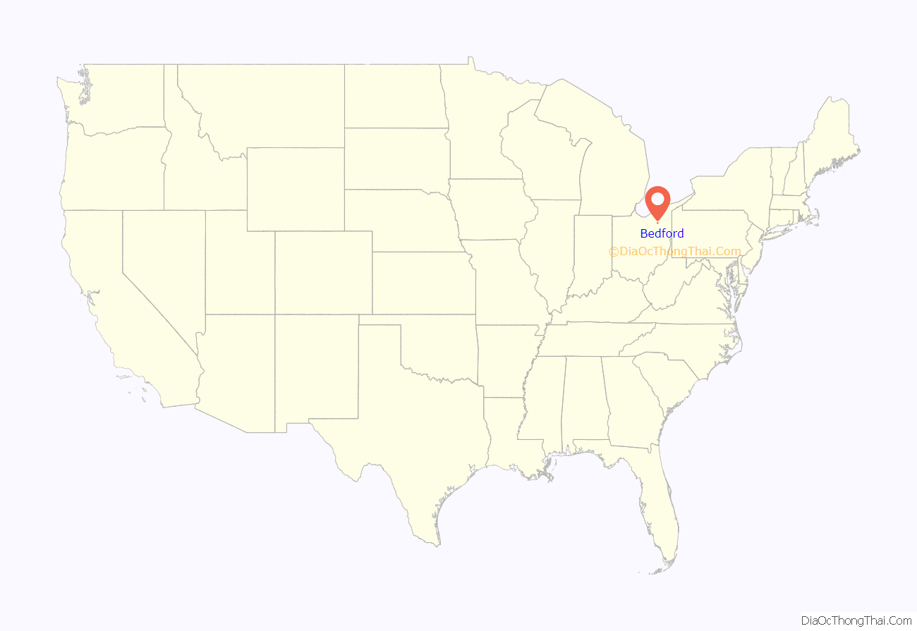
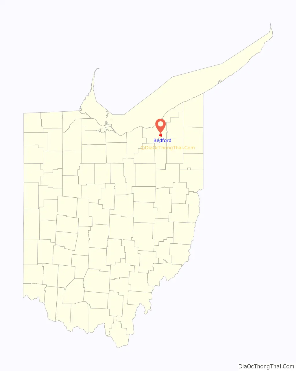
Bedford location map. Where is Bedford city?
History
The area that is now Bedford and northeastern Ohio was originally inhabited by Native Americans as early as 11,000 years ago. By 1662 the area had become a part of the Connecticut Colony through royal charter. Much of the colony’s land, which extended to the Pacific Ocean, was ceded to the early U.S. government, but a few million acres west of the border of Pennsylvania became what was known as the Western Reserve.
Bedford began as part of the Connecticut Western Reserve in 1797. A large portion of the Western Reserve was sold to the Connecticut Land Company in 1795. Surveying of the land began shortly after and was spearheaded by Moses Cleaveland. Seth Pease and Amzi Atwater surveyed Lot 46, which eventually would become Bedford Township. It was surveyed as township 6, range 11.
The first settlers to the area started to arrive in 1813. Early settlers to the region were drawn to Tinkers Creek and the hardwood forests. Waterfalls on Tinkers Creek were ideal for mills, which would power local businesses. The first mill in Bedford Township was built by Adams and Starr in 1815. It was situated at the mouth of Tinkers Creek. The first official settler to the area was Elijah Nobles. He settled here in 1810 in the western part of the township on one of the 100 lots surveyed.
More settlers followed, including Benjamin Franklin Fitch, who founded the Taylor Chair Company in 1816. He began making chairs at his home, which was located at Warrensville Center and Libby Roads in present-day Maple Heights, Ohio. The company did not close until 2012, making it the longest-running manufacturing company in the Western Reserve area. Fitch made chairs that were considered to be better than others because of his use of pre-shrunk wood that prevented creaking. He is also known for inventing the strap lathe, a tool that would become standard in furniture making.
Bedford Township was officially founded in 1823 and Township 6 was renamed Bedford Township by Daniel Benedict, originally a native of Bedford, New York. The original township covered what today includes Bedford, Bedford Heights, Ohio, Maple Heights, Ohio, Oakwood Village, Ohio, and Walton Hills, Ohio.
In 1834, the First Baptist Church was established to help meet the religious needs of the growing population in the area. The first church in Bedford was the First Baptist Church, founded with just 14 original members at the home of Hezekiah Dunham. In 1893, the church moved into its first dedicated building located on the Bedford Commons. The old First Baptist Church is a stone building done in the Late Gothic Revival style and was designed by architect Jacob Snyder. In 1968, the First Baptist Church moved to its present location at the corner of Turney Road and West Glendale Avenue. The old stone church still stands though and is owned by the Bedford Historical Society. It currently serves as a community building and a rental hall.
Bedford became an incorporated village on March 15, 1837. In 1837, the population of Bedford Township had grown to be 475 people and at that time, the residents petitioned to become the Village of Bedford, which sits at the geographic center of Bedford Township. At this time, Hezekiah Dunham, who was a prominent and wealthy local business man, and his wife, Clarissa Dunham, donated three acres of land for the village to be able to build a public square as well as other public and religious buildings. The deed for the land stated the property was to be “used as a public square forever.”
In addition to the falls on Tinkers Creek and the abundant forests, transportation helped Bedford to grow. Before the roads were even built, Bedford was situated along the main route between Pittsburgh and Cleveland and was an important stagecoach stop. Today this is U.S. Route 14, which runs through town from the northwest to southeast.
Transportation became even more important in the area when the Ohio and Erie Canal opened in 1827 and the Cleveland & Pittsburgh Railroad began in 1852. Both of these helped drive more industry to the area, and by 1840 the population of Bedford was 2,021. Another railroad, the Connotton Valley Railroad, opened in 1881.
In 1927, the Bedford Municipal Hospital was built. The original hospital still stands, though it has been heavily added onto since it was first constructed. It is now operated as a branch of University Hospitals of Cleveland.
The village of Maple Heights left Bedford Township in 1915 and in 1932 Maple Heights achieved city status.
In 1932, the Village of Bedford adopted a city manager government and charger and became the City of Bedford. As the village grew, many industries developed in Bedford and new businesses opened. Some of the important businesses in Bedford were manufacturing companies:
- The Marble & Shattuck Chair Company operated in Bedford from 1885 to 1894, when it moved to Cleveland.
- The B.L. Marble Chair Co. made wooden chairs from 1894.
- Founded in 1903, the Franklin Oil and Gas Company made engine oil and similar products.
- The Best Foundry Co., founded in 1905 manufactured metal castings, especially stoves.
- The McMyler-Interstate Company, established in 1910, was the largest manufacturer in Bedford. It made the largest crane in the world in 1919.
- Founded in 1922, the Walker China Company made marbles before manufacturing china.
- The Harper Aircraft Manufacturing Company built monoplanes beginning in 1930.
- In 1938, the Lewis Welding and Engineering Corporation opened and was an important supplier for the military during World War II.
The first car dealerships opened on Broadway Avenue in the early 1950s and formed the Bedford Automile Dealers Association in 1956, formally creating the first Bedford Automile. The Bedford Automile Dealers Association was created to not only give the car dealerships in the area a unified voice for working with the city but to also create a group who would actively help to improve the city.
On February 20, 1951, the northeast corner of Bedford Township broke off from the City of Bedford and incorporated to become the village of Bedford Heights, Ohio. Bedford Heights achieved city status in 1961.
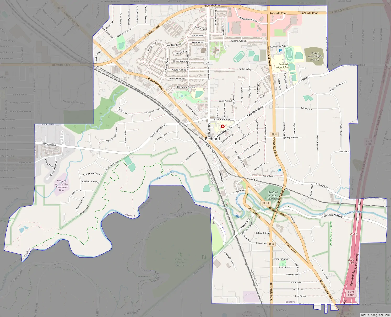
Bedford Road Map
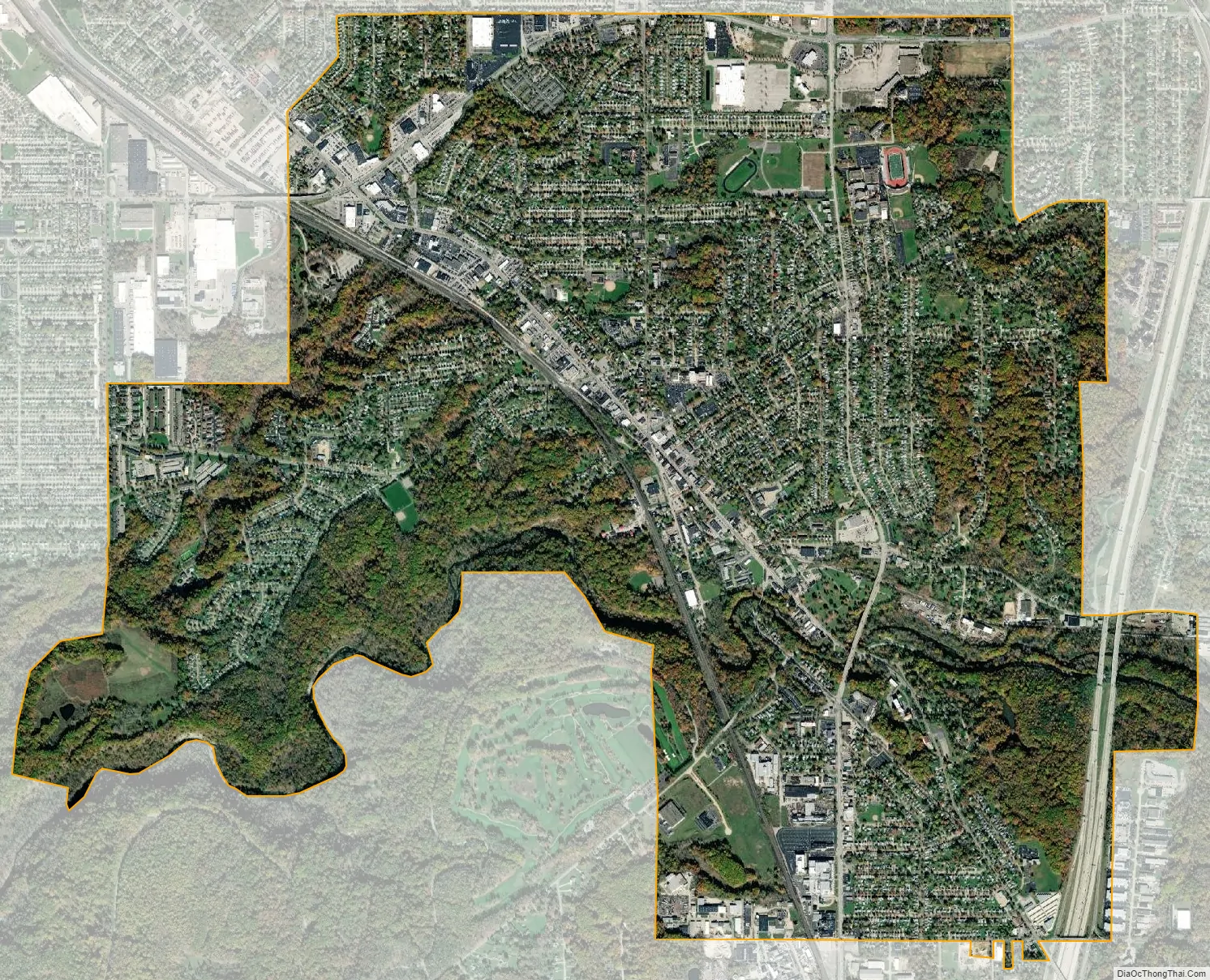
Bedford city Satellite Map
Geography
Bedford is located at 41°23′33″N 81°32′04″W / 41.392404°N 81.534441°W / 41.392404; -81.534441. It is a first ring suburb to the southeast of Cleveland. The city is bounded by Maple Heights to the north and west, Walton Hills and Oakwood to the south, and Bedford Heights to the east.
According to the 2010 census, the city has a total area of 5.40 square miles (14.0 km), of which 5.35 square miles (13.9 km) (or 99.07%) is land and 0.05 square miles (0.13 km) (or 0.93%) is water.
The boundaries of the city of Bedford include part of the Bedford Reservation. The reservation includes Tinker’s Creek, which flows through a gorge that has been listed as a National Natural Landmark. The Great Falls of Tinker’s Creek are within the city limits of Bedford.
See also
Map of Ohio State and its subdivision:- Adams
- Allen
- Ashland
- Ashtabula
- Athens
- Auglaize
- Belmont
- Brown
- Butler
- Carroll
- Champaign
- Clark
- Clermont
- Clinton
- Columbiana
- Coshocton
- Crawford
- Cuyahoga
- Darke
- Defiance
- Delaware
- Erie
- Fairfield
- Fayette
- Franklin
- Fulton
- Gallia
- Geauga
- Greene
- Guernsey
- Hamilton
- Hancock
- Hardin
- Harrison
- Henry
- Highland
- Hocking
- Holmes
- Huron
- Jackson
- Jefferson
- Knox
- Lake
- Lake Erie
- Lawrence
- Licking
- Logan
- Lorain
- Lucas
- Madison
- Mahoning
- Marion
- Medina
- Meigs
- Mercer
- Miami
- Monroe
- Montgomery
- Morgan
- Morrow
- Muskingum
- Noble
- Ottawa
- Paulding
- Perry
- Pickaway
- Pike
- Portage
- Preble
- Putnam
- Richland
- Ross
- Sandusky
- Scioto
- Seneca
- Shelby
- Stark
- Summit
- Trumbull
- Tuscarawas
- Union
- Van Wert
- Vinton
- Warren
- Washington
- Wayne
- Williams
- Wood
- Wyandot
- Alabama
- Alaska
- Arizona
- Arkansas
- California
- Colorado
- Connecticut
- Delaware
- District of Columbia
- Florida
- Georgia
- Hawaii
- Idaho
- Illinois
- Indiana
- Iowa
- Kansas
- Kentucky
- Louisiana
- Maine
- Maryland
- Massachusetts
- Michigan
- Minnesota
- Mississippi
- Missouri
- Montana
- Nebraska
- Nevada
- New Hampshire
- New Jersey
- New Mexico
- New York
- North Carolina
- North Dakota
- Ohio
- Oklahoma
- Oregon
- Pennsylvania
- Rhode Island
- South Carolina
- South Dakota
- Tennessee
- Texas
- Utah
- Vermont
- Virginia
- Washington
- West Virginia
- Wisconsin
- Wyoming


