Broadview Heights is a city in Cuyahoga County, Ohio, United States, and a suburb in the Greater Cleveland area. The city’s population was 19,936 at the 2020 census.
| Name: | Broadview Heights city |
|---|---|
| LSAD Code: | 25 |
| LSAD Description: | city (suffix) |
| State: | Ohio |
| County: | Cuyahoga County |
| Elevation: | 1,191 ft (363 m) |
| Total Area: | 13.06 sq mi (33.81 km²) |
| Land Area: | 13.03 sq mi (33.76 km²) |
| Water Area: | 0.02 sq mi (0.05 km²) |
| Total Population: | 19,936 |
| Population Density: | 1,529.54/sq mi (590.58/km²) |
| ZIP code: | 44147 |
| Area code: | 440 |
| FIPS code: | 3909064 |
| GNISfeature ID: | 1056723 |
| Website: | https://www.broadview-heights.org/ |
Online Interactive Map
Click on ![]() to view map in "full screen" mode.
to view map in "full screen" mode.
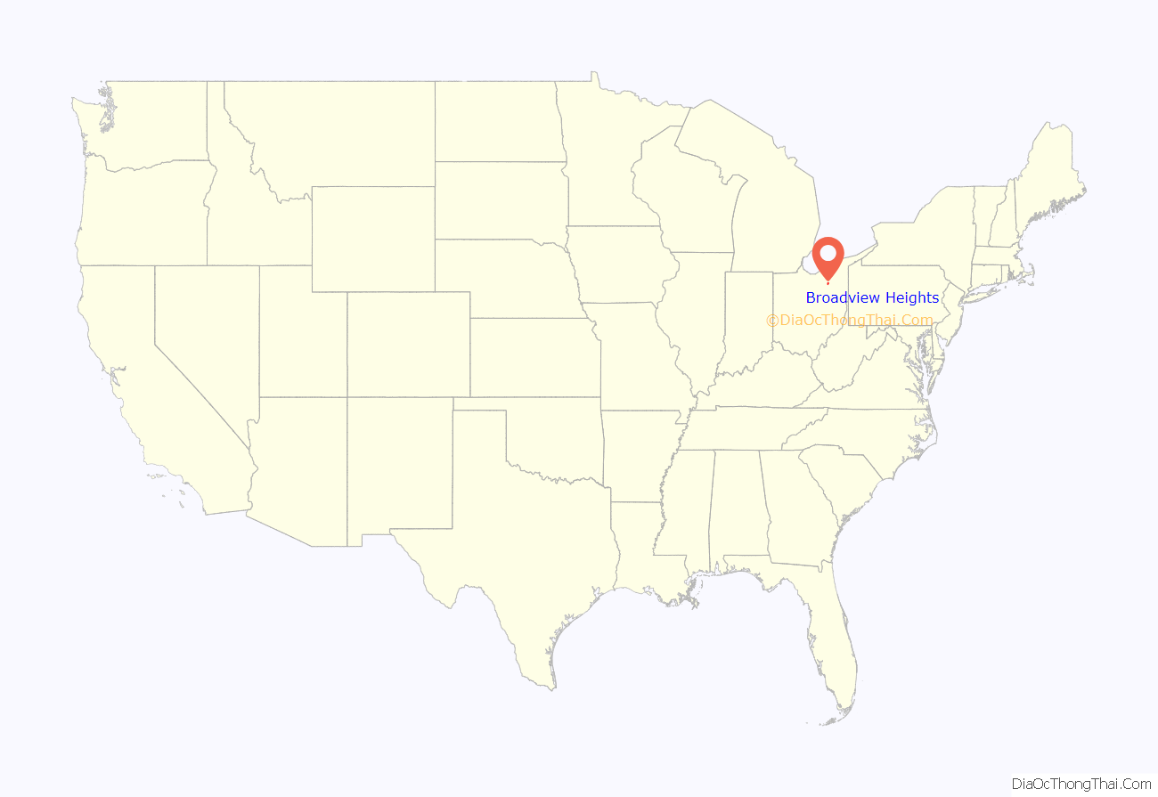
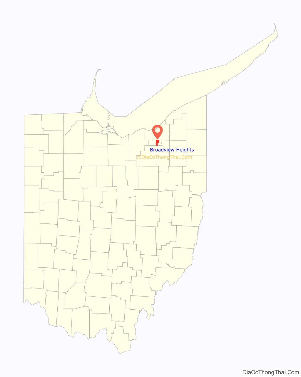
Broadview Heights location map. Where is Broadview Heights city?
History
Early history
Native Americans once occupied the land that is now part of Broadview Heights. In 1811, Seth Paine, a surveyor sent by Colonel John Breck, became the first white man to settle the area. At the time, land now part of Brecksville, Broadview Heights, and North Royalton was known as Brecksville Township. A school was established in 1815 in a since-demolished building located at the intersection of Broadview Road and Avery Road.
Industry
By 1840, Brecksville Township had a cheese factory, a tannery, three distilleries, four saw mills, and multiple grist mills. A manual switchboard located near the intersection of Broadview Road and Wallings Road handled telephone calls for the region.
Incorporation
Broadview Heights was officially incorporated as a village on December 17, 1926 after a petition and an election among residents of the western portion of Brecksville Township. In 1927, Floyd C. Harris took office as the first mayor of Broadview Heights. In 1960, on the basis of census results indicating population growth, Broadview Heights became a city.
Recent history
The current City Hall campus was purchased by the city in 1996 for $750,000. At the time, Broadview Developmental Center, a hospital which had closed in the 1980s, stood on the site. Following the purchase, the site became known as Broadview Center and was renovated. In 1998, Recreation and Human Services moved to the Thorin Building, and City Hall was moved onto the campus in 1999. Buildings on the campus also came to be used by the police department and other local organizations. In 2006, the city demolished the unused portion of the former hospital and reclaimed the land. During the 2018 year, the city renovated and added on to the dated recreation center by adding new basketball courts, a new work out area, and a new pool.
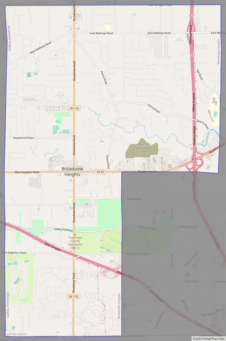
Broadview Heights Road Map
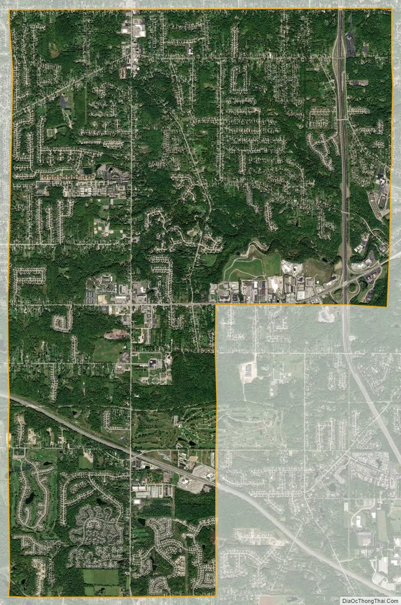
Broadview Heights city Satellite Map
Geography
Broadview Heights is located at 41°19′19″N 81°40′36″W / 41.32194°N 81.67667°W / 41.32194; -81.67667 (41.321827, -81.676595). According to the United States Census Bureau, the city has a total area of 13.07 square miles (33.85 km), of which 13.05 square miles (33.80 km) is land and 0.02 square miles (0.05 km) is water.
See also
Map of Ohio State and its subdivision:- Adams
- Allen
- Ashland
- Ashtabula
- Athens
- Auglaize
- Belmont
- Brown
- Butler
- Carroll
- Champaign
- Clark
- Clermont
- Clinton
- Columbiana
- Coshocton
- Crawford
- Cuyahoga
- Darke
- Defiance
- Delaware
- Erie
- Fairfield
- Fayette
- Franklin
- Fulton
- Gallia
- Geauga
- Greene
- Guernsey
- Hamilton
- Hancock
- Hardin
- Harrison
- Henry
- Highland
- Hocking
- Holmes
- Huron
- Jackson
- Jefferson
- Knox
- Lake
- Lake Erie
- Lawrence
- Licking
- Logan
- Lorain
- Lucas
- Madison
- Mahoning
- Marion
- Medina
- Meigs
- Mercer
- Miami
- Monroe
- Montgomery
- Morgan
- Morrow
- Muskingum
- Noble
- Ottawa
- Paulding
- Perry
- Pickaway
- Pike
- Portage
- Preble
- Putnam
- Richland
- Ross
- Sandusky
- Scioto
- Seneca
- Shelby
- Stark
- Summit
- Trumbull
- Tuscarawas
- Union
- Van Wert
- Vinton
- Warren
- Washington
- Wayne
- Williams
- Wood
- Wyandot
- Alabama
- Alaska
- Arizona
- Arkansas
- California
- Colorado
- Connecticut
- Delaware
- District of Columbia
- Florida
- Georgia
- Hawaii
- Idaho
- Illinois
- Indiana
- Iowa
- Kansas
- Kentucky
- Louisiana
- Maine
- Maryland
- Massachusetts
- Michigan
- Minnesota
- Mississippi
- Missouri
- Montana
- Nebraska
- Nevada
- New Hampshire
- New Jersey
- New Mexico
- New York
- North Carolina
- North Dakota
- Ohio
- Oklahoma
- Oregon
- Pennsylvania
- Rhode Island
- South Carolina
- South Dakota
- Tennessee
- Texas
- Utah
- Vermont
- Virginia
- Washington
- West Virginia
- Wisconsin
- Wyoming


