Chagrin Falls is a village in eastern Cuyahoga County, Ohio, United States. A suburb of Cleveland, it is part of the Cleveland metropolitan area. The village was established around Chagrin Falls on the Chagrin River. As of the 2020 census, the population was 4,188.
| Name: | Chagrin Falls village |
|---|---|
| LSAD Code: | 47 |
| LSAD Description: | village (suffix) |
| State: | Ohio |
| County: | Cuyahoga County |
| Elevation: | 1,004 ft (306 m) |
| Total Area: | 2.14 sq mi (5.54 km²) |
| Land Area: | 2.08 sq mi (5.39 km²) |
| Water Area: | 0.06 sq mi (0.15 km²) |
| Total Population: | 4,188 |
| Population Density: | 2,011.53/sq mi (776.66/km²) |
| ZIP code: | 44022 |
| Area code: | 440 |
| FIPS code: | 3913358 |
| GNISfeature ID: | 1083437 |
| Website: | http://www.chagrin-falls.org/ |
Online Interactive Map
Click on ![]() to view map in "full screen" mode.
to view map in "full screen" mode.
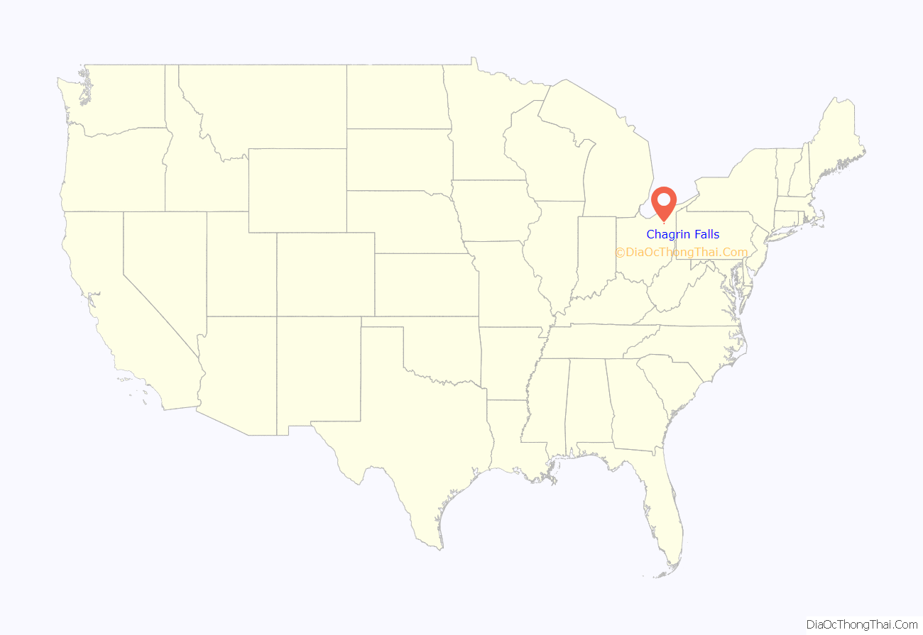
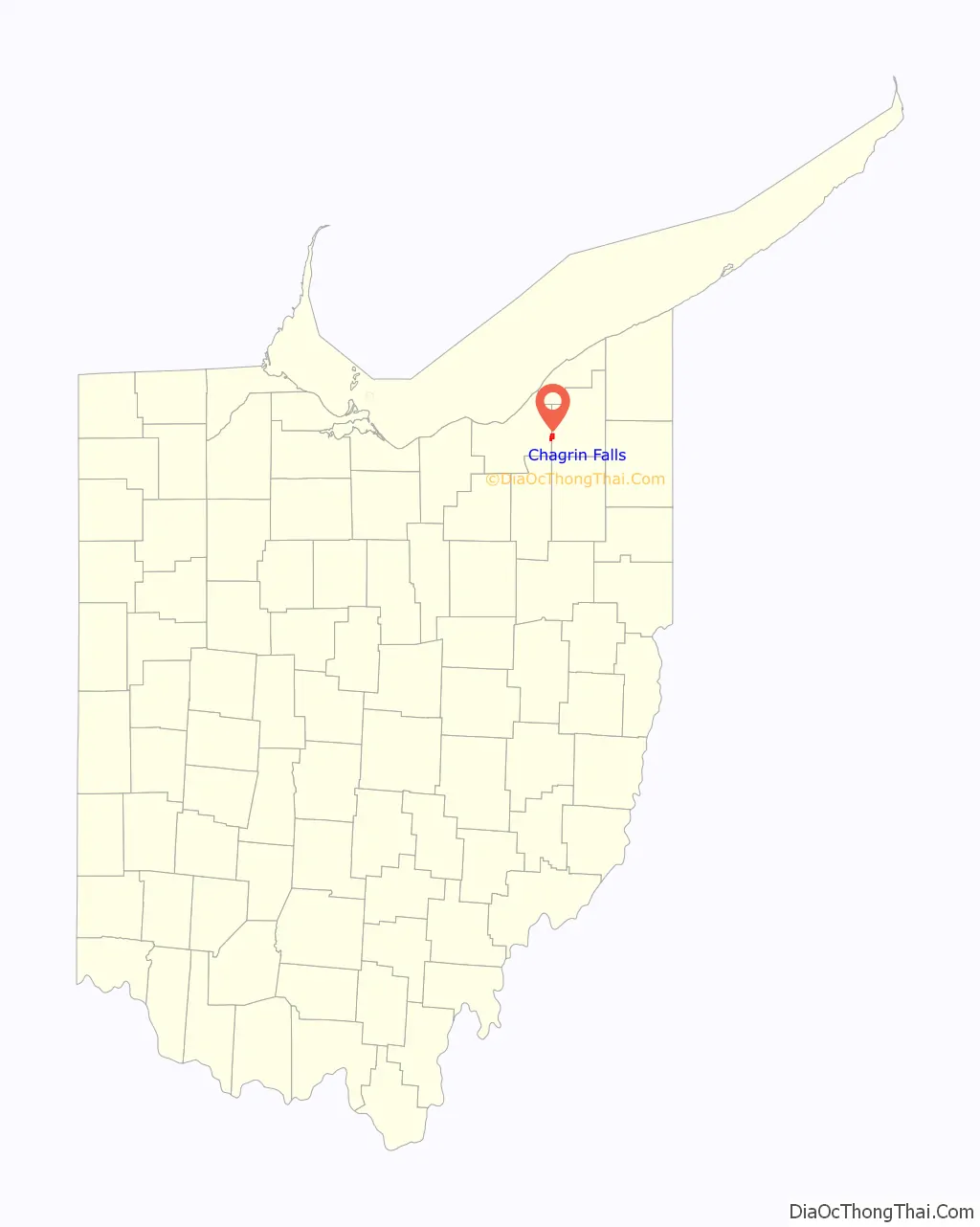
Chagrin Falls location map. Where is Chagrin Falls village?
History
Chagrin Falls was laid out in 1837. The community takes its name from a series of waterfalls along the Chagrin River, which runs through the town. The village was incorporated in 1844 from parts of three townships in two counties.
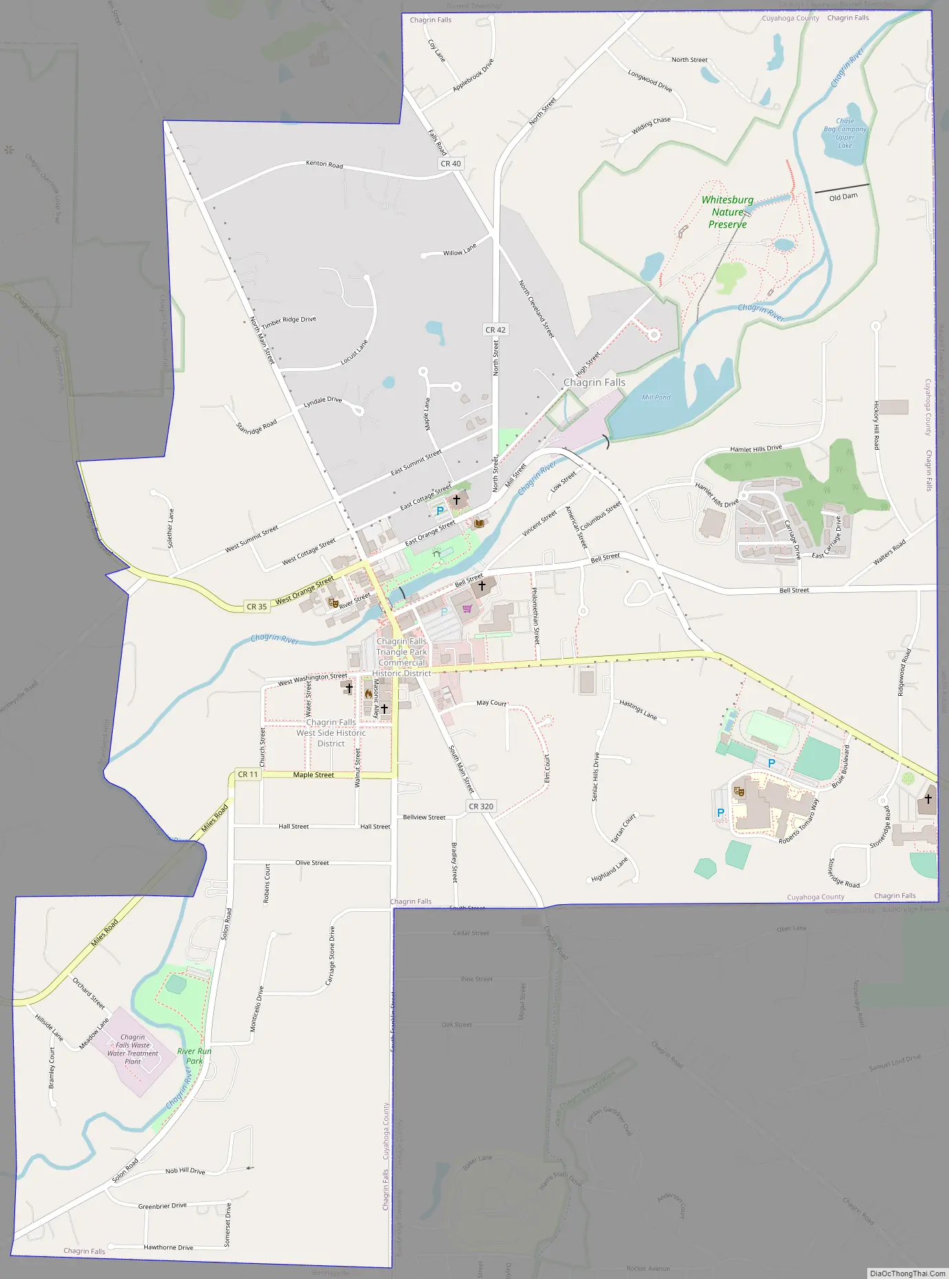
Chagrin Falls Road Map
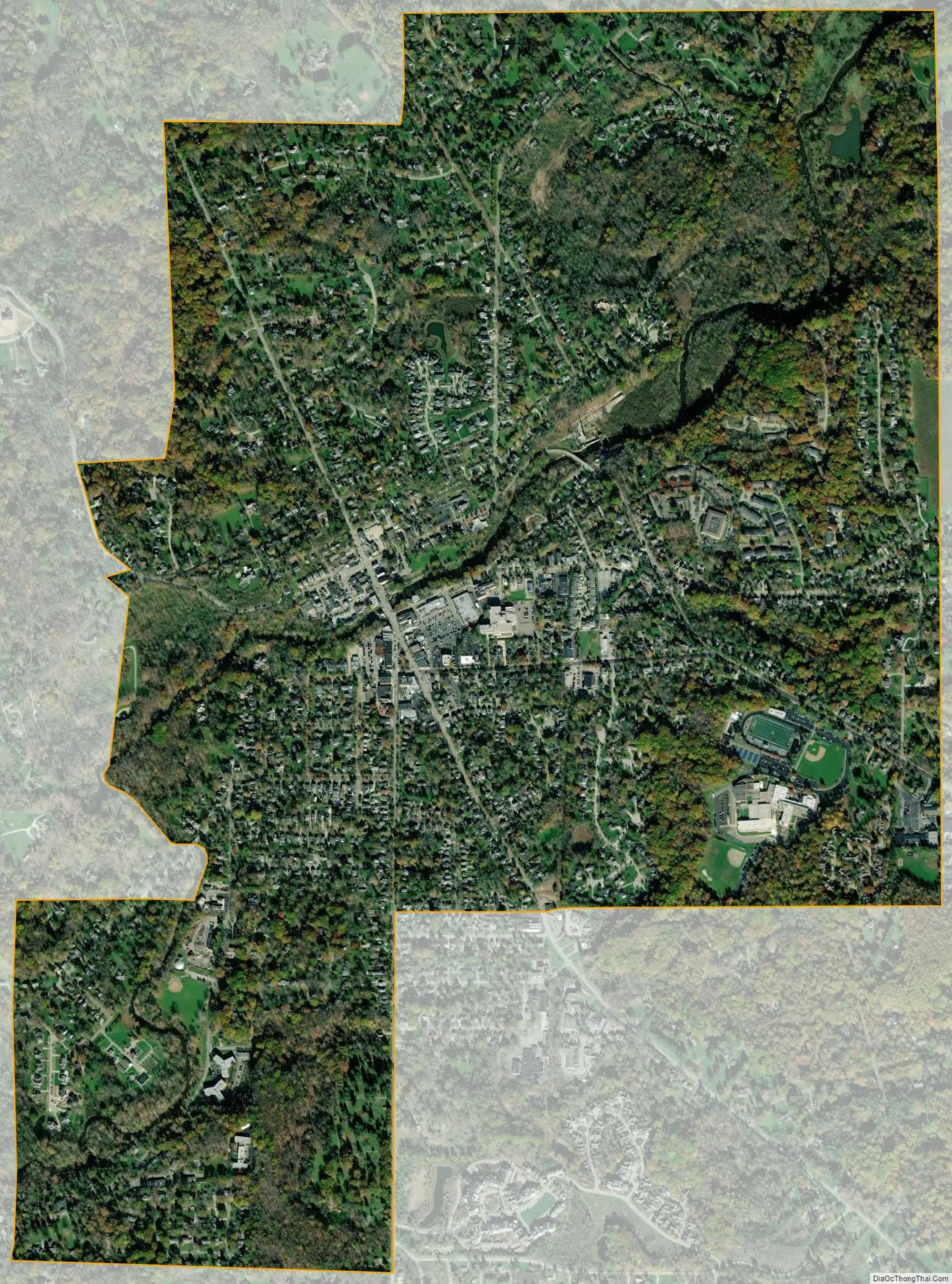
Chagrin Falls city Satellite Map
Geography
According to the United States Census Bureau, the village has a total area of 2.14 square miles (5.54 km), of which 2.08 square miles (5.39 km) is land and 0.06 square miles (0.16 km) is covered by water. One notable landmark is the Chagrin Falls waterfall.
See also
Map of Ohio State and its subdivision:- Adams
- Allen
- Ashland
- Ashtabula
- Athens
- Auglaize
- Belmont
- Brown
- Butler
- Carroll
- Champaign
- Clark
- Clermont
- Clinton
- Columbiana
- Coshocton
- Crawford
- Cuyahoga
- Darke
- Defiance
- Delaware
- Erie
- Fairfield
- Fayette
- Franklin
- Fulton
- Gallia
- Geauga
- Greene
- Guernsey
- Hamilton
- Hancock
- Hardin
- Harrison
- Henry
- Highland
- Hocking
- Holmes
- Huron
- Jackson
- Jefferson
- Knox
- Lake
- Lake Erie
- Lawrence
- Licking
- Logan
- Lorain
- Lucas
- Madison
- Mahoning
- Marion
- Medina
- Meigs
- Mercer
- Miami
- Monroe
- Montgomery
- Morgan
- Morrow
- Muskingum
- Noble
- Ottawa
- Paulding
- Perry
- Pickaway
- Pike
- Portage
- Preble
- Putnam
- Richland
- Ross
- Sandusky
- Scioto
- Seneca
- Shelby
- Stark
- Summit
- Trumbull
- Tuscarawas
- Union
- Van Wert
- Vinton
- Warren
- Washington
- Wayne
- Williams
- Wood
- Wyandot
- Alabama
- Alaska
- Arizona
- Arkansas
- California
- Colorado
- Connecticut
- Delaware
- District of Columbia
- Florida
- Georgia
- Hawaii
- Idaho
- Illinois
- Indiana
- Iowa
- Kansas
- Kentucky
- Louisiana
- Maine
- Maryland
- Massachusetts
- Michigan
- Minnesota
- Mississippi
- Missouri
- Montana
- Nebraska
- Nevada
- New Hampshire
- New Jersey
- New Mexico
- New York
- North Carolina
- North Dakota
- Ohio
- Oklahoma
- Oregon
- Pennsylvania
- Rhode Island
- South Carolina
- South Dakota
- Tennessee
- Texas
- Utah
- Vermont
- Virginia
- Washington
- West Virginia
- Wisconsin
- Wyoming


