East Sparta is a village in Stark County, Ohio, United States. The population was 819 at the 2010 census. It is part of the Canton–Massillon Metropolitan Statistical Area.
| Name: | East Sparta village |
|---|---|
| LSAD Code: | 47 |
| LSAD Description: | village (suffix) |
| State: | Ohio |
| County: | Stark County |
| Elevation: | 968 ft (295 m) |
| Total Area: | 1.82 sq mi (4.71 km²) |
| Land Area: | 1.82 sq mi (4.71 km²) |
| Water Area: | 0.00 sq mi (0.00 km²) |
| Total Population: | 749 |
| Population Density: | 411.54/sq mi (158.88/km²) |
| ZIP code: | 44626 |
| Area code: | 330 |
| FIPS code: | 3924052 |
| GNISfeature ID: | 1061041 |
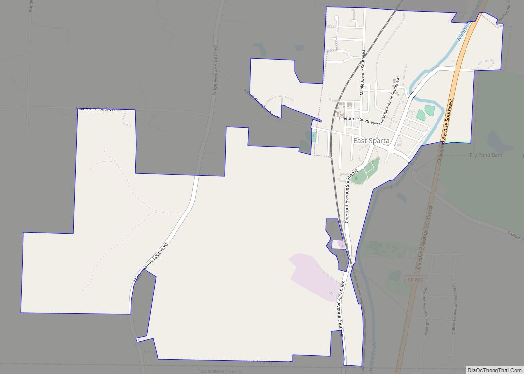
Online Interactive Map
Click on ![]() to view map in "full screen" mode.
to view map in "full screen" mode.
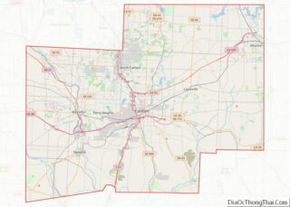
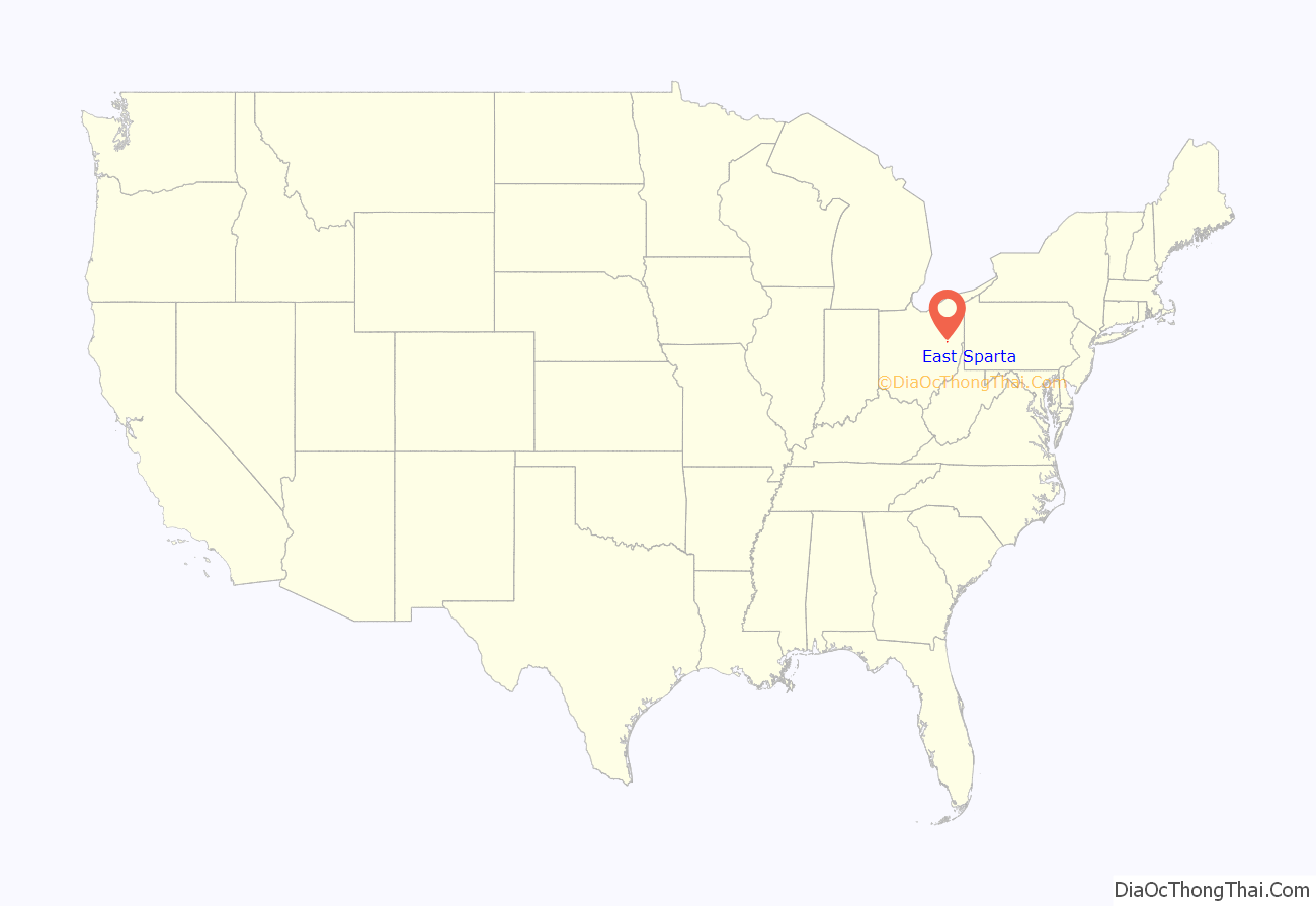
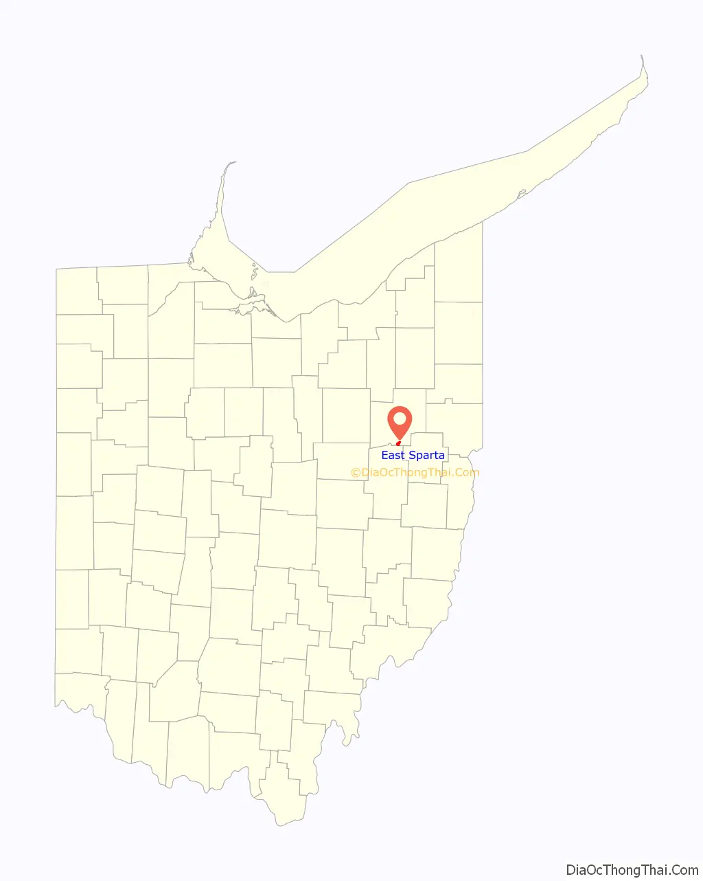
East Sparta location map. Where is East Sparta village?
History
East Sparta was originally called Sparta, and under the latter name was laid out in 1815, and named after the ancient city of Sparta, in Greece.
On June 3, 2015 East Sparta’s 70-year-old water tower was dismantled.
On July 28, 2017 East Sparta’s Towne Pump Tavern built in 1909 burned down.
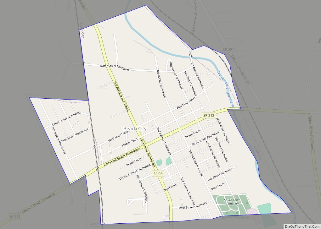
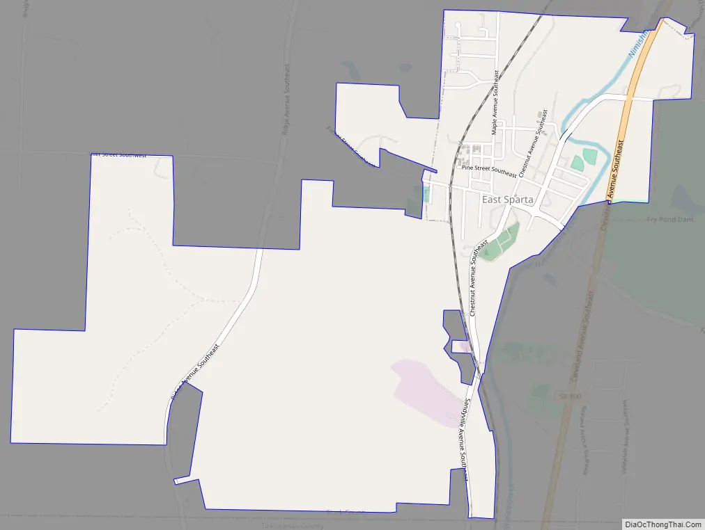
East Sparta Road Map
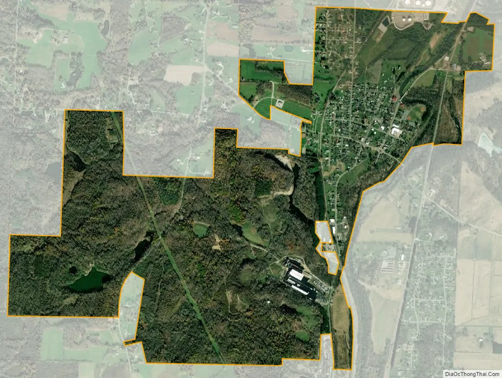
East Sparta city Satellite Map
Geography
East Sparta is located at 40°40′12″N 81°21′13″W / 40.67000°N 81.35361°W / 40.67000; -81.35361 (40.669893, -81.353680), along Nimishillen Creek, a short distance north of the Tuscarawas County border.
According to the United States Census Bureau, the village has a total area of 1.68 square miles (4.35 km), all land.
See also
Map of Ohio State and its subdivision:- Adams
- Allen
- Ashland
- Ashtabula
- Athens
- Auglaize
- Belmont
- Brown
- Butler
- Carroll
- Champaign
- Clark
- Clermont
- Clinton
- Columbiana
- Coshocton
- Crawford
- Cuyahoga
- Darke
- Defiance
- Delaware
- Erie
- Fairfield
- Fayette
- Franklin
- Fulton
- Gallia
- Geauga
- Greene
- Guernsey
- Hamilton
- Hancock
- Hardin
- Harrison
- Henry
- Highland
- Hocking
- Holmes
- Huron
- Jackson
- Jefferson
- Knox
- Lake
- Lake Erie
- Lawrence
- Licking
- Logan
- Lorain
- Lucas
- Madison
- Mahoning
- Marion
- Medina
- Meigs
- Mercer
- Miami
- Monroe
- Montgomery
- Morgan
- Morrow
- Muskingum
- Noble
- Ottawa
- Paulding
- Perry
- Pickaway
- Pike
- Portage
- Preble
- Putnam
- Richland
- Ross
- Sandusky
- Scioto
- Seneca
- Shelby
- Stark
- Summit
- Trumbull
- Tuscarawas
- Union
- Van Wert
- Vinton
- Warren
- Washington
- Wayne
- Williams
- Wood
- Wyandot
- Alabama
- Alaska
- Arizona
- Arkansas
- California
- Colorado
- Connecticut
- Delaware
- District of Columbia
- Florida
- Georgia
- Hawaii
- Idaho
- Illinois
- Indiana
- Iowa
- Kansas
- Kentucky
- Louisiana
- Maine
- Maryland
- Massachusetts
- Michigan
- Minnesota
- Mississippi
- Missouri
- Montana
- Nebraska
- Nevada
- New Hampshire
- New Jersey
- New Mexico
- New York
- North Carolina
- North Dakota
- Ohio
- Oklahoma
- Oregon
- Pennsylvania
- Rhode Island
- South Carolina
- South Dakota
- Tennessee
- Texas
- Utah
- Vermont
- Virginia
- Washington
- West Virginia
- Wisconsin
- Wyoming