Elizabethtown is a census-designated place (CDP) in Whitewater Township, Hamilton County, Ohio, United States. The population was 323 at the 2020 census.
| Name: | Elizabethtown CDP |
|---|---|
| LSAD Code: | 57 |
| LSAD Description: | CDP (suffix) |
| State: | Ohio |
| County: | Hamilton County |
| Elevation: | 491 ft (150 m) |
| Total Area: | 0.90 sq mi (2.34 km²) |
| Land Area: | 0.89 sq mi (2.30 km²) |
| Water Area: | 0.01 sq mi (0.04 km²) |
| Total Population: | 323 |
| Population Density: | 363.33/sq mi (140.22/km²) |
| FIPS code: | 3924850 |
| GNISfeature ID: | 1056275 |
Online Interactive Map
Click on ![]() to view map in "full screen" mode.
to view map in "full screen" mode.
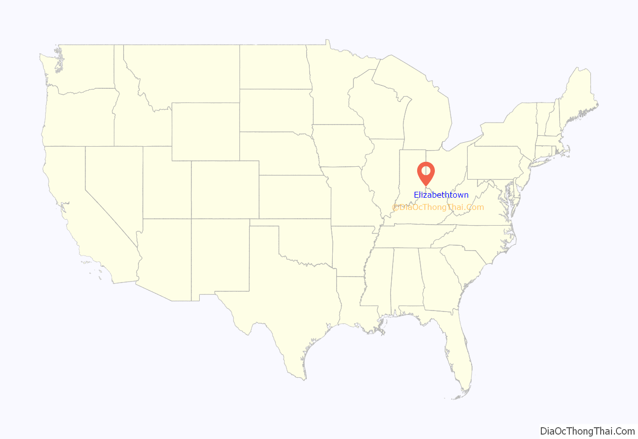
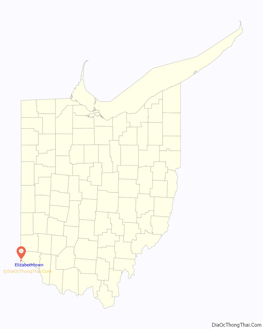
Elizabethtown location map. Where is Elizabethtown CDP?
History
Elizabethtown was platted in 1817 by Isaac Mills, and named for his wife. It was a depot on the Cleveland, Cincinnati, Chicago and St. Louis Railway. In 1894, Elizabethtown was described as having three stores, two churches and a grain elevator.
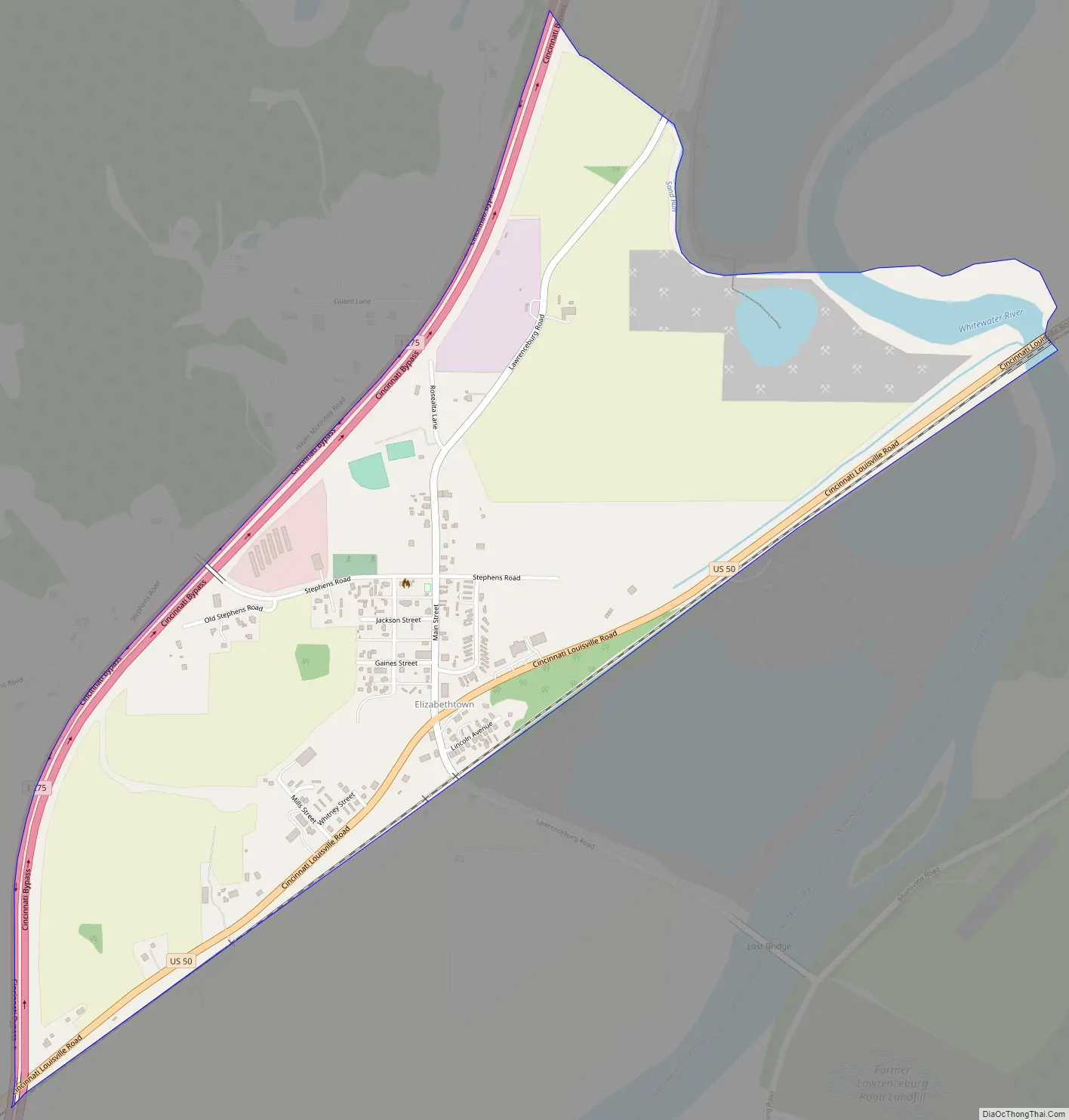
Elizabethtown Road Map
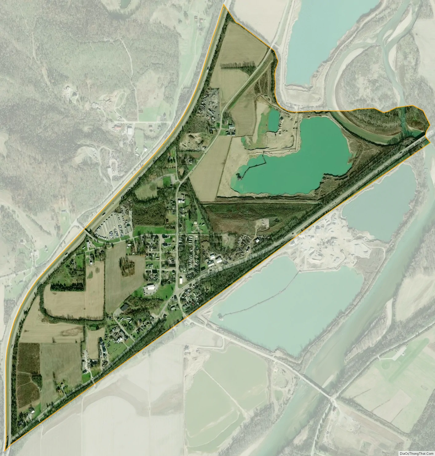
Elizabethtown city Satellite Map
Geography
Elizabethtown is located at 39°9′30″N 84°48′16″W / 39.15833°N 84.80444°W / 39.15833; -84.80444, in the valley of the Great Miami River, 20 miles (32 km) west of downtown Cincinnati. U.S. Route 50 runs through the center of the community, and Interstate 275 passes it to the northwest but does not provide direct access to it.
According to the United States Census Bureau, the CDP has a total area of 0.89 square miles (2.3 km), all land.
See also
Map of Ohio State and its subdivision:- Adams
- Allen
- Ashland
- Ashtabula
- Athens
- Auglaize
- Belmont
- Brown
- Butler
- Carroll
- Champaign
- Clark
- Clermont
- Clinton
- Columbiana
- Coshocton
- Crawford
- Cuyahoga
- Darke
- Defiance
- Delaware
- Erie
- Fairfield
- Fayette
- Franklin
- Fulton
- Gallia
- Geauga
- Greene
- Guernsey
- Hamilton
- Hancock
- Hardin
- Harrison
- Henry
- Highland
- Hocking
- Holmes
- Huron
- Jackson
- Jefferson
- Knox
- Lake
- Lake Erie
- Lawrence
- Licking
- Logan
- Lorain
- Lucas
- Madison
- Mahoning
- Marion
- Medina
- Meigs
- Mercer
- Miami
- Monroe
- Montgomery
- Morgan
- Morrow
- Muskingum
- Noble
- Ottawa
- Paulding
- Perry
- Pickaway
- Pike
- Portage
- Preble
- Putnam
- Richland
- Ross
- Sandusky
- Scioto
- Seneca
- Shelby
- Stark
- Summit
- Trumbull
- Tuscarawas
- Union
- Van Wert
- Vinton
- Warren
- Washington
- Wayne
- Williams
- Wood
- Wyandot
- Alabama
- Alaska
- Arizona
- Arkansas
- California
- Colorado
- Connecticut
- Delaware
- District of Columbia
- Florida
- Georgia
- Hawaii
- Idaho
- Illinois
- Indiana
- Iowa
- Kansas
- Kentucky
- Louisiana
- Maine
- Maryland
- Massachusetts
- Michigan
- Minnesota
- Mississippi
- Missouri
- Montana
- Nebraska
- Nevada
- New Hampshire
- New Jersey
- New Mexico
- New York
- North Carolina
- North Dakota
- Ohio
- Oklahoma
- Oregon
- Pennsylvania
- Rhode Island
- South Carolina
- South Dakota
- Tennessee
- Texas
- Utah
- Vermont
- Virginia
- Washington
- West Virginia
- Wisconsin
- Wyoming


