Fairfield is a suburban city located in Butler county in the U.S. state of Ohio. Fairfield is located approximately 25 miles north of Cincinnati and is situated on the east bank of the Great Miami River. The population was 42,623 as of the 2020 Census. Incorporated in 1955 from portions of Fairfield Township, it includes the former hamlets of Symmes Corner, Fair Play, Furmandale, and Stockton. The Fairfield City School District is one of the largest in Ohio and serves both the City of Fairfield and Fairfield Township.
| Name: | Fairfield city |
|---|---|
| LSAD Code: | 25 |
| LSAD Description: | city (suffix) |
| State: | Ohio |
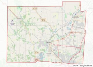
| County: | Butler County, Hamilton County |
| Founded: | 1787 |
| Incorporated: | 1955 |
| Elevation: | 591 ft (180 m) |
| Total Area: | 20.92 sq mi (54.18 km²) |
| Land Area: | 20.83 sq mi (53.96 km²) |
| Water Area: | 0.09 sq mi (0.22 km²) |
| Total Population: | 44,907 |
| Population Density: | 2,155.47/sq mi (832.25/km²) |
| Area code: | 513 |
| FIPS code: | 3925970 |
| GNISfeature ID: | 1048720 |
| Website: | www.fairfield-city.org |
Online Interactive Map
Click on ![]() to view map in "full screen" mode.
to view map in "full screen" mode.
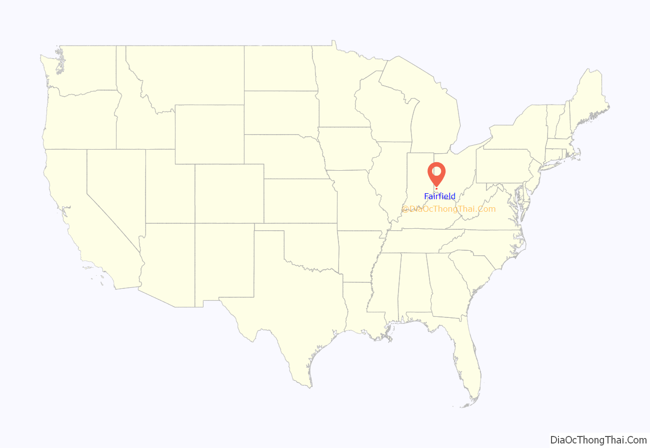
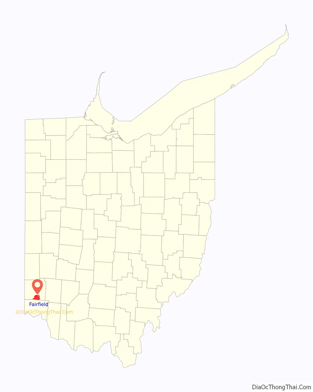
Fairfield location map. Where is Fairfield city?
History
Early history
Prior to European settlement the Fairfield area was home to several Indian tribes, most prominently the Shawnee and the Miami. The prehistoric Hopewell and Adena peoples constructed numerous earthworks around the city, though most were unwittingly removed by early settlers in order to accommodate farm fields.
The area that is now Fairfield was part of the original Symmes Purchase. Also known as the Miami Purchase, the region was acquired by Judge John Cleves Symmes from the Continental Congress in 1788 and included much of the land between the Little Miami and Great Miami rivers that became the present day counties of Hamilton, Butler, and Warren.
As the area was settled hamlets developed to serve the surrounding countryside. Judge Symmes’ great-nephew, Celadon Symmes, was the founder and first settler of Symmes Corner. Located at the intersection of Pleasant Avenue and Nilles Road it now serves as Fairfield’s town center. The hamlet of Fair Play was located on the east bank of the Great Miami River. It was known for its mills, including Ohio’s first paper mill. The community was destroyed by a flood in the late 1800s. Today the Miami Chapel Cemetery and the Fair Play School are some of the few remaining vestiges of the village.
In the 1850s, the Cincinnati, Hamilton & Dayton Railway (today CSX) was extended through Fairfield, fostering the development of several communities. The villages of Schencks Station and Stockton were established along the rail line. Schencks Station was located near the present-day intersection of Symmes Road and State Route 4 and was named for local landowner Aaron Schenck. Stockton could be found at the crossroads of State Route 4 and Seward Road. Originally known as Jones Station, the village provided area farms with necessities including a smithy, a general store, churches, and a school. In between the two communities was the village of Furmandale; also known as Schnapstown or Snaptown. Located at the current intersection of Winton and Nilles roads, the community took its name from Nathaniel Furman who operated a private school for girls within the community. A few miles to the east of these communities was the Miami-Erie Canal which, prior to the arrival of the railroad, enabled early settlers to move their commodities to market.
Growth and incorporation
Fairfield remained a quiet, primarily agricultural community until the mid-20th century. As the City of Hamilton grew its industry expanded south into present day Fairfield. Fisher Body, a manufacturing division of General Motors, established a plant at the northeast corner of State Route 4 and Symmes Road near the location of what was Schencks Station. During the same timeframe Fairfield started to experience residential growth, initially as a southern suburb of Hamilton. In 1954 a group of citizens wishing to avoid annexation into Hamilton organized an incorporation campaign. The initial petition was to create a municipal corporation from Fairfield Township in its entirety. A referendum was held in April 1954 with incorporation failing by a vote of 1,219 to 831. A renewed effort focused on those precincts that voted affirmatively. A second referendum was held in July 1954 with incorporation winning by a vote of 738 to 216. Fairfield was established as a statutory village in 1955 with a mayor-council form of government.
The next 30 years represented a period of rapid growth for the community. By 1960 the village had exceeded a population of 5,000 and was reclassified as a statutory city. The Interstate 275 beltway was constructed around Cincinnati in the late 1970s. The new road provided easy access to Fairfield from the northern Cincinnati suburbs, thus providing an additional high quality transportation route. This, in turn, drove substantial commercial and residential investment in the community.
Growing pains and stabilization
The city’s form-of-government was a subject of debate almost from its inception. In 1961 a charter commission was formed to study the issue. After due consideration the commission recommended adoption of a charter with the council-administrator form of government, but the initiative was rejected by the voters. The question resurfaced in 1971, but did not progress beyond council conversations. In 1976 the issue gained momentum with form-of-government becoming an issue in council campaigns. In 1978 a charter commission was established and charged with framing a charter that would establish a council-administrator form-of-government. The city’s second charter commission spent eight months researching the charters of various Ohio communities. A referendum was held on June 5, 1979, in which the issue was approved by a vote of 1,423 to 1,265. The council-administrator (later council-manager) form went into effect on January 1, 1980.
General Motors announced that the Hamilton-Fairfield Chevrolet Pontiac Canada Group, known as the Fisher Body plant, would be phased out in the first quarter of 1989. The effect of the plant closing was a loss of 2,500 jobs and 28 percent of the city’s income tax revenue, amounting to $1.7 million.
The city regained economic balance in the 1990s and experienced wide, diverse business development. With a population of 39,729 at the beginning of 1990, the city’s explosive population growth had begun to slow, allowing it to focus on quality development of remaining residential and commercial areas. During this time, Fairfield updated and expanded its sanitary sewers, established detention basins for better stormwater control, continued to address road improvements, and established a community center.
In 1995, Fairfield withdraw from Fairfield, Union, and Springfield townships via a paper township called “Heritage Township”, reusing a name from a previous failed attempt to incorporate Symmes and Deerfield townships as a city.
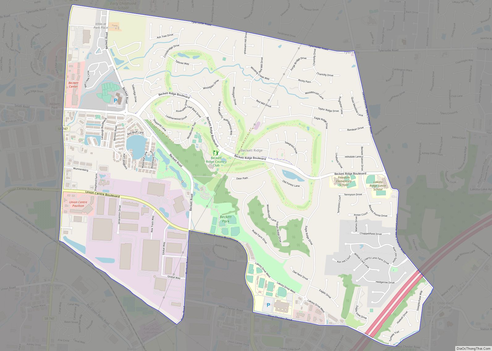
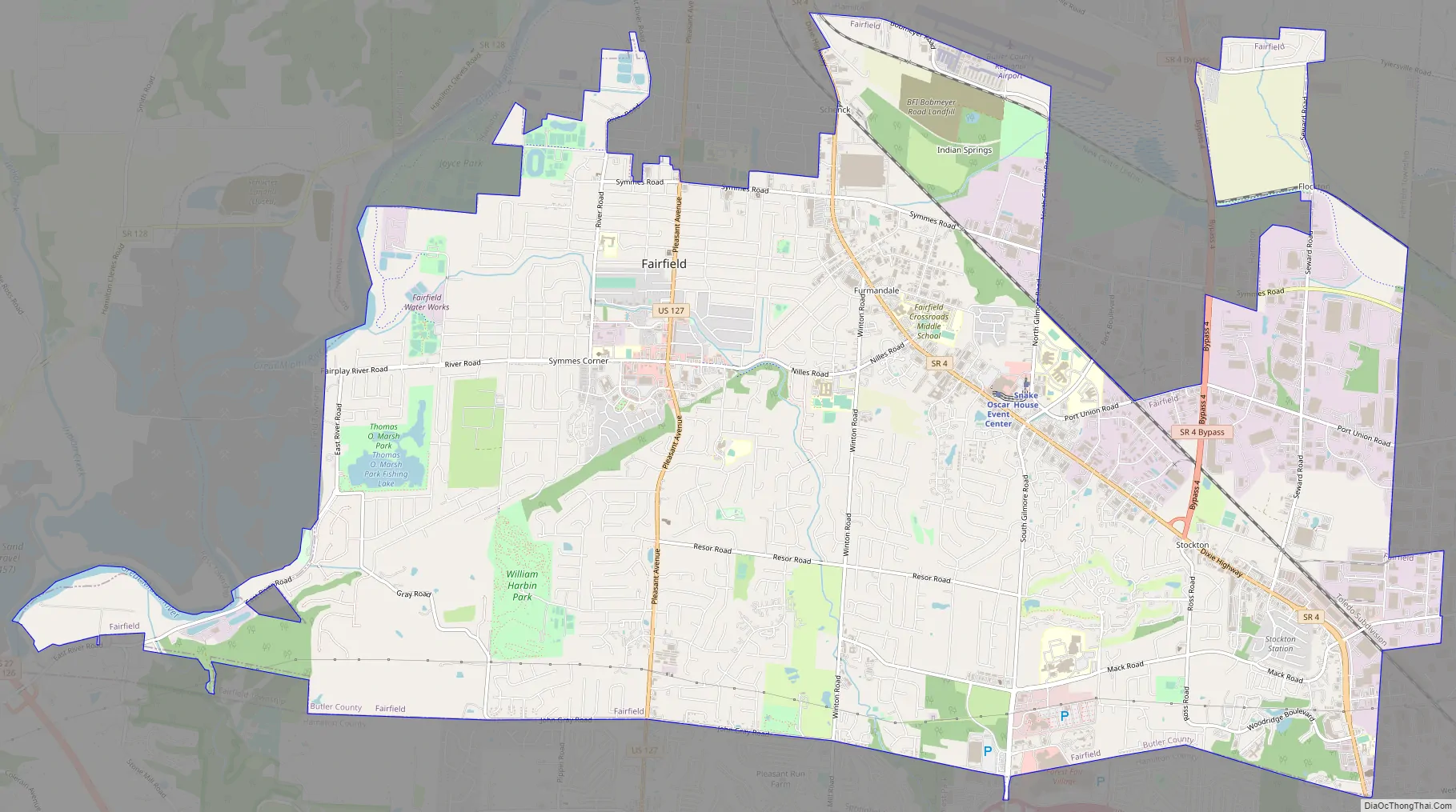
Fairfield Road Map
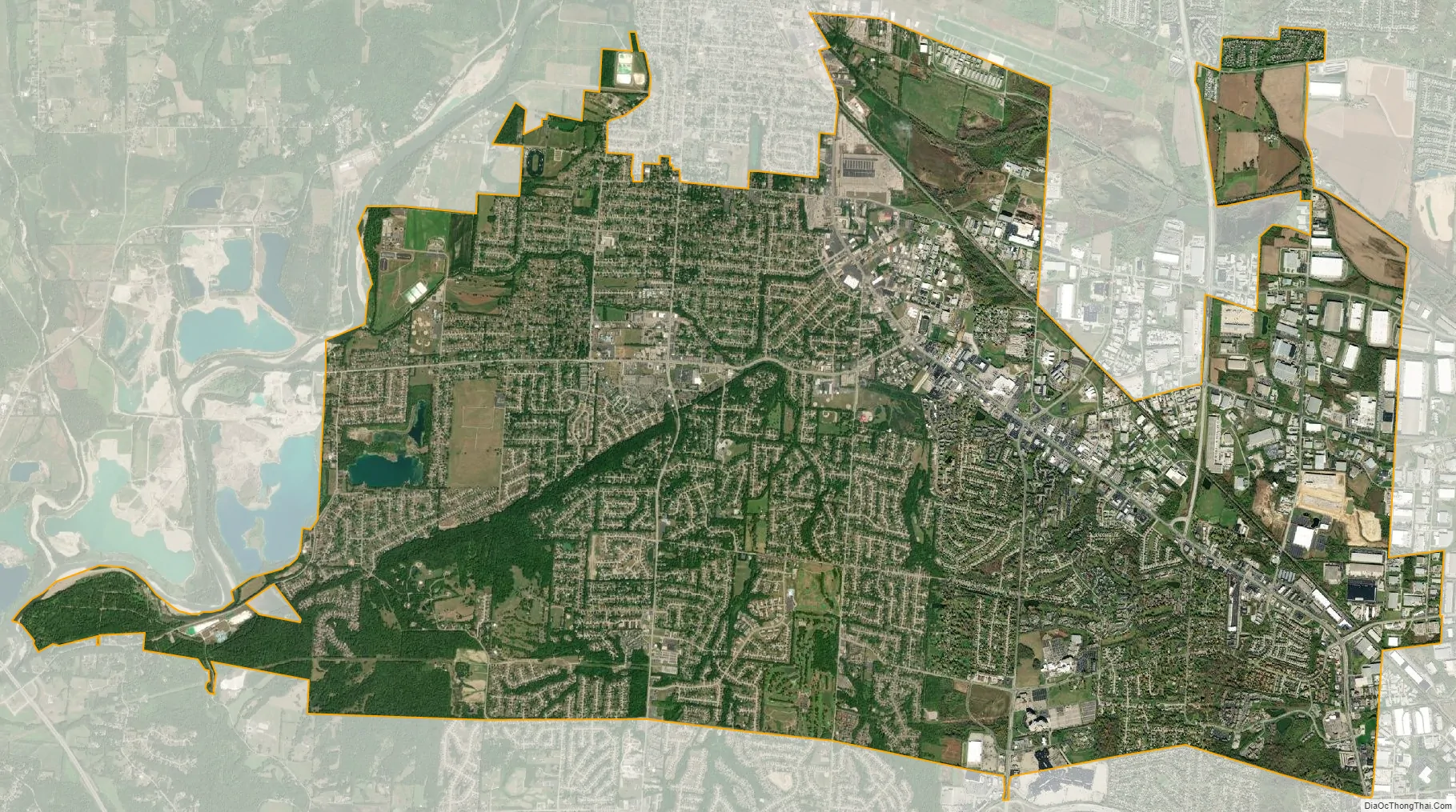
Fairfield city Satellite Map
Geography
According to the United States Census Bureau, the city has a total area of 21.06 square miles (54.55 km), of which 20.94 square miles (54.23 km) is land and 0.12 square miles (0.31 km) is water. The Butler County line serves as Fairfield’s southern corporate boundary with a small portion of the City extending into Hamilton County. This portion contains no population. The city is bounded on the north by the City of Hamilton and the eponymously named Fairfield Township; the east by West Chester and Fairfield townships; the south by the cities of Springdale and Forest Park as well as Springfield and Colerain townships; and on the west by Fairfield and Ross townships. The city is bisected by a major rail line and is served by several interstate, federal and state highways which provide for excellent access. This transportation infrastructure has contributed greatly to Fairfield’s economic success.
Most of Fairfield sits on top of the Great Miami Buried Valley Aquifer; one of the largest underground reservoirs in the Midwest. The aquifer provides a clean and safe source of drinking water for communities up and down the course of the Great Miami River. The cities of Fairfield, Hamilton and Cincinnati operate water production facilities within Fairfield corporate boundaries; all of which draw from the aquifer.
See also
Map of Ohio State and its subdivision:- Adams
- Allen
- Ashland
- Ashtabula
- Athens
- Auglaize
- Belmont
- Brown
- Butler
- Carroll
- Champaign
- Clark
- Clermont
- Clinton
- Columbiana
- Coshocton
- Crawford
- Cuyahoga
- Darke
- Defiance
- Delaware
- Erie
- Fairfield
- Fayette
- Franklin
- Fulton
- Gallia
- Geauga
- Greene
- Guernsey
- Hamilton
- Hancock
- Hardin
- Harrison
- Henry
- Highland
- Hocking
- Holmes
- Huron
- Jackson
- Jefferson
- Knox
- Lake
- Lake Erie
- Lawrence
- Licking
- Logan
- Lorain
- Lucas
- Madison
- Mahoning
- Marion
- Medina
- Meigs
- Mercer
- Miami
- Monroe
- Montgomery
- Morgan
- Morrow
- Muskingum
- Noble
- Ottawa
- Paulding
- Perry
- Pickaway
- Pike
- Portage
- Preble
- Putnam
- Richland
- Ross
- Sandusky
- Scioto
- Seneca
- Shelby
- Stark
- Summit
- Trumbull
- Tuscarawas
- Union
- Van Wert
- Vinton
- Warren
- Washington
- Wayne
- Williams
- Wood
- Wyandot
- Alabama
- Alaska
- Arizona
- Arkansas
- California
- Colorado
- Connecticut
- Delaware
- District of Columbia
- Florida
- Georgia
- Hawaii
- Idaho
- Illinois
- Indiana
- Iowa
- Kansas
- Kentucky
- Louisiana
- Maine
- Maryland
- Massachusetts
- Michigan
- Minnesota
- Mississippi
- Missouri
- Montana
- Nebraska
- Nevada
- New Hampshire
- New Jersey
- New Mexico
- New York
- North Carolina
- North Dakota
- Ohio
- Oklahoma
- Oregon
- Pennsylvania
- Rhode Island
- South Carolina
- South Dakota
- Tennessee
- Texas
- Utah
- Vermont
- Virginia
- Washington
- West Virginia
- Wisconsin
- Wyoming