Fairview Park is a city in Cuyahoga County, Ohio, United States. A suburb of Cleveland, it once formed part of the historical Rockport Township, along with the area of West Park and the suburbs of Lakewood and Rocky River. It borders Cleveland to the east, Westlake and North Olmsted to the west, Rocky River and Lakewood to the north and Brook Park to the south. At the 2010 census, the city population was 16,826.
| Name: | Fairview Park city |
|---|---|
| LSAD Code: | 25 |
| LSAD Description: | city (suffix) |
| State: | Ohio |
| County: | Cuyahoga County |
| Elevation: | 745 ft (227 m) |
| Total Area: | 4.69 sq mi (12.15 km²) |
| Land Area: | 4.69 sq mi (12.15 km²) |
| Water Area: | 0.00 sq mi (0.00 km²) |
| Total Population: | 17,291 |
| Population Density: | 3,687.57/sq mi (1,423.66/km²) |
| ZIP code: | 44126 |
| Area code: | 440 |
| FIPS code: | 3926446 |
| GNISfeature ID: | 1072213 |
| Website: | www.fairviewpark.org |
Online Interactive Map
Click on ![]() to view map in "full screen" mode.
to view map in "full screen" mode.
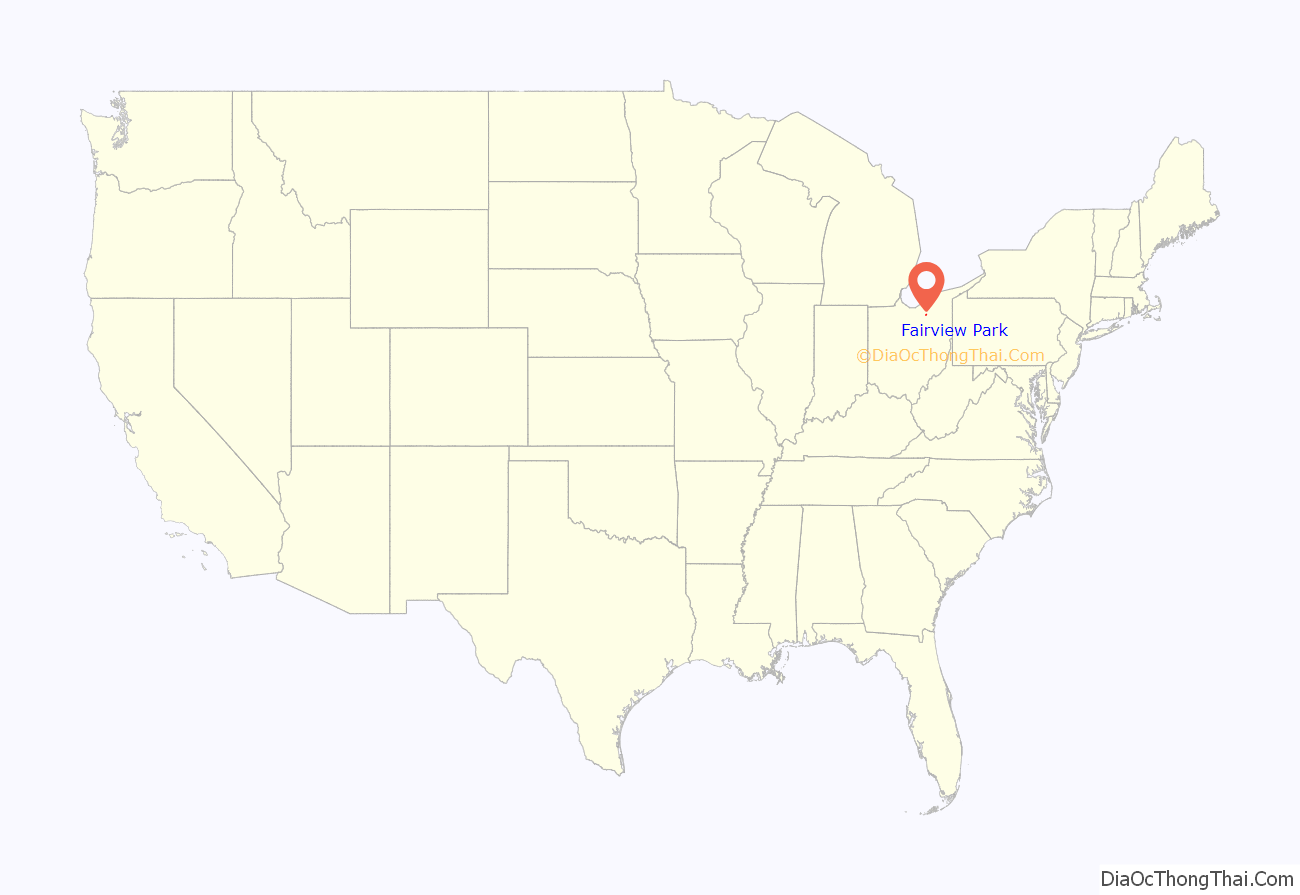
Fairview Park location map. Where is Fairview Park city?
History
Fairview Park was originally part of Rockport Township, later the Rocky River hamlet. The hamlet was incorporated as a village in 1903 and was split in 1910, with the northern part of the region becoming Rocky River and the southern part assuming the name Goldwood. Part of the Goldwood Township was later annexed to Rocky River and Goldwood would subsequently be incorporated as a separate village. Afterwards, Goldwood was split into two regions. A large portion of the land to the north became the Village of Fairview (later Fairview Village). Meanwhile, the remaining land located in the southwest corner and land along Center Ridge Road remained as Goldwood and was later incorporated as a village. By 1925, the remaining Goldwood region was renamed Parkview.
Both Fairview Village and Parkview remained small suburbs of its neighboring Cleveland (which had annexed most of what was West Park in 1923). In 1929, an economic recession in Fairview led to consideration of annexation to Cleveland. However, the plan never went to the ballot and Fairview maintained its independence. In 1948, Fairview became Fairview Park. Much of the growth of this region did not take place until after World War II. Most notably, the village began attracting former Cleveland residents when Fairview Shopping Center opened in 1947 on Lorain Road. In 1950, the village’s size exceeded 5,000 at 9,234 and became the City of Fairview Park. The first city charter was adopted in November 1958. The remaining Parkview region was later annexed to Fairview in 1967.
Fairview Park Road Map
Fairview Park city Satellite Map
Geography
According to the United States Census Bureau, the city has a total area of 4.68 square miles (12.12 km), all land.
See also
Map of Ohio State and its subdivision:- Adams
- Allen
- Ashland
- Ashtabula
- Athens
- Auglaize
- Belmont
- Brown
- Butler
- Carroll
- Champaign
- Clark
- Clermont
- Clinton
- Columbiana
- Coshocton
- Crawford
- Cuyahoga
- Darke
- Defiance
- Delaware
- Erie
- Fairfield
- Fayette
- Franklin
- Fulton
- Gallia
- Geauga
- Greene
- Guernsey
- Hamilton
- Hancock
- Hardin
- Harrison
- Henry
- Highland
- Hocking
- Holmes
- Huron
- Jackson
- Jefferson
- Knox
- Lake
- Lake Erie
- Lawrence
- Licking
- Logan
- Lorain
- Lucas
- Madison
- Mahoning
- Marion
- Medina
- Meigs
- Mercer
- Miami
- Monroe
- Montgomery
- Morgan
- Morrow
- Muskingum
- Noble
- Ottawa
- Paulding
- Perry
- Pickaway
- Pike
- Portage
- Preble
- Putnam
- Richland
- Ross
- Sandusky
- Scioto
- Seneca
- Shelby
- Stark
- Summit
- Trumbull
- Tuscarawas
- Union
- Van Wert
- Vinton
- Warren
- Washington
- Wayne
- Williams
- Wood
- Wyandot
- Alabama
- Alaska
- Arizona
- Arkansas
- California
- Colorado
- Connecticut
- Delaware
- District of Columbia
- Florida
- Georgia
- Hawaii
- Idaho
- Illinois
- Indiana
- Iowa
- Kansas
- Kentucky
- Louisiana
- Maine
- Maryland
- Massachusetts
- Michigan
- Minnesota
- Mississippi
- Missouri
- Montana
- Nebraska
- Nevada
- New Hampshire
- New Jersey
- New Mexico
- New York
- North Carolina
- North Dakota
- Ohio
- Oklahoma
- Oregon
- Pennsylvania
- Rhode Island
- South Carolina
- South Dakota
- Tennessee
- Texas
- Utah
- Vermont
- Virginia
- Washington
- West Virginia
- Wisconsin
- Wyoming
