Finneytown is a census-designated place (CDP) in Springfield Township, Hamilton County, in southwest Ohio, United States, just north of Cincinnati. The population was 12,399 at the 2020 census. Finneytown is home to the largest private school in Ohio (St. Xavier High School) and the Cincinnati area’s annual Greek Festival (at Holy Trinity-St. Nicholas Greek Orthodox Church).
Finneytown is named for Ebenezer Ward Finney, a Revolutionary War soldier whose burial site is located just south of the current township. The land was originally purchased from John Cleves Symmes by Rev. Ebenezer Ward, and given to his grandson Ebenezer Ward Finney.
| Name: | Finneytown CDP |
|---|---|
| LSAD Code: | 57 |
| LSAD Description: | CDP (suffix) |
| State: | Ohio |
| County: | Hamilton County |
| Elevation: | 889 ft (271 m) |
| Total Area: | 3.99 sq mi (10.32 km²) |
| Land Area: | 3.99 sq mi (10.32 km²) |
| Water Area: | 0.00 sq mi (0.00 km²) |
| Total Population: | 12,399 |
| Population Density: | 3,110.64/sq mi (1,201.00/km²) |
| ZIP code: | 45224, 45231 |
| Area code: | 513 |
| FIPS code: | 3927104 |
| GNISfeature ID: | 1048734 |
Online Interactive Map
Click on ![]() to view map in "full screen" mode.
to view map in "full screen" mode.
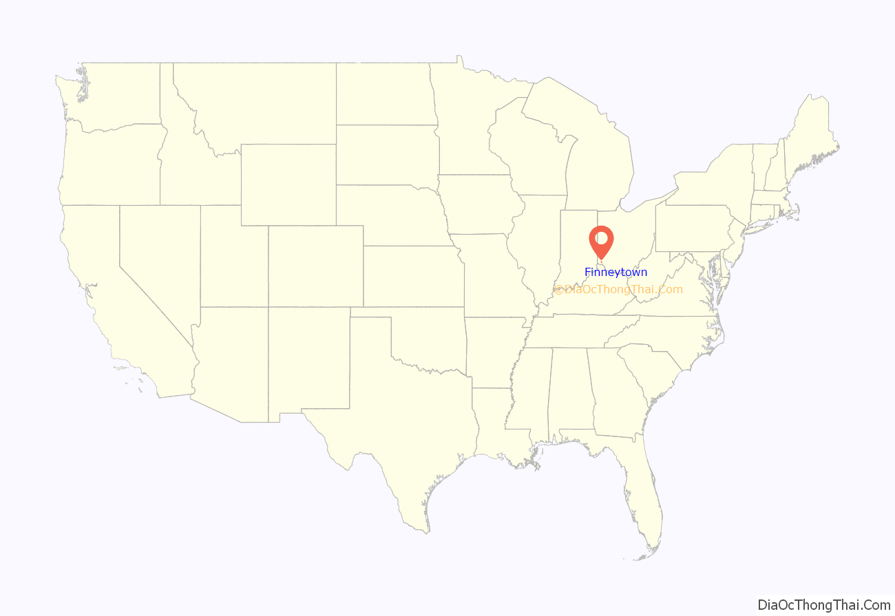
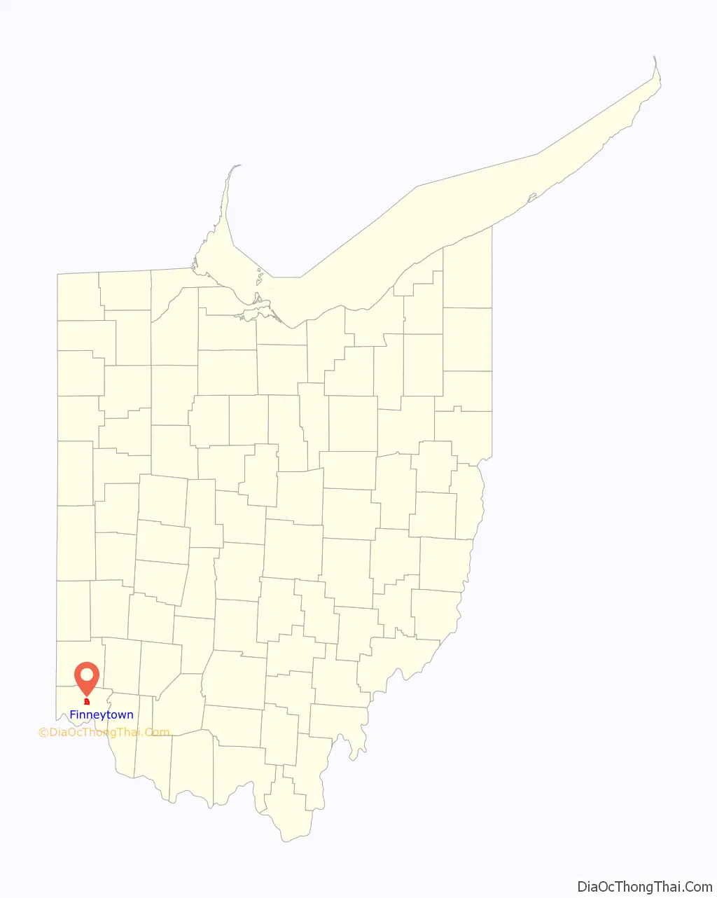
Finneytown location map. Where is Finneytown CDP?
History
In April 1795, an old preacher named Reverend Ebenezer Ward bought the section of land which included modern day Finneytown from John Cleves Symmes. Ebenezer Ward became ill and wrote will which designated the land to be inherited by his grandson, Ebenezer Ward Finney (born 1755). At the time the 41-year-old Finney was living in Rensselaer County, New York and had served in the 4th New York Regiment during the American Revolutionary War. Once he learned about his inheritance of Rev. Ward’s land, Finney traveled to Finneytown to inspect the land. Finneytown at the time was sparsely populated and had one trail that went East-West, known at the time as The North Bend to Carthage Trace (modern day Northbend Road) and an Indian trail that went North-South. Finney sold his old farm and moved into Finneytown with his family in 1800. He set up his farmstead on a hilltop location near the North Bend road and the road to Winton’s Plantation, and he also donated a plot of his land for a small church. Ebenezer Ward Finney died in 1822 at the age of 67. One of the original pioneers, Samuel Raymond, moved to Finney’s land and built a blacksmith shop, which remained until the 20th century.
In the 20th century, Finneytown saw a huge amount of growth as it transitioned from a rural area to a suburb. 1905 saw the creation of the Special District School #10, and a building was built in 1915 with two rooms, a gym/auditorium, and a basement lunchroom to fill the demand for education. The early 20th century saw an introduction of automobiles to Finneytown, which created a demand of the development of the roads from dirt roads. This led to the pavement of the roads, with Winton Road, one of the main streets of Finneytown, being paved in 1926. Whitaker Elementary, named after Telford Whitaker, who was a teacher, principal, and superintendent in Finneytown from 1930 to 1965. Whitaker Elementary served initially 1st-8th grades. After the Second World War, Finneytown saw a population boom as the school age population increased by 368% between 1948 and 1958. Farms were replaced by suburbs, shopping centers, and new shops. This population growth and a new requirement from the state for school districts to have a K-12 program, led to the foundation of the Finneytown Secondary Campus in 1958. This was quickly followed by the construction of Cottonwood Elementary in 1962 and Brent Elementary in 1964. The schools would be continuously expanded in the subsequent years. In 2010, Cottonwood Elementary was demolished due to difficulty of maintenance, and a new Elementary school, Finneytown Elementary, was built in 2022 to replace Brent.
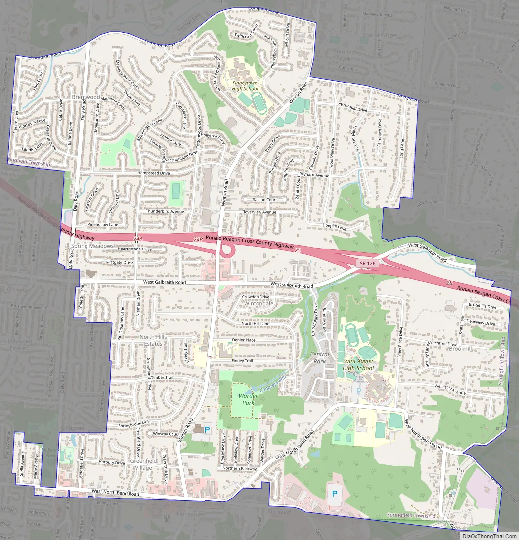
Finneytown Road Map
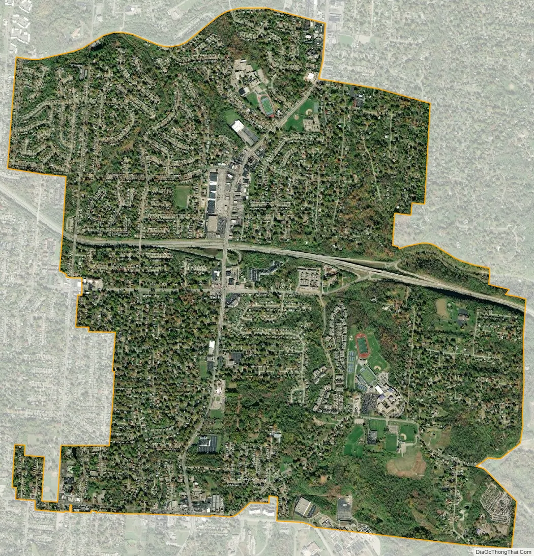
Finneytown city Satellite Map
Geography
Finneytown is located at 39°13′1″N 84°31′17″W / 39.21694°N 84.52139°W / 39.21694; -84.52139 (39.217059, -84.521513).
According to the United States Census Bureau, the CDP has a total area of 4.0 square miles (10 km), all land.
See also
Map of Ohio State and its subdivision:- Adams
- Allen
- Ashland
- Ashtabula
- Athens
- Auglaize
- Belmont
- Brown
- Butler
- Carroll
- Champaign
- Clark
- Clermont
- Clinton
- Columbiana
- Coshocton
- Crawford
- Cuyahoga
- Darke
- Defiance
- Delaware
- Erie
- Fairfield
- Fayette
- Franklin
- Fulton
- Gallia
- Geauga
- Greene
- Guernsey
- Hamilton
- Hancock
- Hardin
- Harrison
- Henry
- Highland
- Hocking
- Holmes
- Huron
- Jackson
- Jefferson
- Knox
- Lake
- Lake Erie
- Lawrence
- Licking
- Logan
- Lorain
- Lucas
- Madison
- Mahoning
- Marion
- Medina
- Meigs
- Mercer
- Miami
- Monroe
- Montgomery
- Morgan
- Morrow
- Muskingum
- Noble
- Ottawa
- Paulding
- Perry
- Pickaway
- Pike
- Portage
- Preble
- Putnam
- Richland
- Ross
- Sandusky
- Scioto
- Seneca
- Shelby
- Stark
- Summit
- Trumbull
- Tuscarawas
- Union
- Van Wert
- Vinton
- Warren
- Washington
- Wayne
- Williams
- Wood
- Wyandot
- Alabama
- Alaska
- Arizona
- Arkansas
- California
- Colorado
- Connecticut
- Delaware
- District of Columbia
- Florida
- Georgia
- Hawaii
- Idaho
- Illinois
- Indiana
- Iowa
- Kansas
- Kentucky
- Louisiana
- Maine
- Maryland
- Massachusetts
- Michigan
- Minnesota
- Mississippi
- Missouri
- Montana
- Nebraska
- Nevada
- New Hampshire
- New Jersey
- New Mexico
- New York
- North Carolina
- North Dakota
- Ohio
- Oklahoma
- Oregon
- Pennsylvania
- Rhode Island
- South Carolina
- South Dakota
- Tennessee
- Texas
- Utah
- Vermont
- Virginia
- Washington
- West Virginia
- Wisconsin
- Wyoming


