Glandorf is a village in Putnam County, Ohio, United States. The population was 1,001 at the 2010 census.
| Name: | Glandorf village |
|---|---|
| LSAD Code: | 47 |
| LSAD Description: | village (suffix) |
| State: | Ohio |
| County: | Putnam County |
| Elevation: | 728 ft (222 m) |
| Total Area: | 1.64 sq mi (4.24 km²) |
| Land Area: | 1.64 sq mi (4.24 km²) |
| Water Area: | 0.00 sq mi (0.00 km²) |
| Total Population: | 969 |
| Population Density: | 592.30/sq mi (228.67/km²) |
| ZIP code: | 45848 |
| Area code: | 419 |
| FIPS code: | 3930282 |
| GNISfeature ID: | 1064725 |
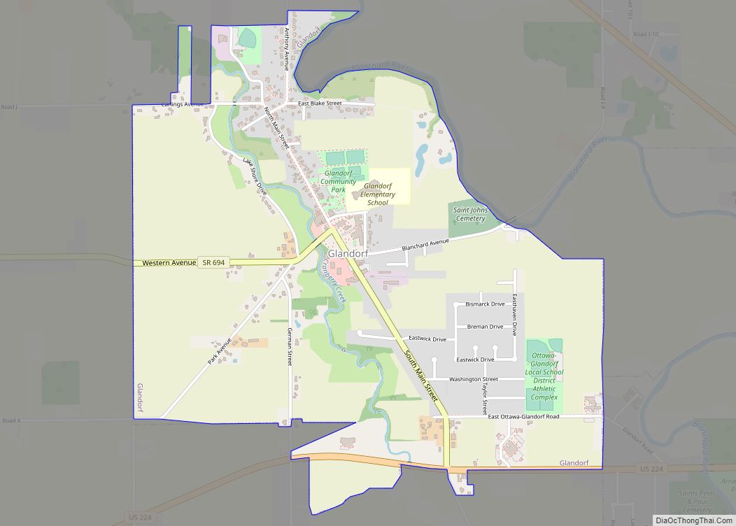
Online Interactive Map
Click on ![]() to view map in "full screen" mode.
to view map in "full screen" mode.
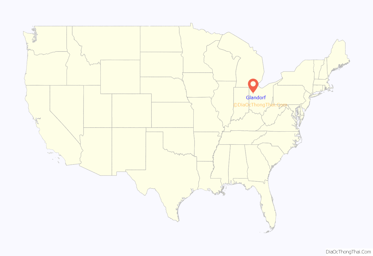
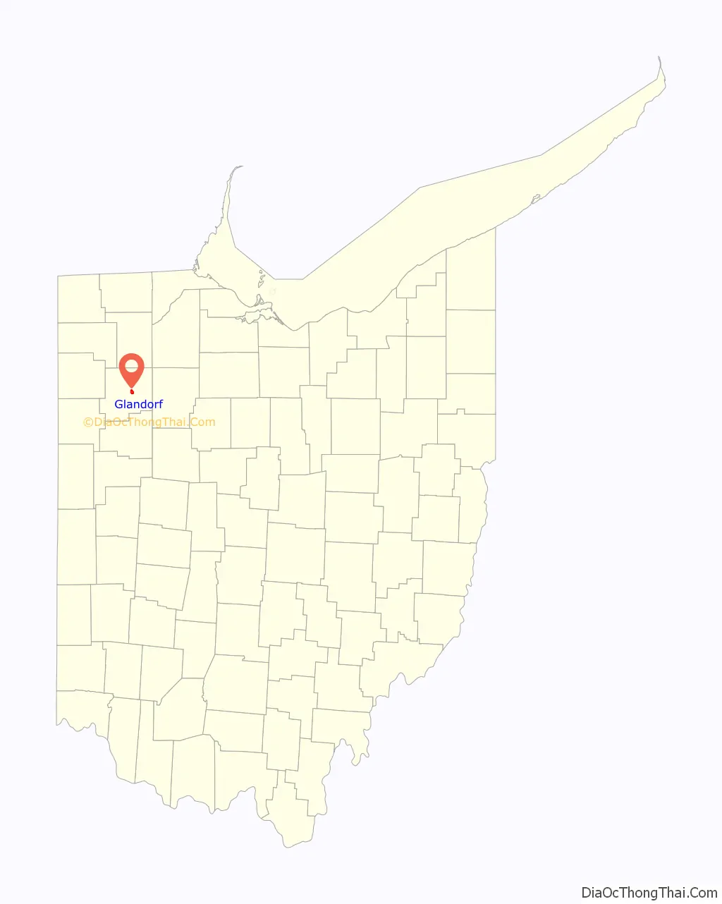
Glandorf location map. Where is Glandorf village?
History
Glandorf was founded by Johann Wilhelm Horstmann and six other men from Glandorf, Germany in 1834. They embarked on the ship Columbus on September 7, 1833, in Amsterdam, landed November 6, 1833 in New York, and purchased some land in Putnam County in December. Members of this group were Johann F. Kahle, Wilhelm Gülker, Christian Strop, F. Wischmann, Friedrich Bredeick and Mathias and Friedrich Bockrath. Kahle bought land at Greensburg approximately 5 miles to the west of Glandorf and named it “Maria Camp”. Horstmann’s land was named Glandorf. Their wives and ten other families from Glandorf followed in 1834. This was just the beginning of further emigration from Germany to Ohio and other US states. After his death on February 21, 1843, Horstmann left his land to the community.
In 1834, Horstmann built a log house to serve as church, school, and rectory. The new parish was placed under the patronage of St. John the Baptist. In 1835, the log house was replaced by a wooden church with a steeple, a bell and a pulpit from hallowed-out sycamore log. A brick church followed between 1846 and 1848. In 1878, the Neo-Gothic church St. John the Baptist was erected and consecrated on December 15. In 1992, a fire started in the sacristy of the church, and the sacristy and its contents were a complete loss. The entire interior had to be repainted. A convent of the German sisters’ order of the Society of the Precious Blood was founded in 1849. They cultivated the land which was originally owned by Horstmann and served as teachers. The convent was abandoned in 1917.
St. John the Baptist
St. John the Baptist church with monument of Johann Wilhelm Horstmann
Monument of Johann Wilhelm Horstmann
Sesquicentennial Memorial 1834 – 1984
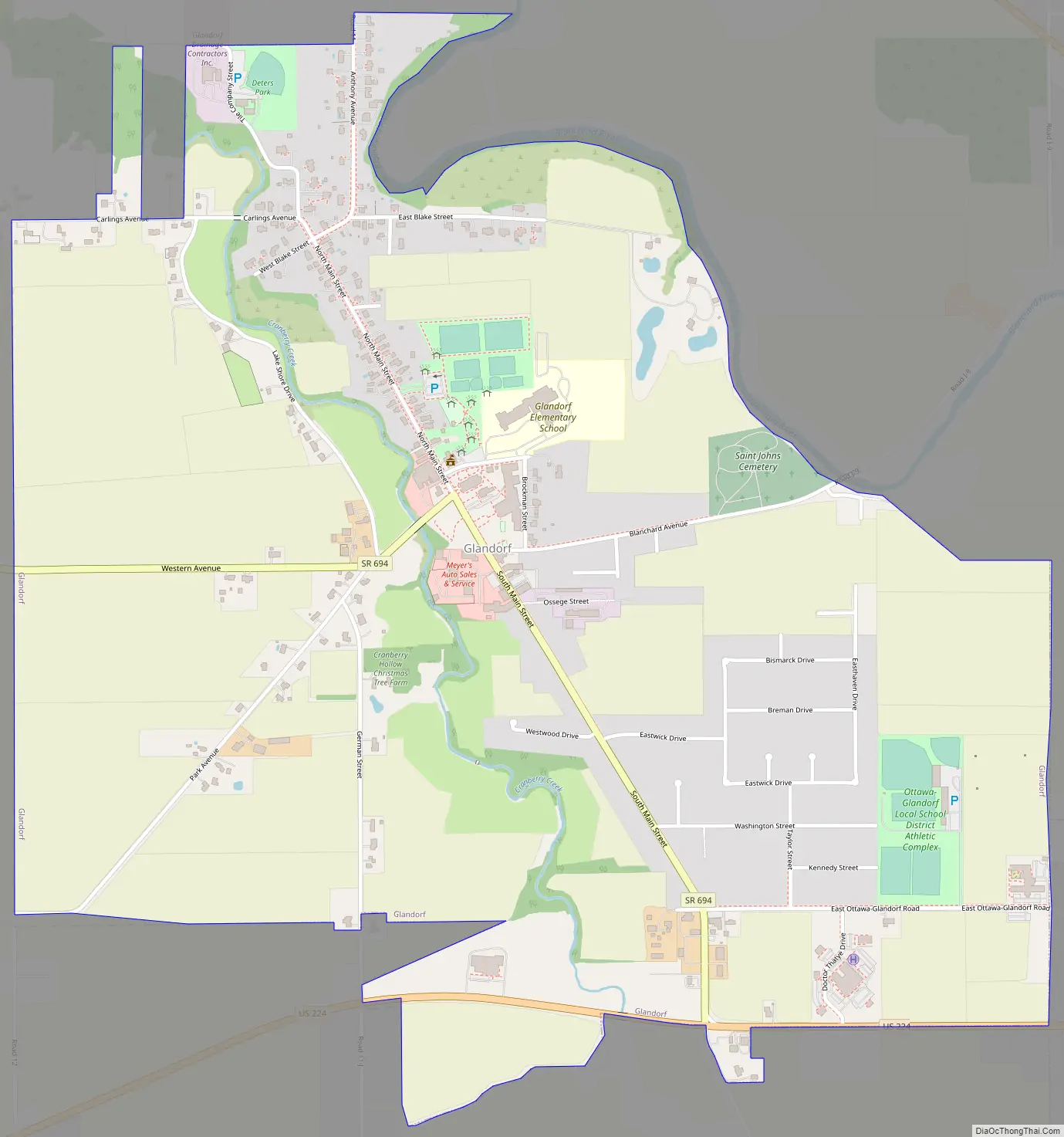
Glandorf Road Map
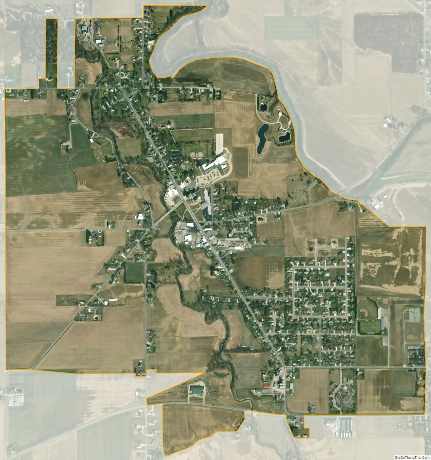
Glandorf city Satellite Map
Geography
Glandorf is located at 41°1′49″N 84°4′45″W / 41.03028°N 84.07917°W / 41.03028; -84.07917 (41.030355, -84.079109).
According to the United States Census Bureau, the village has a total area of 1.62 square miles (4.20 km), all land.
See also
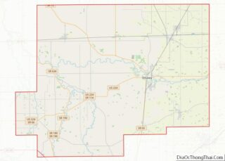
Map of Ohio State and its subdivision:- Adams
- Allen
- Ashland
- Ashtabula
- Athens
- Auglaize
- Belmont
- Brown
- Butler
- Carroll
- Champaign
- Clark
- Clermont
- Clinton
- Columbiana
- Coshocton
- Crawford
- Cuyahoga
- Darke
- Defiance
- Delaware
- Erie
- Fairfield
- Fayette
- Franklin
- Fulton
- Gallia
- Geauga
- Greene
- Guernsey
- Hamilton
- Hancock
- Hardin
- Harrison
- Henry
- Highland
- Hocking
- Holmes
- Huron
- Jackson
- Jefferson
- Knox
- Lake
- Lake Erie
- Lawrence
- Licking
- Logan
- Lorain
- Lucas
- Madison
- Mahoning
- Marion
- Medina
- Meigs
- Mercer
- Miami
- Monroe
- Montgomery
- Morgan
- Morrow
- Muskingum
- Noble
- Ottawa
- Paulding
- Perry
- Pickaway
- Pike
- Portage
- Preble
- Putnam
- Richland
- Ross
- Sandusky
- Scioto
- Seneca
- Shelby
- Stark
- Summit
- Trumbull
- Tuscarawas
- Union
- Van Wert
- Vinton
- Warren
- Washington
- Wayne
- Williams
- Wood
- Wyandot
- Alabama
- Alaska
- Arizona
- Arkansas
- California
- Colorado
- Connecticut
- Delaware
- District of Columbia
- Florida
- Georgia
- Hawaii
- Idaho
- Illinois
- Indiana
- Iowa
- Kansas
- Kentucky
- Louisiana
- Maine
- Maryland
- Massachusetts
- Michigan
- Minnesota
- Mississippi
- Missouri
- Montana
- Nebraska
- Nevada
- New Hampshire
- New Jersey
- New Mexico
- New York
- North Carolina
- North Dakota
- Ohio
- Oklahoma
- Oregon
- Pennsylvania
- Rhode Island
- South Carolina
- South Dakota
- Tennessee
- Texas
- Utah
- Vermont
- Virginia
- Washington
- West Virginia
- Wisconsin
- Wyoming