Green Springs is a village in Sandusky and Seneca counties in the U.S. state of Ohio. The population was 1,368 at the 2010 census.
Its “claim to fame” is Mineral Springs, the largest natural sulfur spring in the world. Elmwood at the Springs Healthcare Center, formerly St. Francis Health Care Centre, is located there.
| Name: | Green Springs village |
|---|---|
| LSAD Code: | 47 |
| LSAD Description: | village (suffix) |
| State: | Ohio |
| County: | Sandusky County, Seneca County |
| Elevation: | 709 ft (216 m) |
| Total Area: | 1.16 sq mi (3.01 km²) |
| Land Area: | 1.16 sq mi (3.00 km²) |
| Water Area: | 0.00 sq mi (0.01 km²) |
| Total Population: | 1,233 |
| Population Density: | 1,062.93/sq mi (410.33/km²) |
| ZIP code: | 44836 |
| Area code: | 419 |
| FIPS code: | 3932256 |
| GNISfeature ID: | 1061115 |
| Website: | https://www.gsohio.org |
Online Interactive Map
Click on ![]() to view map in "full screen" mode.
to view map in "full screen" mode.
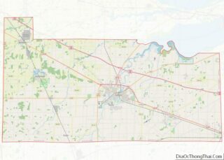
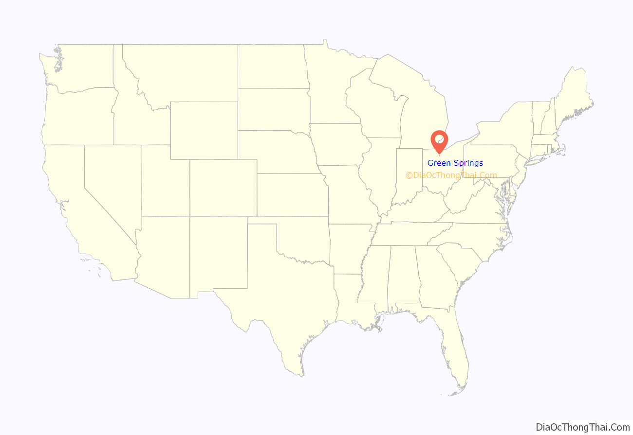
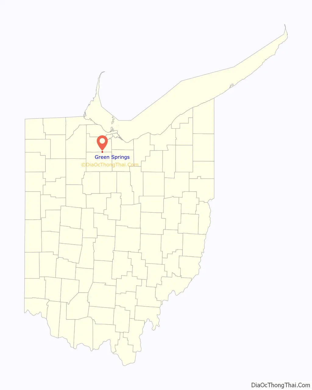
Green Springs location map. Where is Green Springs village?
History
The Green Springs area was originally inhabited by the Kaskaskia and Miami Nation.
On September 29, 1817 the Seneca whom had been displaced from their native lands in New York signed the Treaty of Fort Meigs, which established the 40,000 acre Seneca Indian Reservation and a $500 annuity. But on February 28, 1831, as part of the Treaty of Little Sandusky the Seneca agreed to relinquish their 40,000 acres in Ohio in exchange for 67,000 acres west of the Mississippi River and other provisions including a 5% annuity on the balance of the proceeds from the sale of the land in Ohio. This was part of the larger Indian Removal developed by the administration of Andrew Jackson.
In 1831, Jacob Stem, the founder of Green Springs, bought the land from the government. He purchased about 1,200 acres (4.9 km) within Sandusky and Seneca counties, including the sulfur spring. It has been told by older citizens of that time that he really did not get the spring then, but later on bought it from the Indians for 12 bags of wheat, 12 bags of oats, 12 bags of corn, and a mule. The village was originally called Stemtown, named after the founder. It was later called Green Springs, named from the color of the water from the spring.
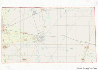
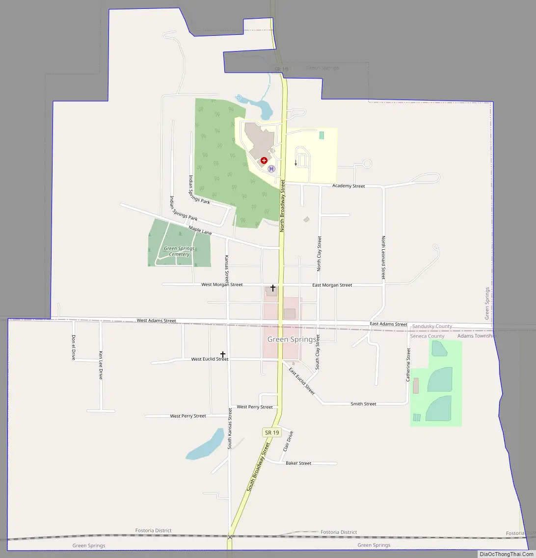
Green Springs Road Map
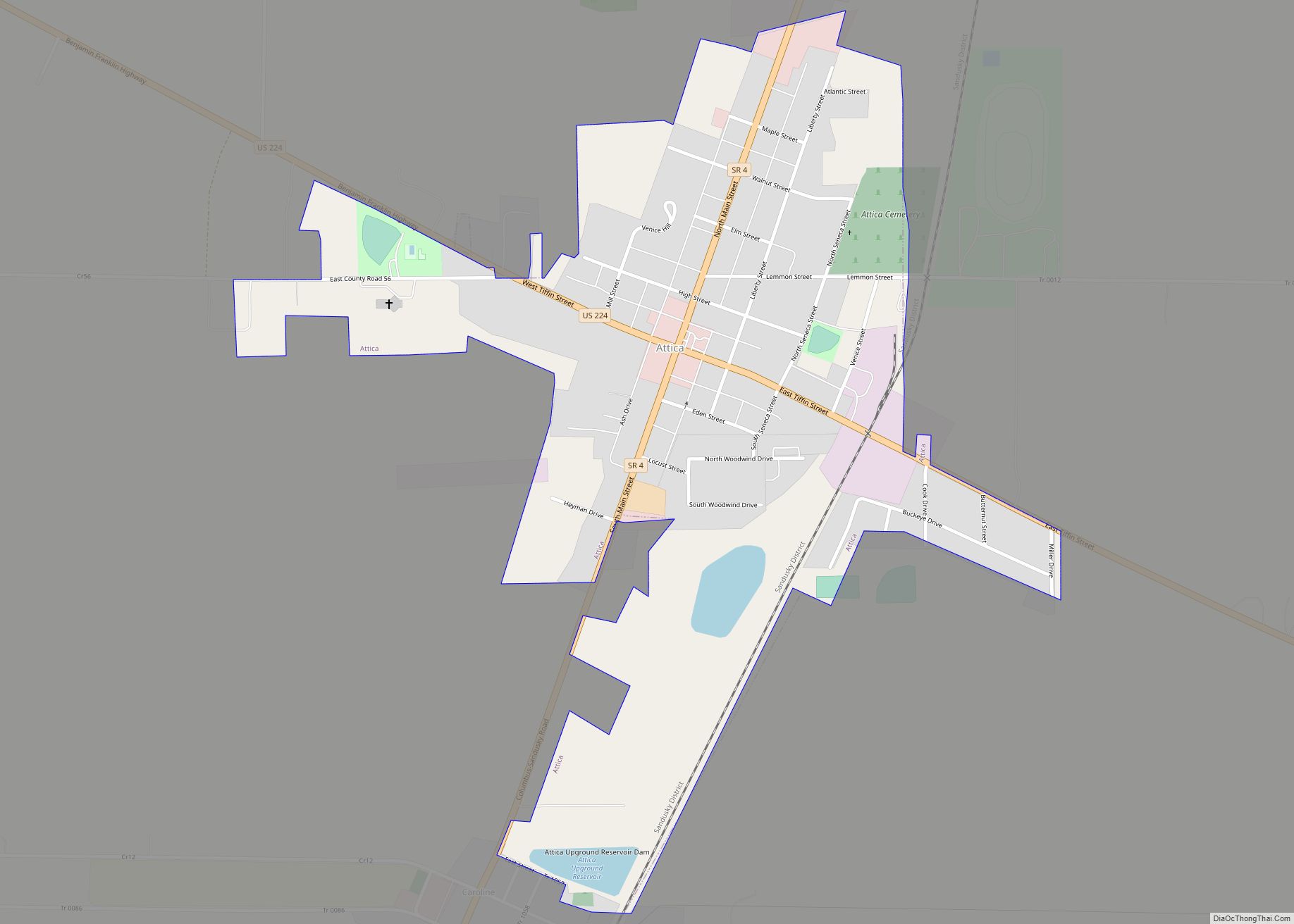
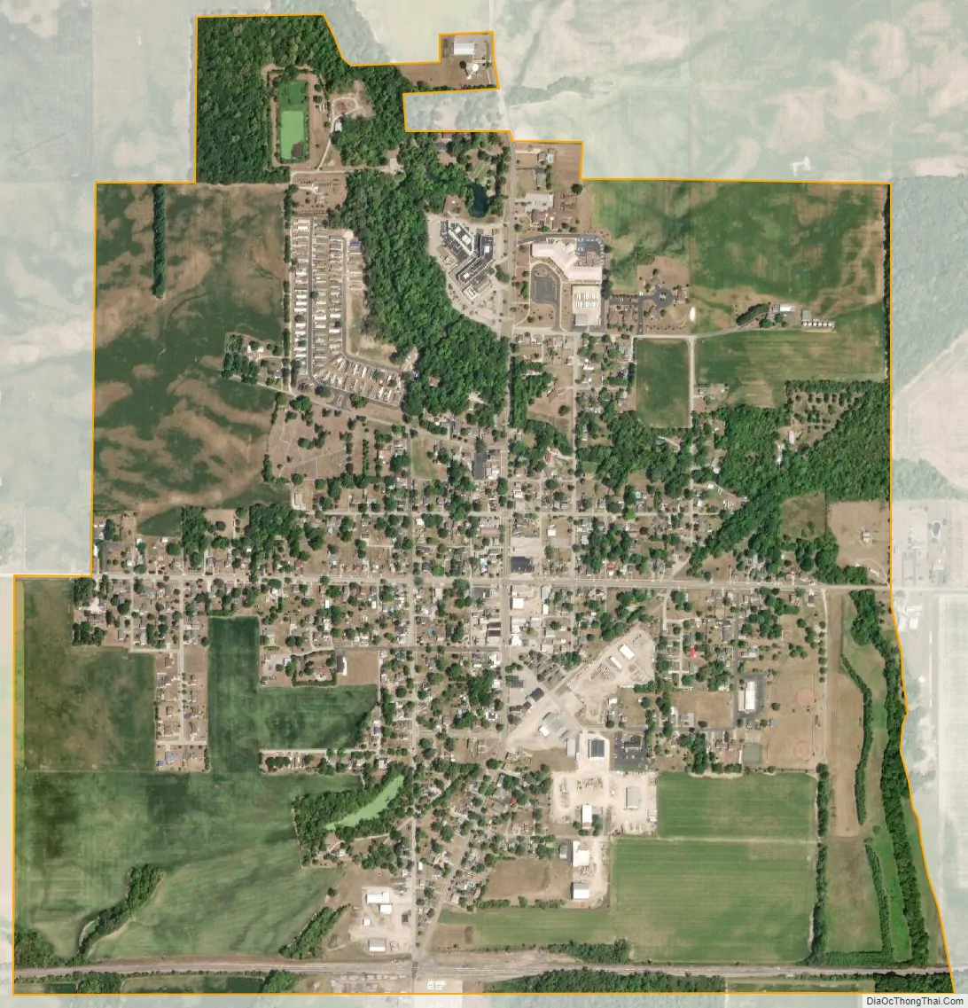
Green Springs city Satellite Map
Geography
Green Springs is located at 41°15′26″N 83°03′06″W / 41.257152°N 83.051753°W / 41.257152; -83.051753 (41.257152, -83.051753).
According to the United States Census Bureau, the village has a total area of 1.21 square miles (3.13 km), all land.
State Route 19 passes through the community, the in-town portion of which is called Broadway Street.
The Mad River and Lake Erie Railroad formerly passed through Green Springs, while the Nickel Plate Railroad (Currently the Fostoria District owned by Norfolk Southern) passes on the south edge of the town.
See also
Map of Ohio State and its subdivision:- Adams
- Allen
- Ashland
- Ashtabula
- Athens
- Auglaize
- Belmont
- Brown
- Butler
- Carroll
- Champaign
- Clark
- Clermont
- Clinton
- Columbiana
- Coshocton
- Crawford
- Cuyahoga
- Darke
- Defiance
- Delaware
- Erie
- Fairfield
- Fayette
- Franklin
- Fulton
- Gallia
- Geauga
- Greene
- Guernsey
- Hamilton
- Hancock
- Hardin
- Harrison
- Henry
- Highland
- Hocking
- Holmes
- Huron
- Jackson
- Jefferson
- Knox
- Lake
- Lake Erie
- Lawrence
- Licking
- Logan
- Lorain
- Lucas
- Madison
- Mahoning
- Marion
- Medina
- Meigs
- Mercer
- Miami
- Monroe
- Montgomery
- Morgan
- Morrow
- Muskingum
- Noble
- Ottawa
- Paulding
- Perry
- Pickaway
- Pike
- Portage
- Preble
- Putnam
- Richland
- Ross
- Sandusky
- Scioto
- Seneca
- Shelby
- Stark
- Summit
- Trumbull
- Tuscarawas
- Union
- Van Wert
- Vinton
- Warren
- Washington
- Wayne
- Williams
- Wood
- Wyandot
- Alabama
- Alaska
- Arizona
- Arkansas
- California
- Colorado
- Connecticut
- Delaware
- District of Columbia
- Florida
- Georgia
- Hawaii
- Idaho
- Illinois
- Indiana
- Iowa
- Kansas
- Kentucky
- Louisiana
- Maine
- Maryland
- Massachusetts
- Michigan
- Minnesota
- Mississippi
- Missouri
- Montana
- Nebraska
- Nevada
- New Hampshire
- New Jersey
- New Mexico
- New York
- North Carolina
- North Dakota
- Ohio
- Oklahoma
- Oregon
- Pennsylvania
- Rhode Island
- South Carolina
- South Dakota
- Tennessee
- Texas
- Utah
- Vermont
- Virginia
- Washington
- West Virginia
- Wisconsin
- Wyoming