Lakewood is a city in Cuyahoga County, Ohio, United States, on the southern shore of Lake Erie. Established in 1889, it is one of Cleveland’s historical streetcar suburbs and part of the Cleveland metropolitan area. The population was 50,942 at the 2020 census, making it the third largest city in Cuyahoga County, behind Cleveland and Parma.
| Name: | Lakewood city |
|---|---|
| LSAD Code: | 25 |
| LSAD Description: | city (suffix) |
| State: | Ohio |
| County: | Cuyahoga County |
| Elevation: | 702 ft (214 m) |
| Total Area: | 6.70 sq mi (17.34 km²) |
| Land Area: | 5.54 sq mi (14.36 km²) |
| Water Area: | 1.15 sq mi (2.98 km²) |
| Total Population: | 50,942 |
| Population Density: | 9,190.33/sq mi (3,548.69/km²) |
| ZIP code: | 44107 |
| Area code: | 216 |
| FIPS code: | 3941664 |
| GNISfeature ID: | 1064966 |
| Website: | lakewoodoh.gov |
Online Interactive Map
Click on ![]() to view map in "full screen" mode.
to view map in "full screen" mode.
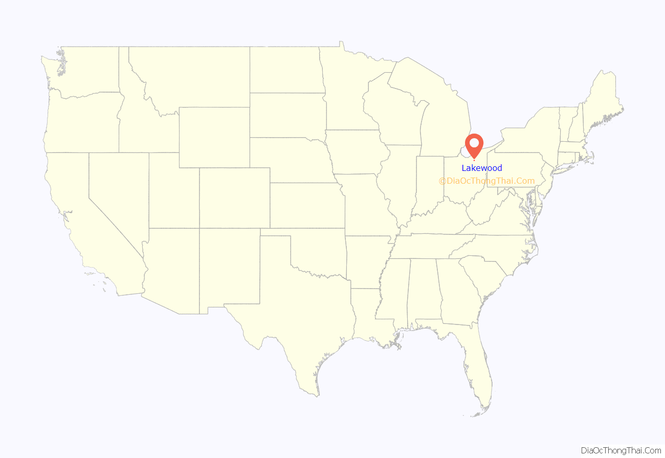
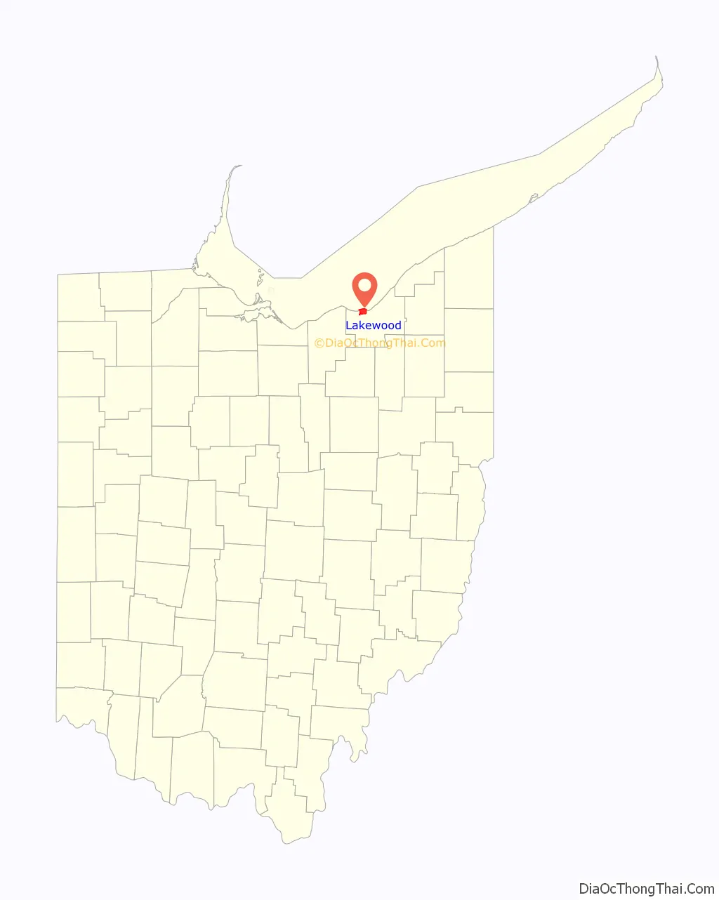
Lakewood location map. Where is Lakewood city?
History
Lakewood was incorporated as a village in 1889, and named for its lakefront location.
Earliest days
The wilderness west of the Cuyahoga River was delayed being settled due to a treaty the American government made with the Native Americans in 1785, whereby no white man was to settle on that land. Consequently, when Moses Cleaveland arrived in 1796, his activities were confined to the east side of the river.
The area now called Lakewood was populated by the Ottawa, Potawatomi, Chippewa, Wyandot, Munsee, Delaware and Shawnee tribes until the Treaty of Ft. Industry pushed them west in 1805. The treaty, signed at Ft. Industry near what is now downtown Toledo, Ohio, ceded 500,000 acres of some of the tribes’ land to the United States for about $18,000 or 3.5 cents/acre. The Shawnee and Seneca, living with the Wyandot, were to get $1000 “…every year forever hereafter.”
The area now occupied by Lakewood, Rocky River, Fairview Park, and West Park was purchased from the Connecticut Land Company by a syndicate of six men headed by Judson Canfield on April 4, 1807, for $26,084.
In 1806 the area was formally surveyed as Rockport Township. In 1818, permanent settlement began with the arrival from Connecticut of James Nicholson. Other early pioneers included Jared Kirtland and Mars Wager. Settlements were mostly along Detroit Avenue, a toll road operated by the Rockport Plank Company from 1848 to 1901, with large farms and properties extending north to Lake Erie. Making bricks and planting orchards were among the most prolific occupations until natural gas and oil wells were developed in the early 1880s.
By 1819 18 families lived in Rockport Township. In 1893, streetcars came to Lakewood with the construction of the Detroit Avenue line, followed by the Clifton Boulevard line in 1903 and the Madison Avenue line in 1916.
First government
Lakewood, the first suburb west of Cleveland on the shores of Lake Erie, began as Township 7, Range 14, of the Connecticut Western Reserve in 1805. It was a wooded wilderness through which cut the old Huron Post Road that ran from Buffalo, New York, to Detroit, Michigan. In 1819 a small group of eighteen families living in the area of present-day Lakewood, Rocky River, and part of Cleveland’s West Park neighborhood named the growing community Rockport Township. In April of that year, the first election took place in Rufus Wright’s tavern with a member of each household present. Three were elected as trustees: Henry Alger, Erastus Johnson, and Rufus Wright. Elected as overseers of the poor were James Nicholson and Samuel Dean. Henry Canfield was elected clerk. This type of government served Rockport for the next 70 years, with an election held each year.
In 1889 East Rockport, with 400 residents, separated from the township and became the Hamlet of Lakewood. Settlement accelerated rapidly, with Lakewood becoming a village with 3,500 residents in 1903. City status, with 12,000 residents, came just eight years later. By 1930 the population of Lakewood was 70,509.
Agriculture
The early settlers in Township 7 sustained their lives through farming. The land was ideal for fruit farming and many vineyards began to emerge. Current street names reflect this history such as Orchard Grove and Blossom Park. The fertile soil and lake climate that were ideal for producing crops is what attracted many people to move to the township. There was also vast amounts of trees to be used for building homes and other structures. The most common occupations in Lakewood were farming and the building trades.
First roads
Roads were the earliest influence on development in Lakewood. The Rockport Plank Road Company improved the old Detroit Road in 1848, opening a toll road from present-day West 25th Street in Cleveland to five miles west of the Rocky River. It continued operating as a toll road until 1901. A series of bridges spanning the Rocky River Valley, the first of which was built in 1821, improved commerce between Cleveland and the emerging communities to its west. An 1874 atlas of Cuyahoga County shows present-day main roads such as Detroit Avenue, Madison Avenue, Franklin Boulevard, Hilliard Road, Warren Road, and Riverside Drive.
Schools
Under the Ohio Common School Act of April 9, 1867, three schools were allotted to East Rockport, called 6, 8, and 10; they were later designated East, Middle, and West. Each school had one teacher. As the community began to grow and more schools were required, the school board adopted the policy of honoring Ohio’s presidents by assigning their names to the school buildings.
Railroads
The Rocky River Railroad was organized in 1869 by speculators as an excursion line to bring Clevelanders to the resort area they developed at the mouth of the Rocky River. Financially unsuccessful as a pleasure and amusement venture, the line was sold to the Nickel Plate Railroad in 1881. The railroad line still exists today, running in an east–west direction north of Detroit Avenue.
Lakewood Hospital
Lakewood Hospital first opened its doors in 1907. The hospital, founded by Dr. Lee Graber, was originally located in a double house on Detroit Avenue, then built a “modern” building in 1917 and was renovated in 1940, 1950, 1967 and 1970-71. The city of Lakewood purchased the hospital in 1931. The Cleveland Clinic added the hospital to its health system in 2006.
In January 2015, the Cleveland Clinic announced it would close the hospital in 2016 and replace it with a family medical center. After a year of community debate, the hospital was closed. The new medical center which included outpatient programs, an emergency department and wellness services opened across the street from the old hospital site in 2018. None of the 845 employees of Lakewood lost their jobs, as they were offered other positions in the Cleveland Clinic system. There was opposition to the closing from a citizens’ group called “Save Lakewood Hospital” who contended that the city could find another entity to manage the hospital and keep it open.
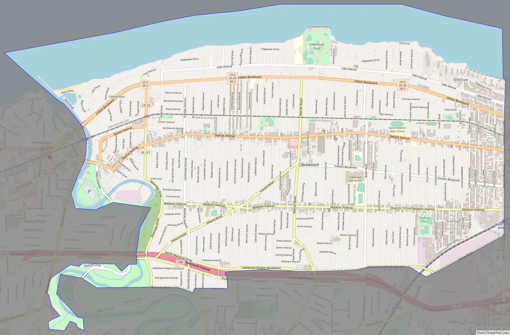
Lakewood Road Map
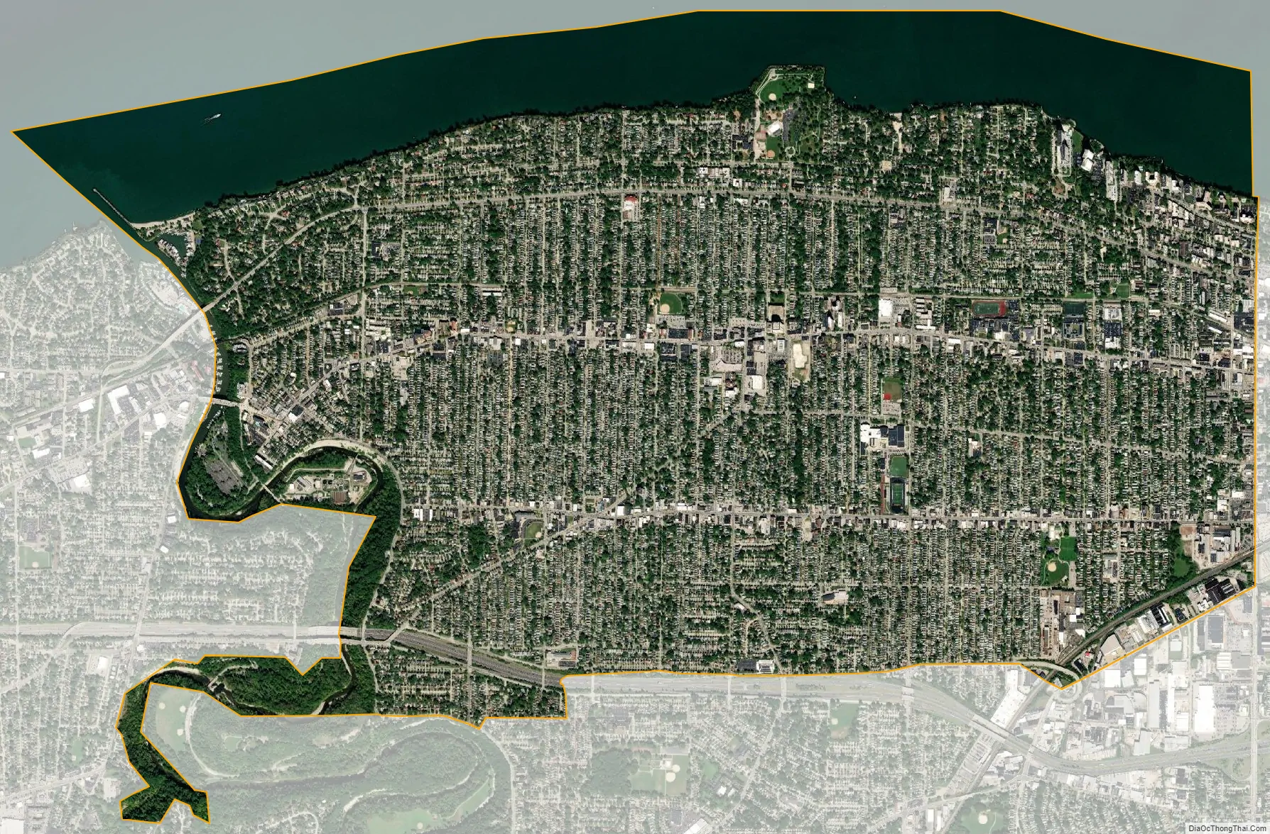
Lakewood city Satellite Map
Geography
Lakewood is located about 6 miles (9.7 km) west of Downtown Cleveland. The city borders Lake Erie to the north, the Cleveland neighborhoods of Edgewater and Cudell to the east, and the neighborhoods of Jefferson and Kamm’s Corners to the south. It borders the suburb of Rocky River to the west at the Rocky River valley. According to the United States Census Bureau, the city has a total area of 6.69 square miles (17.33 km), of which 5.53 square miles (14.32 km) is land and 1.16 square miles (3.00 km) is water.
Neighborhoods
- Arts District – Centered around the Beck Center for the Arts, on the west side of Lakewood.
- Birdtown – Southeastern corner of Lakewood, a well-known 8-street residential district on the southeast side of the city that was built specifically for the workers of the nearby National Carbon Company in the 1890s. The houses are distinctive and most of the streets are named after birds. Birdtown was designated a National Register Historic District in 2006. It is adjacent to Madison Park, the former Union Carbide factory, and the W. 117th St. Rapid Transit Station. Many of the original houses built there were boarding houses. Birdtown achieved National Historic Register status in 2006.
- Clifton Boulevard – Lined with big trees and multi-family homes, apartment complexes, and 4×4 brick structures, and turn of the century single family colonials, the seven-lane Clifton Boulevard is one of the busiest streets in greater Cleveland.
- Clifton Park – The wealthiest neighborhood of Lakewood is situated in the northwestern corner of the city, and consists mostly of magnificent Victorian mansions. It is bounded by Sloane on the south, Webb Road on the east, the Rocky River on the west, and Lake Erie on the north. Built in the late 19th century, this area has been historically, and continues to be, home to many of greater Cleveland’s most prominent citizens. Includes the private Clifton Beach community.
- Downtown Lakewood – The main section of Lakewood is centered at Detroit Avenue and Warren Road. Downtown Lakewood spans from Bunts Avenue to the east and Arthur Avenue to the west along Detroit. This district was formally identified when Lakewood was chosen as a member of the national MainStreet program in 2005. The area is lined with office buildings, restaurants, and variety shops. Lakewood Library, the USPS, and the site of the former Lakewood Hospital are all located in this district.
- The Edge – This easternmost neighborhood includes many concert venues, pubs, and taverns.
- Victorian Village – This was named after the large Victorian homes on Grace, Clarence and Cohassett Avenues on the city’s east end. When constructed in the early 1900s, it served as residences for executives from the National Carbon Company.
- The Gold Coast – Collection of high rises on the northeast end of Lakewood, bordering Lake Erie.
- Rockport Square – Rockport Square (not to be confused with the former Rockport Township) is an urban renewal project along Detroit Avenue on the eastern side of the city. Construction began in 2004 of roughly 200 condos, lofts, and live-work spaces.
- West End – The West End is the westernmost neighborhood of Lakewood, along the Rocky River Reservation. In 2002, the administration of Mayor Madelaine Cain proposed to seize homes in this area using eminent domain, to replace them with retail development. After a citizen-led resistance attracted national media attention from 60 Minutes, the West End proposal failed in a 2003 referendum.
See also
Map of Ohio State and its subdivision:- Adams
- Allen
- Ashland
- Ashtabula
- Athens
- Auglaize
- Belmont
- Brown
- Butler
- Carroll
- Champaign
- Clark
- Clermont
- Clinton
- Columbiana
- Coshocton
- Crawford
- Cuyahoga
- Darke
- Defiance
- Delaware
- Erie
- Fairfield
- Fayette
- Franklin
- Fulton
- Gallia
- Geauga
- Greene
- Guernsey
- Hamilton
- Hancock
- Hardin
- Harrison
- Henry
- Highland
- Hocking
- Holmes
- Huron
- Jackson
- Jefferson
- Knox
- Lake
- Lake Erie
- Lawrence
- Licking
- Logan
- Lorain
- Lucas
- Madison
- Mahoning
- Marion
- Medina
- Meigs
- Mercer
- Miami
- Monroe
- Montgomery
- Morgan
- Morrow
- Muskingum
- Noble
- Ottawa
- Paulding
- Perry
- Pickaway
- Pike
- Portage
- Preble
- Putnam
- Richland
- Ross
- Sandusky
- Scioto
- Seneca
- Shelby
- Stark
- Summit
- Trumbull
- Tuscarawas
- Union
- Van Wert
- Vinton
- Warren
- Washington
- Wayne
- Williams
- Wood
- Wyandot
- Alabama
- Alaska
- Arizona
- Arkansas
- California
- Colorado
- Connecticut
- Delaware
- District of Columbia
- Florida
- Georgia
- Hawaii
- Idaho
- Illinois
- Indiana
- Iowa
- Kansas
- Kentucky
- Louisiana
- Maine
- Maryland
- Massachusetts
- Michigan
- Minnesota
- Mississippi
- Missouri
- Montana
- Nebraska
- Nevada
- New Hampshire
- New Jersey
- New Mexico
- New York
- North Carolina
- North Dakota
- Ohio
- Oklahoma
- Oregon
- Pennsylvania
- Rhode Island
- South Carolina
- South Dakota
- Tennessee
- Texas
- Utah
- Vermont
- Virginia
- Washington
- West Virginia
- Wisconsin
- Wyoming


