Madeira is a city in Hamilton County, Ohio, United States. The population was 9,487 at the 2020 census. Madeira has a Council-Manager form of government, where the elected City Council appoints a paid City Manager to run the day-to-day operations of the city. Madeira is served by its own police department, while fire service is provided by the Madeira-Indian Hill Joint Fire District. Madeira is largely a residential community, with a small downtown and some light industry. Educational needs are served by the Madeira City Schools. Madeira is a suburb of Cincinnati. In 2007, BusinessWeek ranked it as one of the “Best Places to Raise Kids–For Less.”
| Name: | Madeira city |
|---|---|
| LSAD Code: | 25 |
| LSAD Description: | city (suffix) |
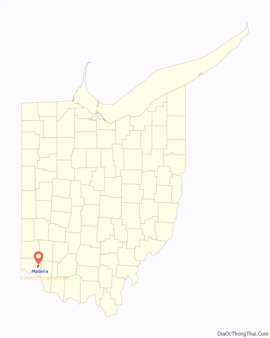
| State: | Ohio |
| County: | Hamilton County |
| Elevation: | 758 ft (231 m) |
| Total Area: | 3.35 sq mi (8.69 km²) |
| Land Area: | 3.35 sq mi (8.68 km²) |
| Water Area: | 0.00 sq mi (0.01 km²) |
| Total Population: | 9,487 |
| Population Density: | 2,831.10/sq mi (1,092.97/km²) |
| ZIP code: | 45243 |
| Area code: | 513 |
| FIPS code: | 3946312 |
| GNISfeature ID: | 1061459 |
| Website: | www.madeiracity.com |
Online Interactive Map
Click on ![]() to view map in "full screen" mode.
to view map in "full screen" mode.
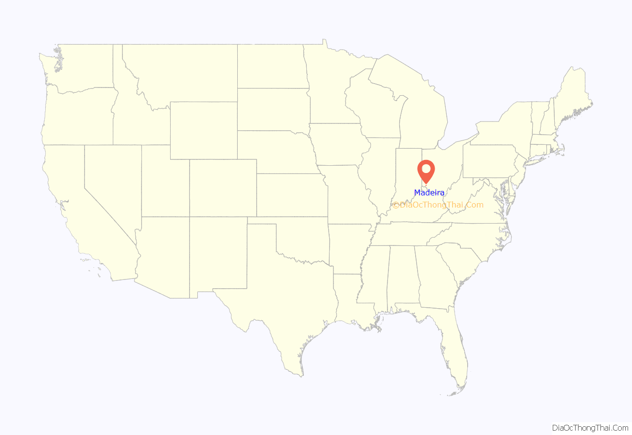
Madeira location map. Where is Madeira city?
History
Madeira was largely laid out in 1871. Before this time the place was known as a post town, and was named for John Madeira who owned a large tract of land in the vicinity.
Madeira was incorporated as a village under the statutes of the State of Ohio in 1910. The village was protected by a series of elected marshals and appointed deputy marshals until 1942 when Madeira’s first Chief of Police was appointed.
Madeira gained city status in August 1959. The city nearly doubled in area with the 1970 annexation of the South Kenwood area of Columbia Township.
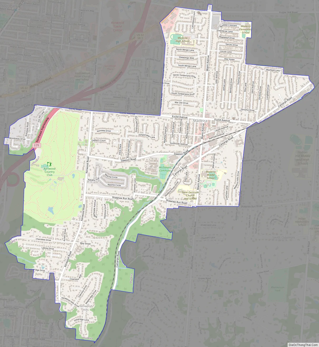
Madeira Road Map
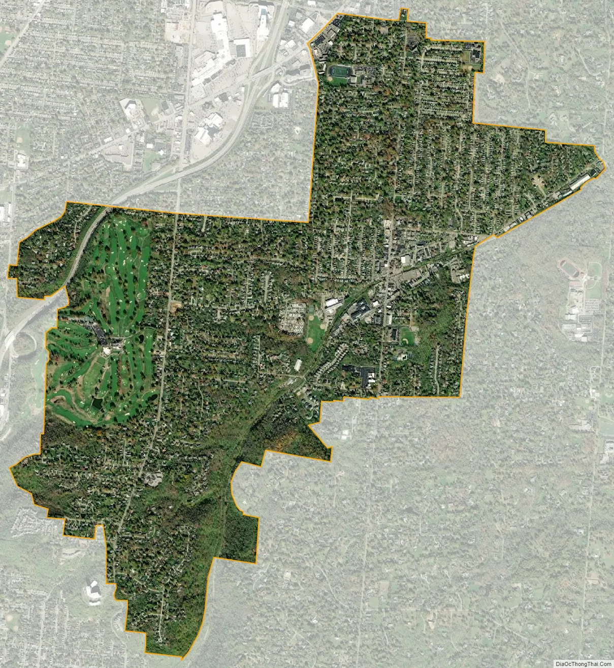
Madeira city Satellite Map
Geography
Madeira is located at 39°11′18″N 84°22′6″W / 39.18833°N 84.36833°W / 39.18833; -84.36833 (39.188310, -84.368366).
According to the United States Census Bureau, the city has a total area of 3.38 square miles (8.75 km), all land.
It is bordered by:
- Indian Hill to the east
- Columbia Township to the south
- Cincinnati (Madisonville) to the south and west
- Silverton to the west
- Sycamore Township to the north
See also
Map of Ohio State and its subdivision:- Adams
- Allen
- Ashland
- Ashtabula
- Athens
- Auglaize
- Belmont
- Brown
- Butler
- Carroll
- Champaign
- Clark
- Clermont
- Clinton
- Columbiana
- Coshocton
- Crawford
- Cuyahoga
- Darke
- Defiance
- Delaware
- Erie
- Fairfield
- Fayette
- Franklin
- Fulton
- Gallia
- Geauga
- Greene
- Guernsey
- Hamilton
- Hancock
- Hardin
- Harrison
- Henry
- Highland
- Hocking
- Holmes
- Huron
- Jackson
- Jefferson
- Knox
- Lake
- Lake Erie
- Lawrence
- Licking
- Logan
- Lorain
- Lucas
- Madison
- Mahoning
- Marion
- Medina
- Meigs
- Mercer
- Miami
- Monroe
- Montgomery
- Morgan
- Morrow
- Muskingum
- Noble
- Ottawa
- Paulding
- Perry
- Pickaway
- Pike
- Portage
- Preble
- Putnam
- Richland
- Ross
- Sandusky
- Scioto
- Seneca
- Shelby
- Stark
- Summit
- Trumbull
- Tuscarawas
- Union
- Van Wert
- Vinton
- Warren
- Washington
- Wayne
- Williams
- Wood
- Wyandot
- Alabama
- Alaska
- Arizona
- Arkansas
- California
- Colorado
- Connecticut
- Delaware
- District of Columbia
- Florida
- Georgia
- Hawaii
- Idaho
- Illinois
- Indiana
- Iowa
- Kansas
- Kentucky
- Louisiana
- Maine
- Maryland
- Massachusetts
- Michigan
- Minnesota
- Mississippi
- Missouri
- Montana
- Nebraska
- Nevada
- New Hampshire
- New Jersey
- New Mexico
- New York
- North Carolina
- North Dakota
- Ohio
- Oklahoma
- Oregon
- Pennsylvania
- Rhode Island
- South Carolina
- South Dakota
- Tennessee
- Texas
- Utah
- Vermont
- Virginia
- Washington
- West Virginia
- Wisconsin
- Wyoming


