Mount Healthy is a city in Hamilton County, Ohio, United States, in the Cincinnati/Northern Kentucky metropolitan area. The population was 6,996 at the 2020 census.
| Name: | Mount Healthy city |
|---|---|
| LSAD Code: | 25 |
| LSAD Description: | city (suffix) |
| State: | Ohio |
| County: | Hamilton County |
| Founded: | 1817 (as Mount Pleasant) |
| Elevation: | 837 ft (255 m) |
| Total Area: | 1.50 sq mi (3.87 km²) |
| Land Area: | 1.50 sq mi (3.87 km²) |
| Water Area: | 0.00 sq mi (0.00 km²) |
| Total Population: | 6,996 |
| Population Density: | 4,679.60/sq mi (1,806.51/km²) |
| ZIP code: | 45231 |
| Area code: | 513 |
| FIPS code: | 3952752 |
| GNISfeature ID: | 1056439 |
| Website: | www.mthealthy.org |
Online Interactive Map
Click on ![]() to view map in "full screen" mode.
to view map in "full screen" mode.
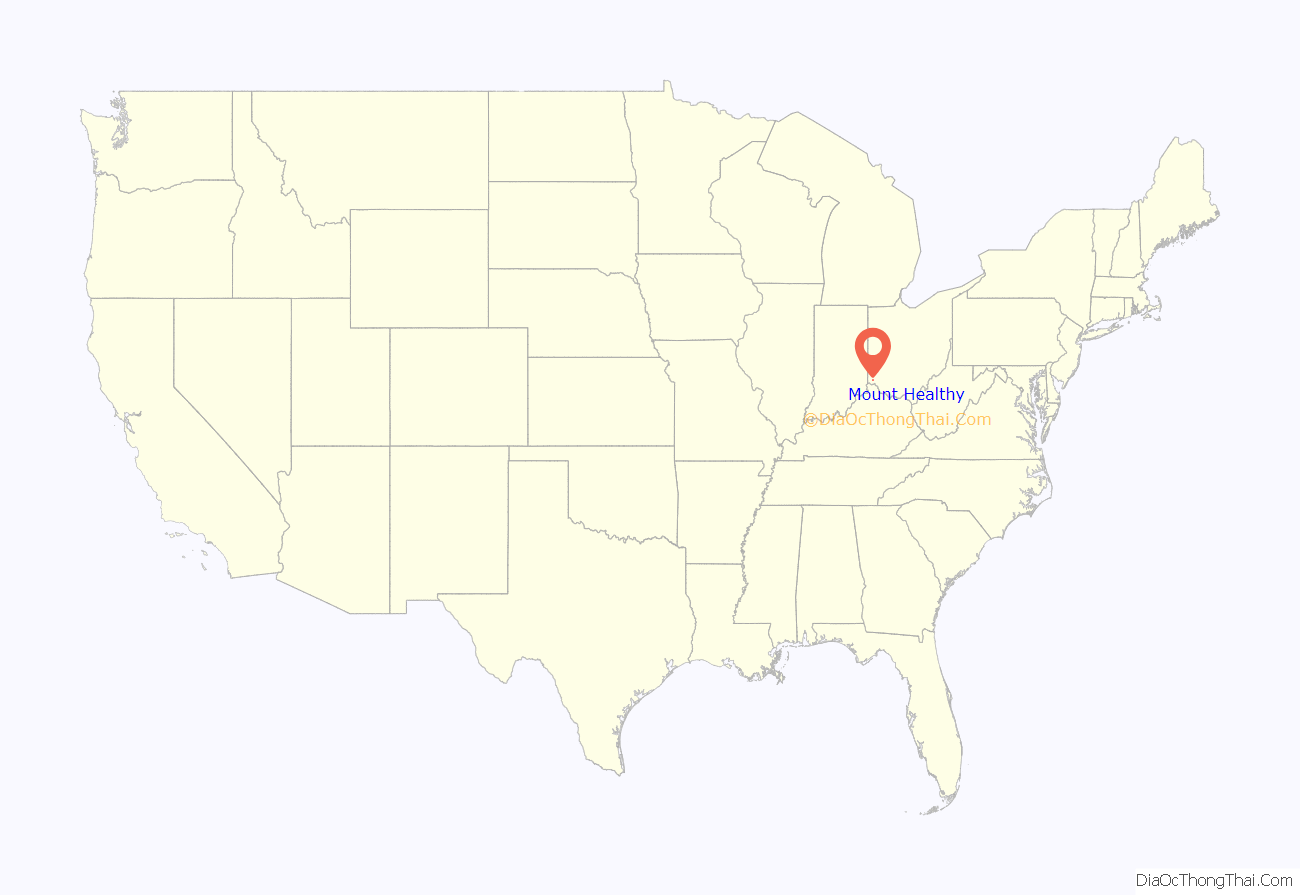
Mount Healthy location map. Where is Mount Healthy city?

History
Mount Healthy was founded in 1817 as the village of Mount Pleasant. In 1850, the village renamed itself “Mount Healthy”, following a cholera epidemic, in which many of its citizens survived while those in the surrounding territory did not. The village became a city in 1951.
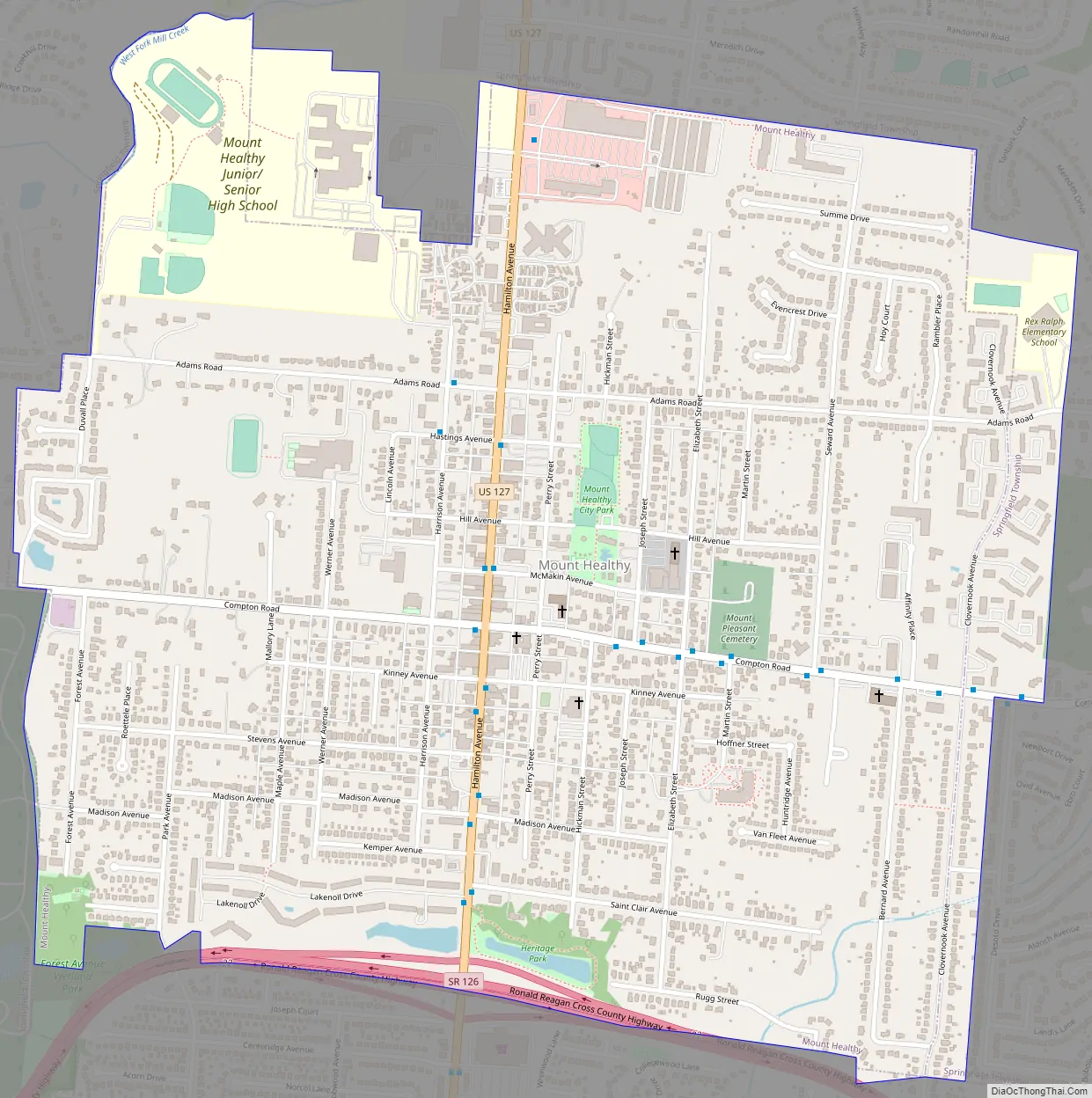
Mount Healthy Road Map
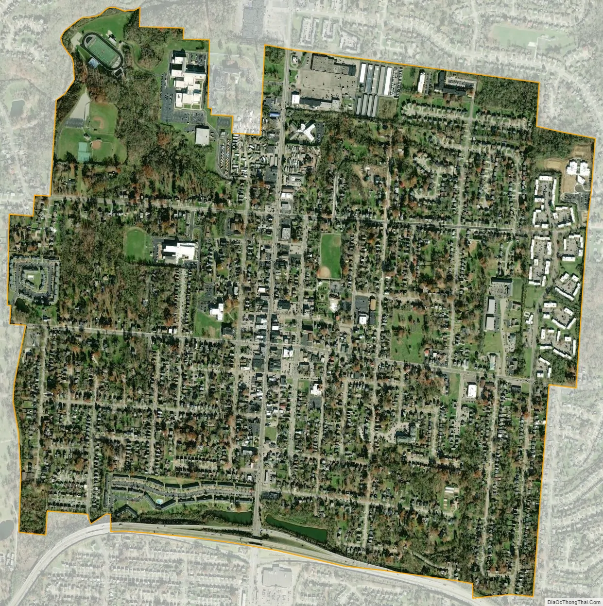
Mount Healthy city Satellite Map
Geography
Mount Healthy is located at 39°13′55″N 84°32′50″W / 39.23194°N 84.54722°W / 39.23194; -84.54722 (39.231808, -84.547244).
According to the United States Census Bureau, the city has a total area of 1.41 square miles (3.65 km), all land.
See also
Map of Ohio State and its subdivision:- Adams
- Allen
- Ashland
- Ashtabula
- Athens
- Auglaize
- Belmont
- Brown
- Butler
- Carroll
- Champaign
- Clark
- Clermont
- Clinton
- Columbiana
- Coshocton
- Crawford
- Cuyahoga
- Darke
- Defiance
- Delaware
- Erie
- Fairfield
- Fayette
- Franklin
- Fulton
- Gallia
- Geauga
- Greene
- Guernsey
- Hamilton
- Hancock
- Hardin
- Harrison
- Henry
- Highland
- Hocking
- Holmes
- Huron
- Jackson
- Jefferson
- Knox
- Lake
- Lake Erie
- Lawrence
- Licking
- Logan
- Lorain
- Lucas
- Madison
- Mahoning
- Marion
- Medina
- Meigs
- Mercer
- Miami
- Monroe
- Montgomery
- Morgan
- Morrow
- Muskingum
- Noble
- Ottawa
- Paulding
- Perry
- Pickaway
- Pike
- Portage
- Preble
- Putnam
- Richland
- Ross
- Sandusky
- Scioto
- Seneca
- Shelby
- Stark
- Summit
- Trumbull
- Tuscarawas
- Union
- Van Wert
- Vinton
- Warren
- Washington
- Wayne
- Williams
- Wood
- Wyandot
- Alabama
- Alaska
- Arizona
- Arkansas
- California
- Colorado
- Connecticut
- Delaware
- District of Columbia
- Florida
- Georgia
- Hawaii
- Idaho
- Illinois
- Indiana
- Iowa
- Kansas
- Kentucky
- Louisiana
- Maine
- Maryland
- Massachusetts
- Michigan
- Minnesota
- Mississippi
- Missouri
- Montana
- Nebraska
- Nevada
- New Hampshire
- New Jersey
- New Mexico
- New York
- North Carolina
- North Dakota
- Ohio
- Oklahoma
- Oregon
- Pennsylvania
- Rhode Island
- South Carolina
- South Dakota
- Tennessee
- Texas
- Utah
- Vermont
- Virginia
- Washington
- West Virginia
- Wisconsin
- Wyoming


