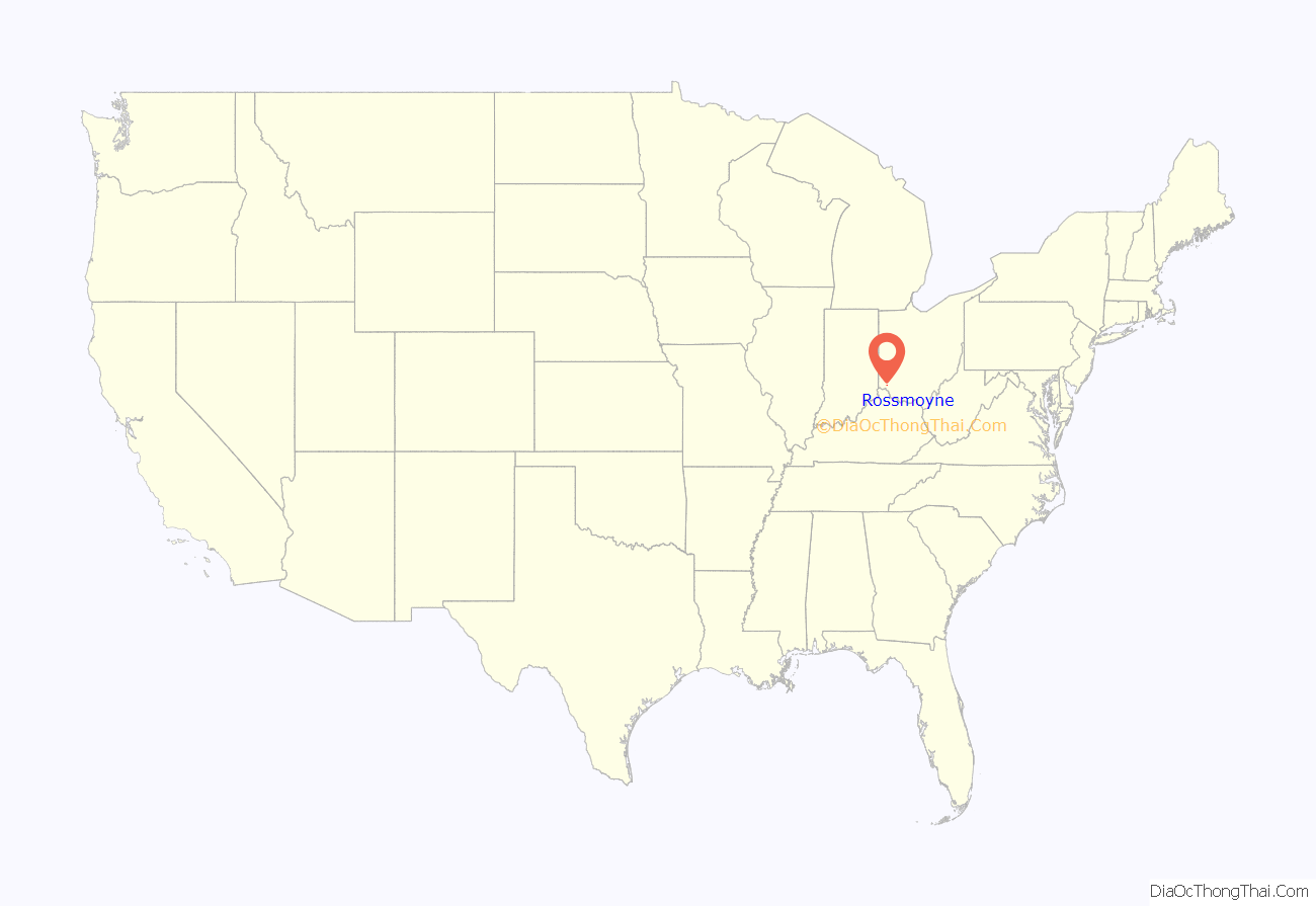
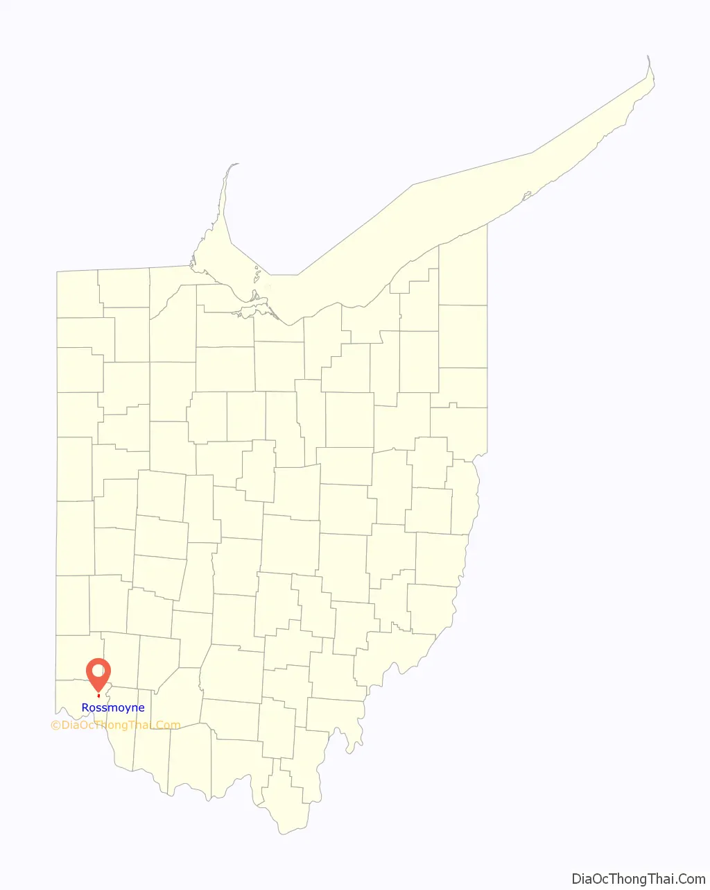
Rossmoyne is a census-designated place (CDP) in Sycamore Township, Hamilton County, Ohio, United States, 13 miles (21 km) northeast of downtown Cincinnati. The population of Rossmoyne was 1,788 at the 2020 census.
| Name: | Rossmoyne CDP |
|---|---|
| LSAD Code: | 57 |
| LSAD Description: | CDP (suffix) |
| State: | Ohio |
| County: | Hamilton County |
| Elevation: | 840 ft (260 m) |
| Total Area: | 0.54 sq mi (1.40 km²) |
| Land Area: | 0.54 sq mi (1.40 km²) |
| Water Area: | 0.00 sq mi (0.00 km²) |
| Total Population: | 1,788 |
| Population Density: | 3,317.25/sq mi (1,281.21/km²) |
| ZIP code: | 45236 |
| FIPS code: | 3968714 |
| GNISfeature ID: | 1065248 |
Online Interactive Map
Click on ![]() to view map in "full screen" mode.
to view map in "full screen" mode.
Rossmoyne location map. Where is Rossmoyne CDP?
History
Rossmoyne was originally known as Mill Dale in the 19th century.
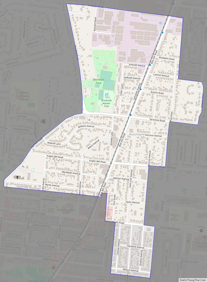
Rossmoyne Road Map
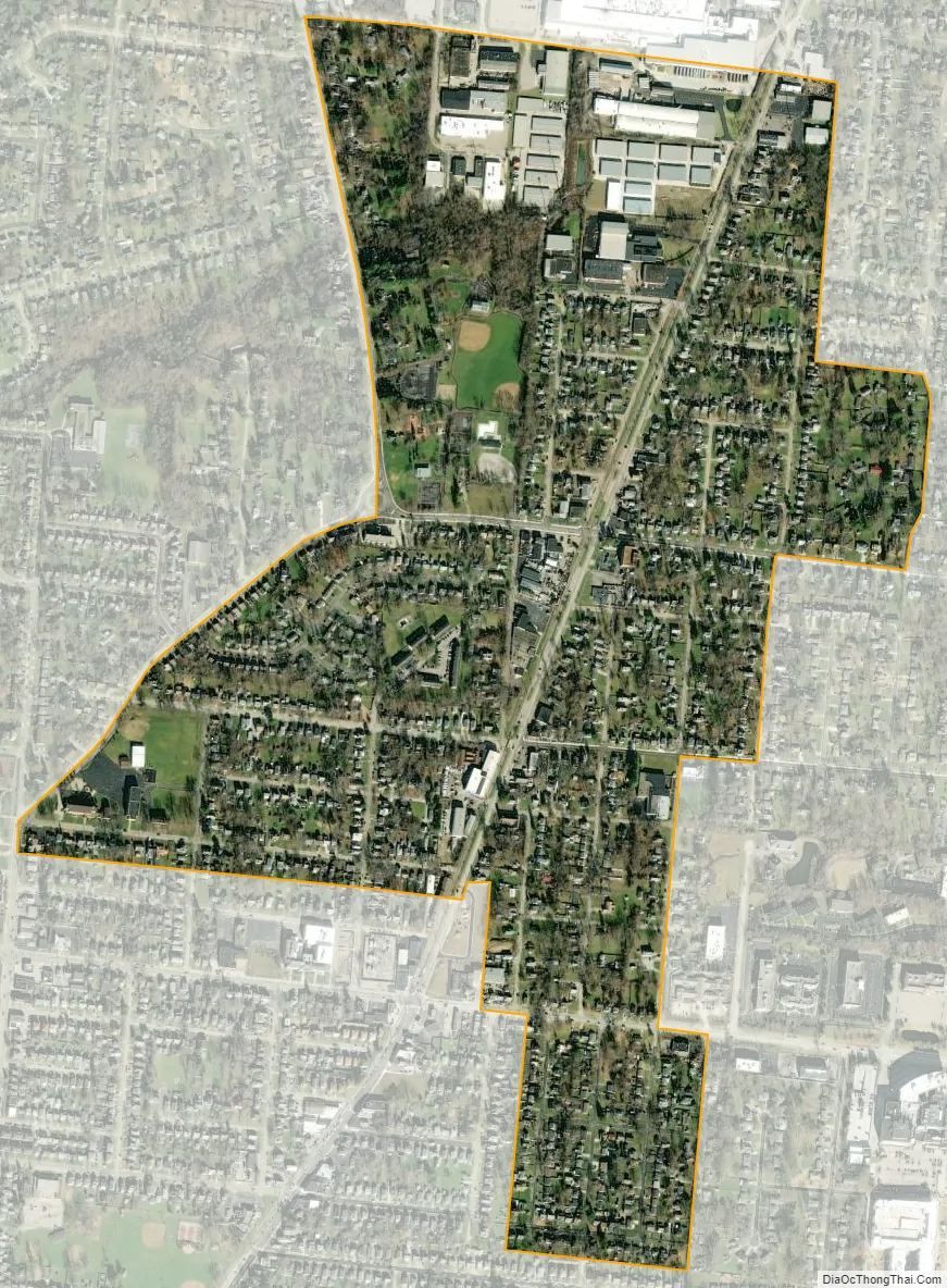
Rossmoyne city Satellite Map
Geography
Rossmoyne is located at 39°12′49″N 84°23′12″W / 39.21361°N 84.38667°W / 39.21361; -84.38667. It is bordered by Deer Park to the south, Dillonvale to the west, Blue Ash to the north, and Kenwood to the east.
According to the United States Census Bureau, the CDP has a total area of 0.58 square miles (1.5 km), all land.
See also
Map of Ohio State and its subdivision:- Adams
- Allen
- Ashland
- Ashtabula
- Athens
- Auglaize
- Belmont
- Brown
- Butler
- Carroll
- Champaign
- Clark
- Clermont
- Clinton
- Columbiana
- Coshocton
- Crawford
- Cuyahoga
- Darke
- Defiance
- Delaware
- Erie
- Fairfield
- Fayette
- Franklin
- Fulton
- Gallia
- Geauga
- Greene
- Guernsey
- Hamilton
- Hancock
- Hardin
- Harrison
- Henry
- Highland
- Hocking
- Holmes
- Huron
- Jackson
- Jefferson
- Knox
- Lake
- Lake Erie
- Lawrence
- Licking
- Logan
- Lorain
- Lucas
- Madison
- Mahoning
- Marion
- Medina
- Meigs
- Mercer
- Miami
- Monroe
- Montgomery
- Morgan
- Morrow
- Muskingum
- Noble
- Ottawa
- Paulding
- Perry
- Pickaway
- Pike
- Portage
- Preble
- Putnam
- Richland
- Ross
- Sandusky
- Scioto
- Seneca
- Shelby
- Stark
- Summit
- Trumbull
- Tuscarawas
- Union
- Van Wert
- Vinton
- Warren
- Washington
- Wayne
- Williams
- Wood
- Wyandot
- Alabama
- Alaska
- Arizona
- Arkansas
- California
- Colorado
- Connecticut
- Delaware
- District of Columbia
- Florida
- Georgia
- Hawaii
- Idaho
- Illinois
- Indiana
- Iowa
- Kansas
- Kentucky
- Louisiana
- Maine
- Maryland
- Massachusetts
- Michigan
- Minnesota
- Mississippi
- Missouri
- Montana
- Nebraska
- Nevada
- New Hampshire
- New Jersey
- New Mexico
- New York
- North Carolina
- North Dakota
- Ohio
- Oklahoma
- Oregon
- Pennsylvania
- Rhode Island
- South Carolina
- South Dakota
- Tennessee
- Texas
- Utah
- Vermont
- Virginia
- Washington
- West Virginia
- Wisconsin
- Wyoming


