Silverton is a village in Hamilton County, Ohio, United States. The village was formed out of Columbia and Sycamore townships, but withdrew from both and formed a paper township. The population was 4,908 at the 2020 census.
| Name: | Silverton village |
|---|---|
| LSAD Code: | 47 |
| LSAD Description: | village (suffix) |
| State: | Ohio |
| County: | Hamilton County |
| Elevation: | 850 ft (259 m) |
| Total Area: | 1.11 sq mi (2.88 km²) |
| Land Area: | 1.11 sq mi (2.88 km²) |
| Water Area: | 0.00 sq mi (0.00 km²) |
| Total Population: | 4,908 |
| Population Density: | 4,409.70/sq mi (1,702.41/km²) |
| ZIP code: | 45236 |
| Area code: | 513 |
| FIPS code: | 3972522 |
| GNISfeature ID: | 1065328 |
| Website: | www.cityofsilverton.com |
Online Interactive Map
Click on ![]() to view map in "full screen" mode.
to view map in "full screen" mode.
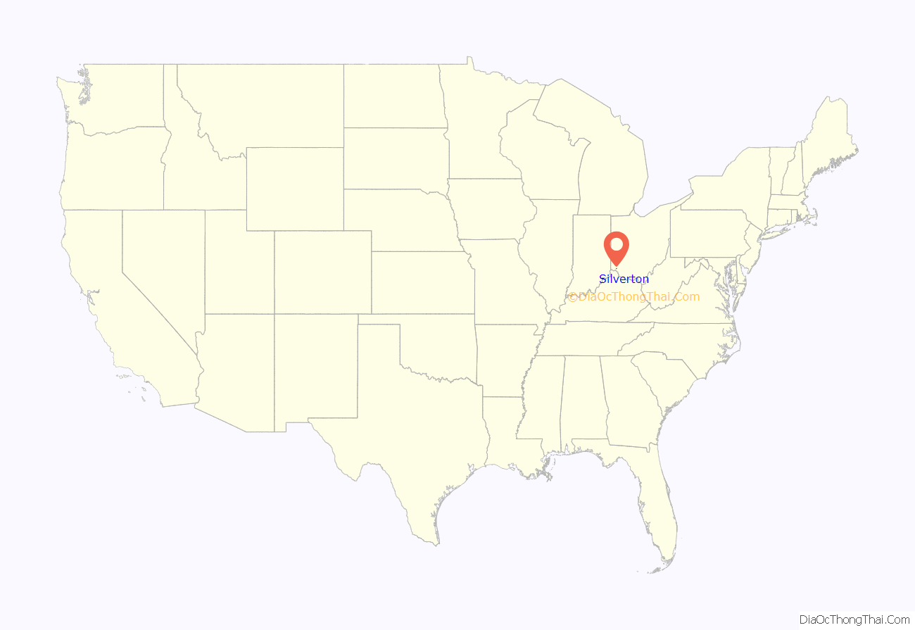
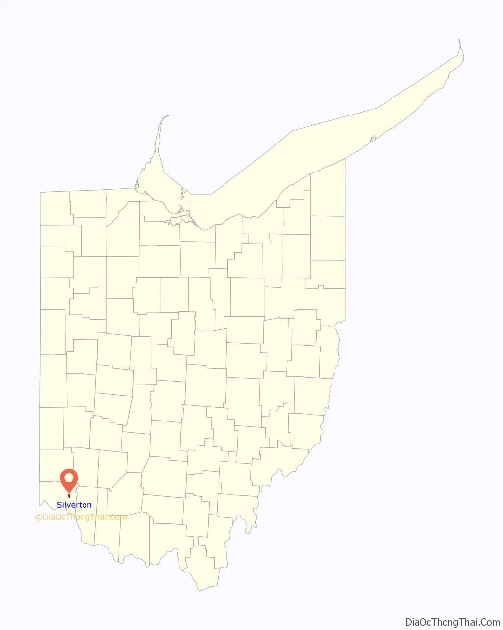
Silverton location map. Where is Silverton village?
History
Formed out of Columbia and Sycamore townships, Silverton had its beginnings in the post-Revolutionary War land grants. In 1809 David Mosner opened a general store at the crossroads of Plainfield Pike and Montgomery Road. For the next several decades the surrounding town was known alternately as “Mosner” or “Enterprise”. The Mosner name was formalized in 1861 when a post office opened under that designation.
The future of the community was forever changed in 1883 when the Cincinnati, Lebanon and Northern Railway opened a line through town, enabling residents to commute to jobs in Cincinnati. Seth Haines and Robert Cresap platted Silverton’s first subdivision shortly thereafter. It is widely accepted that the town was renamed Silverton in honor of Haines’ wife, Elizabeth Silver Haines.
In 1884 the community was incorporated as the Hamlet of Silverton. The early subdivisions were designed to appeal to investors as well as prospective homeowners. The lots divided comfortably, most of them with 25-foot (7.6 m) frontages.
Silverton was promoted as a healthful and economical alternative to life in the city.
The hamlet slowly developed into a suburb over the next twenty years, with village status attained by general election in 1904. The village was by then served by the Interurban Railway & Terminal Company line, which ran along Montgomery Road (now U.S. Route 22), as well as the CL&N. Residents regularly commuted to jobs in Cincinnati.
By 1910 the village had a population of 459. Silverton grew rapidly over the next 50 years, attaining The City of Silverton status in 1961 with a population exceeding 5,500.
Around the beginning of the 20th century the John C. Meier Grape Juice Company purchased land along the railroad line and began producing grape juice and wine in Silverton. Now known as Meier’s Wine Cellars, it is both the oldest and largest winery in Ohio.
Silverton’s demographics began to expand in the 1960s to include more African-American families. The village’s strong neighborhood and convenient location, made it attractive to many, both white and black alike.
The “white flight” experienced by many other communities, was not a factor in Silverton. Organizations like the Silverton Neighborhood Association was formed to break through cultural barriers and to promote dialogue between neighbors. And it worked. Silverton transformed itself into a successful intentionally integrated community.
In 1974, The City of Silverton elected its first African American Mayor, Richard F. Hunter, Sr. who served as a Silverton Councilmember previously. Mayor Hunter served the City of Silverton as Mayor over 20 years and longer than any mayor in the city’s history.
Along with First Lady Lorene Verdell Hunter, née Thomas, a teacher for over 35 years for the City of Cincinnati Public Schools, and their 5 children (Richard, Jr./Rick, Michael, Debbie, Lori and Ralph), the Hunter Family helped bridge the gap between blacks and whites while growing the city into a strong and vibrant community. .
Silverton received recognition as a Tree City USA community in 2008.
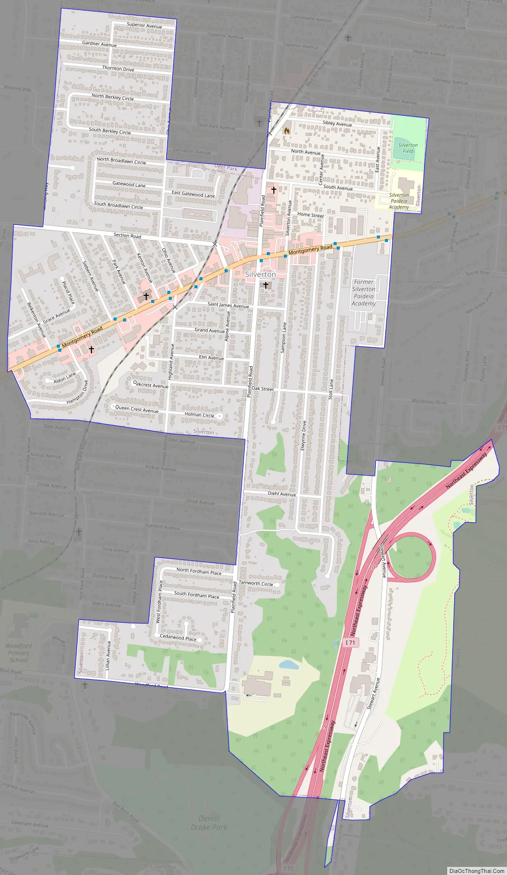
Silverton Road Map
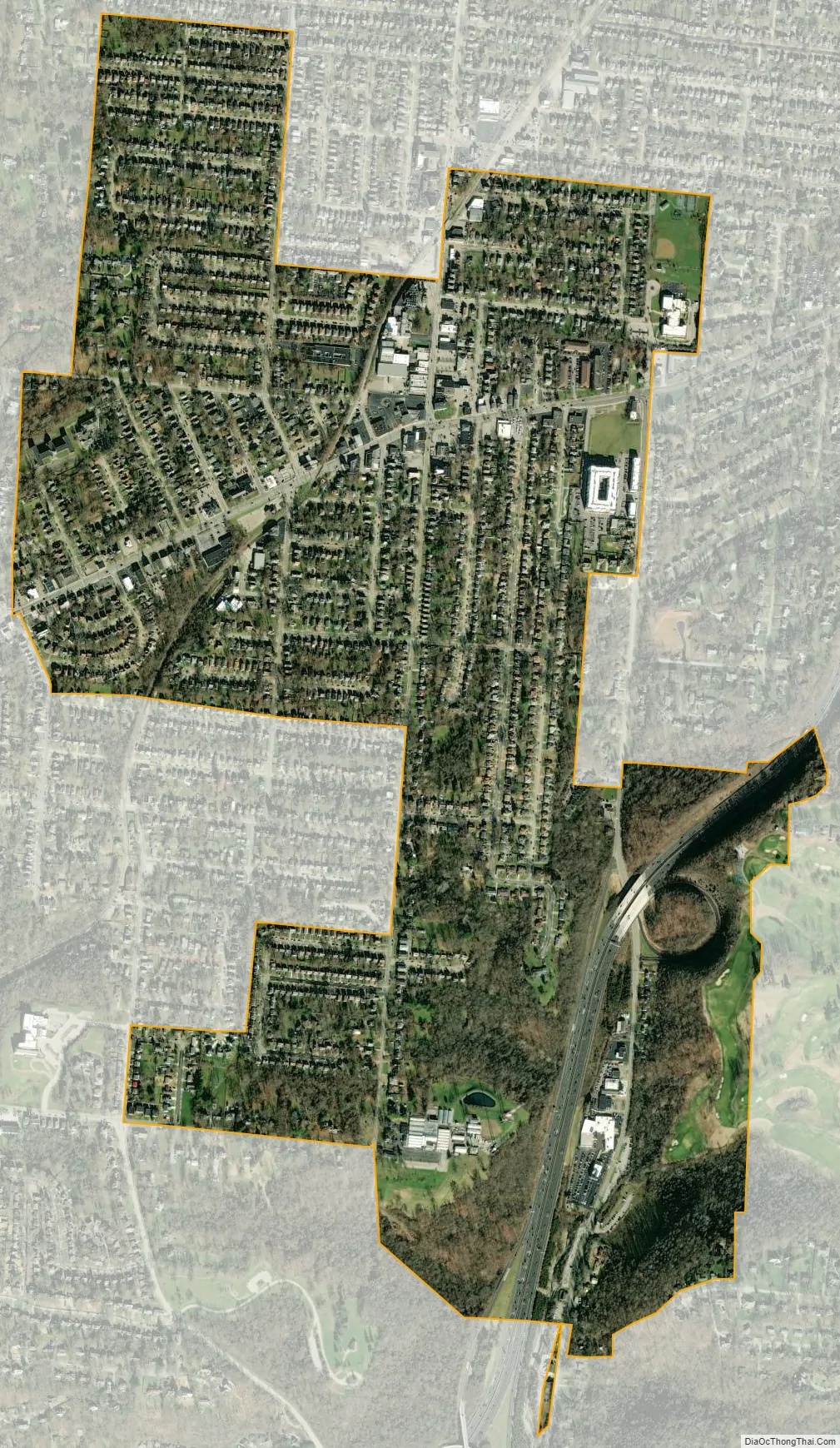
Silverton city Satellite Map
Geography
Silverton is located at 39°11′28″N 84°24′10″W / 39.19111°N 84.40278°W / 39.19111; -84.40278 (39.191160, -84.402762).
According to the United States Census Bureau, the village has a total area of 1.11 square miles (2.87 km), all land.
See also
Map of Ohio State and its subdivision:- Adams
- Allen
- Ashland
- Ashtabula
- Athens
- Auglaize
- Belmont
- Brown
- Butler
- Carroll
- Champaign
- Clark
- Clermont
- Clinton
- Columbiana
- Coshocton
- Crawford
- Cuyahoga
- Darke
- Defiance
- Delaware
- Erie
- Fairfield
- Fayette
- Franklin
- Fulton
- Gallia
- Geauga
- Greene
- Guernsey
- Hamilton
- Hancock
- Hardin
- Harrison
- Henry
- Highland
- Hocking
- Holmes
- Huron
- Jackson
- Jefferson
- Knox
- Lake
- Lake Erie
- Lawrence
- Licking
- Logan
- Lorain
- Lucas
- Madison
- Mahoning
- Marion
- Medina
- Meigs
- Mercer
- Miami
- Monroe
- Montgomery
- Morgan
- Morrow
- Muskingum
- Noble
- Ottawa
- Paulding
- Perry
- Pickaway
- Pike
- Portage
- Preble
- Putnam
- Richland
- Ross
- Sandusky
- Scioto
- Seneca
- Shelby
- Stark
- Summit
- Trumbull
- Tuscarawas
- Union
- Van Wert
- Vinton
- Warren
- Washington
- Wayne
- Williams
- Wood
- Wyandot
- Alabama
- Alaska
- Arizona
- Arkansas
- California
- Colorado
- Connecticut
- Delaware
- District of Columbia
- Florida
- Georgia
- Hawaii
- Idaho
- Illinois
- Indiana
- Iowa
- Kansas
- Kentucky
- Louisiana
- Maine
- Maryland
- Massachusetts
- Michigan
- Minnesota
- Mississippi
- Missouri
- Montana
- Nebraska
- Nevada
- New Hampshire
- New Jersey
- New Mexico
- New York
- North Carolina
- North Dakota
- Ohio
- Oklahoma
- Oregon
- Pennsylvania
- Rhode Island
- South Carolina
- South Dakota
- Tennessee
- Texas
- Utah
- Vermont
- Virginia
- Washington
- West Virginia
- Wisconsin
- Wyoming


