University Heights is a city in Cuyahoga County, Ohio, United States. It borders Beachwood to the east, Cleveland Heights to the west, South Euclid to the north and Shaker Heights to the south. The population was 13,914 as of the 2020 Census. University Heights is nicknamed the “City of Beautiful Homes.” University Heights is closely tied to neighboring Cleveland Heights, with the two sharing a school system, library system, post office and ZIP Code, some city services, and local media outlets. With about half the population under the age of 30, University Heights is home to one of the youngest communities in the region, including both students and families.
| Name: | University Heights city |
|---|---|
| LSAD Code: | 25 |
| LSAD Description: | city (suffix) |
| State: | Ohio |
| County: | Cuyahoga County |
| Elevation: | 1,027 ft (313 m) |
| Total Area: | 1.83 sq mi (4.73 km²) |
| Land Area: | 1.83 sq mi (4.73 km²) |
| Water Area: | 0.00 sq mi (0.00 km²) |
| Total Population: | 13,914 |
| Population Density: | 7,619.93/sq mi (2,941.54/km²) |
| Area code: | 216 |
| FIPS code: | 3978932 |
| GNISfeature ID: | 1065413 |
| Website: | www.universityheights.com |
Online Interactive Map
Click on ![]() to view map in "full screen" mode.
to view map in "full screen" mode.
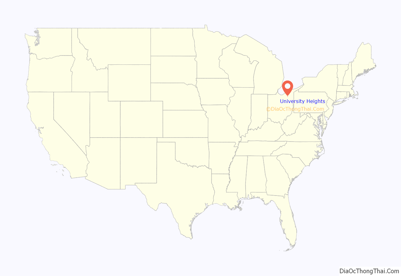
University Heights location map. Where is University Heights city?
History
Originally part of the Warrensville Township, University Heights was incorporated as Idlewood Village in 1908. It adopted its present name in the mid-1920s, when John Carroll University was anticipated to move into the area. John Carroll attracted massive growth and University Heights soon became recognized as a city in 1940.
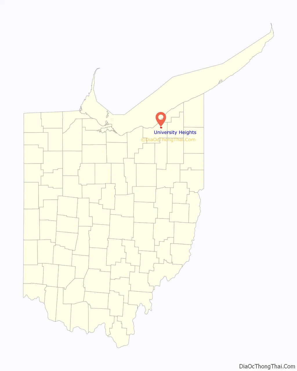
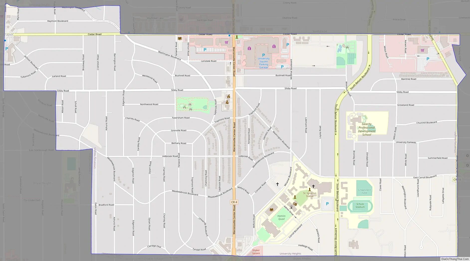
University Heights Road Map
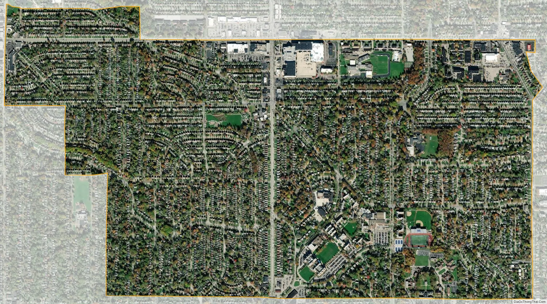
University Heights city Satellite Map
Geography
University Heights is located at 41°29′42″N 81°32′13″W / 41.49500°N 81.53694°W / 41.49500; -81.53694 (41.495019, −81.536864). According to the United States Census Bureau, the city has a total area of 1.82 square miles (4.71 km), all land.
Both branches of Dugway Brook rise in University Heights, on or near the campus of John Carroll University. All of the brook within the city was culverted in the early 20th century and now flows under the pavement. Meadowbrook Boulevard traces the winding course of the upper west branch.
See also
Map of Ohio State and its subdivision:- Adams
- Allen
- Ashland
- Ashtabula
- Athens
- Auglaize
- Belmont
- Brown
- Butler
- Carroll
- Champaign
- Clark
- Clermont
- Clinton
- Columbiana
- Coshocton
- Crawford
- Cuyahoga
- Darke
- Defiance
- Delaware
- Erie
- Fairfield
- Fayette
- Franklin
- Fulton
- Gallia
- Geauga
- Greene
- Guernsey
- Hamilton
- Hancock
- Hardin
- Harrison
- Henry
- Highland
- Hocking
- Holmes
- Huron
- Jackson
- Jefferson
- Knox
- Lake
- Lake Erie
- Lawrence
- Licking
- Logan
- Lorain
- Lucas
- Madison
- Mahoning
- Marion
- Medina
- Meigs
- Mercer
- Miami
- Monroe
- Montgomery
- Morgan
- Morrow
- Muskingum
- Noble
- Ottawa
- Paulding
- Perry
- Pickaway
- Pike
- Portage
- Preble
- Putnam
- Richland
- Ross
- Sandusky
- Scioto
- Seneca
- Shelby
- Stark
- Summit
- Trumbull
- Tuscarawas
- Union
- Van Wert
- Vinton
- Warren
- Washington
- Wayne
- Williams
- Wood
- Wyandot
- Alabama
- Alaska
- Arizona
- Arkansas
- California
- Colorado
- Connecticut
- Delaware
- District of Columbia
- Florida
- Georgia
- Hawaii
- Idaho
- Illinois
- Indiana
- Iowa
- Kansas
- Kentucky
- Louisiana
- Maine
- Maryland
- Massachusetts
- Michigan
- Minnesota
- Mississippi
- Missouri
- Montana
- Nebraska
- Nevada
- New Hampshire
- New Jersey
- New Mexico
- New York
- North Carolina
- North Dakota
- Ohio
- Oklahoma
- Oregon
- Pennsylvania
- Rhode Island
- South Carolina
- South Dakota
- Tennessee
- Texas
- Utah
- Vermont
- Virginia
- Washington
- West Virginia
- Wisconsin
- Wyoming


