Clarion is a borough in and the county seat of Clarion County, Pennsylvania, United States. It is located 77 miles (124 km) north-northeast of Pittsburgh and is part of the Pittsburgh DMA. Clarion was settled in 1839 and incorporated in 1841. In the past, the surrounding area produced natural gas, oil, lumber and coal. The population was 2,004 in 1900, 2,864 in 1910, and 3,931 at the 2020 census, down from 5,276 at the 2010 census. It is home to the annual Autumn Leaf Festival and Clarion University of Pennsylvania. The county courthouse was added to the National Register of Historic Places in 1979.
| Name: | Clarion borough |
|---|---|
| LSAD Code: | 21 |
| LSAD Description: | borough (suffix) |
| State: | Pennsylvania |
| County: | Clarion County |
| Incorporated: | 1841 |
| Elevation: | 1,491 ft (454 m) |
| Total Area: | 1.62 sq mi (4.19 km²) |
| Land Area: | 1.57 sq mi (4.08 km²) |
| Water Area: | 0.04 sq mi (0.11 km²) |
| Total Population: | 3,931 |
| Population Density: | 2,497.46/sq mi (964.04/km²) |
| ZIP code: | 16214 |
| Area code: | 814 |
| FIPS code: | 4213800 |
| Website: | www.clarionboro.org |
Online Interactive Map
Click on ![]() to view map in "full screen" mode.
to view map in "full screen" mode.
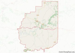
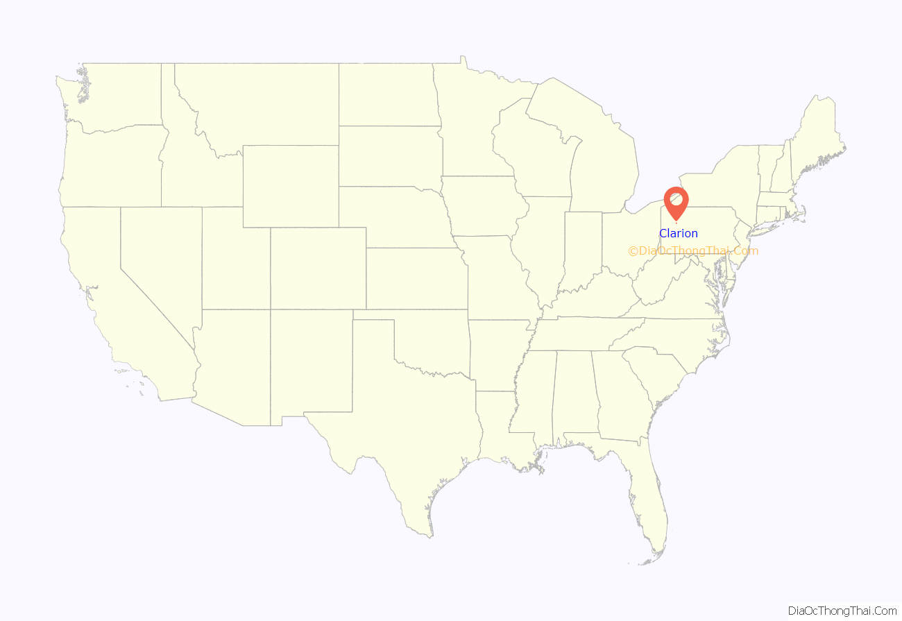
Clarion location map. Where is Clarion borough?

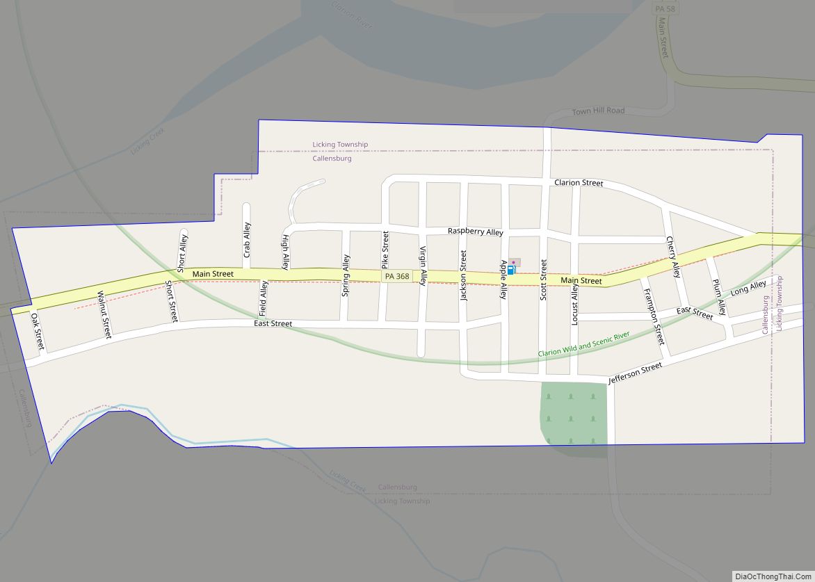
Clarion Road Map
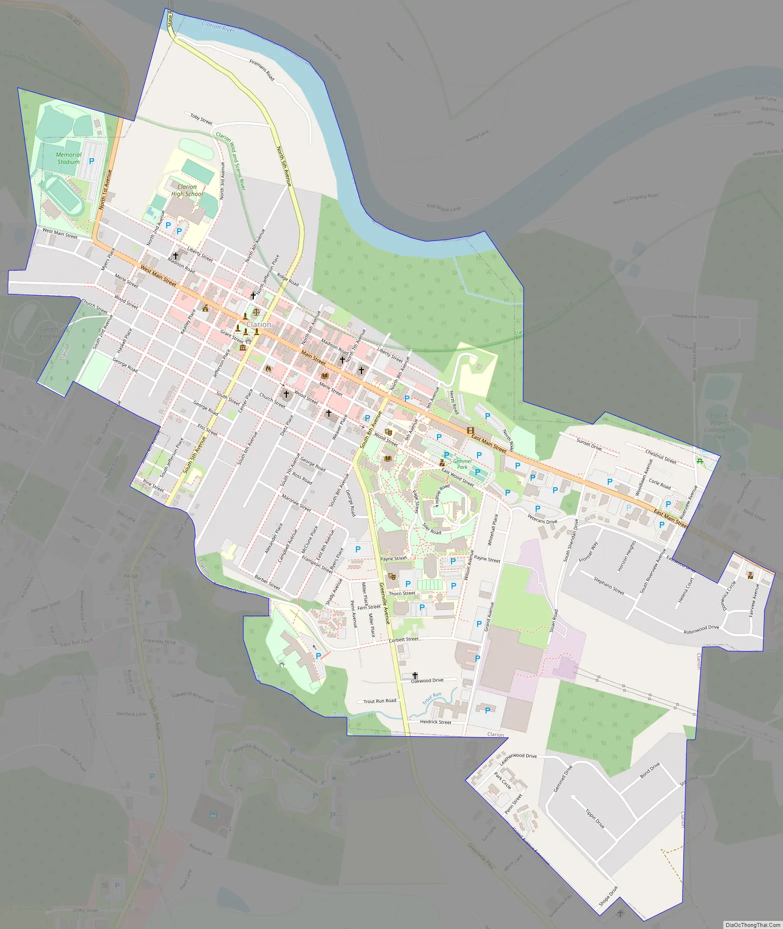
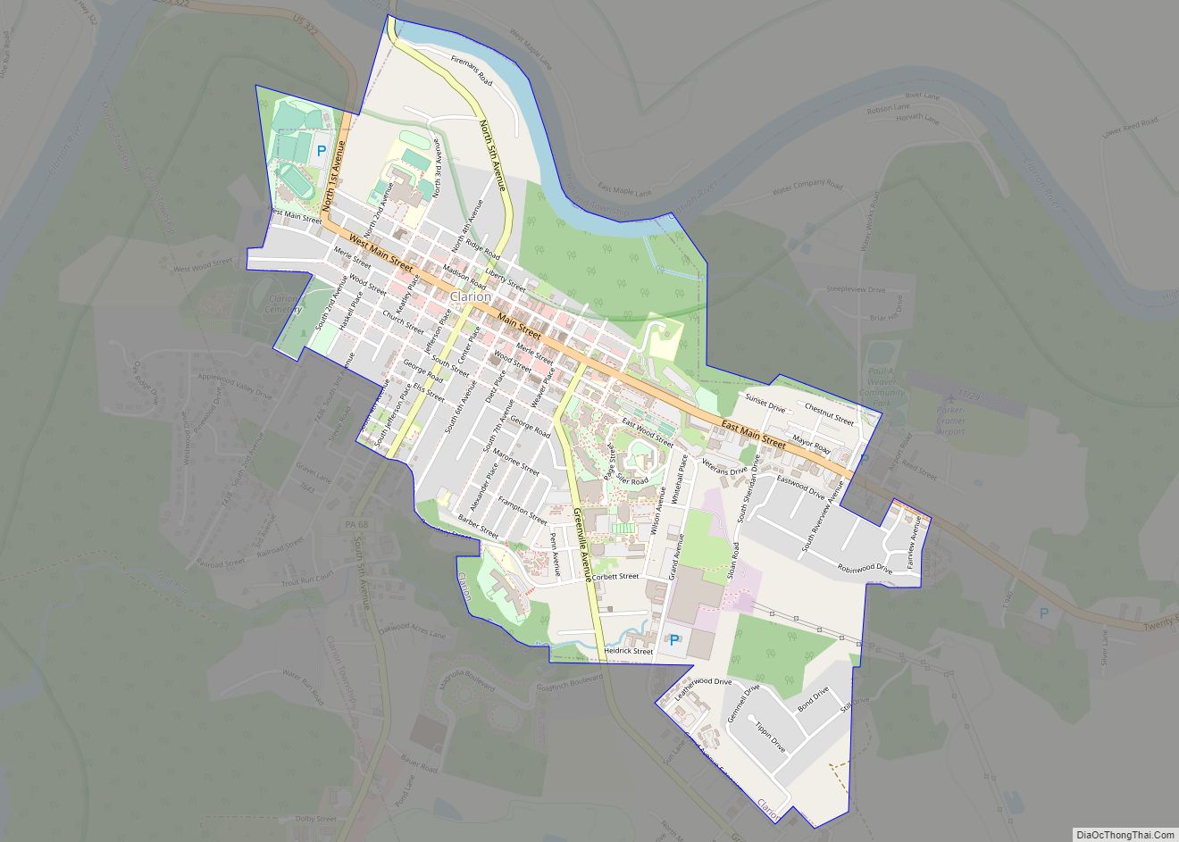
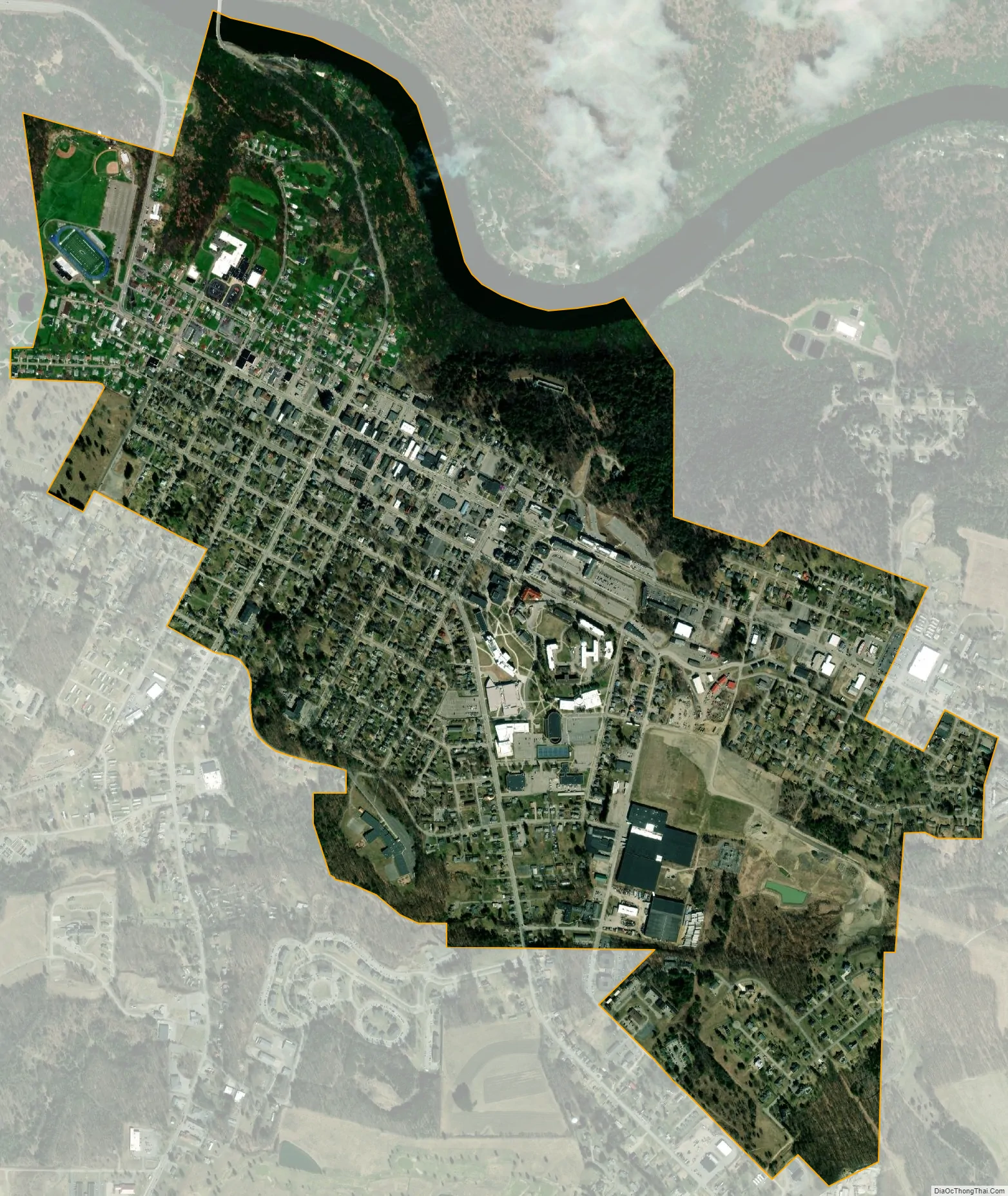
Clarion city Satellite Map
Geography
Clarion is located slightly northeast of the center of Clarion County at 41°12′42″N 79°23′2″W / 41.21167°N 79.38389°W / 41.21167; -79.38389 (41.211791, -79.384005), in the Allegheny Plateau region of western Pennsylvania. The main part of the borough sits at an elevation of 1,400 to 1,500 feet (430 to 460 m) above sea level, overlooking the 400-foot-deep (120 m) valley of the Clarion River, a tributary of the Allegheny River.
U.S. Route 322 passes through the borough as Main Street, leading northwest 28 miles (45 km) to Franklin and southeast 16 miles (26 km) to Brookville. Pennsylvania Route 68 (Fifth Avenue) leads south from the center of Clarion, 2 miles (3 km) to Exit 62 of Interstate 80 and 11 miles (18 km) to Sligo.
According to the United States Census Bureau, the borough has a total area of 1.62 square miles (4.19 km), of which 1.58 square miles (4.08 km) is land and 0.04 square miles (0.11 km), or 2.70%, is water.
See also
Map of Pennsylvania State and its subdivision:- Adams
- Allegheny
- Armstrong
- Beaver
- Bedford
- Berks
- Blair
- Bradford
- Bucks
- Butler
- Cambria
- Cameron
- Carbon
- Centre
- Chester
- Clarion
- Clearfield
- Clinton
- Columbia
- Crawford
- Cumberland
- Dauphin
- Delaware
- Elk
- Erie
- Fayette
- Forest
- Franklin
- Fulton
- Greene
- Huntingdon
- Indiana
- Jefferson
- Juniata
- Lackawanna
- Lancaster
- Lawrence
- Lebanon
- Lehigh
- Luzerne
- Lycoming
- Mc Kean
- Mercer
- Mifflin
- Monroe
- Montgomery
- Montour
- Northampton
- Northumberland
- Perry
- Philadelphia
- Pike
- Potter
- Schuylkill
- Snyder
- Somerset
- Sullivan
- Susquehanna
- Tioga
- Union
- Venango
- Warren
- Washington
- Wayne
- Westmoreland
- Wyoming
- York
- Alabama
- Alaska
- Arizona
- Arkansas
- California
- Colorado
- Connecticut
- Delaware
- District of Columbia
- Florida
- Georgia
- Hawaii
- Idaho
- Illinois
- Indiana
- Iowa
- Kansas
- Kentucky
- Louisiana
- Maine
- Maryland
- Massachusetts
- Michigan
- Minnesota
- Mississippi
- Missouri
- Montana
- Nebraska
- Nevada
- New Hampshire
- New Jersey
- New Mexico
- New York
- North Carolina
- North Dakota
- Ohio
- Oklahoma
- Oregon
- Pennsylvania
- Rhode Island
- South Carolina
- South Dakota
- Tennessee
- Texas
- Utah
- Vermont
- Virginia
- Washington
- West Virginia
- Wisconsin
- Wyoming