Bagley is a village in Grant County in the U.S. state of Wisconsin located on the Upper Mississippi River about 9 miles (15 km) south of Prairie du Chien, Wisconsin. The population was 379 at the 2010 census. It is a popular riverside destination in the summer, when the population can quadruple. The village was named for Vermont natives Alfred and Mary Bagley, who owned the site.
| Name: | Bagley village |
|---|---|
| LSAD Code: | 47 |
| LSAD Description: | village (suffix) |
| State: | Wisconsin |
| County: | Grant County |
| Elevation: | 640 ft (195 m) |
| Total Area: | 0.74 sq mi (1.91 km²) |
| Land Area: | 0.72 sq mi (1.86 km²) |
| Water Area: | 0.02 sq mi (0.05 km²) |
| Total Population: | 379 |
| Population Density: | 511.14/sq mi (197.44/km²) |
| Area code: | 608 |
| FIPS code: | 5504250 |
| GNISfeature ID: | 1561083 |
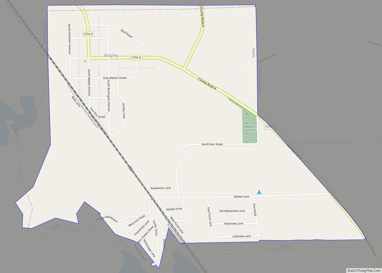
Online Interactive Map
Click on ![]() to view map in "full screen" mode.
to view map in "full screen" mode.
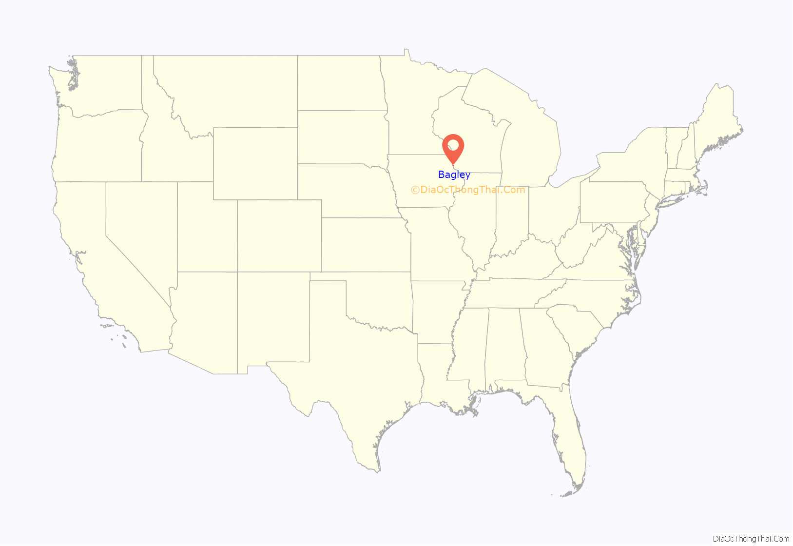
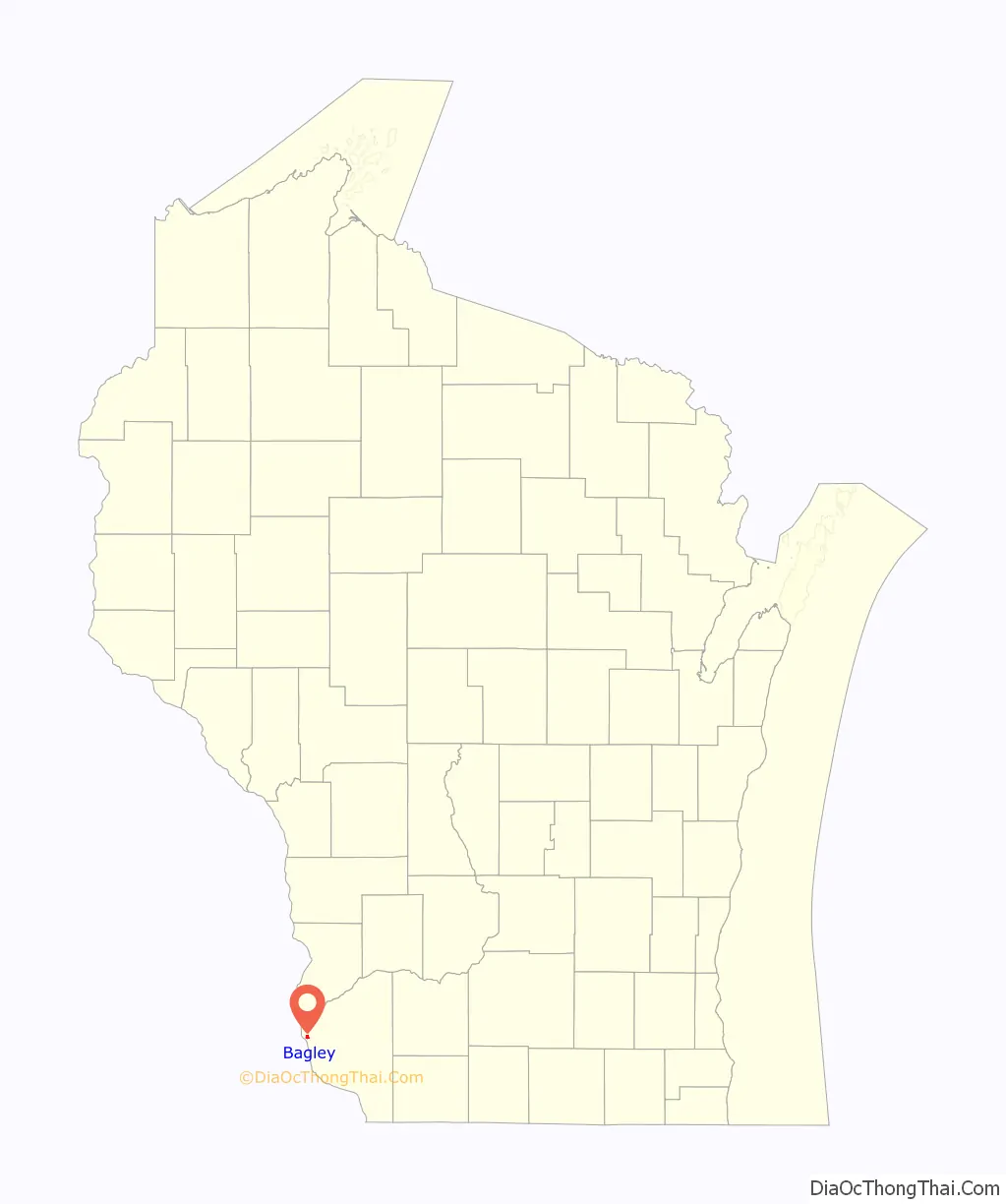
Bagley location map. Where is Bagley village?
History
The land for the village originally belonged to Mary Bagley when in 1884 the Chicago, Burlington and Quincy Railroad built a depot. Later that year, the Saint Paul Land Company purchased the land and platted the village.
The village suffered damage on July 18, 2007 when a large thunderstorm dumped 7 inches (180 mm) of rain on the area. The storm was part of a “mesoscale convective systems”, bringing thunderstorms with huge amounts of rain and lightning. What were normally minor streams, particularly Glass Hollow Creek, became raging torrents, pushing debris before them, backing up water into the town. No deaths or injuries were reported, but 50 people were evacuated from their homes by boat. Although nearly every home and business sustained damage, the town was not eligible for federal disaster aid.
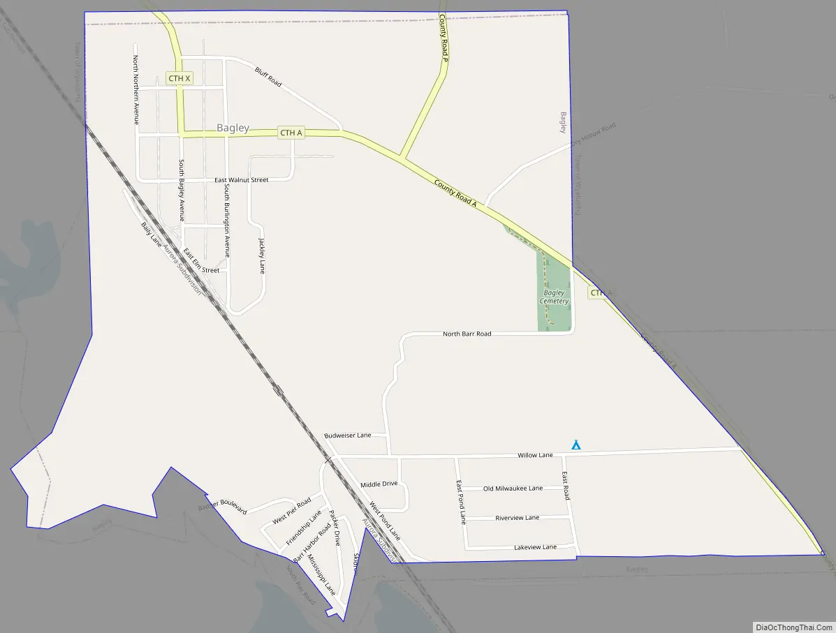
Bagley Road Map
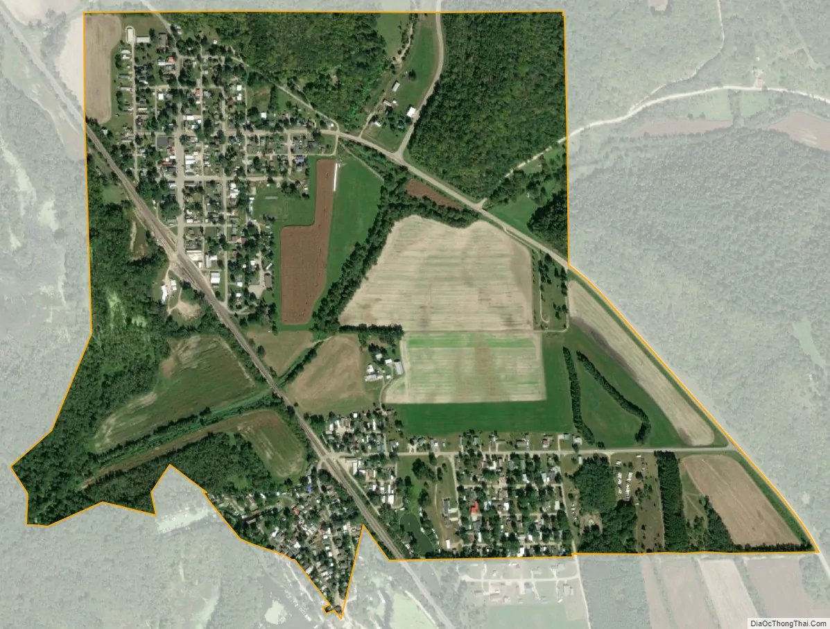
Bagley city Satellite Map
Geography
Bagley is located at 42°54′10″N 91°6′3″W / 42.90278°N 91.10083°W / 42.90278; -91.10083 (42.902764, -91.100714).
According to the United States Census Bureau, the village has a total area of 0.81 square miles (2.10 km), of which, 0.77 square miles (1.99 km) of it is land and 0.04 square miles (0.10 km) is water.
See also
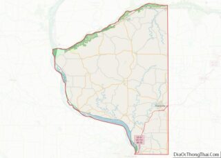
Map of Wisconsin State and its subdivision:- Adams
- Ashland
- Barron
- Bayfield
- Brown
- Buffalo
- Burnett
- Calumet
- Chippewa
- Clark
- Columbia
- Crawford
- Dane
- Dodge
- Door
- Douglas
- Dunn
- Eau Claire
- Florence
- Fond du Lac
- Forest
- Grant
- Green
- Green Lake
- Iowa
- Iron
- Jackson
- Jefferson
- Juneau
- Kenosha
- Kewaunee
- La Crosse
- Lafayette
- Lake Michigan
- Lake Superior
- Langlade
- Lincoln
- Manitowoc
- Marathon
- Marinette
- Marquette
- Menominee
- Milwaukee
- Monroe
- Oconto
- Oneida
- Outagamie
- Ozaukee
- Pepin
- Pierce
- Polk
- Portage
- Price
- Racine
- Richland
- Rock
- Rusk
- Saint Croix
- Sauk
- Sawyer
- Shawano
- Sheboygan
- Taylor
- Trempealeau
- Vernon
- Vilas
- Walworth
- Washburn
- Washington
- Waukesha
- Waupaca
- Waushara
- Winnebago
- Wood
- Alabama
- Alaska
- Arizona
- Arkansas
- California
- Colorado
- Connecticut
- Delaware
- District of Columbia
- Florida
- Georgia
- Hawaii
- Idaho
- Illinois
- Indiana
- Iowa
- Kansas
- Kentucky
- Louisiana
- Maine
- Maryland
- Massachusetts
- Michigan
- Minnesota
- Mississippi
- Missouri
- Montana
- Nebraska
- Nevada
- New Hampshire
- New Jersey
- New Mexico
- New York
- North Carolina
- North Dakota
- Ohio
- Oklahoma
- Oregon
- Pennsylvania
- Rhode Island
- South Carolina
- South Dakota
- Tennessee
- Texas
- Utah
- Vermont
- Virginia
- Washington
- West Virginia
- Wisconsin
- Wyoming