Belleville is a village in Dane and Green counties in the U.S. state of Wisconsin. The population was 2,491 at the 2020 census. Of this, 1,909 were in Dane County, and 582 were in Green County.
The Dane County portion of Belleville is part of the Madison Metropolitan Statistical Area, while the Green County portion is part of the Monroe Micropolitan Statistical Area.
| Name: | Belleville village |
|---|---|
| LSAD Code: | 47 |
| LSAD Description: | village (suffix) |
| State: | Wisconsin |
| County: | Dane County, Green County |
| Elevation: | 873 ft (266 m) |
| Total Area: | 1.81 sq mi (4.68 km²) |
| Land Area: | 1.59 sq mi (4.11 km²) |
| Water Area: | 0.22 sq mi (0.57 km²) |
| Total Population: | 2,491 |
| Population Density: | 1,551.98/sq mi (599.35/km²) |
| Area code: | 608 |
| FIPS code: | 5506300 |
| GNISfeature ID: | 1561535 |
| Website: | bellevillewi.org |
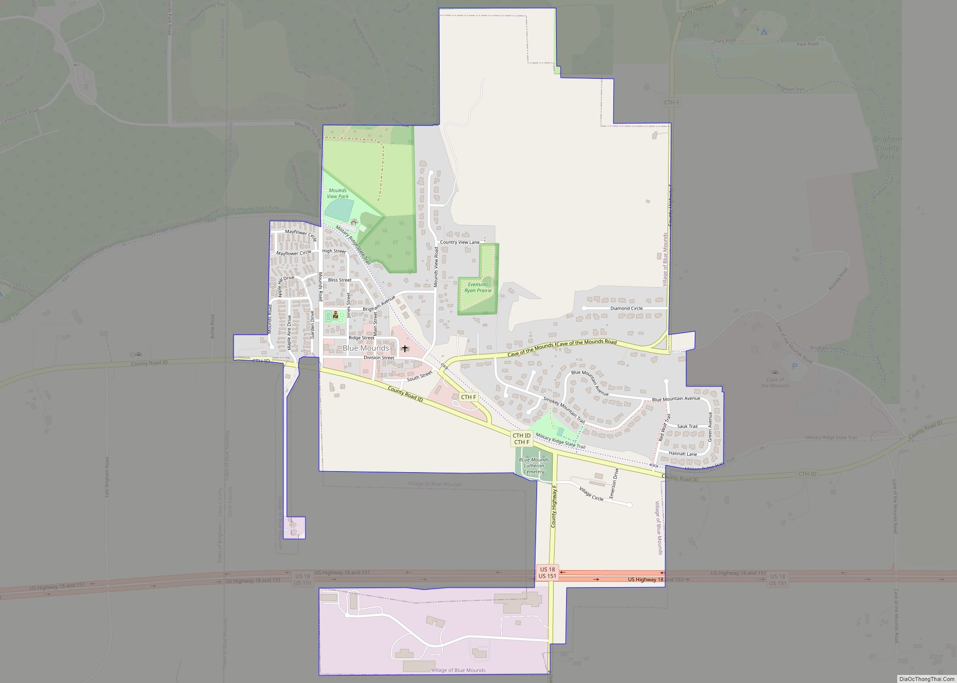
Online Interactive Map
Click on ![]() to view map in "full screen" mode.
to view map in "full screen" mode.
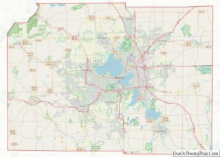
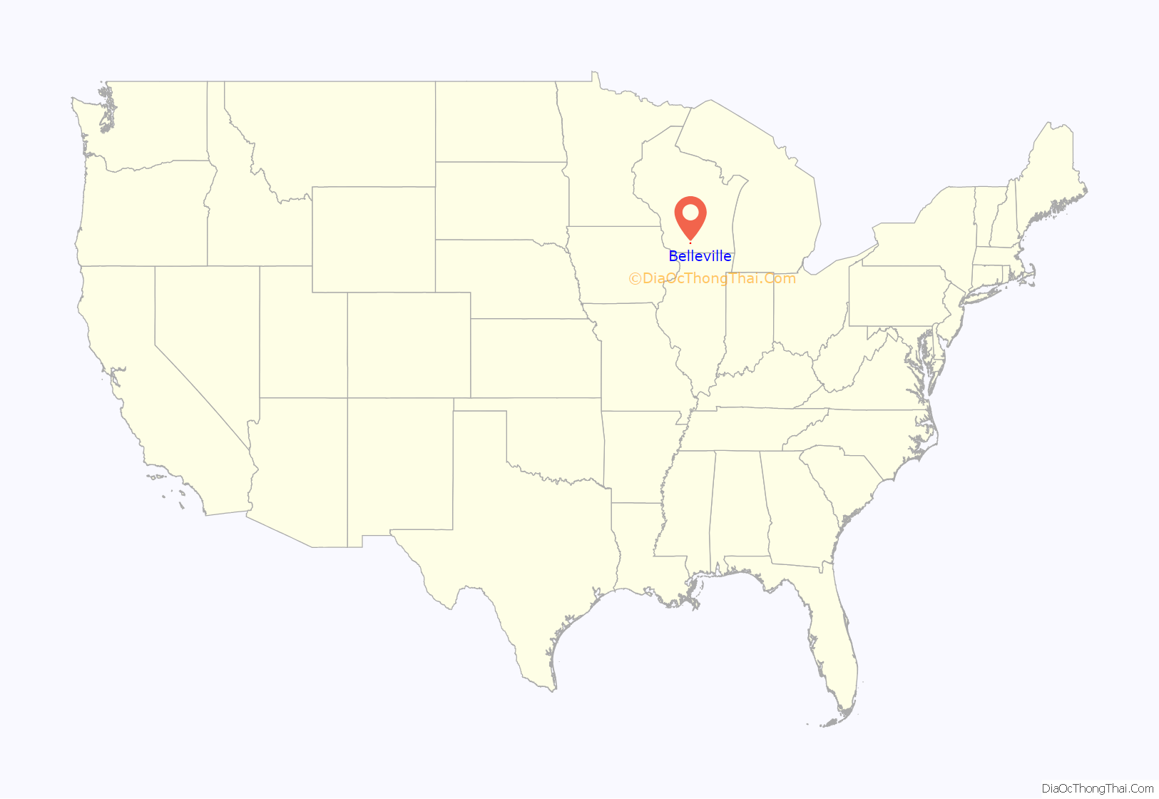
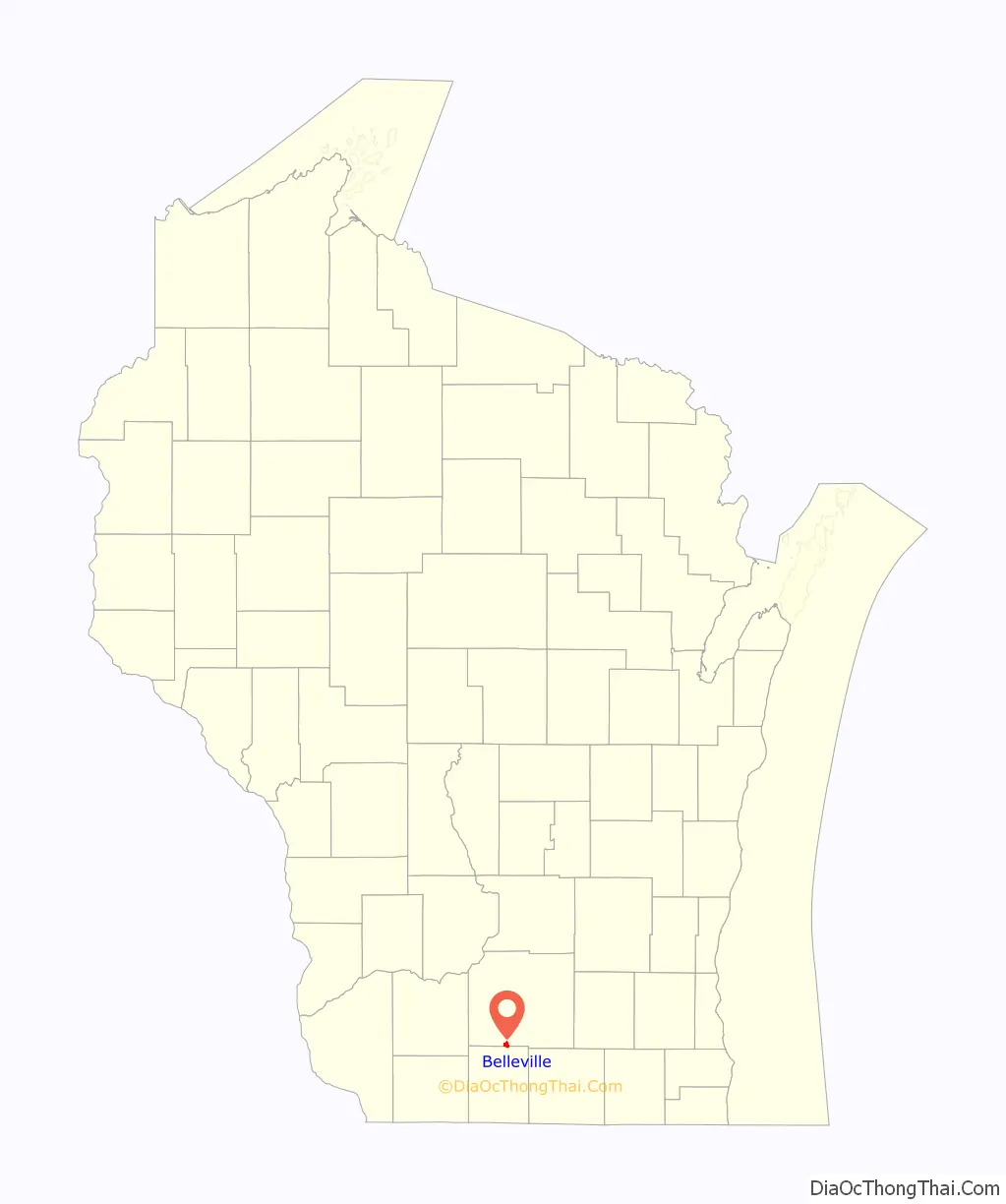
Belleville location map. Where is Belleville village?
History
At least some of the land the village now occupies was owned between 1838 and 1841 by Daniel Webster, the American statesman, who also speculated in land on the frontier. In 1845, John Frederick acquired property around the Sugar River and commenced construction of a dam and sawmill, and later a grist mill. By 1850, along with John Mitchell, Frederick platted the village and named it Belleville after his hometown of Belleville, Ontario.
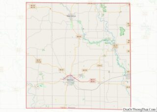
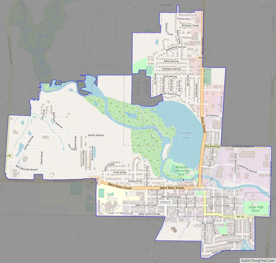
Belleville Road Map
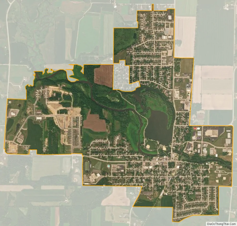
Belleville city Satellite Map
Geography
According to the United States Census Bureau, the village has a total area of 1.78 square miles (4.61 km), of which, 1.58 square miles (4.09 km) of it is land and 0.20 square miles (0.52 km) is water.
See also
Map of Wisconsin State and its subdivision:- Adams
- Ashland
- Barron
- Bayfield
- Brown
- Buffalo
- Burnett
- Calumet
- Chippewa
- Clark
- Columbia
- Crawford
- Dane
- Dodge
- Door
- Douglas
- Dunn
- Eau Claire
- Florence
- Fond du Lac
- Forest
- Grant
- Green
- Green Lake
- Iowa
- Iron
- Jackson
- Jefferson
- Juneau
- Kenosha
- Kewaunee
- La Crosse
- Lafayette
- Lake Michigan
- Lake Superior
- Langlade
- Lincoln
- Manitowoc
- Marathon
- Marinette
- Marquette
- Menominee
- Milwaukee
- Monroe
- Oconto
- Oneida
- Outagamie
- Ozaukee
- Pepin
- Pierce
- Polk
- Portage
- Price
- Racine
- Richland
- Rock
- Rusk
- Saint Croix
- Sauk
- Sawyer
- Shawano
- Sheboygan
- Taylor
- Trempealeau
- Vernon
- Vilas
- Walworth
- Washburn
- Washington
- Waukesha
- Waupaca
- Waushara
- Winnebago
- Wood
- Alabama
- Alaska
- Arizona
- Arkansas
- California
- Colorado
- Connecticut
- Delaware
- District of Columbia
- Florida
- Georgia
- Hawaii
- Idaho
- Illinois
- Indiana
- Iowa
- Kansas
- Kentucky
- Louisiana
- Maine
- Maryland
- Massachusetts
- Michigan
- Minnesota
- Mississippi
- Missouri
- Montana
- Nebraska
- Nevada
- New Hampshire
- New Jersey
- New Mexico
- New York
- North Carolina
- North Dakota
- Ohio
- Oklahoma
- Oregon
- Pennsylvania
- Rhode Island
- South Carolina
- South Dakota
- Tennessee
- Texas
- Utah
- Vermont
- Virginia
- Washington
- West Virginia
- Wisconsin
- Wyoming