Cambria is a village in Columbia County, Wisconsin, United States. The population was 767 at the 2010 census. It is part of the Madison Metropolitan Statistical Area.
| Name: | Cambria village |
|---|---|
| LSAD Code: | 47 |
| LSAD Description: | village (suffix) |
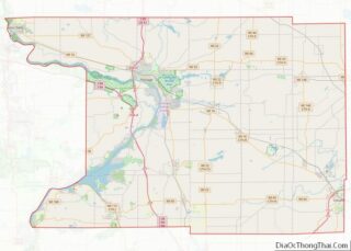
| State: | Wisconsin |
| County: | Columbia County |
| Elevation: | 915 ft (279 m) |
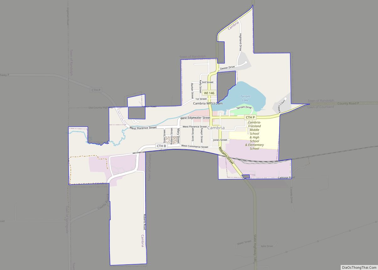
| Total Area: | 1.03 sq mi (2.67 km²) |
| Land Area: | 0.98 sq mi (2.54 km²) |
| Water Area: | 0.05 sq mi (0.13 km²) |
| Total Population: | 767 |
| Population Density: | 763.27/sq mi (294.60/km²) |
| Area code: | 920 |
| FIPS code: | 5512200 |
| GNISfeature ID: | 1562559 |
| Website: | www.cambriawisconsin.com |
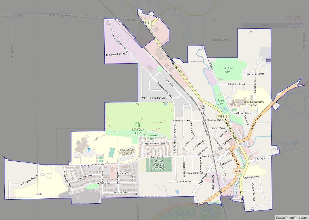
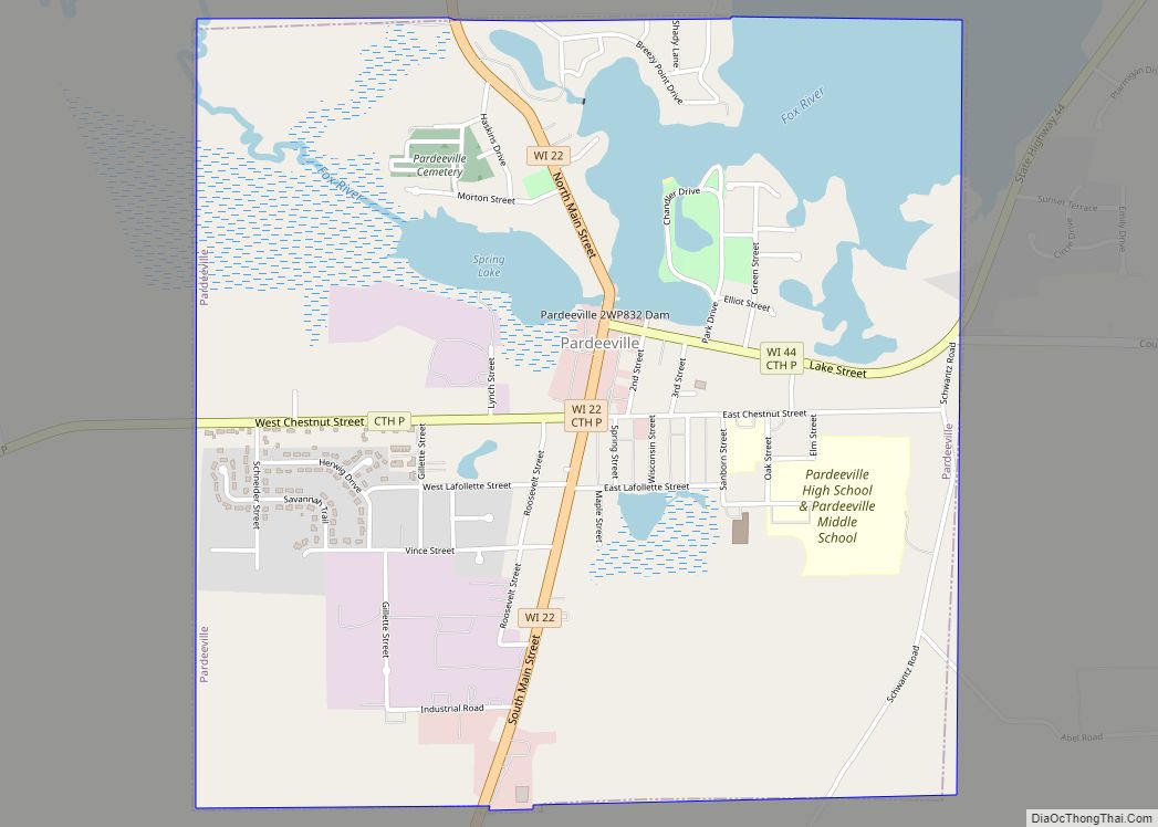
Online Interactive Map
Click on ![]() to view map in "full screen" mode.
to view map in "full screen" mode.
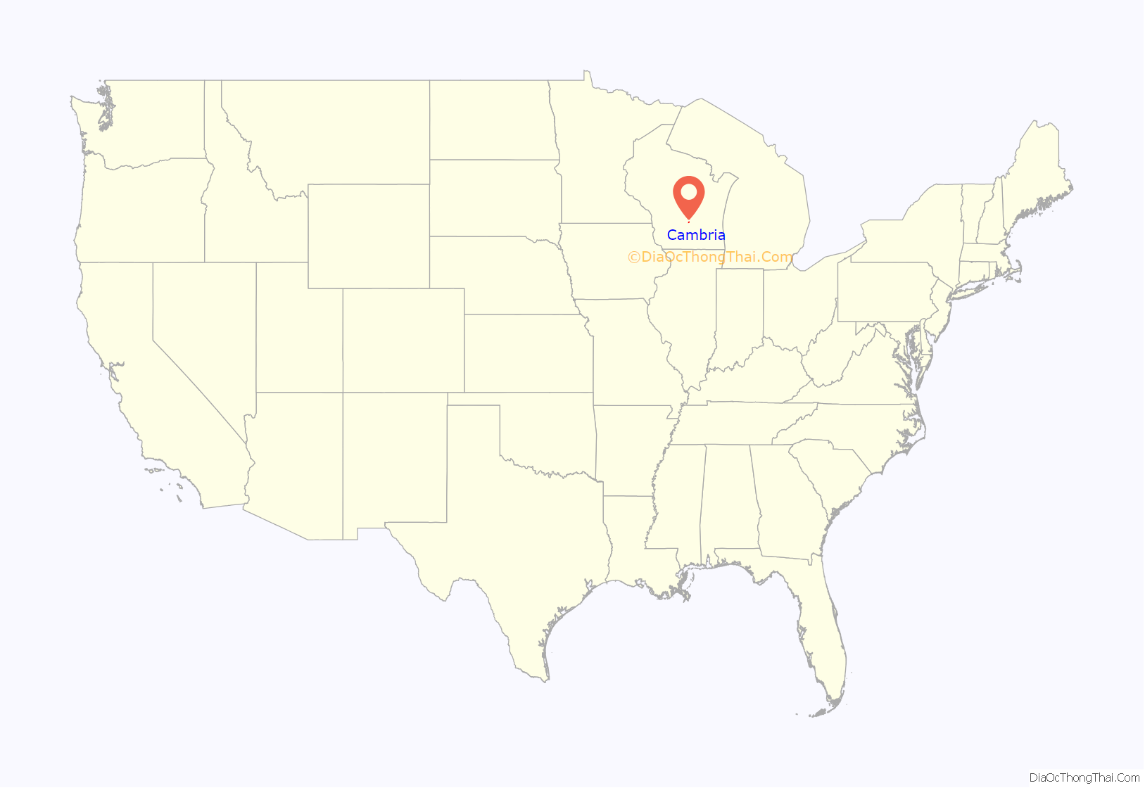
Cambria location map. Where is Cambria village?
History
The town was incorporated in 1866. It was first called Florence, or Langdon’s Mills, later Bellville, and finally Cambria, the Latin name for Wales, probably on account of the Welsh settlers who came there in 1845.
Preceding the first Welsh colonists by about a year were two brothers, John and Samuel Langdon. In 1844, they settled on the site of the present village of Cambria, Samuel P. Langdon building a sawmill on a branch of Duck Creek, the other opening a small stock of merchandise. They surveyed and platted four blocks, and called the village Florence. But the mill dominated the landscape in those days, and the settlement around it was called Langdon’s Mills.
The settlement had just begun when about fifty Welshmen, with their wives and children, came from North Wales, many from Dolwyddelan. Morris J. Rowlands, a son of one of the colonists, wrote in 1912,
The Dolwyddelan connection is recorded in an article published posthumously by J. Glyn Davies, a descendant of John Jones, Talysarn, whose brothers and sisters had emigrated to Cambria. In the article, he records that as a young man in 1898, he had visited Cambria to meet his kindred and found it was still a Welsh-speaking community which maintained its links with Wales.
In 1848 the Langdons, founders of the settlement from which sprung the village, raised a frame for a gristmill, but they had exhausted their means in their sawmill and store, and were unable to purchase the necessary machinery to operate it. In the spring of 1849 a Mr. Bell appeared and advanced money for that purpose, taking a mortgage upon the Langdon property as security. In consequence of nonpayment of the debt, the property passed into his hands, and the new owner surveyed and platted quite a large addition to the original site. In order to perpetuate his name he called the village Bellville.
Mr. Bell continued to operate the mill until 1851, when he disposed of all his holdings — not only in the mill but in the village site — to John Jones and Evan Edwards. But the new proprietors of the village, as well as the Welshmen who had settled there, were not pleased with the name Bellville, and by them it was changed to Cambria. But little growth was attained until the completion of the railroad through the place in 1857; and it has never had a rapid development.
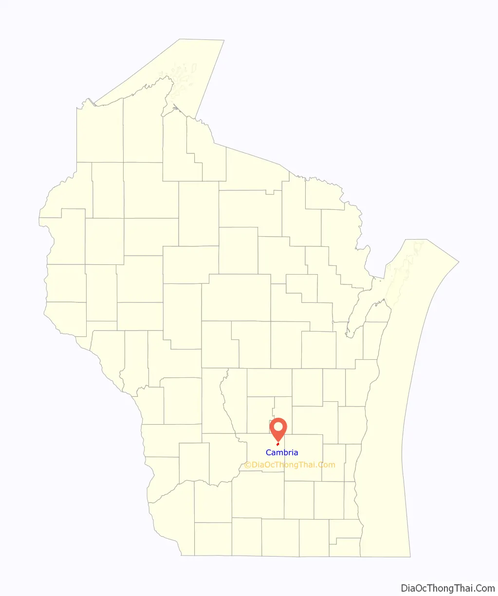
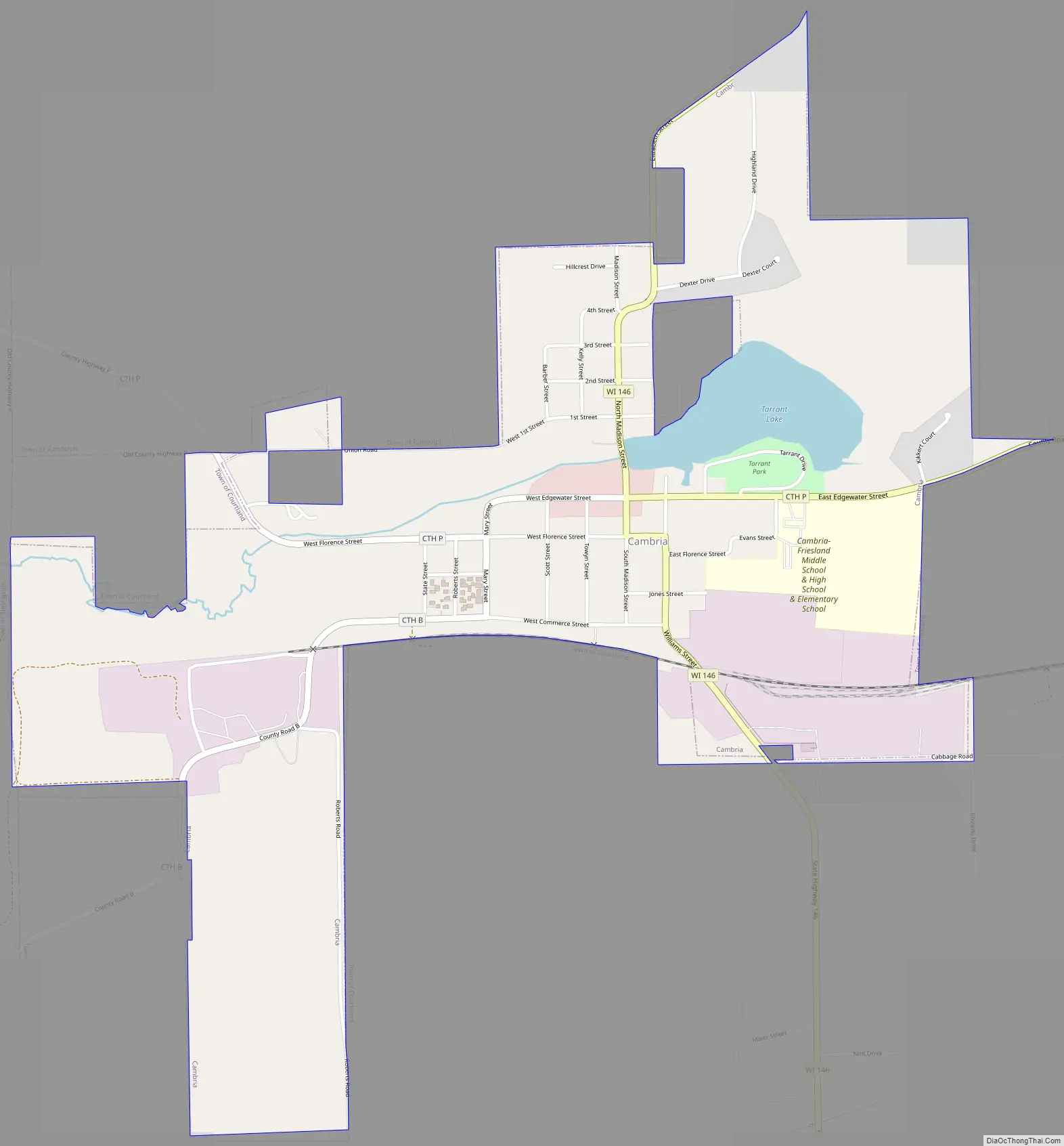
Cambria Road Map
Cambria city Satellite Map
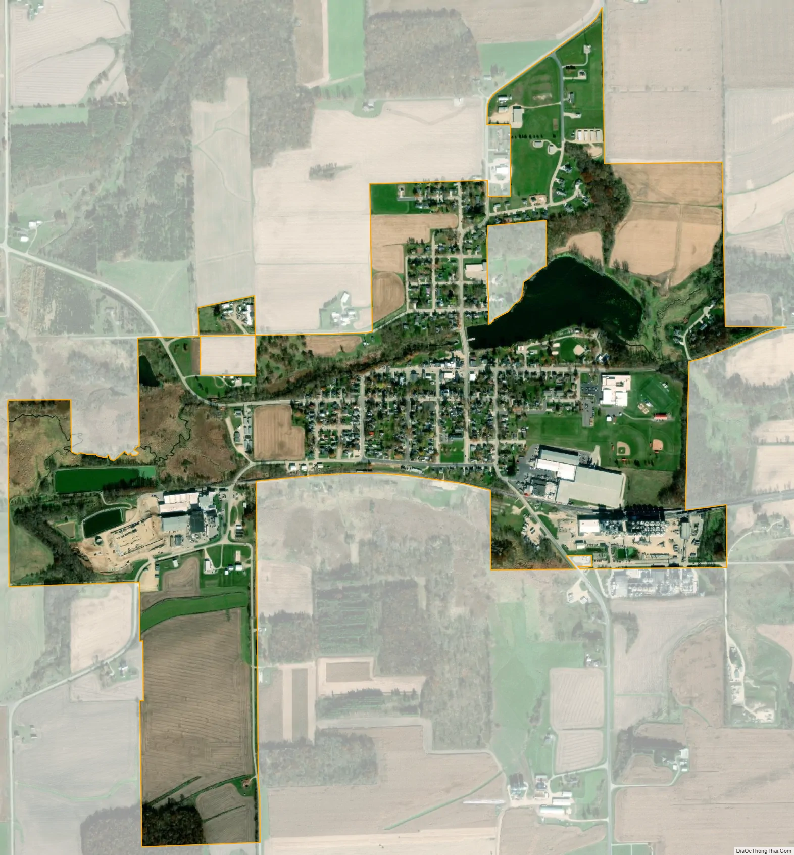
Geography
Cambria is located at 43°32′34″N 89°6′36″W / 43.54278°N 89.11000°W / 43.54278; -89.11000 (43.542645, -89.109919).
According to the United States Census Bureau, the village has a total area of 1.04 square miles (2.69 km), of which, 0.99 square miles (2.56 km) of it is land and 0.05 square miles (0.13 km) is water.
See also
Map of Wisconsin State and its subdivision:- Adams
- Ashland
- Barron
- Bayfield
- Brown
- Buffalo
- Burnett
- Calumet
- Chippewa
- Clark
- Columbia
- Crawford
- Dane
- Dodge
- Door
- Douglas
- Dunn
- Eau Claire
- Florence
- Fond du Lac
- Forest
- Grant
- Green
- Green Lake
- Iowa
- Iron
- Jackson
- Jefferson
- Juneau
- Kenosha
- Kewaunee
- La Crosse
- Lafayette
- Lake Michigan
- Lake Superior
- Langlade
- Lincoln
- Manitowoc
- Marathon
- Marinette
- Marquette
- Menominee
- Milwaukee
- Monroe
- Oconto
- Oneida
- Outagamie
- Ozaukee
- Pepin
- Pierce
- Polk
- Portage
- Price
- Racine
- Richland
- Rock
- Rusk
- Saint Croix
- Sauk
- Sawyer
- Shawano
- Sheboygan
- Taylor
- Trempealeau
- Vernon
- Vilas
- Walworth
- Washburn
- Washington
- Waukesha
- Waupaca
- Waushara
- Winnebago
- Wood
- Alabama
- Alaska
- Arizona
- Arkansas
- California
- Colorado
- Connecticut
- Delaware
- District of Columbia
- Florida
- Georgia
- Hawaii
- Idaho
- Illinois
- Indiana
- Iowa
- Kansas
- Kentucky
- Louisiana
- Maine
- Maryland
- Massachusetts
- Michigan
- Minnesota
- Mississippi
- Missouri
- Montana
- Nebraska
- Nevada
- New Hampshire
- New Jersey
- New Mexico
- New York
- North Carolina
- North Dakota
- Ohio
- Oklahoma
- Oregon
- Pennsylvania
- Rhode Island
- South Carolina
- South Dakota
- Tennessee
- Texas
- Utah
- Vermont
- Virginia
- Washington
- West Virginia
- Wisconsin
- Wyoming