Shullsburg is a city in Lafayette County, Wisconsin, United States. The population was 1,226 at the 2010 census. The city is adjacent to the Town of Shullsburg. Founded in 1827 it is one of the oldest settlements in Wisconsin. There are 34 buildings listed on the National Register of Historic Places on its historic Water Street Commercial District. It is located within the Midwestern Driftless Area and is known for its history of lead mining and its cheese industry.
| Name: | Shullsburg city |
|---|---|
| LSAD Code: | 25 |
| LSAD Description: | city (suffix) |
| State: | Wisconsin |
| County: | Lafayette County |
| Elevation: | 980 ft (300 m) |
| Total Area: | 1.33 sq mi (3.45 km²) |
| Land Area: | 1.33 sq mi (3.45 km²) |
| Water Area: | 0.00 sq mi (0.00 km²) |
| Total Population: | 1,226 |
| Population Density: | 894.30/sq mi (345.37/km²) |
| ZIP code: | 53586 |
| Area code: | 608 |
| FIPS code: | 5573825 |
| GNISfeature ID: | 1574081 |
| Website: | www.shullsburgwisconsin.org |
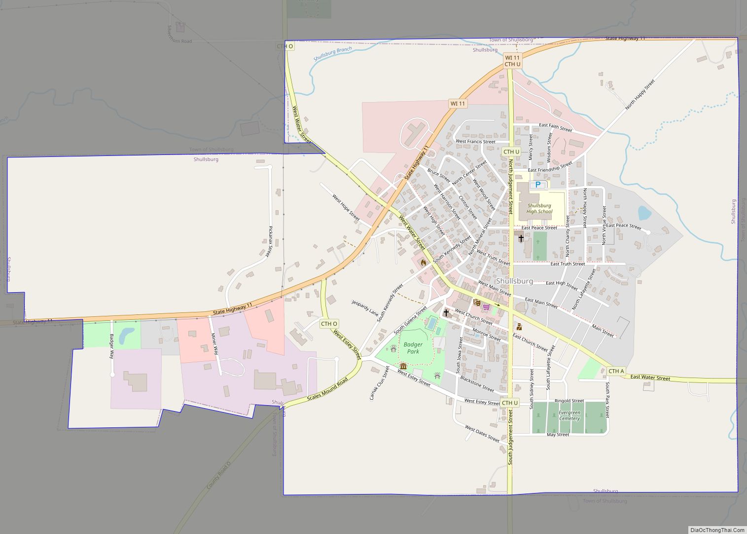
Online Interactive Map
Click on ![]() to view map in "full screen" mode.
to view map in "full screen" mode.
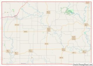
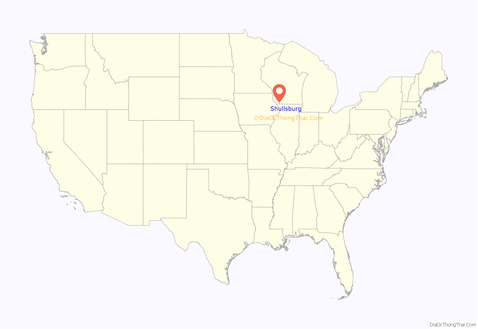
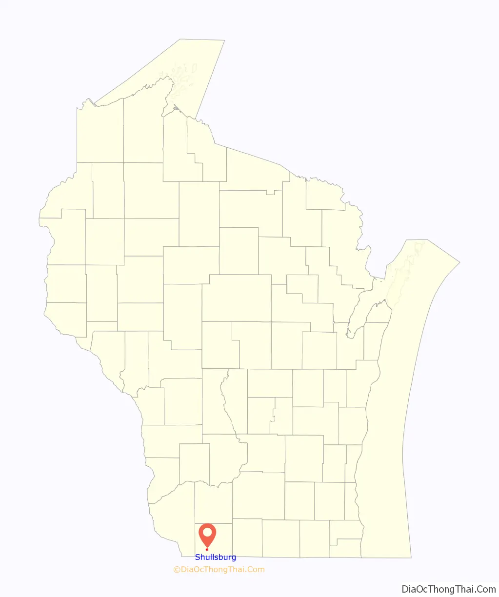
Shullsburg location map. Where is Shullsburg city?
History
Shullsburg was founded during the 1820s in parts by Jason Shull and Henry Gratiot and due to their ventures into lead mining. Following the Black Hawk War conflict Gratiot’s Grove (Wisconsin) and other small settlements consolidated into Shullsburg. In 1841 Missionary Priest Samuel Mazzuchelli platted the Northeast section of town and named the streets after the virtues of life. After arrival of railroad in the 1880s the Water Street Commercial District saw the construction of its many brick and limestone buildings. The Shullsburg High School was built in 1900 designed by the town physician Dr. C.C. Gratiot. The 8-Acre Badger Park, designed by Phelps Wyman, was completed in 1942 by the Works Progress Administration and lights were installed at its baseball park in 1948. In February 1943, a collapse at the Mulcahy mine killed two miners, then a second collapse killed six of the rescuers who were trying to dig the first two miners out. In 1974 the Emily Franz Scholarship Fund was formed to help high school students pay for college and is today worth 1.8 million dollars. The last working lead mine in the Upper Midwest Lead District closed at Shullsburg in 1979 and the town fell on hard times. During the 1990s and 2000s the restoration of buildings became important to building preservationists. In 2001 a new library and community center was built with private funds only. In 2016 it was named a Wisconsin Main Street Community.
St. Matthew’s Catholic Church and Parish
Founded in 1835 by Samuel Mazzuchelli, St. Matthew’s is one of the oldest Catholic parishes in Wisconsin. In 1852 construction of the current church began and was completed and dedicated on Saint Patrick’s Day 1861. The Greek Revival architecture of the church stands on the towns highest point. It is built of limestone quarried from the local Rennick Quarry. During the 1890s an “impoverished artist” was hired to paint the Stations of the Cross and are known today for the beautiful depictions. In 1907 the steeple was felled in a storm and was replaced the following year along with the placement of the stained glass windows. Today the sextagonal steeple stands at 135 feet tall with a 12 foot cross. In 1918 an adjoining parochial school was built and staffed by Sisters of Mercy and it served students until 1969. In 2010 the parish celebrated its 175th anniversary with a mass led by Bishop Robert C. Morlino.
Shullsburg School
The Shullsburg K-12 School is a Romanesque structure built in 1900. It is highlighted by arched windows and three arched door openings that form arcades across the buildings facade. The building was designed by school board member C.C. Gratiot. Gratiot designed many homes and commercial buildings in Shullsburg. In 1949 a gymnasium was built of matching limestone with crews provided by the Motherland Works Progress Administration. Another gym addition occurred in 1996. Today (2019) the K-12 school serves the community of Shullsburg and 360 students.
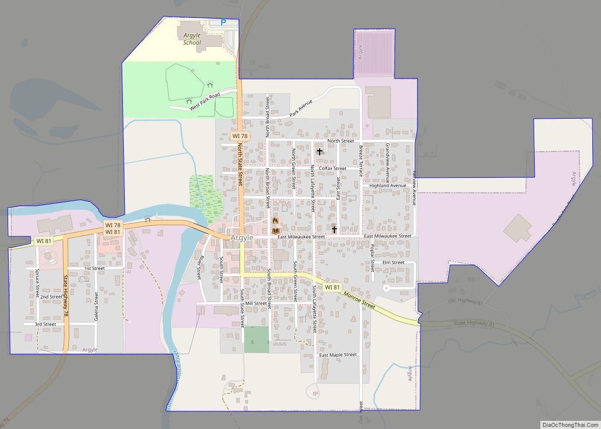
Shullsburg Road Map
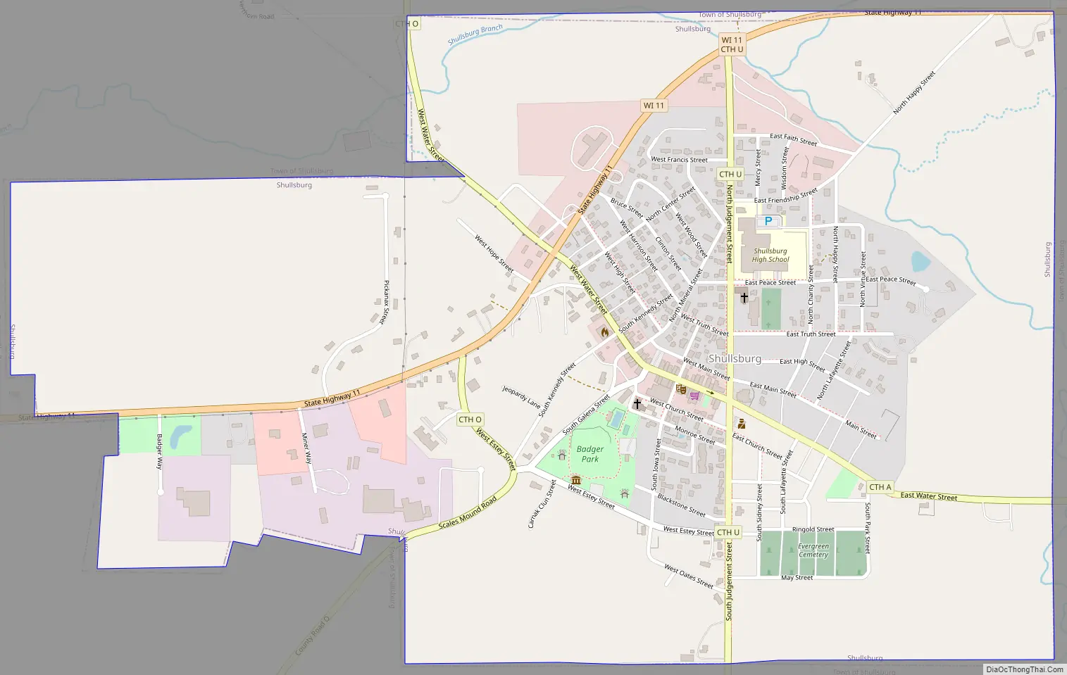
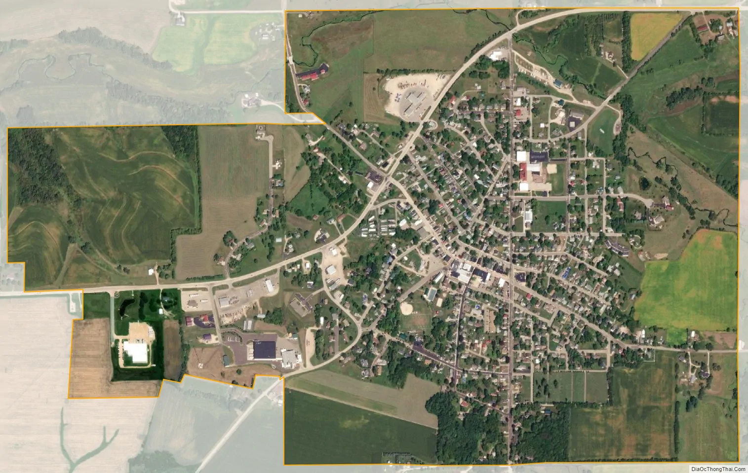
Shullsburg city Satellite Map
Geography
According to the United States Census Bureau, the city has a total area of 1.11 square miles (2.87 km), all of it land.
See also
Map of Wisconsin State and its subdivision:- Adams
- Ashland
- Barron
- Bayfield
- Brown
- Buffalo
- Burnett
- Calumet
- Chippewa
- Clark
- Columbia
- Crawford
- Dane
- Dodge
- Door
- Douglas
- Dunn
- Eau Claire
- Florence
- Fond du Lac
- Forest
- Grant
- Green
- Green Lake
- Iowa
- Iron
- Jackson
- Jefferson
- Juneau
- Kenosha
- Kewaunee
- La Crosse
- Lafayette
- Lake Michigan
- Lake Superior
- Langlade
- Lincoln
- Manitowoc
- Marathon
- Marinette
- Marquette
- Menominee
- Milwaukee
- Monroe
- Oconto
- Oneida
- Outagamie
- Ozaukee
- Pepin
- Pierce
- Polk
- Portage
- Price
- Racine
- Richland
- Rock
- Rusk
- Saint Croix
- Sauk
- Sawyer
- Shawano
- Sheboygan
- Taylor
- Trempealeau
- Vernon
- Vilas
- Walworth
- Washburn
- Washington
- Waukesha
- Waupaca
- Waushara
- Winnebago
- Wood
- Alabama
- Alaska
- Arizona
- Arkansas
- California
- Colorado
- Connecticut
- Delaware
- District of Columbia
- Florida
- Georgia
- Hawaii
- Idaho
- Illinois
- Indiana
- Iowa
- Kansas
- Kentucky
- Louisiana
- Maine
- Maryland
- Massachusetts
- Michigan
- Minnesota
- Mississippi
- Missouri
- Montana
- Nebraska
- Nevada
- New Hampshire
- New Jersey
- New Mexico
- New York
- North Carolina
- North Dakota
- Ohio
- Oklahoma
- Oregon
- Pennsylvania
- Rhode Island
- South Carolina
- South Dakota
- Tennessee
- Texas
- Utah
- Vermont
- Virginia
- Washington
- West Virginia
- Wisconsin
- Wyoming