Eagle Lake is a census-designated place (CDP) in the town of Dover, Racine County, Wisconsin, United States. The population was 1,251 at the 2020 census.
| Name: | Eagle Lake CDP |
|---|---|
| LSAD Code: | 57 |
| LSAD Description: | CDP (suffix) |
| State: | Wisconsin |
| County: | Racine County |
| Elevation: | 801 ft (244 m) |
| Total Area: | 3.0 sq mi (7.8 km²) |
| Land Area: | 2.2 sq mi (5.7 km²) |
| Water Area: | 0.8 sq mi (2.1 km²) |
| Total Population: | 1,251 |
| Population Density: | 420/sq mi (160/km²) |
| Area code: | 262 |
| FIPS code: | 5521525 |
| GNISfeature ID: | 1867656 |
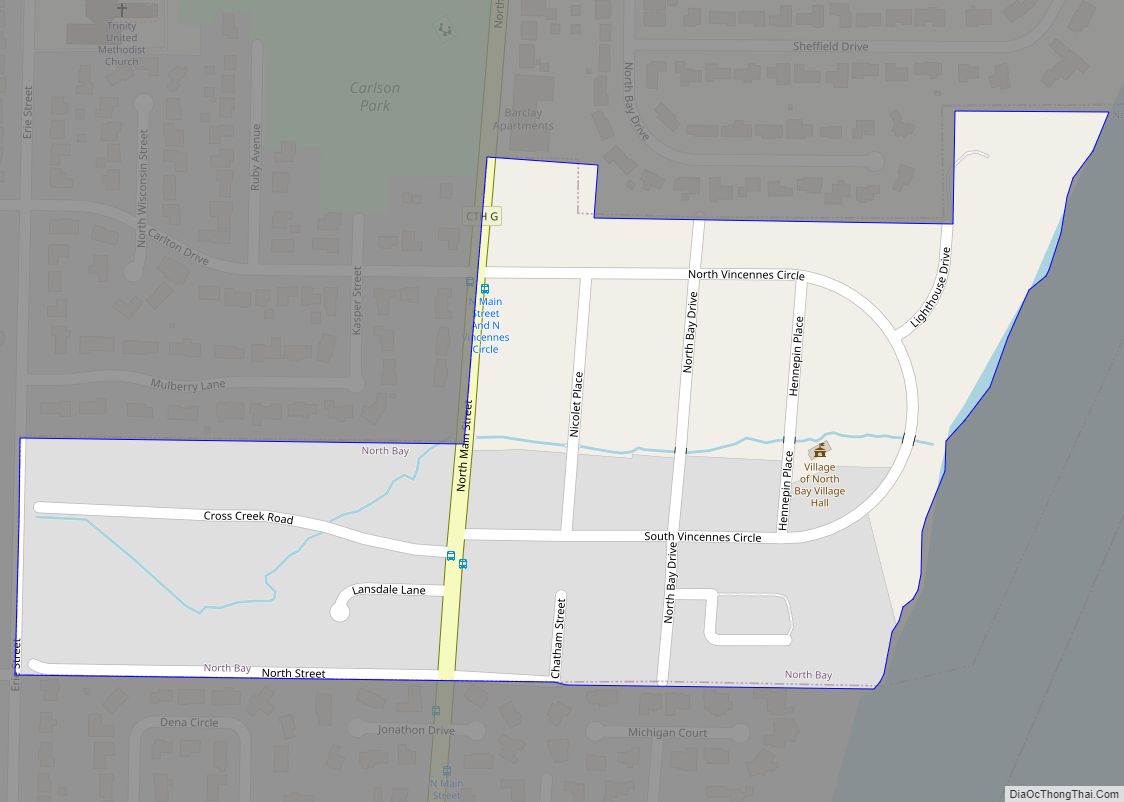
Online Interactive Map
Click on ![]() to view map in "full screen" mode.
to view map in "full screen" mode.
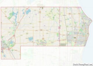
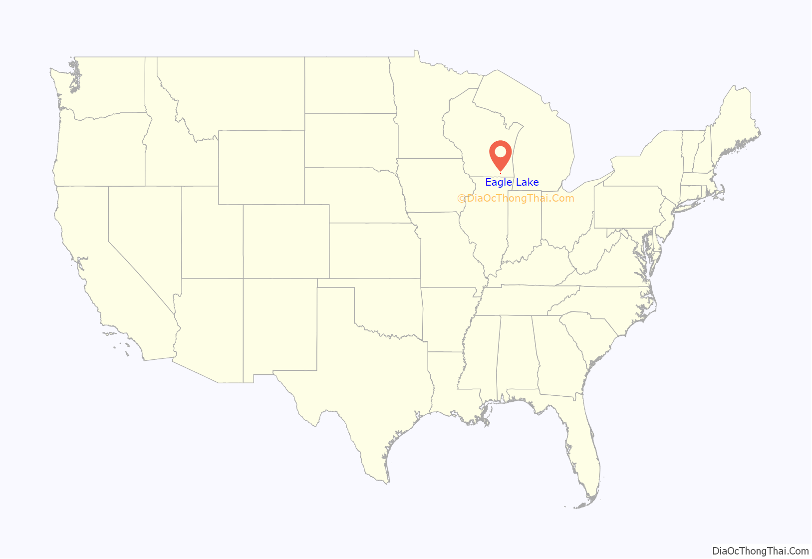
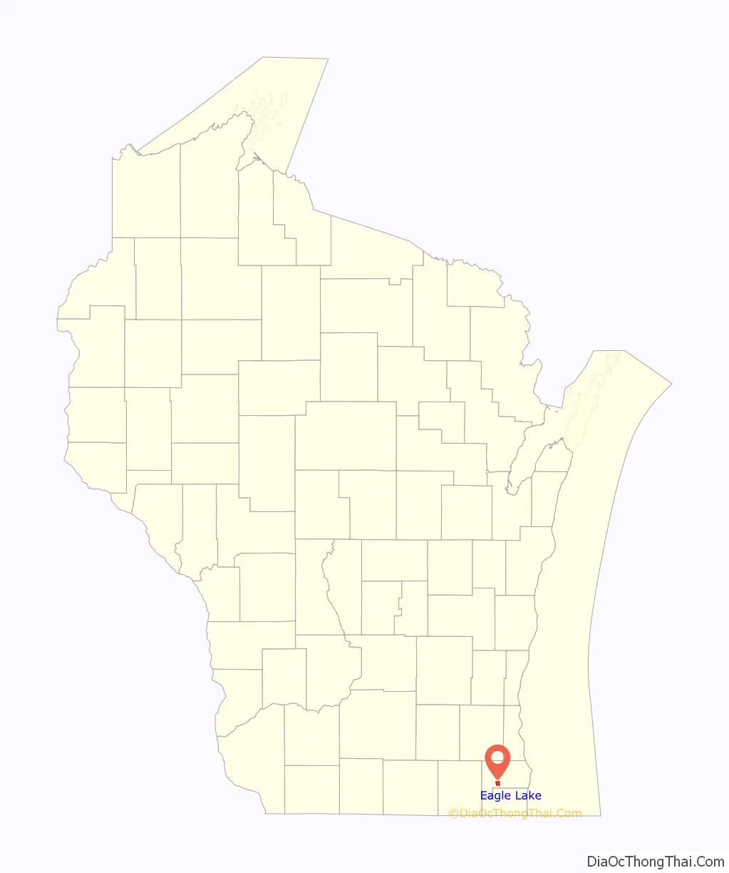
Eagle Lake location map. Where is Eagle Lake CDP?
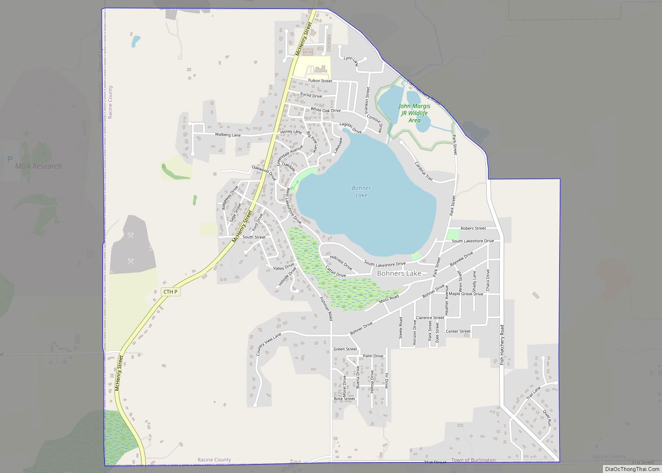
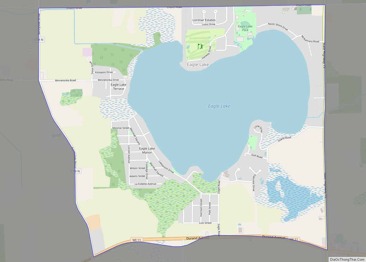
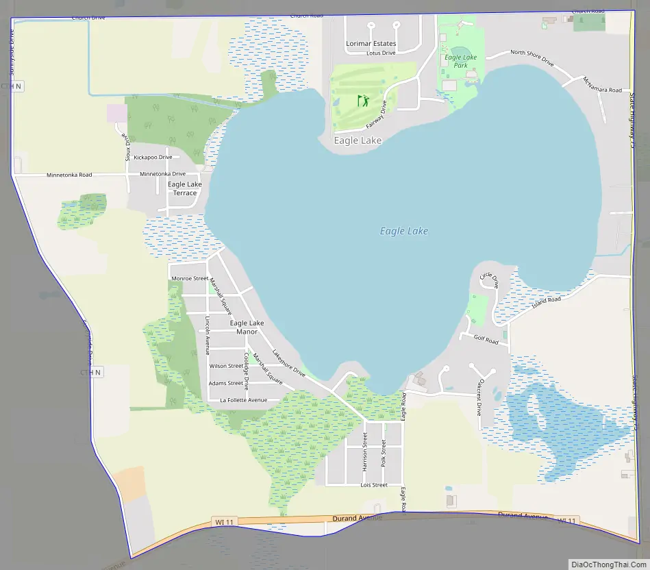
Eagle Lake Road Map
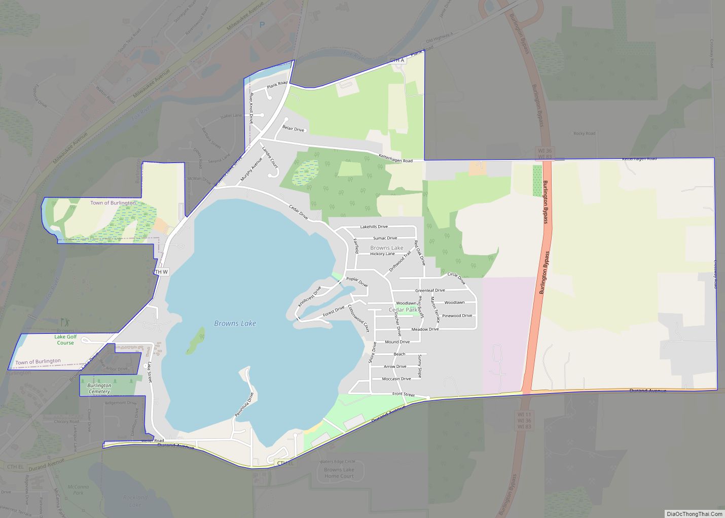
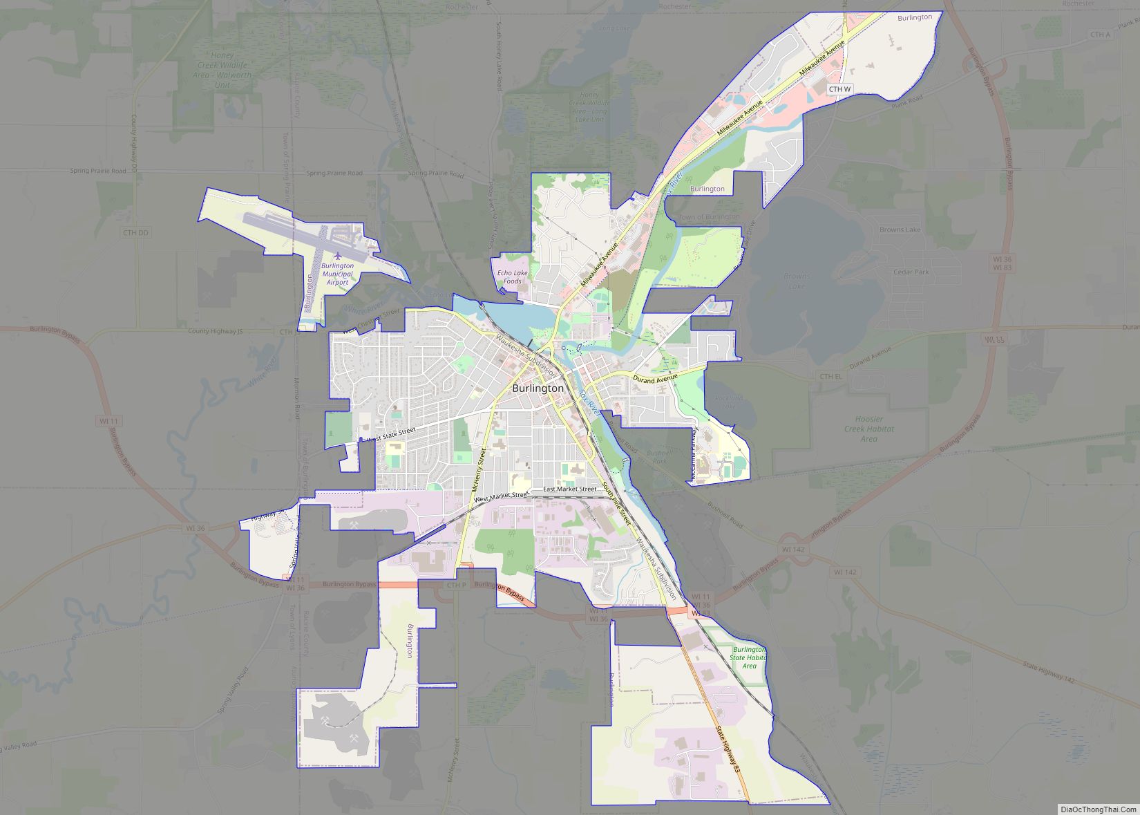
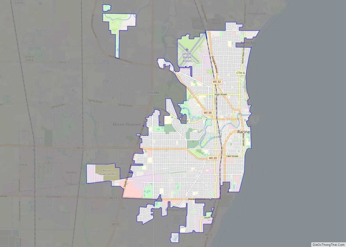
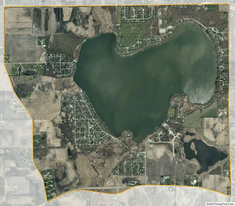
Eagle Lake city Satellite Map
Geography
Eagle Lake is located at 42°41′51″N 88°8′1″W / 42.69750°N 88.13361°W / 42.69750; -88.13361 (42.697369, -88.133741).
According to the United States Census Bureau, the CDP has a total area of 3.0 square miles (7.8 km), of which, 2.2 square miles (5.7 km) of it is land and 0.8 square miles (2.1 km) of it (27.00%) is water
Racine County’s Eagle Lake Park is located on the north side of the lake. The park’s entrance is found on Church Road, approximately one quarter of a mile west of Wisconsin Highway 75. Eagle Lake Park includes green space, a public boat launch, a baseball/softball diamond, several picnic areas (including a covered partitioned pavilion), restrooms, as well as playground equipment.
See also
Map of Wisconsin State and its subdivision:- Adams
- Ashland
- Barron
- Bayfield
- Brown
- Buffalo
- Burnett
- Calumet
- Chippewa
- Clark
- Columbia
- Crawford
- Dane
- Dodge
- Door
- Douglas
- Dunn
- Eau Claire
- Florence
- Fond du Lac
- Forest
- Grant
- Green
- Green Lake
- Iowa
- Iron
- Jackson
- Jefferson
- Juneau
- Kenosha
- Kewaunee
- La Crosse
- Lafayette
- Lake Michigan
- Lake Superior
- Langlade
- Lincoln
- Manitowoc
- Marathon
- Marinette
- Marquette
- Menominee
- Milwaukee
- Monroe
- Oconto
- Oneida
- Outagamie
- Ozaukee
- Pepin
- Pierce
- Polk
- Portage
- Price
- Racine
- Richland
- Rock
- Rusk
- Saint Croix
- Sauk
- Sawyer
- Shawano
- Sheboygan
- Taylor
- Trempealeau
- Vernon
- Vilas
- Walworth
- Washburn
- Washington
- Waukesha
- Waupaca
- Waushara
- Winnebago
- Wood
- Alabama
- Alaska
- Arizona
- Arkansas
- California
- Colorado
- Connecticut
- Delaware
- District of Columbia
- Florida
- Georgia
- Hawaii
- Idaho
- Illinois
- Indiana
- Iowa
- Kansas
- Kentucky
- Louisiana
- Maine
- Maryland
- Massachusetts
- Michigan
- Minnesota
- Mississippi
- Missouri
- Montana
- Nebraska
- Nevada
- New Hampshire
- New Jersey
- New Mexico
- New York
- North Carolina
- North Dakota
- Ohio
- Oklahoma
- Oregon
- Pennsylvania
- Rhode Island
- South Carolina
- South Dakota
- Tennessee
- Texas
- Utah
- Vermont
- Virginia
- Washington
- West Virginia
- Wisconsin
- Wyoming