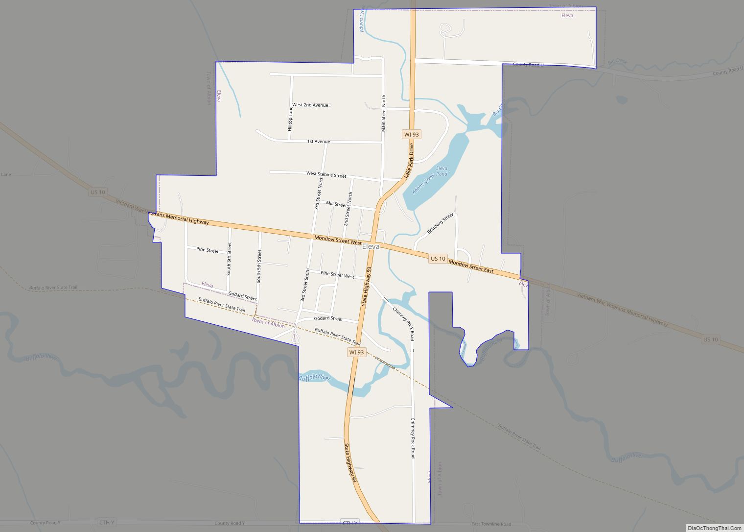
Eleva is a village in Trempealeau County, Wisconsin, along the Buffalo River. The population was 670 at the 2010 Census and reached 685 in the 2020 Census.
| Name: | Eleva village |
|---|---|
| LSAD Code: | 47 |
| LSAD Description: | village (suffix) |
| State: | Wisconsin |
| County: | Trempealeau County |
| Elevation: | 863 ft (263 m) |
| Total Area: | 0.58 sq mi (1.50 km²) |
| Land Area: | 0.56 sq mi (1.46 km²) |
| Water Area: | 0.02 sq mi (0.04 km²) |
| Total Population: | 685 |
| Population Density: | 1,266.51/sq mi (489/km²) |
| ZIP code: | 54738 |
| Area code: | 715 & 534 |
| FIPS code: | 5523175 |
| GNISfeature ID: | 1564504 |
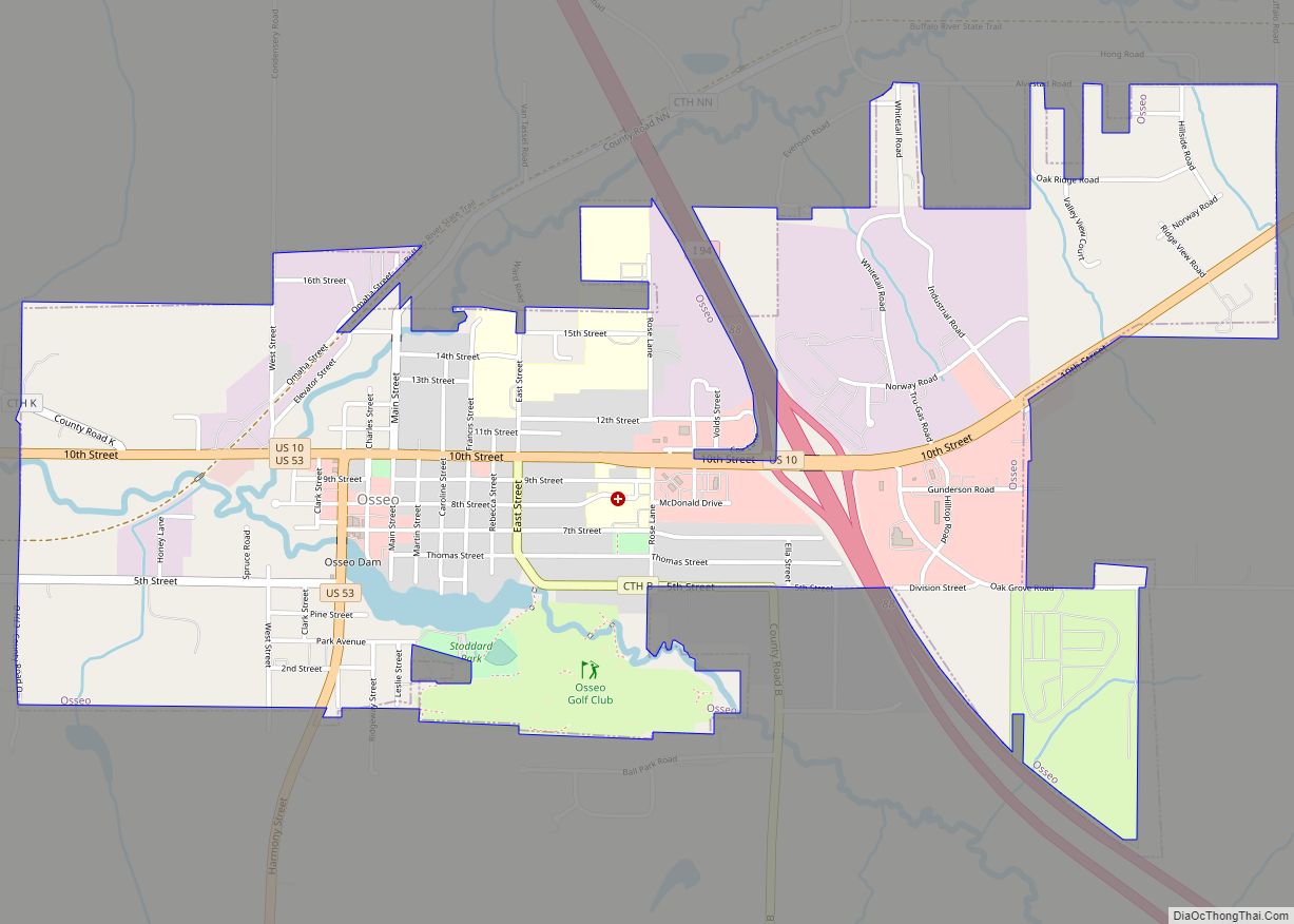
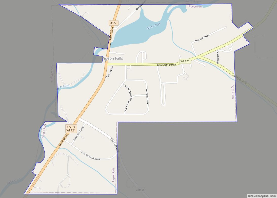
Online Interactive Map
Click on ![]() to view map in "full screen" mode.
to view map in "full screen" mode.
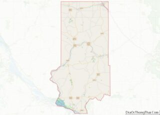
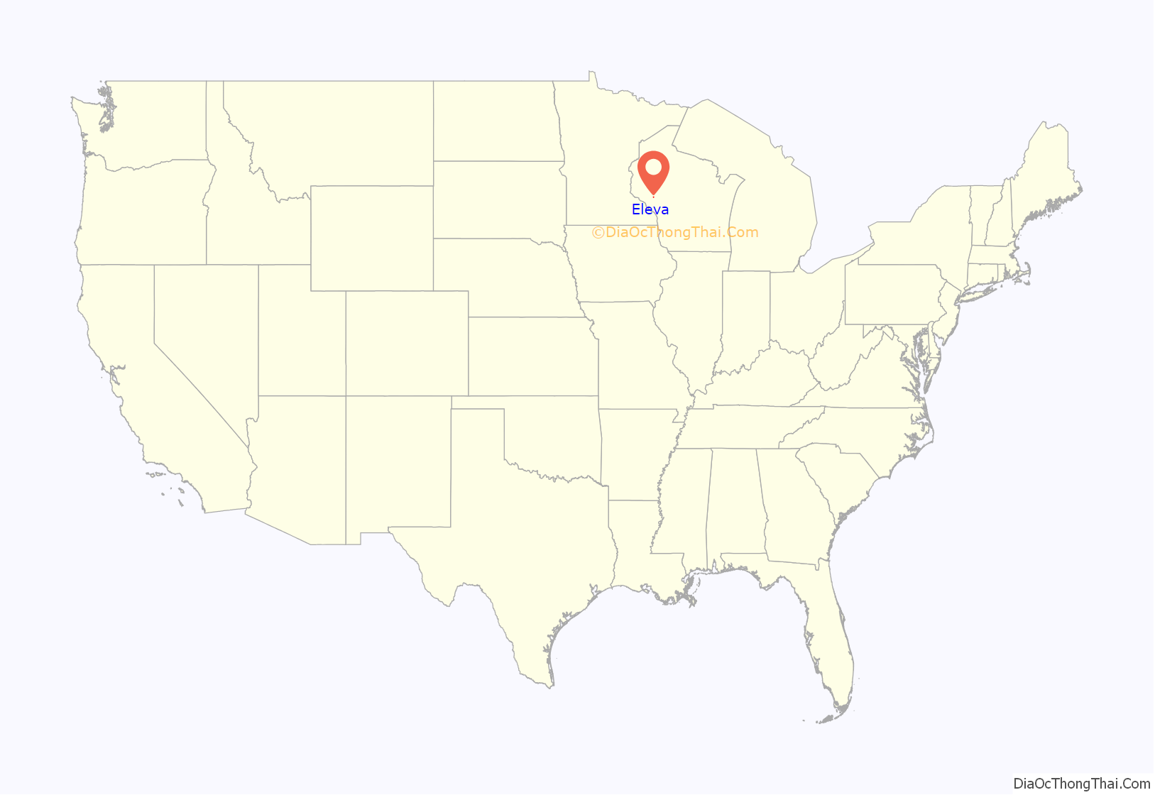
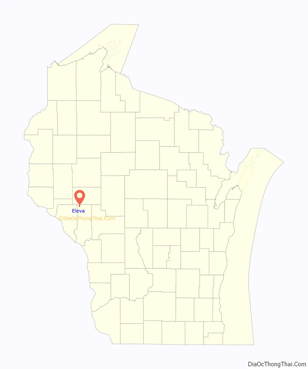
Eleva location map. Where is Eleva village?
History
The village was originally named “New Chicago”. The grain elevator had the letters “ELEVA” painted on it before winter struck. Newcomers assumed the letters were the name of the village. The village was founded in 1880. A post office called Eleva has been in operation since 1885.
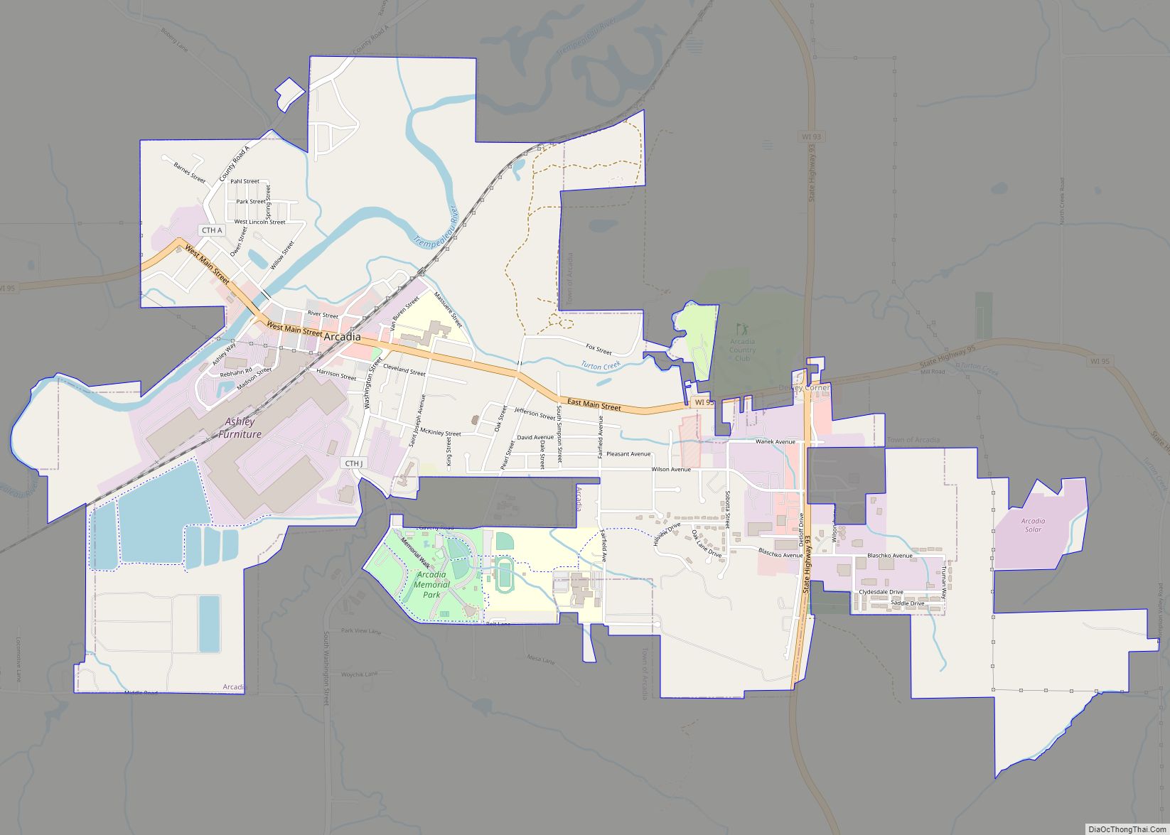
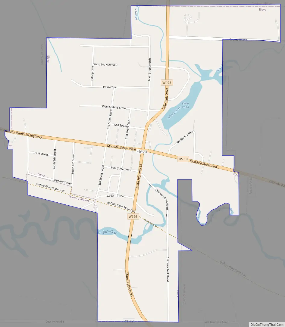
Eleva Road Map
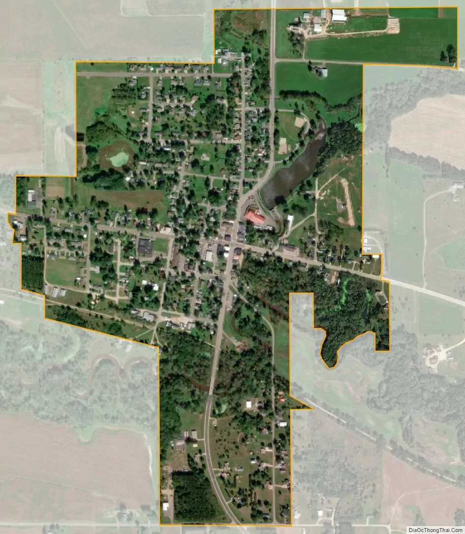
Eleva city Satellite Map
Geography
Eleva is located at 44°34′31″N 91°28′16″W / 44.57528°N 91.47111°W / 44.57528; -91.47111 (44.575298, −91.471019).
According to the United States Census Bureau, the village has a total area of 0.60 square miles (1.55 km), of which, 0.58 square miles (1.50 km) of it is land and 0.02 square miles (0.05 km) is water.
See also
Map of Wisconsin State and its subdivision:- Adams
- Ashland
- Barron
- Bayfield
- Brown
- Buffalo
- Burnett
- Calumet
- Chippewa
- Clark
- Columbia
- Crawford
- Dane
- Dodge
- Door
- Douglas
- Dunn
- Eau Claire
- Florence
- Fond du Lac
- Forest
- Grant
- Green
- Green Lake
- Iowa
- Iron
- Jackson
- Jefferson
- Juneau
- Kenosha
- Kewaunee
- La Crosse
- Lafayette
- Lake Michigan
- Lake Superior
- Langlade
- Lincoln
- Manitowoc
- Marathon
- Marinette
- Marquette
- Menominee
- Milwaukee
- Monroe
- Oconto
- Oneida
- Outagamie
- Ozaukee
- Pepin
- Pierce
- Polk
- Portage
- Price
- Racine
- Richland
- Rock
- Rusk
- Saint Croix
- Sauk
- Sawyer
- Shawano
- Sheboygan
- Taylor
- Trempealeau
- Vernon
- Vilas
- Walworth
- Washburn
- Washington
- Waukesha
- Waupaca
- Waushara
- Winnebago
- Wood
- Alabama
- Alaska
- Arizona
- Arkansas
- California
- Colorado
- Connecticut
- Delaware
- District of Columbia
- Florida
- Georgia
- Hawaii
- Idaho
- Illinois
- Indiana
- Iowa
- Kansas
- Kentucky
- Louisiana
- Maine
- Maryland
- Massachusetts
- Michigan
- Minnesota
- Mississippi
- Missouri
- Montana
- Nebraska
- Nevada
- New Hampshire
- New Jersey
- New Mexico
- New York
- North Carolina
- North Dakota
- Ohio
- Oklahoma
- Oregon
- Pennsylvania
- Rhode Island
- South Carolina
- South Dakota
- Tennessee
- Texas
- Utah
- Vermont
- Virginia
- Washington
- West Virginia
- Wisconsin
- Wyoming