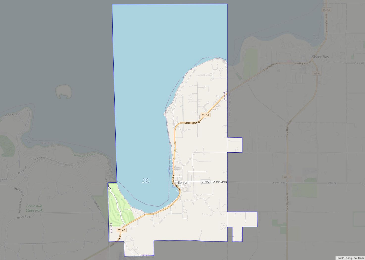
Ephraim is a village in Door County, Wisconsin, United States. It is located across Eagle Harbor from Peninsula State Park. The population was 288 at the 2010 census. The village is known for its white buildings, its views of the bluffs across Eagle Harbor, and its shoreline along Green Bay.
| Name: | Ephraim village |
|---|---|
| LSAD Code: | 47 |
| LSAD Description: | village (suffix) |
| State: | Wisconsin |
| County: | Door County |
| Elevation: | 663 ft (202 m) |
| Total Area: | 8.13 sq mi (21.06 km²) |
| Land Area: | 3.79 sq mi (9.81 km²) |
| Water Area: | 4.34 sq mi (11.25 km²) |
| Total Population: | 288 |
| Population Density: | 73.94/sq mi (28.55/km²) |
| Area code: | 920 |
| FIPS code: | 5524150 |
| GNISfeature ID: | 1564680 |
| Website: | www.ephraim-wisconsin.com |
Online Interactive Map
Click on ![]() to view map in "full screen" mode.
to view map in "full screen" mode.
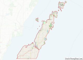
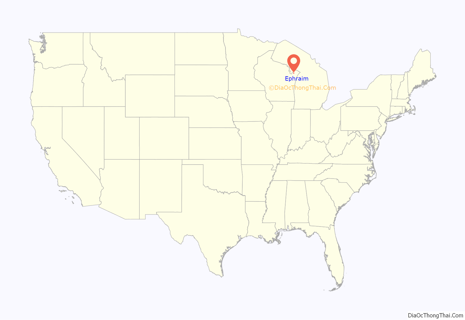
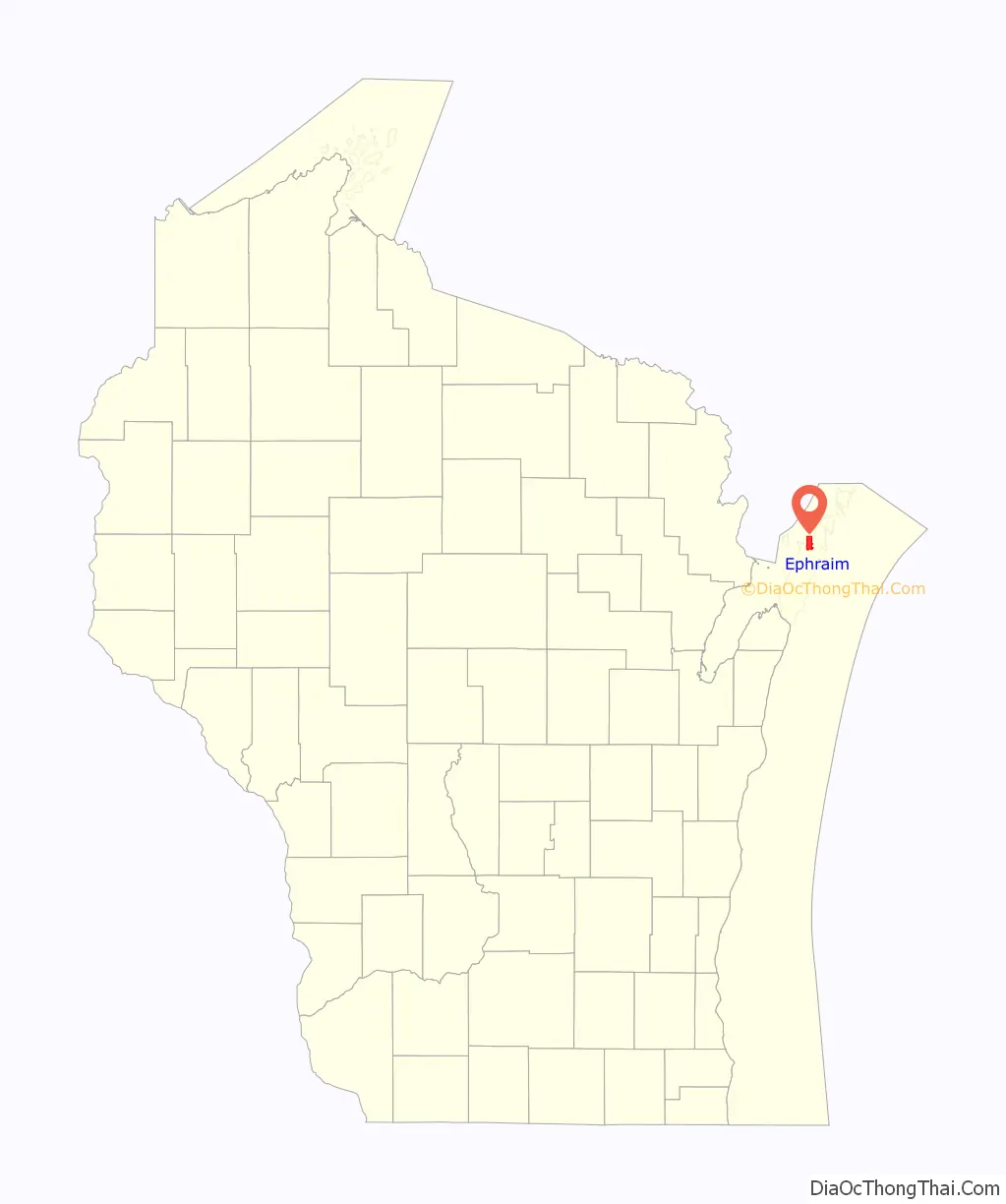
Ephraim location map. Where is Ephraim village?
History
The village was founded in 1853 by the Reverend Andreas Iverson as a Moravian religious community. The steeples of the Ephraim Moravian Church and the Free Evangelical Lutheran Church-Bethania Scandinavian Evangelical Lutheran Congregation are the landmarks of the village as seen from Eagle Harbor. The home of Reverend Iverson, as well as the Anderson Store, the Anderson Barn and History Center, the Pioneer Schoolhouse and the Goodletson log cabin are preserved by the Ephraim Historical Foundation and open to visitors as museums. The Ephraim Historical Foundation also offers walking tours of the village.
Since its founding, the village prohibited alcohol sales or manufacture within the village; it was, until 2016, the only dry municipality in the state of Wisconsin. There were two referendums concerning the sale of liquor within the village, in 1934 and 1992. Both times the citizenry voted decisively to keep the village dry (with majorities of 59% and 74%, respectively). On April 5, 2016, village residents voted on two separate referendums to allow beer and/or wine sales within the village, both of which passed by 56% and 68% majorities.
Ephraim Road Map
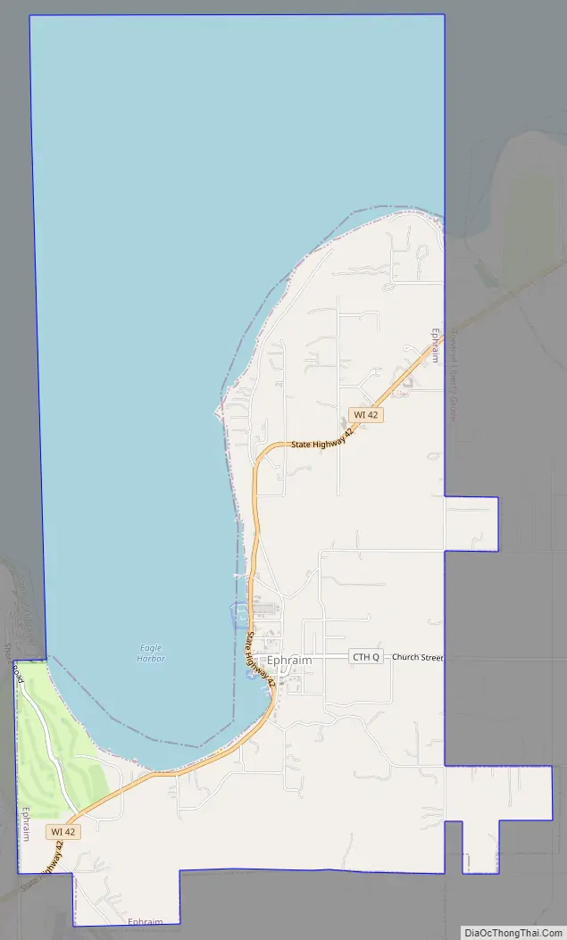
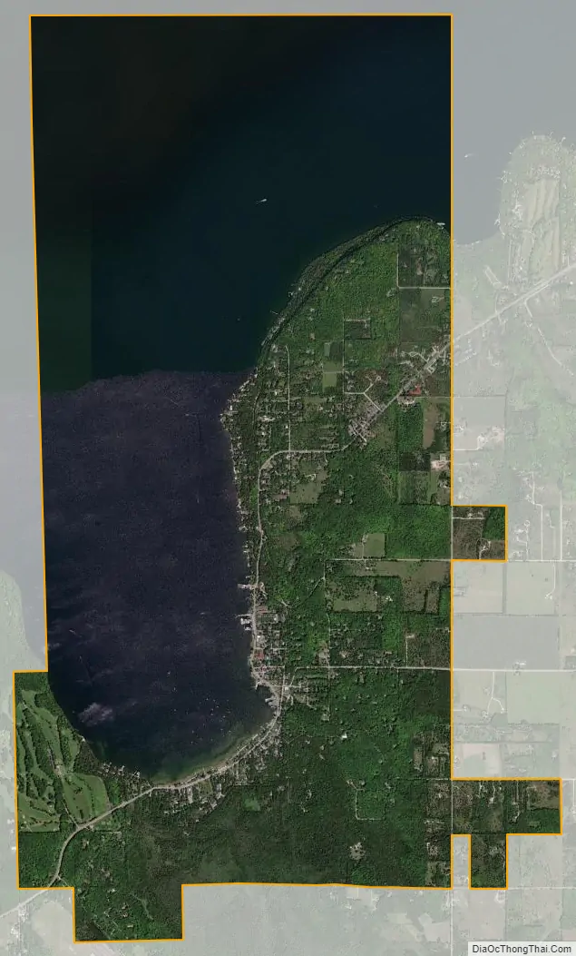
Ephraim city Satellite Map
Geography
To the west is Peninsula State Park; to the east and south are unincorporated parts of the town of Gibraltar. Ephraim is located at 45°9′23″N 87°10′16″W / 45.15639°N 87.17111°W / 45.15639; -87.17111 (45.156509, -87.171047).
According to the United States Census Bureau, the village has a total area of 7.16 square miles (18.54 km), of which, 3.79 square miles (9.82 km) of it is land and 3.37 square miles (8.73 km) is water.
The highest point in the village (at the north end of North Orchard St.) is about 788 feet (240 m) above sea level, or 210 feet (64 m) above the surface of Green Bay.
Climate
The climate in Ephraim is temperate, with warm summers and cold winters.
See also
Map of Wisconsin State and its subdivision:- Adams
- Ashland
- Barron
- Bayfield
- Brown
- Buffalo
- Burnett
- Calumet
- Chippewa
- Clark
- Columbia
- Crawford
- Dane
- Dodge
- Door
- Douglas
- Dunn
- Eau Claire
- Florence
- Fond du Lac
- Forest
- Grant
- Green
- Green Lake
- Iowa
- Iron
- Jackson
- Jefferson
- Juneau
- Kenosha
- Kewaunee
- La Crosse
- Lafayette
- Lake Michigan
- Lake Superior
- Langlade
- Lincoln
- Manitowoc
- Marathon
- Marinette
- Marquette
- Menominee
- Milwaukee
- Monroe
- Oconto
- Oneida
- Outagamie
- Ozaukee
- Pepin
- Pierce
- Polk
- Portage
- Price
- Racine
- Richland
- Rock
- Rusk
- Saint Croix
- Sauk
- Sawyer
- Shawano
- Sheboygan
- Taylor
- Trempealeau
- Vernon
- Vilas
- Walworth
- Washburn
- Washington
- Waukesha
- Waupaca
- Waushara
- Winnebago
- Wood
- Alabama
- Alaska
- Arizona
- Arkansas
- California
- Colorado
- Connecticut
- Delaware
- District of Columbia
- Florida
- Georgia
- Hawaii
- Idaho
- Illinois
- Indiana
- Iowa
- Kansas
- Kentucky
- Louisiana
- Maine
- Maryland
- Massachusetts
- Michigan
- Minnesota
- Mississippi
- Missouri
- Montana
- Nebraska
- Nevada
- New Hampshire
- New Jersey
- New Mexico
- New York
- North Carolina
- North Dakota
- Ohio
- Oklahoma
- Oregon
- Pennsylvania
- Rhode Island
- South Carolina
- South Dakota
- Tennessee
- Texas
- Utah
- Vermont
- Virginia
- Washington
- West Virginia
- Wisconsin
- Wyoming