Sturgeon Bay is a city in and the county seat of Door County, Wisconsin, United States. The population was 9,646 at the 2020 Census. The city is well-known regionally for being the largest city of the Door Peninsula, after which the county is named.
| Name: | Sturgeon Bay city |
|---|---|
| LSAD Code: | 25 |
| LSAD Description: | city (suffix) |
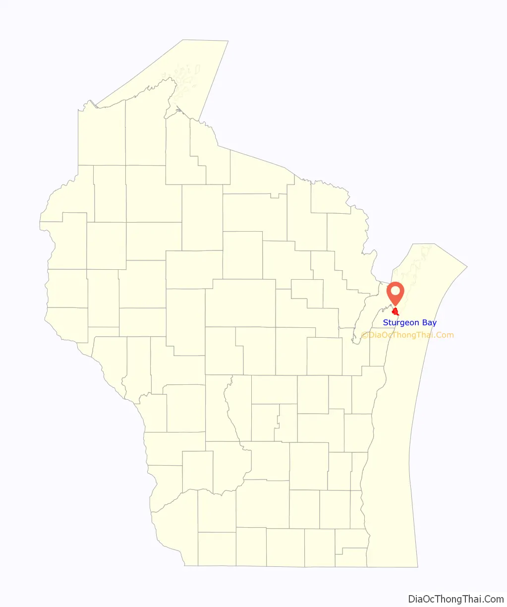
| State: | Wisconsin |
| County: | Door County |
| Total Area: | 11.49 sq mi (29.77 km²) |
| Land Area: | 9.83 sq mi (25.46 km²) |
| Water Area: | 1.66 sq mi (4.31 km²) |
| Total Population: | 9,646 |
| Population Density: | 908.85/sq mi (350.92/km²) |
| Area code: | 920 |
| FIPS code: | 5577875 |
| Website: | www.sturgeonbaywi.org |
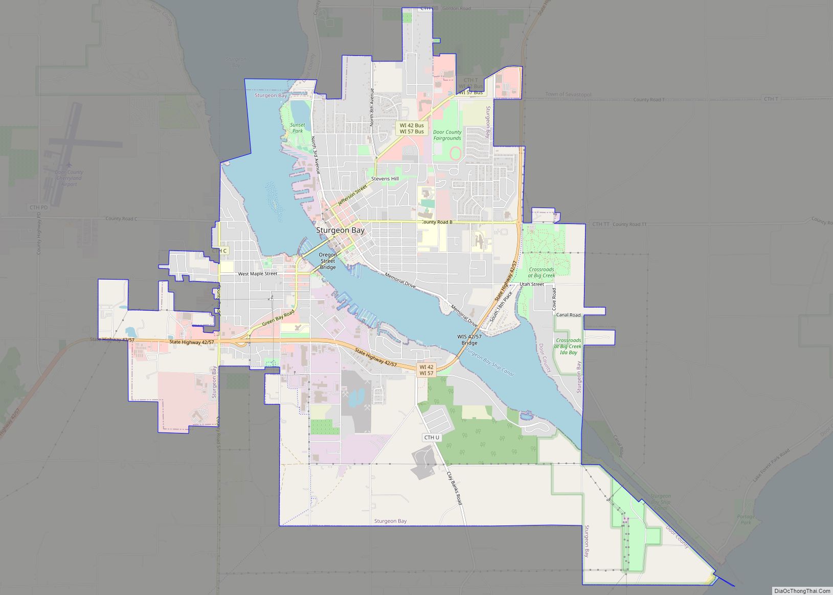
Online Interactive Map
Click on ![]() to view map in "full screen" mode.
to view map in "full screen" mode.
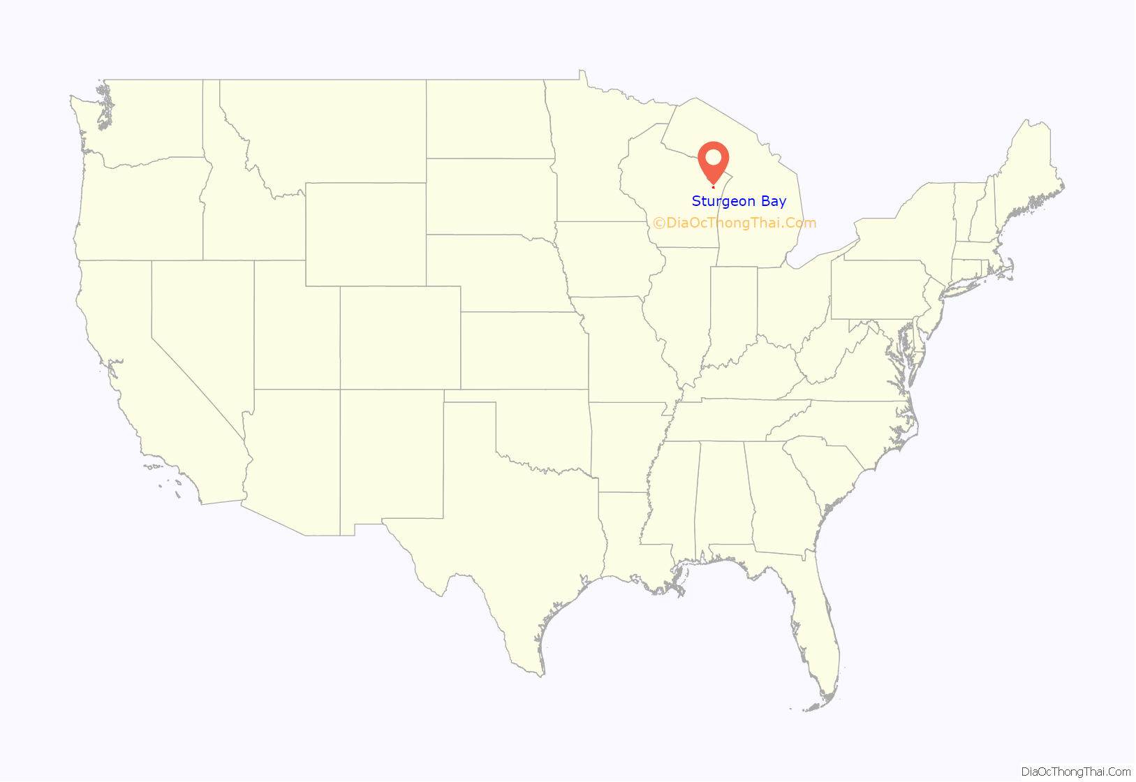
Sturgeon Bay location map. Where is Sturgeon Bay city?
History
The area was originally inhabited by the Ho-Chunk and Menominee. The town is known in the Menominee language as Namāēw-Wīhkit, or “bay of the sturgeon”. The Menominee ceded this territory to the United States in the 1831 Treaty of Washington. After that, the area was available for white settlement.
The community was first recorded as Graham in 1855 but, in 1857, the state legislature organized it as the town of Ottumba. Subsequently, the name was reverted to Graham and, in 1860, a petition was submitted to the county board to change the community’s name to that of the adjacent bay. A company of volunteer firefighters was established in 1869. In 1874, Sturgeon Bay was incorporated as a village. It became a city in 1883, and the police department was founded that year. In 1891, Charles Mitchell Whiteside, a member of the Wisconsin Assembly, sponsored a bill that merged the community of Sawyer with Sturgeon Bay.
The city is locally known for the Sturgeon Bay Bridge at Michigan Street, which at the time of its 1931 opening was the second across the bay and carried the former route of WIS 17 (now WIS 42 and WIS 57/78.
Sturgeon Bay was one of a number of cities in the Midwest to assist with production during World War II.
In 1943, many streets received new names. The former names of some streets are stenciled into older sidewalks.
Historical photos
Sturgeon Bay Road Map
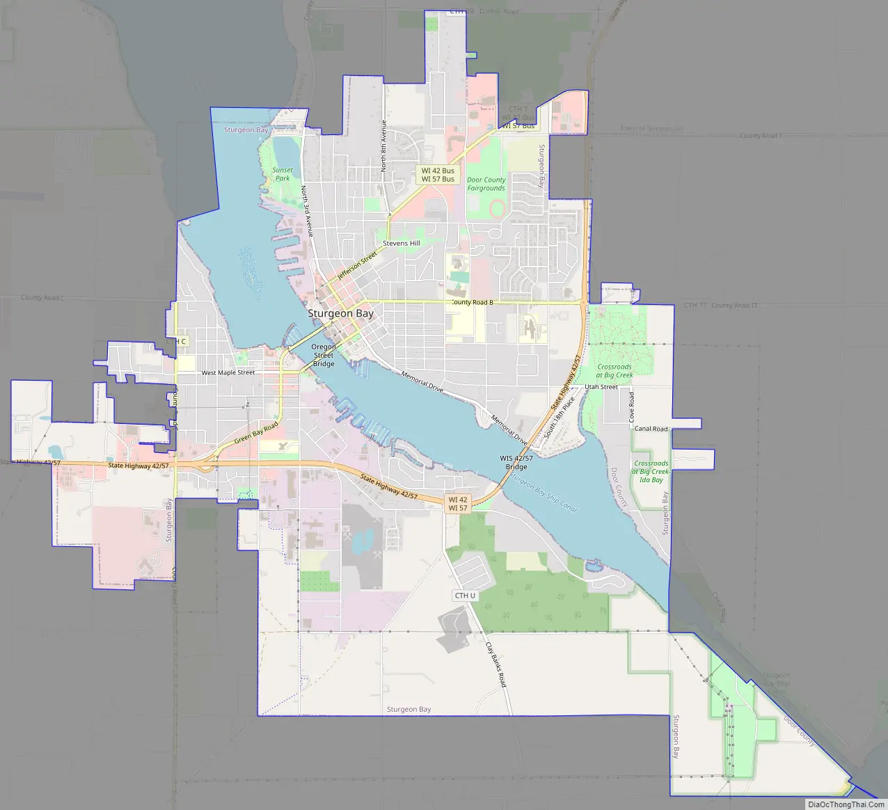
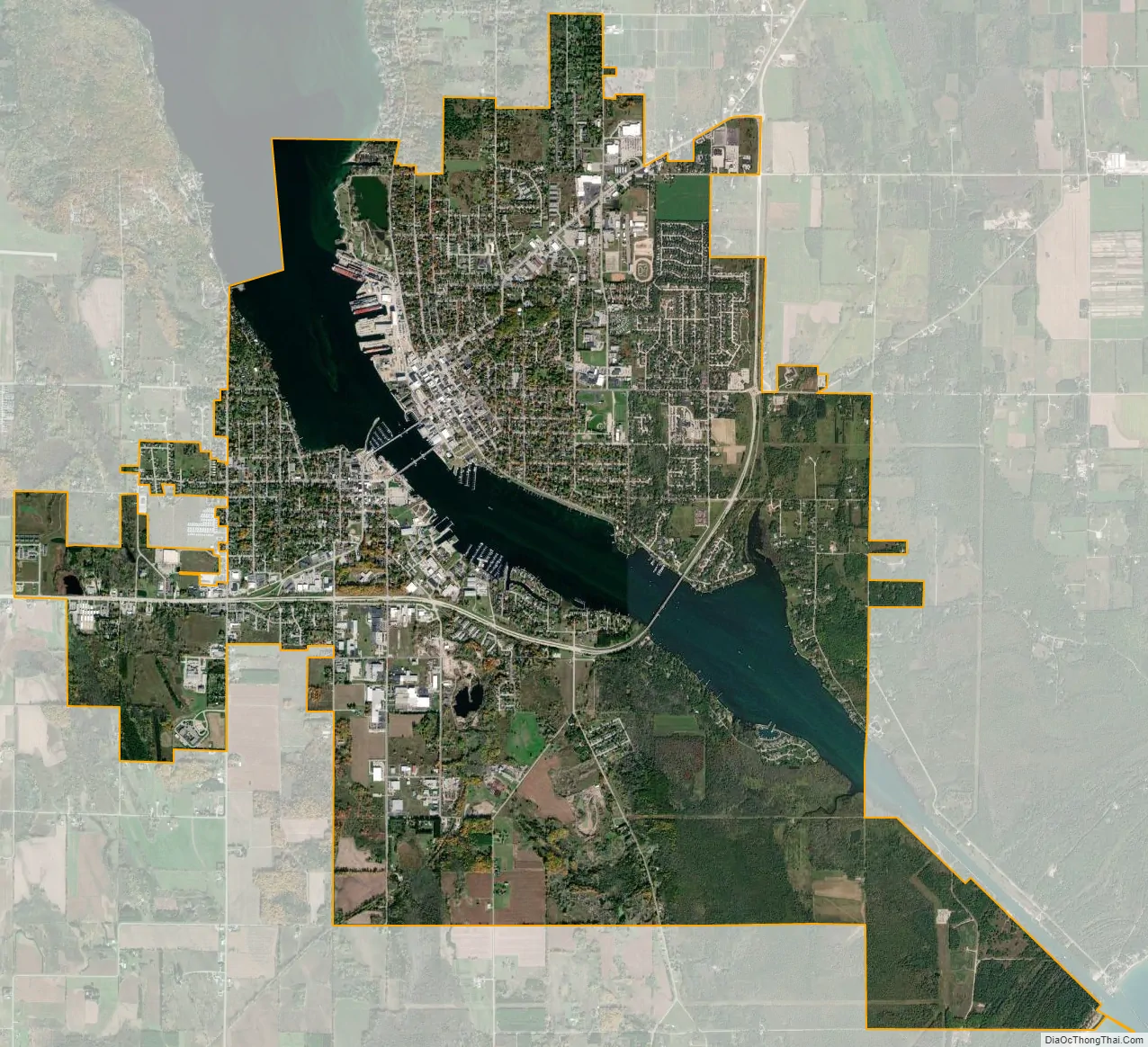
Sturgeon Bay city Satellite Map
Geography
At 584 feet (178 m) above sea level, Sturgeon Bay is located at 44°49′56″N 87°22′19″W / 44.83222°N 87.37194°W / 44.83222; -87.37194 (44.813376, -87.372076). According to the United States Census Bureau, the city has a total area of 11.66 square miles (30.20 km), of which, 9.82 square miles (25.43 km) is land and 1.84 square miles (4.77 km) is water.
Sturgeon Bay is at the natural end of Sturgeon Bay. The Sturgeon Bay Ship Canal was built across the remainder of the Door Peninsula. It is one of several cities along Green Bay, including Green Bay, Marinette and Escanaba, Michigan, and along Lake Michigan north of Manitowoc and south of Manistique, Michigan.
Distance
Sturgeon Bay is 38.4 miles (61.8 km) north of Green Bay, 127 miles (204 km) north of Milwaukee, 169 miles (272 km) south of Houghton, Michigan and 289 miles (465 km) east of Minneapolis. Although Marinette is 21.9 miles (35.2 km) away, people must physically travel towards the bottom of the bay by Green Bay and travel along or nearby the western shore of Green Bay.
Stevens Hill
Stevens Hill is a populated place within the city of Sturgeon Bay, just to the northeast of the downtown. The top of the hill has the highest elevation in the city. It is within Big Hill Park, which is 13.2 acres in area and is used for mountain biking, picnicking, and sledding.
See also
Map of Wisconsin State and its subdivision:- Adams
- Ashland
- Barron
- Bayfield
- Brown
- Buffalo
- Burnett
- Calumet
- Chippewa
- Clark
- Columbia
- Crawford
- Dane
- Dodge
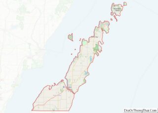
- Door
- Douglas
- Dunn
- Eau Claire
- Florence
- Fond du Lac
- Forest
- Grant
- Green
- Green Lake
- Iowa
- Iron
- Jackson
- Jefferson
- Juneau
- Kenosha
- Kewaunee
- La Crosse
- Lafayette
- Lake Michigan
- Lake Superior
- Langlade
- Lincoln
- Manitowoc
- Marathon
- Marinette
- Marquette
- Menominee
- Milwaukee
- Monroe
- Oconto
- Oneida
- Outagamie
- Ozaukee
- Pepin
- Pierce
- Polk
- Portage
- Price
- Racine
- Richland
- Rock
- Rusk
- Saint Croix
- Sauk
- Sawyer
- Shawano
- Sheboygan
- Taylor
- Trempealeau
- Vernon
- Vilas
- Walworth
- Washburn
- Washington
- Waukesha
- Waupaca
- Waushara
- Winnebago
- Wood
- Alabama
- Alaska
- Arizona
- Arkansas
- California
- Colorado
- Connecticut
- Delaware
- District of Columbia
- Florida
- Georgia
- Hawaii
- Idaho
- Illinois
- Indiana
- Iowa
- Kansas
- Kentucky
- Louisiana
- Maine
- Maryland
- Massachusetts
- Michigan
- Minnesota
- Mississippi
- Missouri
- Montana
- Nebraska
- Nevada
- New Hampshire
- New Jersey
- New Mexico
- New York
- North Carolina
- North Dakota
- Ohio
- Oklahoma
- Oregon
- Pennsylvania
- Rhode Island
- South Carolina
- South Dakota
- Tennessee
- Texas
- Utah
- Vermont
- Virginia
- Washington
- West Virginia
- Wisconsin
- Wyoming