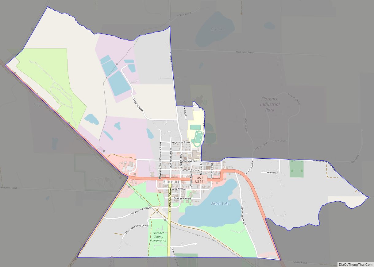
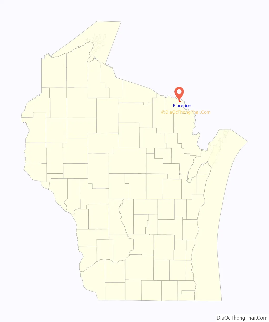
Florence is a census-designated place in and the county seat of Florence County, Wisconsin, United States. Florence is located in northern Florence County, in the town of Florence. Florence has a post office with ZIP code 54121. The community was named a census-designated place in 2010. As of the 2010 census, its population was 592.
| Name: | Florence CDP |
|---|---|
| LSAD Code: | 57 |
| LSAD Description: | CDP (suffix) |
| State: | Wisconsin |
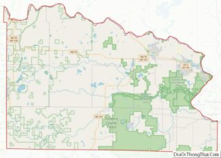
| County: | Florence County |
| Elevation: | 1,306 ft (398 m) |
| Total Area: | 1.783 sq mi (4.62 km²) |
| Land Area: | 1.704 sq mi (4.41 km²) |
| Water Area: | 0.079 sq mi (0.20 km²) |
| Total Population: | 592 |
| Population Density: | 330/sq mi (130/km²) |
| ZIP code: | 54121 |
| Area code: | 715 & 534 |
| FIPS code: | 5526175 |
| GNISfeature ID: | 1565079 |
Online Interactive Map
Click on ![]() to view map in "full screen" mode.
to view map in "full screen" mode.
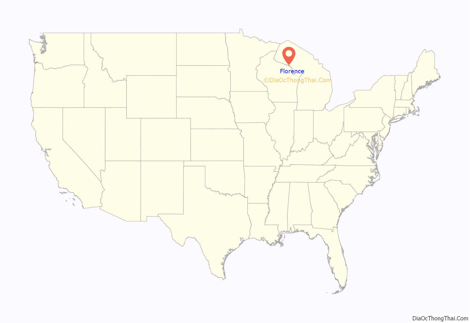
Florence location map. Where is Florence CDP?
History
Florence and the area surrounding belonged to the Menominee and was a hunting and trapping region until iron was discovered there in the 1870s. The Florence Mine was discovered in October of 1874 by H. D. Fisher. The mine was named in 1879 after the wife of Nelson Powell Hulst, Florence Terry Hulst.
The county subsequently took on the same name.
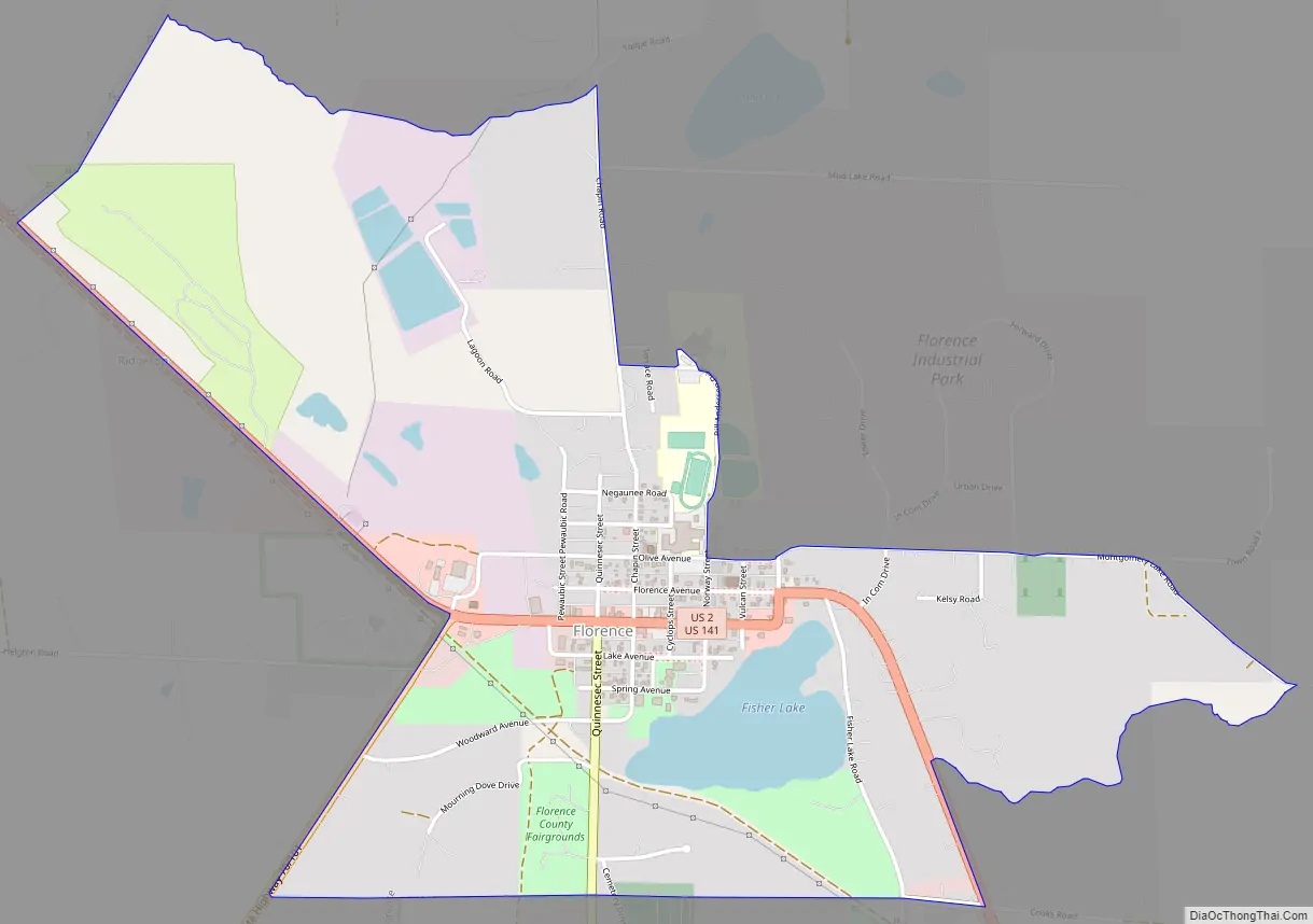
Florence Road Map
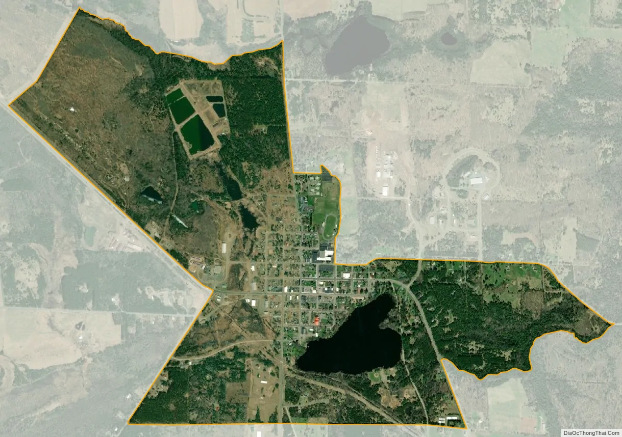
Florence city Satellite Map
Geography
Florence is located at 45°55′20″N 88°15′06″W / 45.92222°N 88.25167°W / 45.92222; -88.25167 at an elevation of 1,306 feet (398 m). Florence is situated in the Northern Highland region of Wisconsin near the Michigan border. Fisher Lake is located to the south of the community, and Fisher Creek runs to its east. The community of Commonwealth is 1 mile (1.6 km) south of Florence. The nearest city to Florence is Iron Mountain, which is 11.5 miles (18.5 km) to the southeast; Florence County has no incorporated communities. US Highway 2 and US Highway 141 run through the community, and Wisconsin Highway 70 and Wisconsin Highway 101 terminate in western Florence; County Highway N also serves the community.
See also
Map of Wisconsin State and its subdivision:- Adams
- Ashland
- Barron
- Bayfield
- Brown
- Buffalo
- Burnett
- Calumet
- Chippewa
- Clark
- Columbia
- Crawford
- Dane
- Dodge
- Door
- Douglas
- Dunn
- Eau Claire
- Florence
- Fond du Lac
- Forest
- Grant
- Green
- Green Lake
- Iowa
- Iron
- Jackson
- Jefferson
- Juneau
- Kenosha
- Kewaunee
- La Crosse
- Lafayette
- Lake Michigan
- Lake Superior
- Langlade
- Lincoln
- Manitowoc
- Marathon
- Marinette
- Marquette
- Menominee
- Milwaukee
- Monroe
- Oconto
- Oneida
- Outagamie
- Ozaukee
- Pepin
- Pierce
- Polk
- Portage
- Price
- Racine
- Richland
- Rock
- Rusk
- Saint Croix
- Sauk
- Sawyer
- Shawano
- Sheboygan
- Taylor
- Trempealeau
- Vernon
- Vilas
- Walworth
- Washburn
- Washington
- Waukesha
- Waupaca
- Waushara
- Winnebago
- Wood
- Alabama
- Alaska
- Arizona
- Arkansas
- California
- Colorado
- Connecticut
- Delaware
- District of Columbia
- Florida
- Georgia
- Hawaii
- Idaho
- Illinois
- Indiana
- Iowa
- Kansas
- Kentucky
- Louisiana
- Maine
- Maryland
- Massachusetts
- Michigan
- Minnesota
- Mississippi
- Missouri
- Montana
- Nebraska
- Nevada
- New Hampshire
- New Jersey
- New Mexico
- New York
- North Carolina
- North Dakota
- Ohio
- Oklahoma
- Oregon
- Pennsylvania
- Rhode Island
- South Carolina
- South Dakota
- Tennessee
- Texas
- Utah
- Vermont
- Virginia
- Washington
- West Virginia
- Wisconsin
- Wyoming