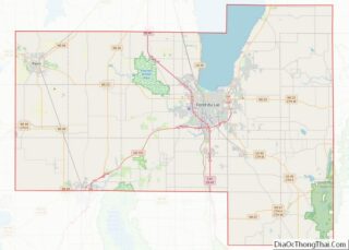
Fond du Lac (/ˈfɒndəˌlæk/) is a city in Fond du Lac County, Wisconsin, United States. The population was 44,678 at the 2020 census. The city forms the core of the United States Census Bureau’s Fond du Lac Metropolitan Statistical Area, which includes all of Fond du Lac County (2020 population: 104,154). Fond du Lac is the 348th largest Metropolitan Statistical Area (MSA) in the United States.
| Name: | Fond du Lac city |
|---|---|
| LSAD Code: | 25 |
| LSAD Description: | city (suffix) |
| State: | Wisconsin |
| County: | Fond du Lac County |
| Incorporated: | 1847 (as a village), 1852 (as a city) |
| Elevation: | 760 ft (232 m) |
| Land Area: | 19.23 sq mi (49.80 km²) |
| Water Area: | 1.31 sq mi (3.39 km²) 6.41% |
| Population Density: | 2,323.8/sq mi (897.2/km²) |
| Area code: | 920 |
| FIPS code: | 5526275 |
| Website: | www.fdl.wi.gov |
Online Interactive Map
Click on ![]() to view map in "full screen" mode.
to view map in "full screen" mode.
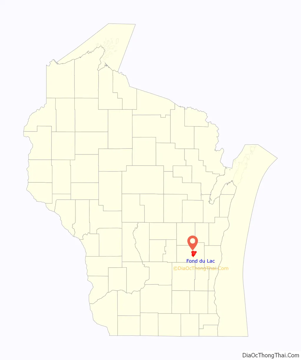
Fond du Lac location map. Where is Fond du Lac city?

History
“Fond du Lac” is French for the “bottom” or the “farthest point” “of the lake,” so named because of its location at the bottom (south end) of Lake Winnebago.
Native American tribes, primarily the Winnebagos but also the Potawatomi, Kickapoo, and Mascoutin lived or gathered in the area long before European explorers arrived. Although the identity of the first European to explore the southern end of Lake Winnebago is uncertain, it was probably Claude-Jean Allouez, followed by French fur trappers. James Doty, a federal judge for the western part of the Michigan Territory, thought the land at the foot of Lake Winnebago might be a good location for a city, so he and his partners bought land in the area. In 1836, during the Wisconsin Territorial Legislature, John Arndt proposed making Fond du Lac the new capital. The motion failed, and Doty convinced the legislature to choose Madison instead. Colwert, Fanna Pier and Alex Tomasik were the first white residents of the area. In 1835, the construction of the Military Ridge Road began. It passed through Fond du Lac, connecting the forts in Wisconsin and Fort Dearborn in Illinois. The first school in Fond du Lac was built in 1843. The first railroad came to the community in 1852. About 1856, the first English-language newspaper in Fond du Lac, the Fond du Lac Commonwealth, was founded. Logging and milling were primary industries in the late 1880s, with access to the lake as the engine of the industry.
From June 1944 to August 1944, the Fond du Lac County Fairgrounds was the site of an Allied prisoner of war camp that held 300 German prisoners of war guarded by 39 U.S. soldiers. The prisoners worked on peas farms and in canneries that summer.
Historic districts
Fond du Lac has 20 listings on the National Register of Historic Places, including four historic districts: the South Main Street Historic District, the North Main Street Historic District, the Linden Street Historic District, and the East Division Street-Sheboygan Street Historic District. Other listings include six houses, two octagon houses, two hotels, a church, a fire station, a train depot, an apartment building, a commercial building, and a prehistoric site. Most of the buildings listed in the register were a result of economic prosperity following the lumber industry boom in the Fox Valley and the newly rich building residences in the area.
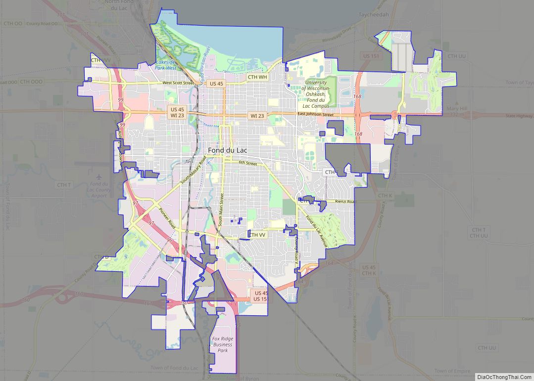
Fond du Lac Road Map
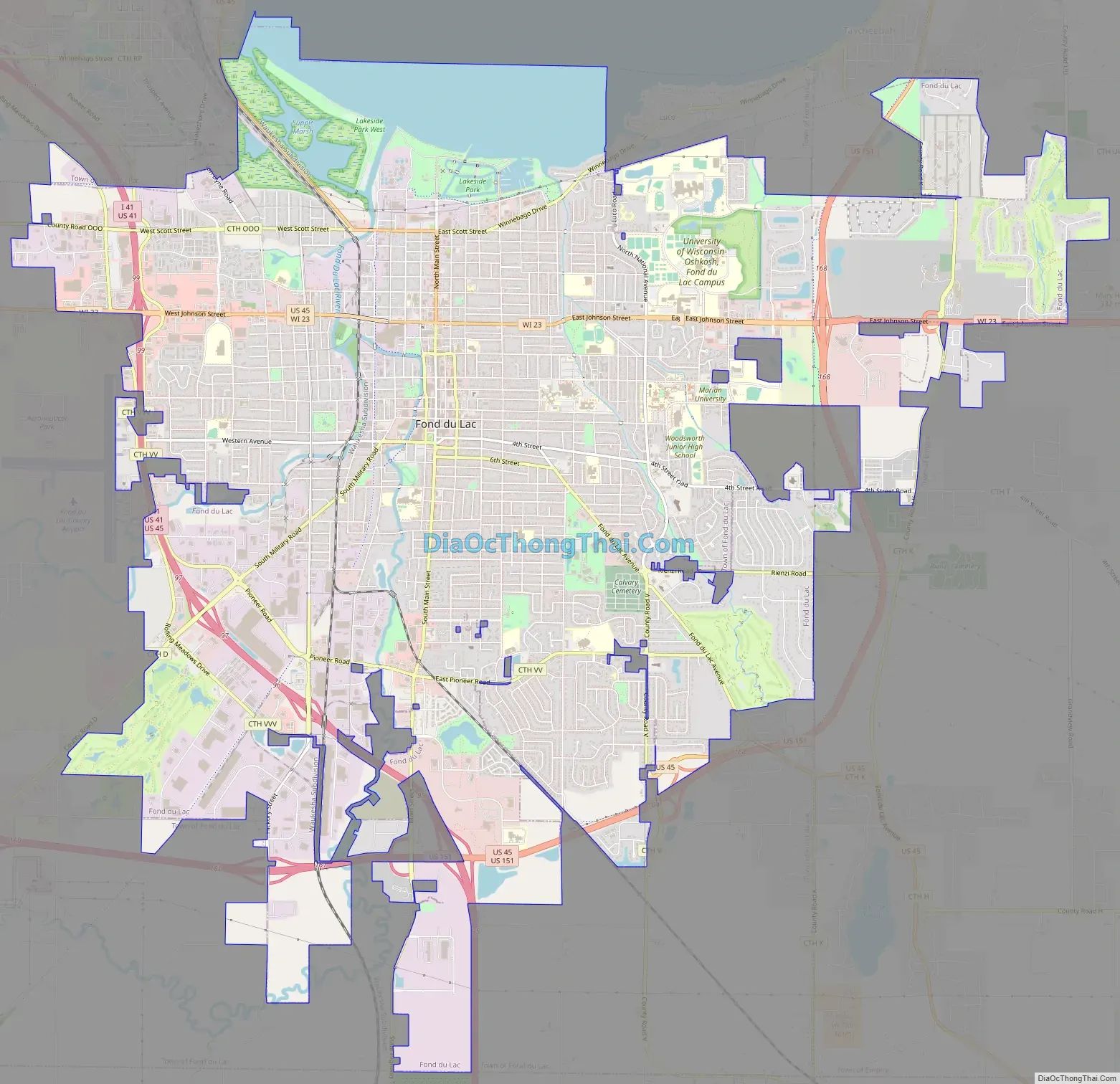
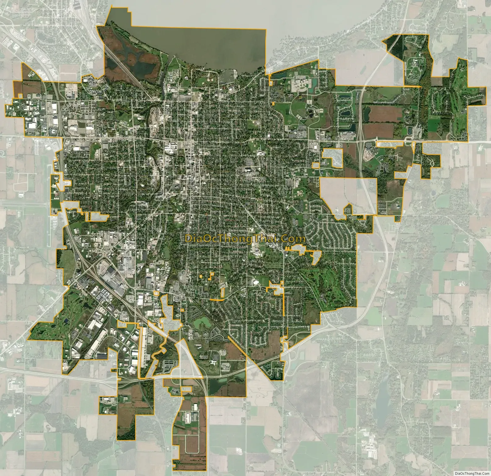
Fond du Lac city Satellite Map
Geography
Fond du Lac is at 43°46′N 88°27′W / 43.767°N 88.450°W / 43.767; -88.450 (43.775, −88.445).
According to the United States Census Bureau, the city has a total area of 20.54 square miles (53.20 km), of which, 19.23 square miles (49.81 km) is land and 1.31 square miles (3.39 km) is water.
Fond du Lac lies on the southern shore of Lake Winnebago. The east and west branches of the Fond du Lac River connect in the city and the river then flows into Lake Winnebago near Lakeside Park.
Climate
As with the rest of Wisconsin, Fond du Lac has a humid continental climate. The record low was −41 °F (−41 °C) on January 30, 1951. The record high was 111 °F (44 °C) on July 13, 1936; the days immediately before and after that date hit 109 °F and 110 °F, respectively.
See also
Map of Wisconsin State and its subdivision:- Adams
- Ashland
- Barron
- Bayfield
- Brown
- Buffalo
- Burnett
- Calumet
- Chippewa
- Clark
- Columbia
- Crawford
- Dane
- Dodge
- Door
- Douglas
- Dunn
- Eau Claire
- Florence
- Fond du Lac
- Forest
- Grant
- Green
- Green Lake
- Iowa
- Iron
- Jackson
- Jefferson
- Juneau
- Kenosha
- Kewaunee
- La Crosse
- Lafayette
- Lake Michigan
- Lake Superior
- Langlade
- Lincoln
- Manitowoc
- Marathon
- Marinette
- Marquette
- Menominee
- Milwaukee
- Monroe
- Oconto
- Oneida
- Outagamie
- Ozaukee
- Pepin
- Pierce
- Polk
- Portage
- Price
- Racine
- Richland
- Rock
- Rusk
- Saint Croix
- Sauk
- Sawyer
- Shawano
- Sheboygan
- Taylor
- Trempealeau
- Vernon
- Vilas
- Walworth
- Washburn
- Washington
- Waukesha
- Waupaca
- Waushara
- Winnebago
- Wood
- Alabama
- Alaska
- Arizona
- Arkansas
- California
- Colorado
- Connecticut
- Delaware
- District of Columbia
- Florida
- Georgia
- Hawaii
- Idaho
- Illinois
- Indiana
- Iowa
- Kansas
- Kentucky
- Louisiana
- Maine
- Maryland
- Massachusetts
- Michigan
- Minnesota
- Mississippi
- Missouri
- Montana
- Nebraska
- Nevada
- New Hampshire
- New Jersey
- New Mexico
- New York
- North Carolina
- North Dakota
- Ohio
- Oklahoma
- Oregon
- Pennsylvania
- Rhode Island
- South Carolina
- South Dakota
- Tennessee
- Texas
- Utah
- Vermont
- Virginia
- Washington
- West Virginia
- Wisconsin
- Wyoming