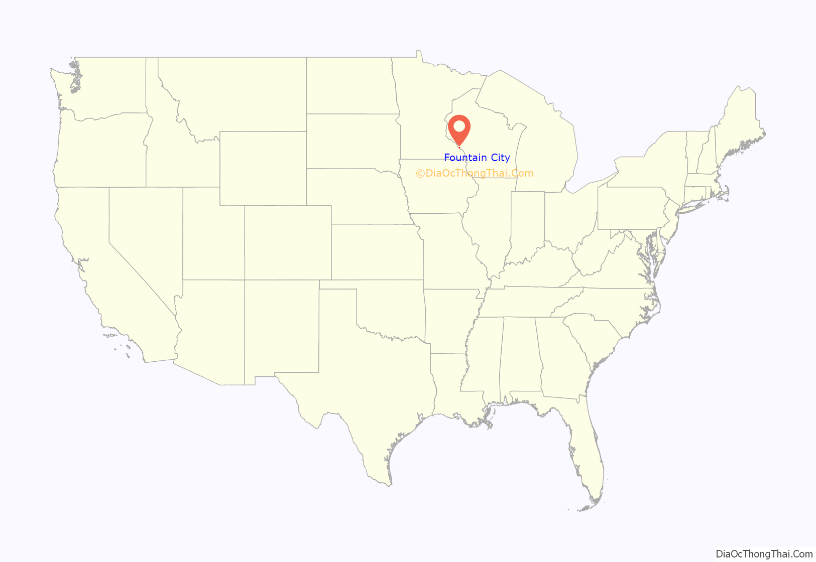
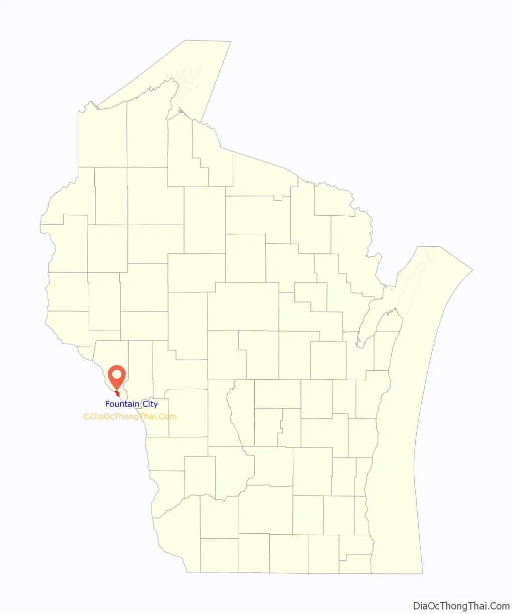
Fountain City is a small city bordering the Mississippi River in Buffalo County, Wisconsin, United States.
The population was 859 at the 2010 census.
| Name: | Fountain City city |
|---|---|
| LSAD Code: | 25 |
| LSAD Description: | city (suffix) |
| State: | Wisconsin |
| County: | Buffalo County |
| Elevation: | 669 ft (204 m) |
| Total Area: | 5.52 sq mi (14.30 km²) |
| Land Area: | 4.38 sq mi (11.33 km²) |
| Water Area: | 1.15 sq mi (2.97 km²) |
| Total Population: | 859 |
| Population Density: | 196.80/sq mi (75.98/km²) |
| Area code: | 608 |
| FIPS code: | 5526850 |
| GNISfeature ID: | 1565171 |
| Website: | www.fountaincitywisconsin.com |
Online Interactive Map
Click on ![]() to view map in "full screen" mode.
to view map in "full screen" mode.
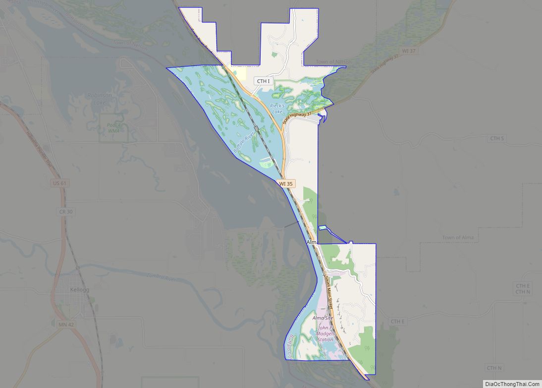
Fountain City location map. Where is Fountain City city?
History
Fountain City was originally called Holmes’ Landing, after Thomas Holmes, who settled there in 1839. Boats would stop at the landing to take on firewood, as well as water from springs not far from the river, leading to the name of Fountain City.
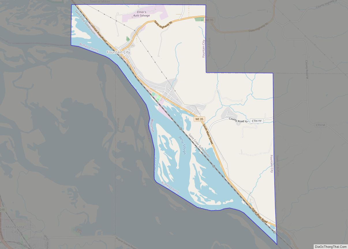
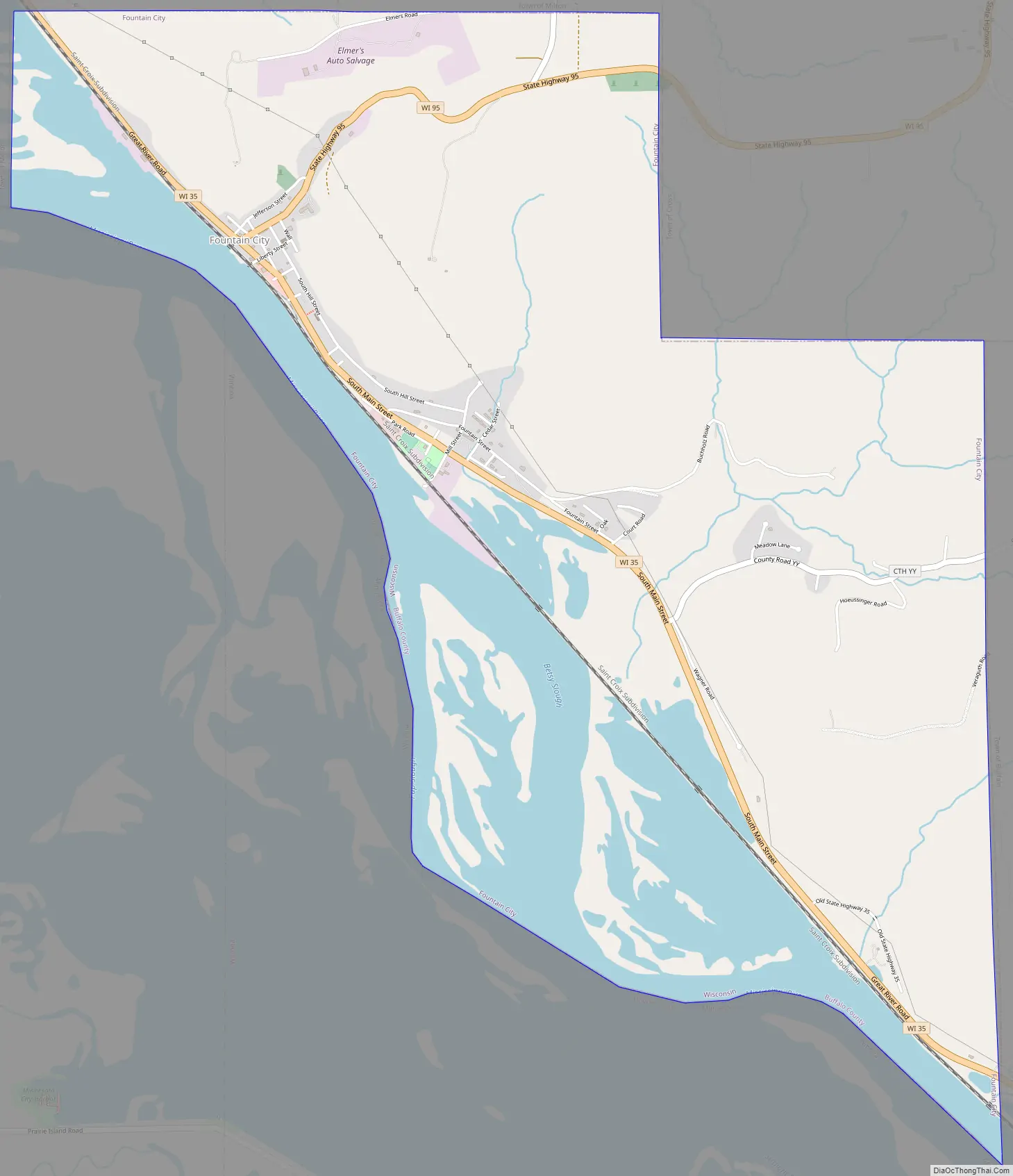
Fountain City Road Map
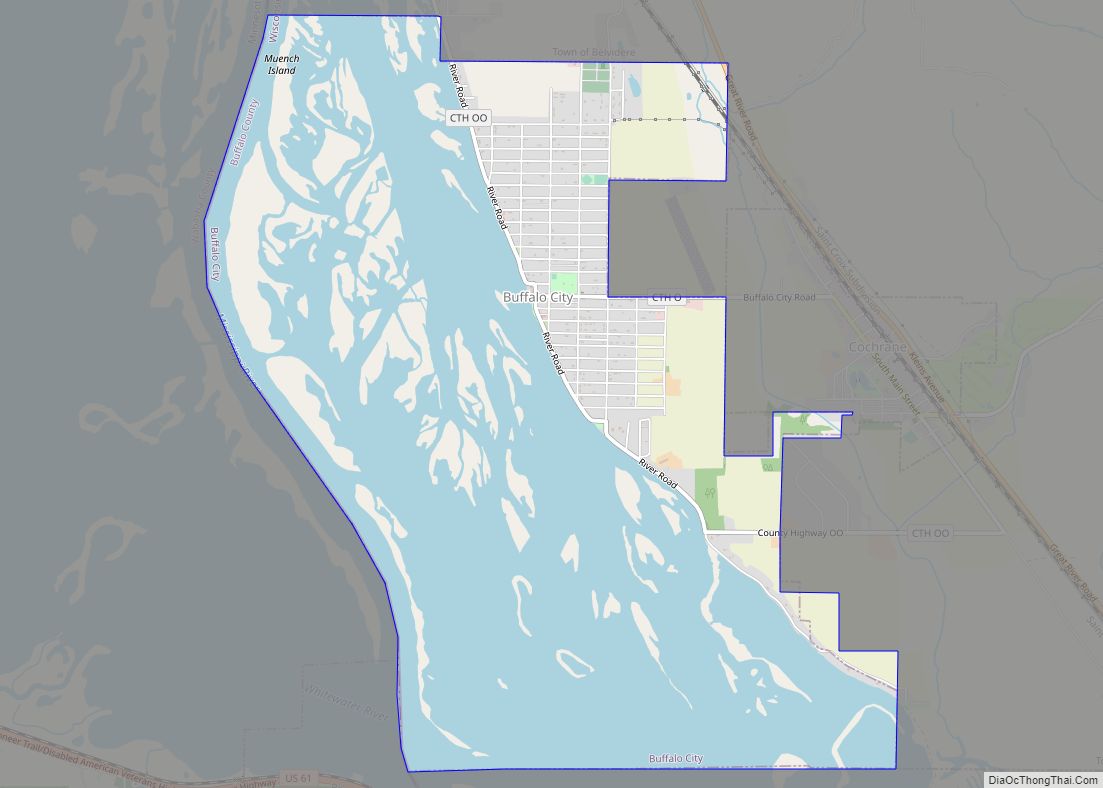
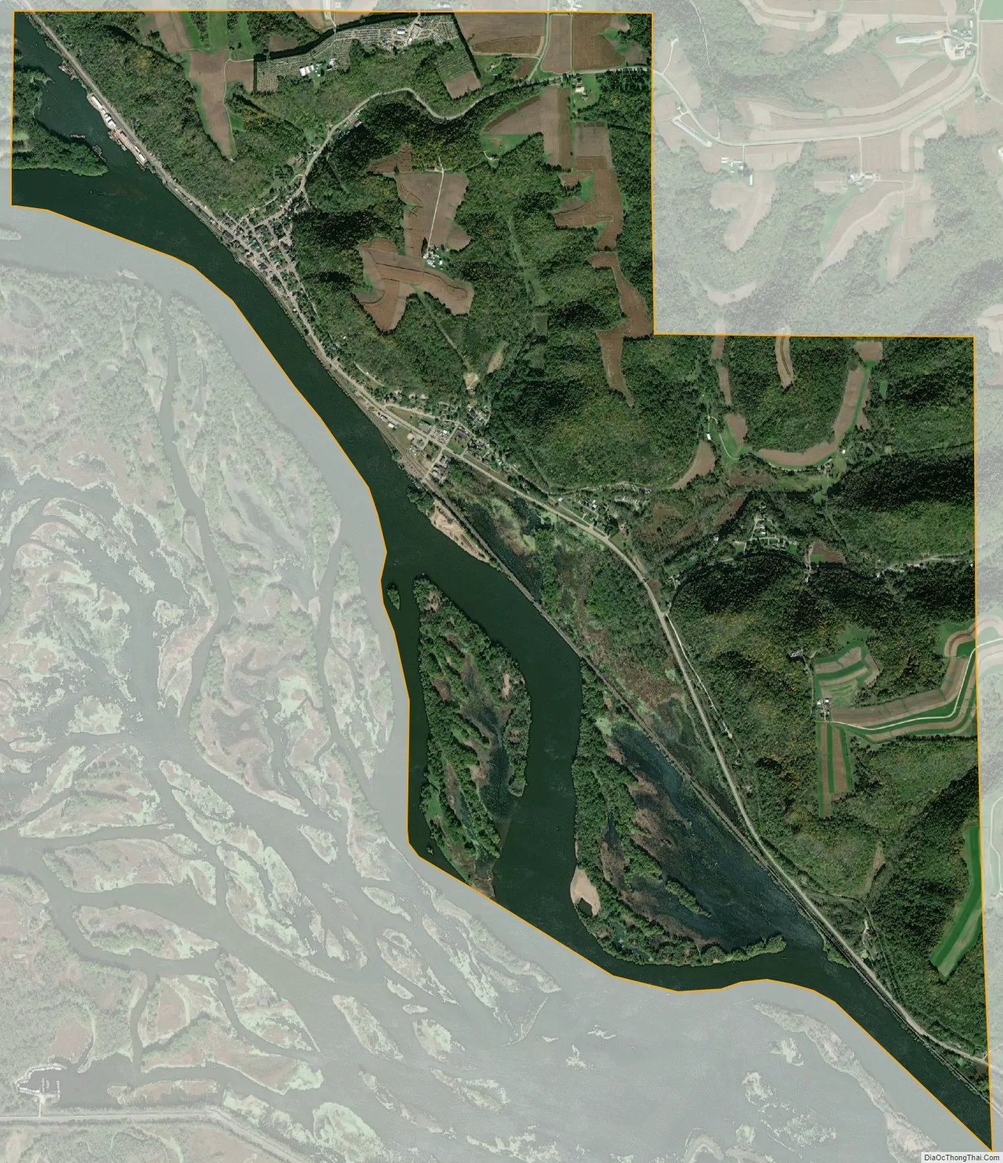
Fountain City city Satellite Map
Geography
Fountain City is located at 44°7′28″N 91°42′34″W / 44.12444°N 91.70944°W / 44.12444; -91.70944 (44.124506, -91.709470), at the intersection of highways 35 and 95.
According to the United States Census Bureau, the city has a total area of 5.57 square miles (14.43 km), of which, 4.29 square miles (11.11 km) are land and 1.28 square miles (3.32 km) are covered by water.
The city is located on a bend in the Mississippi River, where the river flows right at the base of the bluffs on the east side of the valley. Because of this, at some points, the city is only two houses wide; one on each side of Wisconsin Highway 35. Eagle Creek and Waumandee Creek flow into Fountain City Bay northwest of the city limits. Eagle Creek flows around the base of Eagle Bluff, one of the tallest bluffs along the Mississippi.
The steep bluffs are characteristic of the Driftless Area of Wisconsin, Minnesota, and Iowa, a region that was not smoothed over by glacier like much of the rest of the Midwest, but rather deeply cut by runoff from the rapidly melting glaciers.
See also
Map of Wisconsin State and its subdivision:- Adams
- Ashland
- Barron
- Bayfield
- Brown
- Buffalo
- Burnett
- Calumet
- Chippewa
- Clark
- Columbia
- Crawford
- Dane
- Dodge
- Door
- Douglas
- Dunn
- Eau Claire
- Florence
- Fond du Lac
- Forest
- Grant
- Green
- Green Lake
- Iowa
- Iron
- Jackson
- Jefferson
- Juneau
- Kenosha
- Kewaunee
- La Crosse
- Lafayette
- Lake Michigan
- Lake Superior
- Langlade
- Lincoln
- Manitowoc
- Marathon
- Marinette
- Marquette
- Menominee
- Milwaukee
- Monroe
- Oconto
- Oneida
- Outagamie
- Ozaukee
- Pepin
- Pierce
- Polk
- Portage
- Price
- Racine
- Richland
- Rock
- Rusk
- Saint Croix
- Sauk
- Sawyer
- Shawano
- Sheboygan
- Taylor
- Trempealeau
- Vernon
- Vilas
- Walworth
- Washburn
- Washington
- Waukesha
- Waupaca
- Waushara
- Winnebago
- Wood
- Alabama
- Alaska
- Arizona
- Arkansas
- California
- Colorado
- Connecticut
- Delaware
- District of Columbia
- Florida
- Georgia
- Hawaii
- Idaho
- Illinois
- Indiana
- Iowa
- Kansas
- Kentucky
- Louisiana
- Maine
- Maryland
- Massachusetts
- Michigan
- Minnesota
- Mississippi
- Missouri
- Montana
- Nebraska
- Nevada
- New Hampshire
- New Jersey
- New Mexico
- New York
- North Carolina
- North Dakota
- Ohio
- Oklahoma
- Oregon
- Pennsylvania
- Rhode Island
- South Carolina
- South Dakota
- Tennessee
- Texas
- Utah
- Vermont
- Virginia
- Washington
- West Virginia
- Wisconsin
- Wyoming