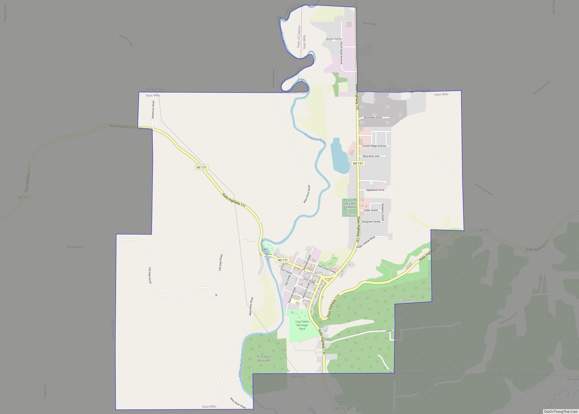
Gays Mills is a village in Crawford County, Wisconsin, United States. The population was 491 at the 2010 census.
| Name: | Gays Mills village |
|---|---|
| LSAD Code: | 47 |
| LSAD Description: | village (suffix) |
| State: | Wisconsin |
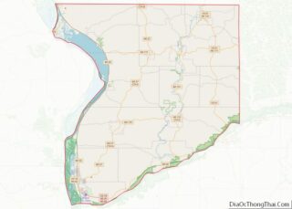
| County: | Crawford County |
| Elevation: | 702 ft (214 m) |
| Total Area: | 4.90 sq mi (12.69 km²) |
| Land Area: | 4.87 sq mi (12.62 km²) |
| Water Area: | 0.03 sq mi (0.07 km²) |
| Total Population: | 491 |
| Population Density: | 104.89/sq mi (40.49/km²) |
| Area code: | 608 |
| FIPS code: | 5528450 |
| GNISfeature ID: | 1565448 |
Online Interactive Map
Click on ![]() to view map in "full screen" mode.
to view map in "full screen" mode.
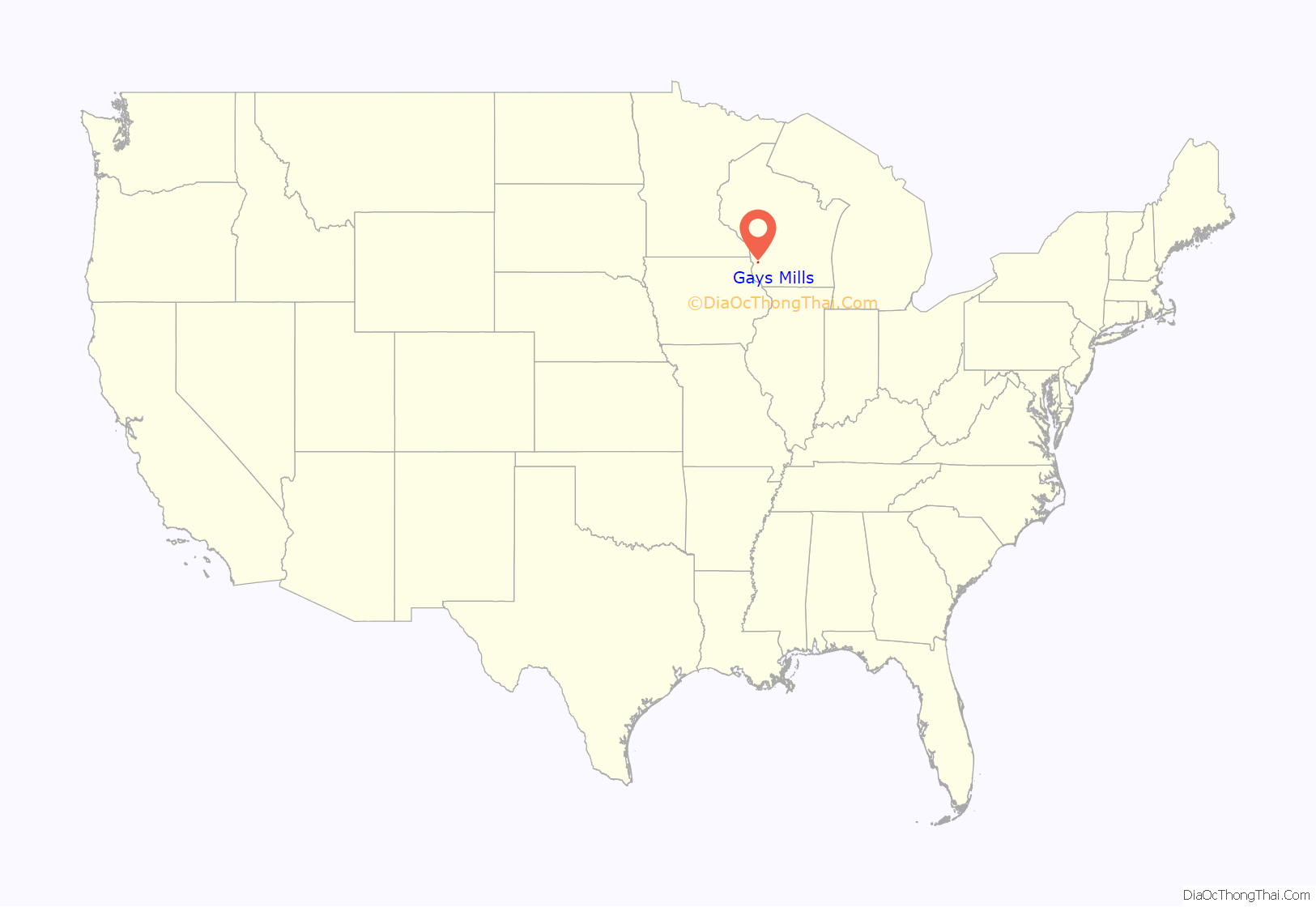
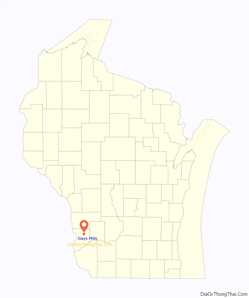
Gays Mills location map. Where is Gays Mills village?
History
In 1847 James B. Gay, a native of Indiana, built a dam and a sawmill on the Kickapoo River, which proved to be a flourishing success. When his health started to fail, James convinced his brothers John and Thomas to move to the area. In 1865 John Gay built the first flour mill south of the saw mill. In 1872 Thomas Gay and family organized the First Congregational Church, the first church in Gays Mills and in 1898 the church building itself was finished. In the years between 1848 and 1865, many families moved into the community, which came to be known as Gays Mills in honor of the founder and his brothers.
Gays Mills was also the home of the Twining apple-growing family. One of the Twinings took his apples to the World’s Fair, where they were a great success, generating mild fame for Gays Mills. Twining and his companions are honored with a historical marker on a hill overlooking the village. Consequently, apples are grown heavily in Crawford County, with numerous commercial orchards surrounding the village.
Flooding
Almost 60 homes were substantially damaged by flooding on the Kickapoo River in 2007 and 2008. In 2008, a meeting was held to discuss moving the village to higher ground because of repeated flooding, which damaged the local economy. In October 2008, the Federal Emergency Management Agency (FEMA) released a 72-page report asking residents and businesses to relocate from the Kickapoo River flood plain. Relocation is estimated to cost $1.7 million to purchase 30 acres (120,000 m) 1-mile (1.6 km) north of the existing location. About 150 of the village’s 230 houses lie in the flood plain. As of October 2008, village leaders were considering what course to take.
In March 2010, a grant of $4.31 million was awarded by the Economic Development Administration to the Village of Gays Mills and the Redevelopment Authority of Gays Mills to develop a strategy for relocating the Village’s commercial district outside of the floodplain.[1] Archived 2010-03-28 at the Wayback Machine
In September 2016, July 2017, and August 2018 Gays Mills was once again hit by flooding.
In July 1951, Wilma Gander, Chief Operator at the Utica Farmers Telephone Company, stayed at the switchboard for 21 hours alerting residents as the Kickapoo River flooded. In 1952, she received The Theodore H. Vail Medal, awarded to telephone employees “in recognition of unusual acts or services.”
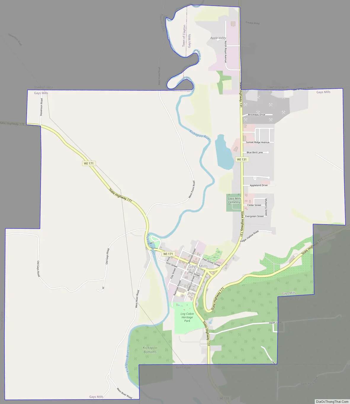
Gays Mills Road Map
Gays Mills city Satellite Map
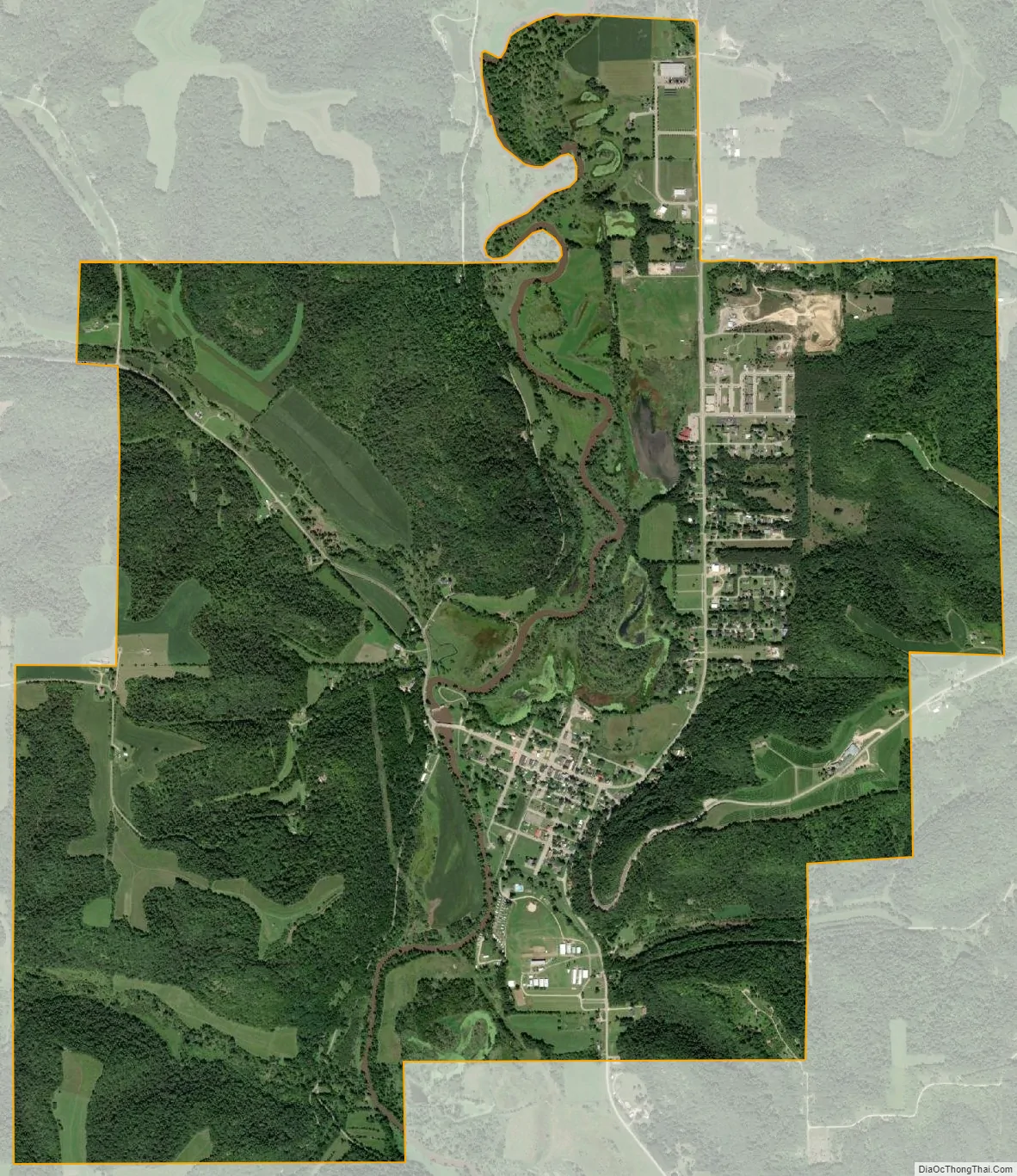
Geography
Gays Mills is located at 43°19′6″N 90°50′48″W / 43.31833°N 90.84667°W / 43.31833; -90.84667 (43.318241, -90.846554).
According to the United States Census Bureau, the village has a total area of 4.90 square miles (12.69 km), of which, 4.87 square miles (12.61 km) of it is land and 0.03 square miles (0.08 km) is water.
See also
Map of Wisconsin State and its subdivision:- Adams
- Ashland
- Barron
- Bayfield
- Brown
- Buffalo
- Burnett
- Calumet
- Chippewa
- Clark
- Columbia
- Crawford
- Dane
- Dodge
- Door
- Douglas
- Dunn
- Eau Claire
- Florence
- Fond du Lac
- Forest
- Grant
- Green
- Green Lake
- Iowa
- Iron
- Jackson
- Jefferson
- Juneau
- Kenosha
- Kewaunee
- La Crosse
- Lafayette
- Lake Michigan
- Lake Superior
- Langlade
- Lincoln
- Manitowoc
- Marathon
- Marinette
- Marquette
- Menominee
- Milwaukee
- Monroe
- Oconto
- Oneida
- Outagamie
- Ozaukee
- Pepin
- Pierce
- Polk
- Portage
- Price
- Racine
- Richland
- Rock
- Rusk
- Saint Croix
- Sauk
- Sawyer
- Shawano
- Sheboygan
- Taylor
- Trempealeau
- Vernon
- Vilas
- Walworth
- Washburn
- Washington
- Waukesha
- Waupaca
- Waushara
- Winnebago
- Wood
- Alabama
- Alaska
- Arizona
- Arkansas
- California
- Colorado
- Connecticut
- Delaware
- District of Columbia
- Florida
- Georgia
- Hawaii
- Idaho
- Illinois
- Indiana
- Iowa
- Kansas
- Kentucky
- Louisiana
- Maine
- Maryland
- Massachusetts
- Michigan
- Minnesota
- Mississippi
- Missouri
- Montana
- Nebraska
- Nevada
- New Hampshire
- New Jersey
- New Mexico
- New York
- North Carolina
- North Dakota
- Ohio
- Oklahoma
- Oregon
- Pennsylvania
- Rhode Island
- South Carolina
- South Dakota
- Tennessee
- Texas
- Utah
- Vermont
- Virginia
- Washington
- West Virginia
- Wisconsin
- Wyoming