Hingham is an unincorporated census-designated place located in the town of Lima, in Sheboygan County, Wisconsin, United States, northeast of Adell and southeast of Waldo. It has a post office with ZIP code 53031. As of the 2010 census, its population was 886.
| Name: | Hingham CDP |
|---|---|
| LSAD Code: | 57 |
| LSAD Description: | CDP (suffix) |
| State: | Wisconsin |
| County: | Sheboygan County |
| Elevation: | 804 ft (245 m) |
| Total Area: | 2.786 sq mi (7.22 km²) |
| Land Area: | 2.695 sq mi (6.98 km²) |
| Water Area: | 0.091 sq mi (0.24 km²) |
| Total Population: | 886 |
| Population Density: | 320/sq mi (120/km²) |
| ZIP code: | 53031 |
| Area code: | 920 |
| FIPS code: | 5535000 |
| GNISfeature ID: | 1566481 |
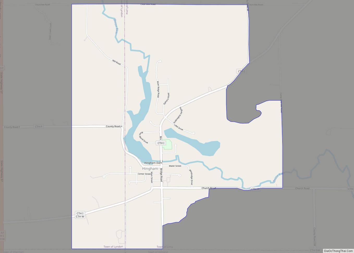
Online Interactive Map
Click on ![]() to view map in "full screen" mode.
to view map in "full screen" mode.
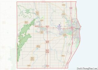
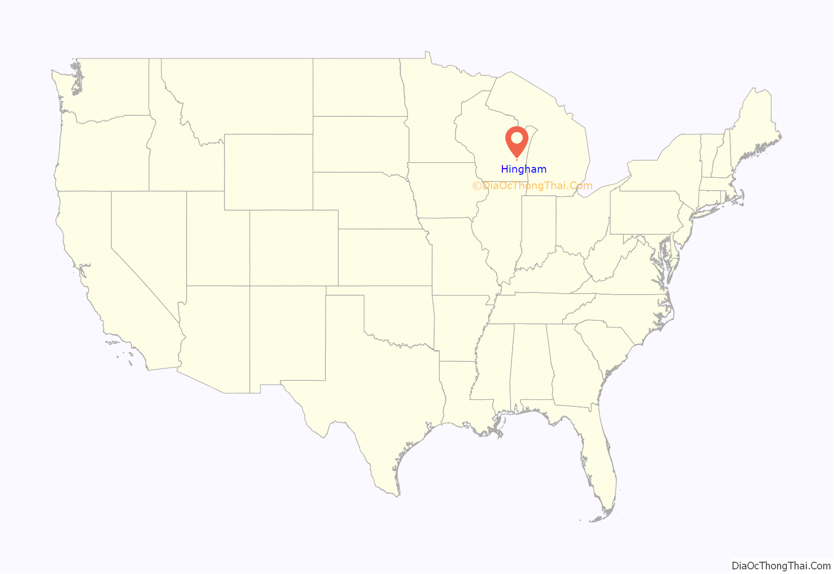
Hingham location map. Where is Hingham CDP?

History
Hingham was platted on September 5, 1850, by Edward Hobart. The land was acquired from Mrs. David Giddings, who had bought it from the U.S. government in 1846. Streets on the original plat included Water, Center, Spring, South and Main. It was named after Hingham, Massachusetts.
Hingham Road Map

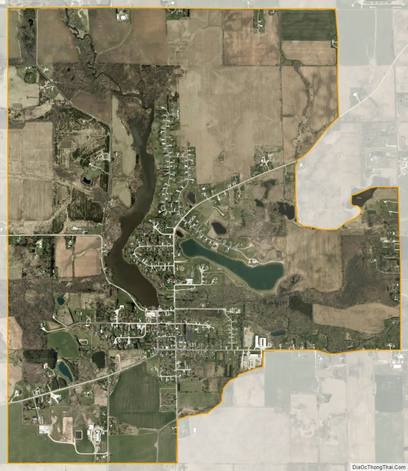
Hingham city Satellite Map
See also
Map of Wisconsin State and its subdivision:- Adams
- Ashland
- Barron
- Bayfield
- Brown
- Buffalo
- Burnett
- Calumet
- Chippewa
- Clark
- Columbia
- Crawford
- Dane
- Dodge
- Door
- Douglas
- Dunn
- Eau Claire
- Florence
- Fond du Lac
- Forest
- Grant
- Green
- Green Lake
- Iowa
- Iron
- Jackson
- Jefferson
- Juneau
- Kenosha
- Kewaunee
- La Crosse
- Lafayette
- Lake Michigan
- Lake Superior
- Langlade
- Lincoln
- Manitowoc
- Marathon
- Marinette
- Marquette
- Menominee
- Milwaukee
- Monroe
- Oconto
- Oneida
- Outagamie
- Ozaukee
- Pepin
- Pierce
- Polk
- Portage
- Price
- Racine
- Richland
- Rock
- Rusk
- Saint Croix
- Sauk
- Sawyer
- Shawano
- Sheboygan
- Taylor
- Trempealeau
- Vernon
- Vilas
- Walworth
- Washburn
- Washington
- Waukesha
- Waupaca
- Waushara
- Winnebago
- Wood
- Alabama
- Alaska
- Arizona
- Arkansas
- California
- Colorado
- Connecticut
- Delaware
- District of Columbia
- Florida
- Georgia
- Hawaii
- Idaho
- Illinois
- Indiana
- Iowa
- Kansas
- Kentucky
- Louisiana
- Maine
- Maryland
- Massachusetts
- Michigan
- Minnesota
- Mississippi
- Missouri
- Montana
- Nebraska
- Nevada
- New Hampshire
- New Jersey
- New Mexico
- New York
- North Carolina
- North Dakota
- Ohio
- Oklahoma
- Oregon
- Pennsylvania
- Rhode Island
- South Carolina
- South Dakota
- Tennessee
- Texas
- Utah
- Vermont
- Virginia
- Washington
- West Virginia
- Wisconsin
- Wyoming