Lodi (/ˈloʊ.daɪ/ LOH-dye) is a city in Columbia County, Wisconsin, United States. The population was 3,189 at the 2020 census. Lodi is part of the Madison Metropolitan Statistical Area.
| Name: | Lodi city |
|---|---|
| LSAD Code: | 25 |
| LSAD Description: | city (suffix) |
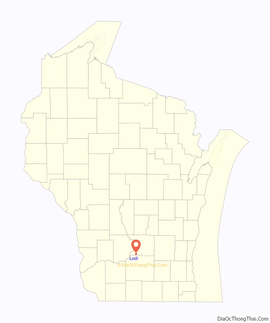
| State: | Wisconsin |
| County: | Columbia County |
| Founded: | 1846 |
| Total Area: | 1.73 sq mi (4.48 km²) |
| Land Area: | 1.73 sq mi (4.48 km²) |
| Water Area: | 0.00 sq mi (0.00 km²) |
| Total Population: | 3,189 |
| Population Density: | 1,789.35/sq mi (690.85/km²) |
| Area code: | 608 |
| FIPS code: | 5545350 |
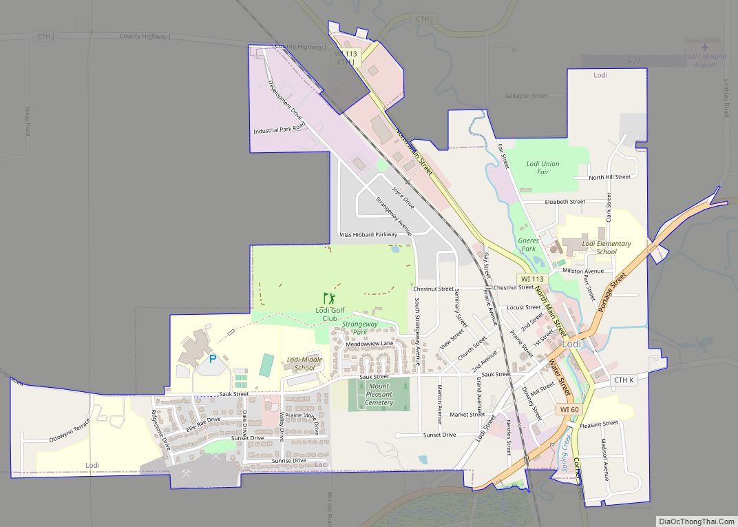
Online Interactive Map
Click on ![]() to view map in "full screen" mode.
to view map in "full screen" mode.
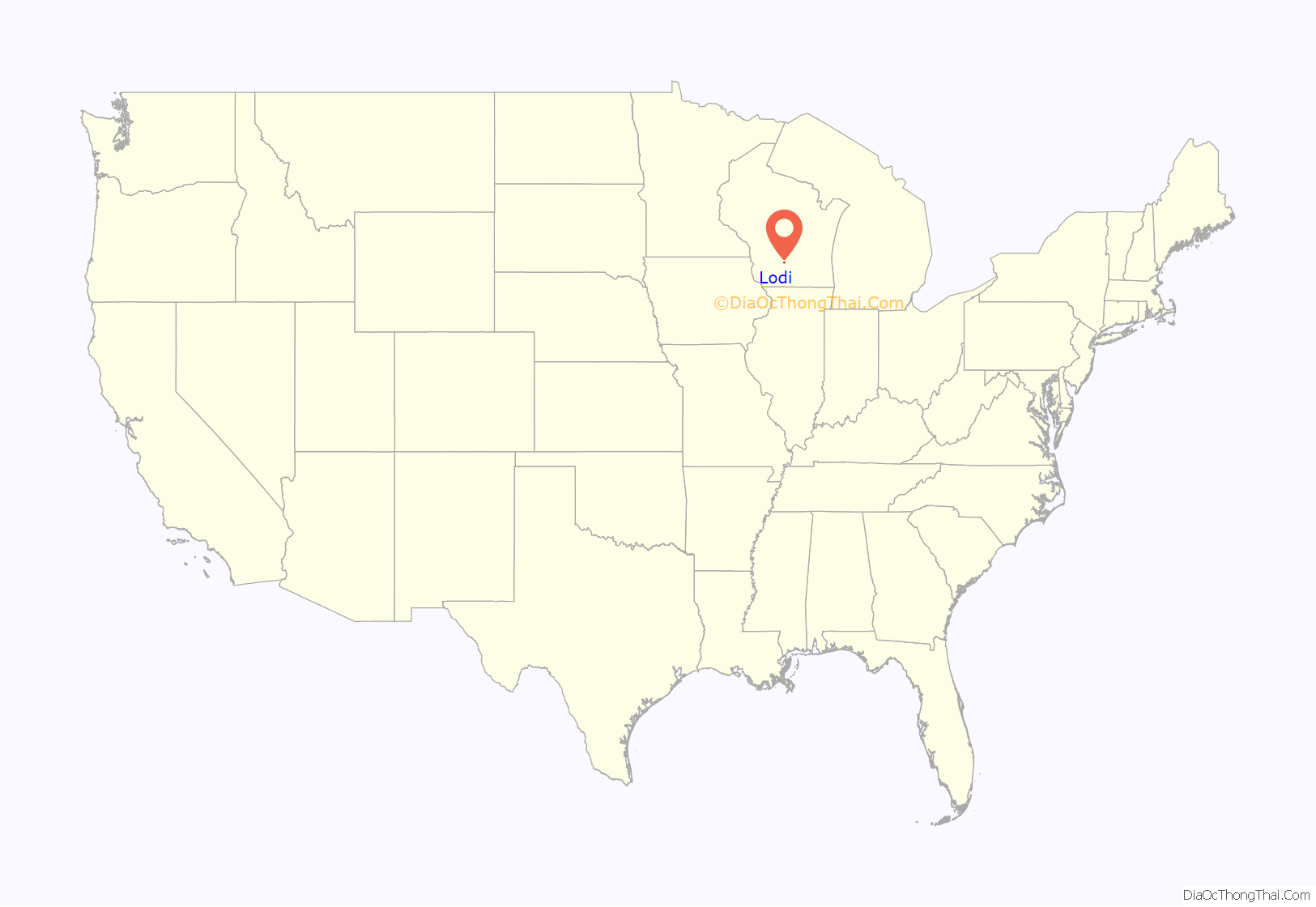
Lodi location map. Where is Lodi city?
History
The scenic Town of Lodi area had long been a home of Native Americans before the first settlers, Marston and George Bartholomew, arrived in 1945 and staked their claim. By 1846 a county government was established which created Pleasant Valley Precinct. The Town of Lodi was created in 1849. Isaac Palmer founded the village of Lodi in 1846 in what was then the Pleasant Valley Precinct of the Wisconsin Territory. He named it after Lodi, in Italy. Palmer chose this glaciated valley as the location for the village because of its water power potential. Spring Creek powered a sawmill that year and a grist mill followed in 1850.
Historic places
- Frank T. and Polly Lewis House
- Lodi School Hillside Improvement Site
- Portage Street Historic District
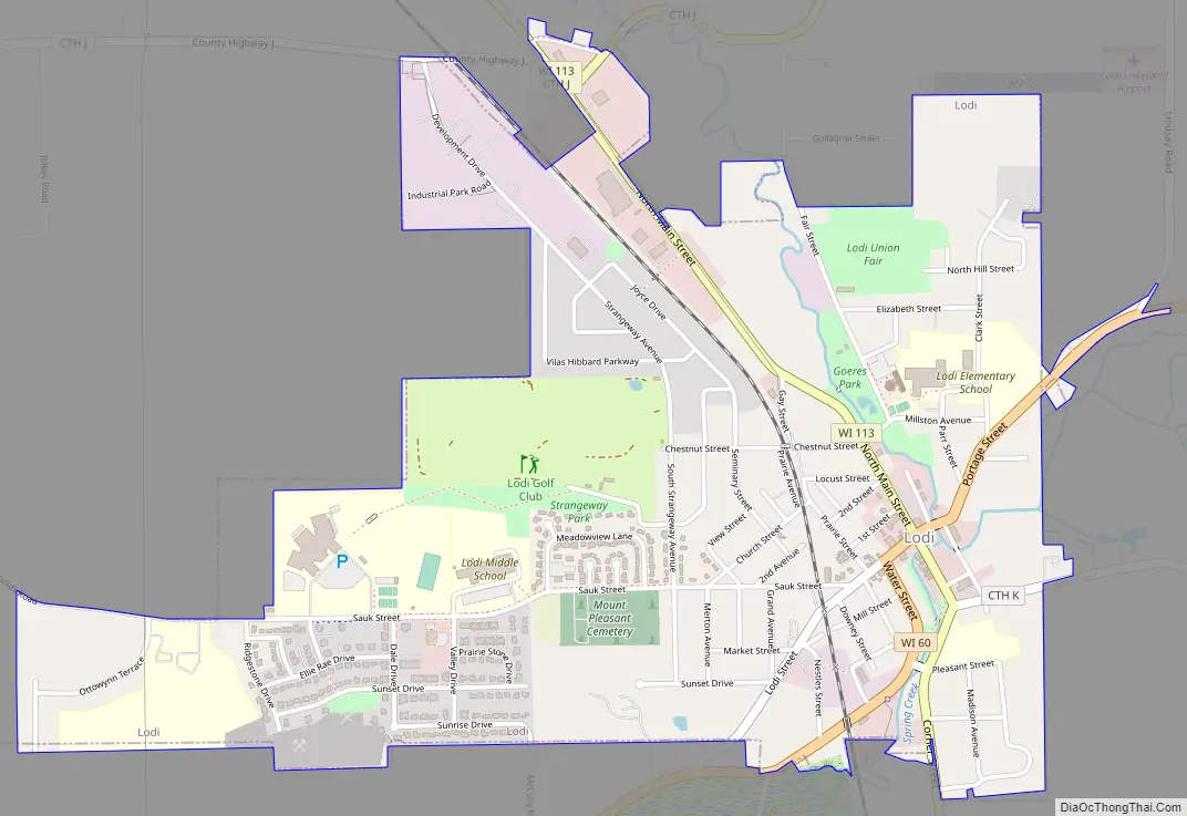
Lodi Road Map
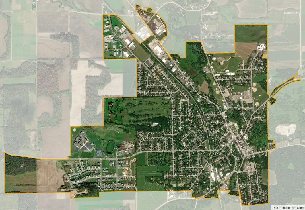
Lodi city Satellite Map
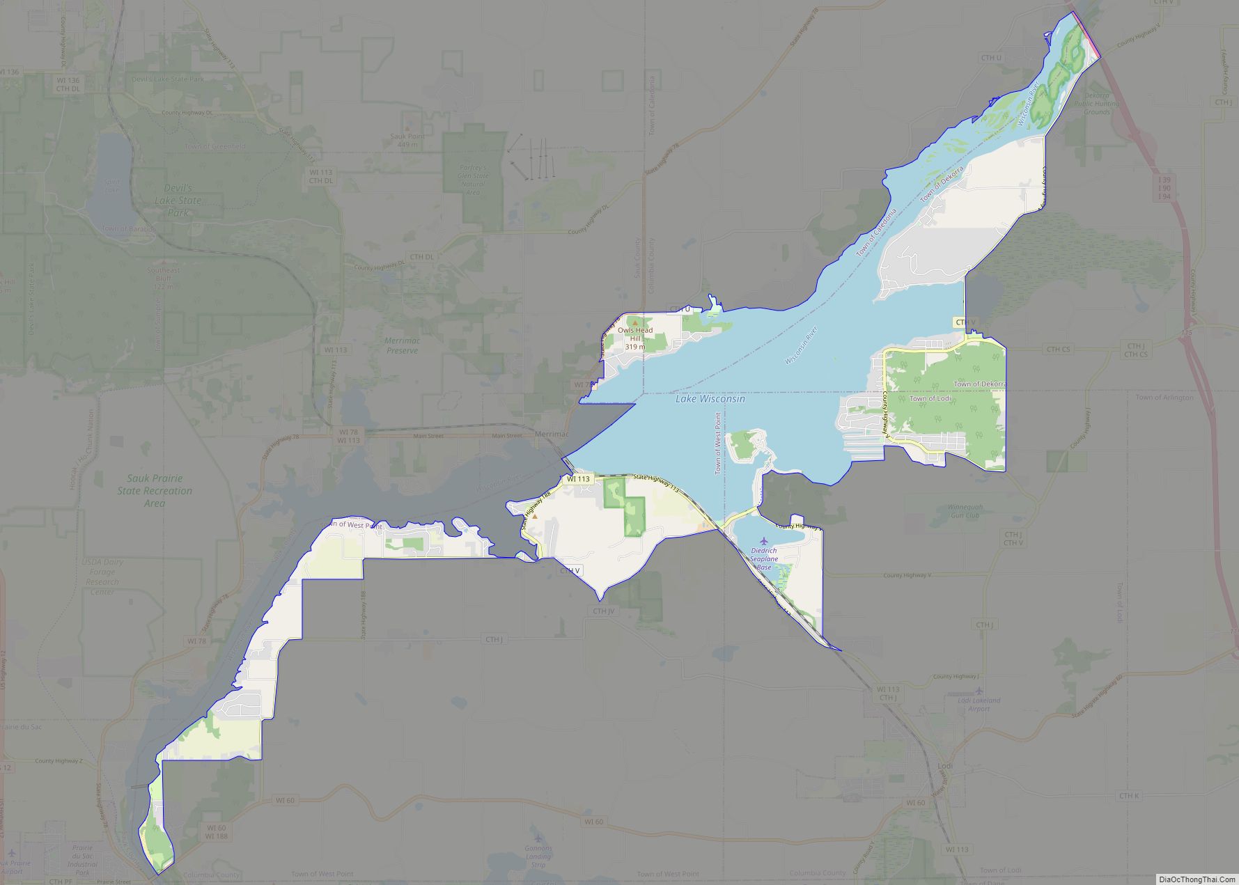
Geography
Lodi is located at 43°18′51″N 89°31′51″W / 43.31417°N 89.53083°W / 43.31417; -89.53083 (43.314296, −89.530994).
According to the United States Census Bureau, the city has a total area of 1.77 square miles (4.58 km), all of it land.
Spring Creek, which runs from the Lodi Marsh through downtown Lodi and empties into Lake Wisconsin, is a local spring-fed brown trout stream. Portions of the creek do not freeze over the winter and thus serve as host to brown trout and waterfowl, particularly mallards. Lodi has adopted a Spring Creek resident mallard, which the residents have named “Susie the Duck”, as a mascot.
The city is completely surrounded by the town of Lodi.
See also
Map of Wisconsin State and its subdivision:- Adams
- Ashland
- Barron
- Bayfield
- Brown
- Buffalo
- Burnett
- Calumet
- Chippewa
- Clark
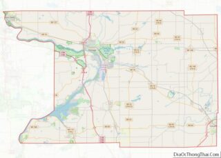
- Columbia
- Crawford
- Dane
- Dodge
- Door
- Douglas
- Dunn
- Eau Claire
- Florence
- Fond du Lac
- Forest
- Grant
- Green
- Green Lake
- Iowa
- Iron
- Jackson
- Jefferson
- Juneau
- Kenosha
- Kewaunee
- La Crosse
- Lafayette
- Lake Michigan
- Lake Superior
- Langlade
- Lincoln
- Manitowoc
- Marathon
- Marinette
- Marquette
- Menominee
- Milwaukee
- Monroe
- Oconto
- Oneida
- Outagamie
- Ozaukee
- Pepin
- Pierce
- Polk
- Portage
- Price
- Racine
- Richland
- Rock
- Rusk
- Saint Croix
- Sauk
- Sawyer
- Shawano
- Sheboygan
- Taylor
- Trempealeau
- Vernon
- Vilas
- Walworth
- Washburn
- Washington
- Waukesha
- Waupaca
- Waushara
- Winnebago
- Wood
- Alabama
- Alaska
- Arizona
- Arkansas
- California
- Colorado
- Connecticut
- Delaware
- District of Columbia
- Florida
- Georgia
- Hawaii
- Idaho
- Illinois
- Indiana
- Iowa
- Kansas
- Kentucky
- Louisiana
- Maine
- Maryland
- Massachusetts
- Michigan
- Minnesota
- Mississippi
- Missouri
- Montana
- Nebraska
- Nevada
- New Hampshire
- New Jersey
- New Mexico
- New York
- North Carolina
- North Dakota
- Ohio
- Oklahoma
- Oregon
- Pennsylvania
- Rhode Island
- South Carolina
- South Dakota
- Tennessee
- Texas
- Utah
- Vermont
- Virginia
- Washington
- West Virginia
- Wisconsin
- Wyoming