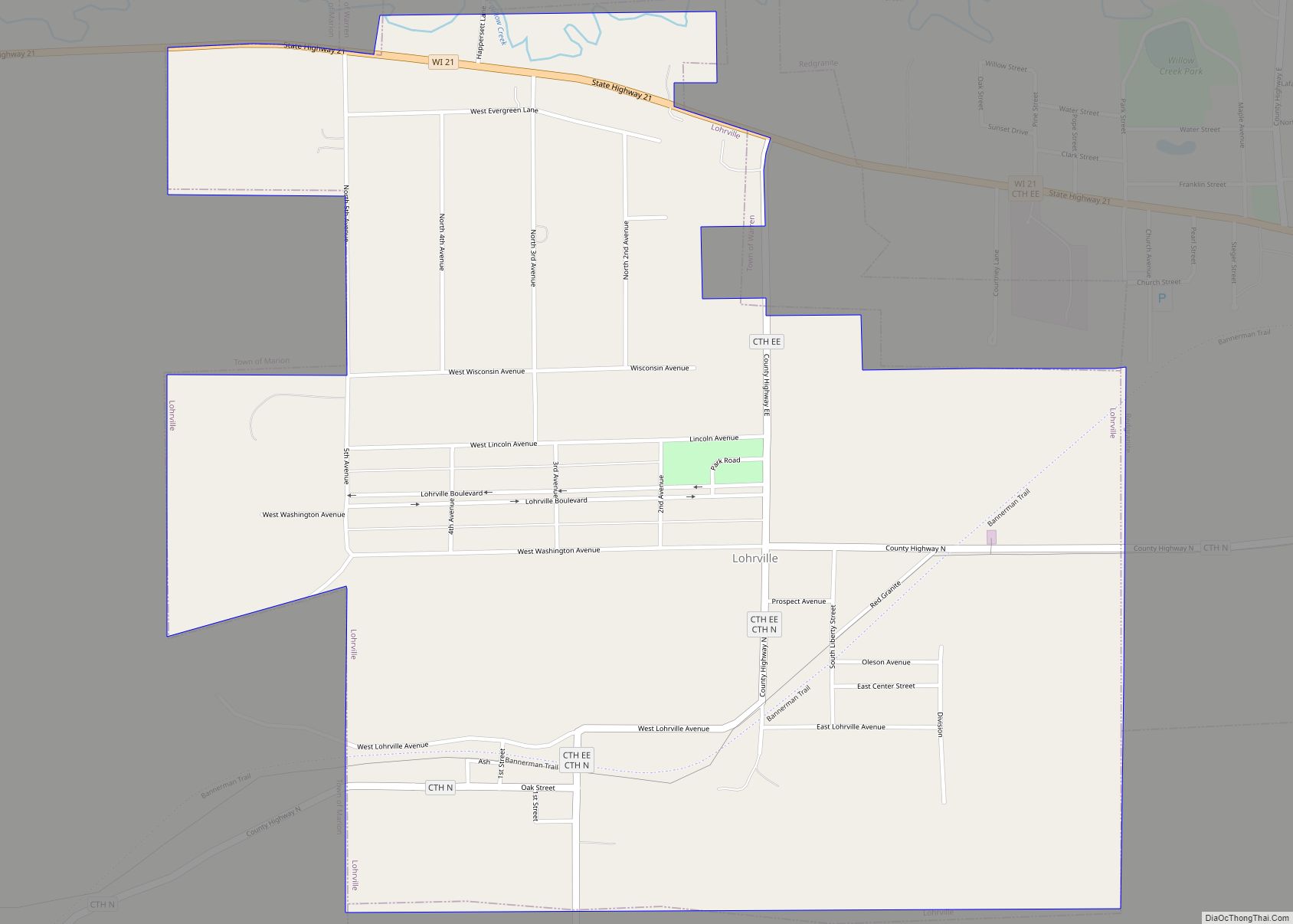
Lohrville is a village in Waushara County, Wisconsin, United States. The population was 402 at the 2010 census.
| Name: | Lohrville village |
|---|---|
| LSAD Code: | 47 |
| LSAD Description: | village (suffix) |
| State: | Wisconsin |
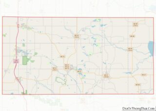
| County: | Waushara County |
| Elevation: | 804 ft (245 m) |
| Total Area: | 1.22 sq mi (3.17 km²) |
| Land Area: | 1.21 sq mi (3.14 km²) |
| Water Area: | 0.01 sq mi (0.03 km²) |
| Total Population: | 402 |
| Population Density: | 320.43/sq mi (123.69/km²) |
| FIPS code: | 5545425 |
| GNISfeature ID: | 1568499 |
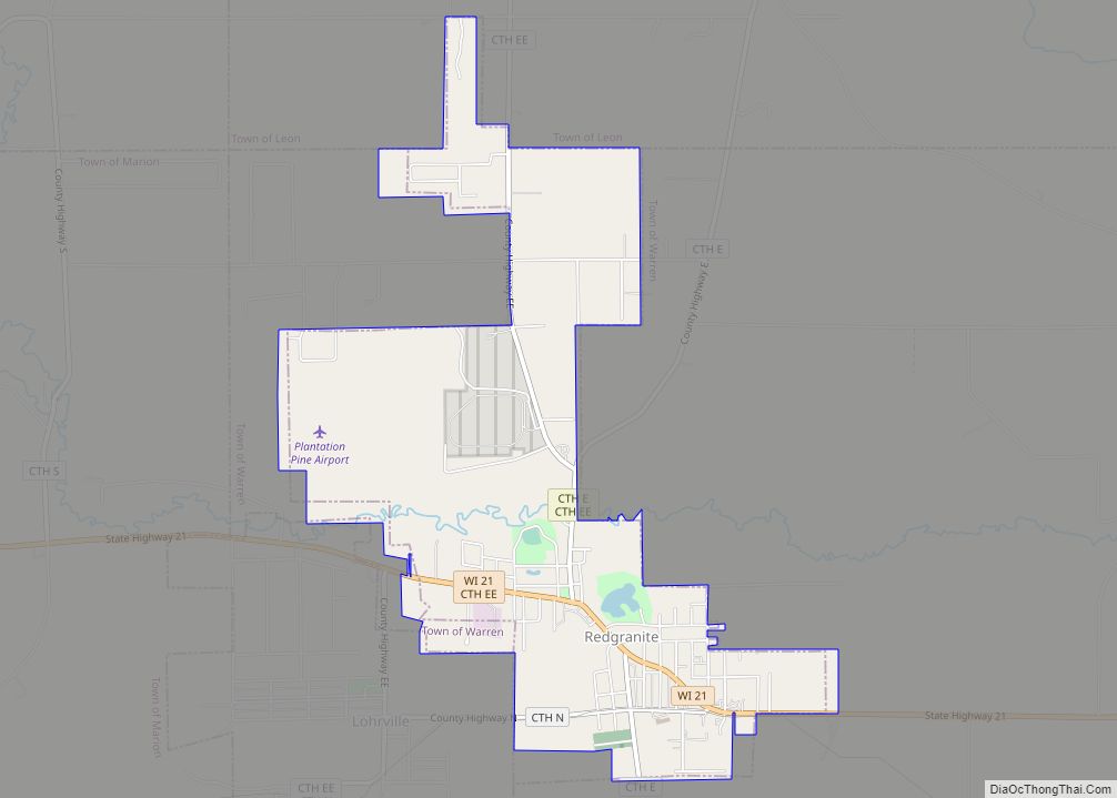
Online Interactive Map
Click on ![]() to view map in "full screen" mode.
to view map in "full screen" mode.
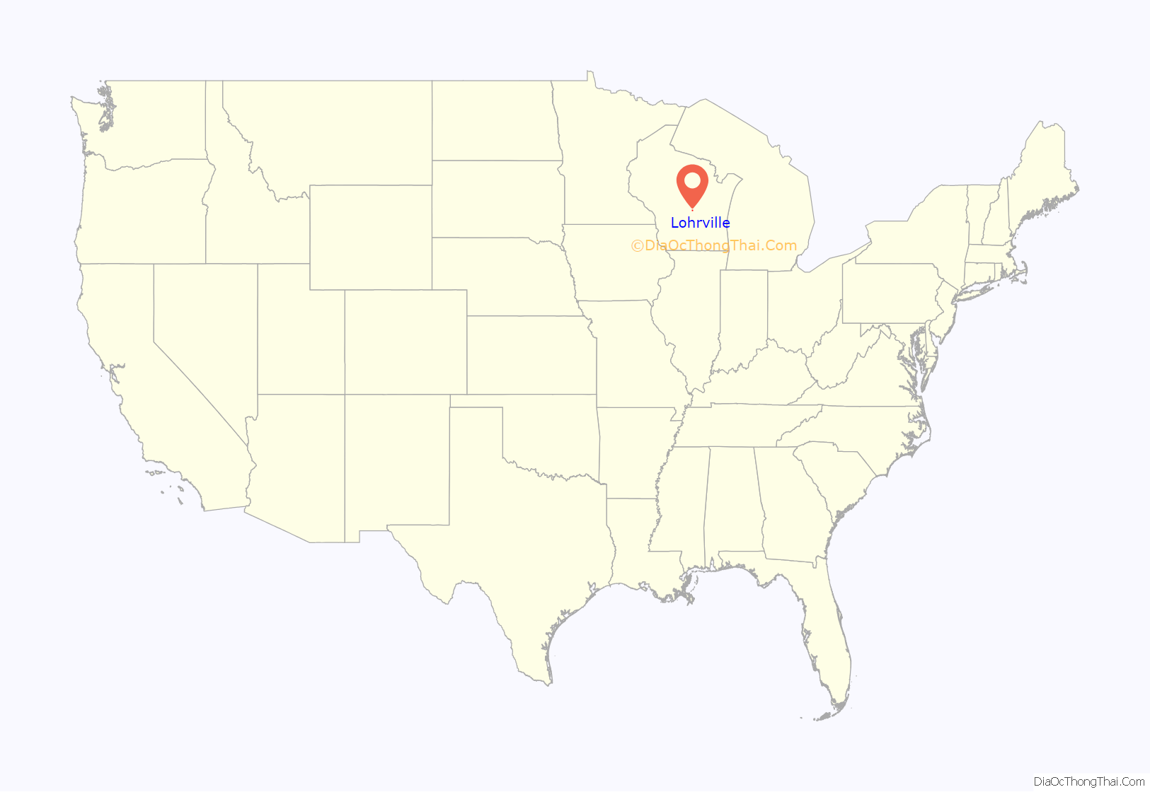
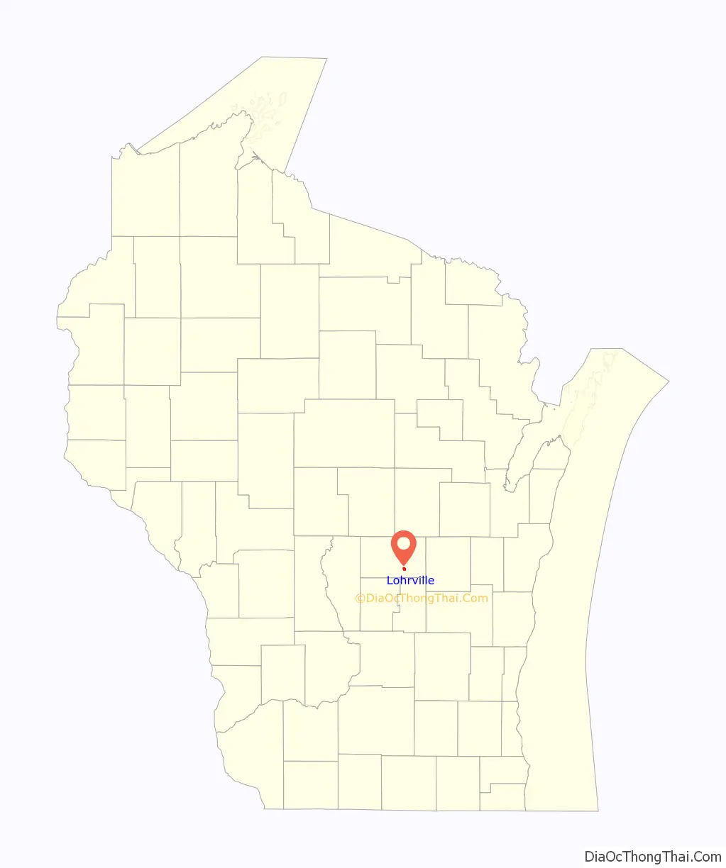
Lohrville location map. Where is Lohrville village?
History
The American Granite Company started quarrying operations in what is now Lohrville in 1906. The village was named for the company’s first president, Charles Lohr. Lohrville’s population grew as workers moved to the area seeking employment in the quarries, and the Chicago and North Western Railway Company built a spur line to the quarries. The village incorporated in 1910.
By 1920, Lohrville had a population of 245, though by 1940 the population had declined to 191.
The railways has since been abandoned and converted to a rail trail called the Bannerman Trail.
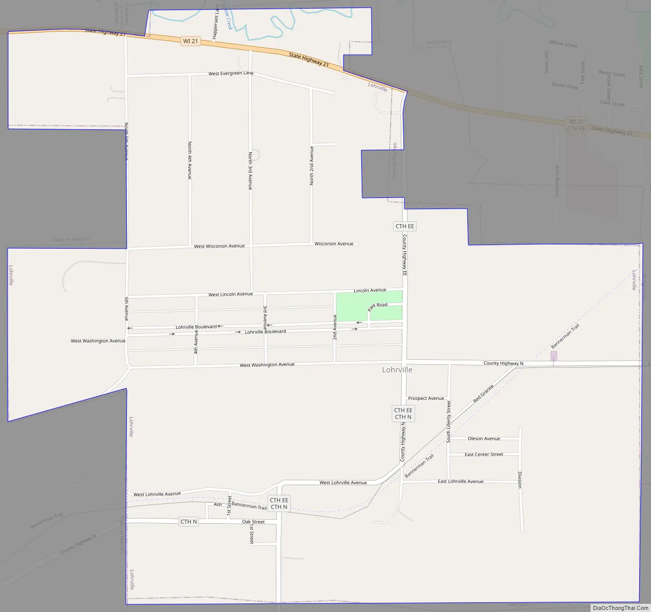
Lohrville Road Map
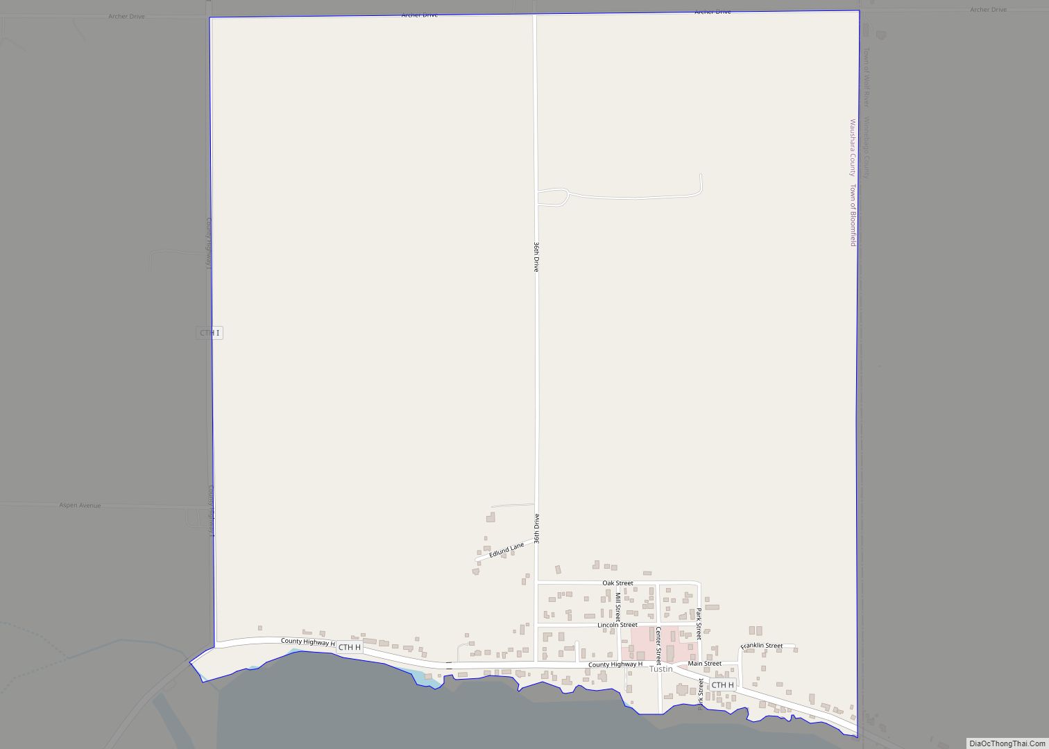
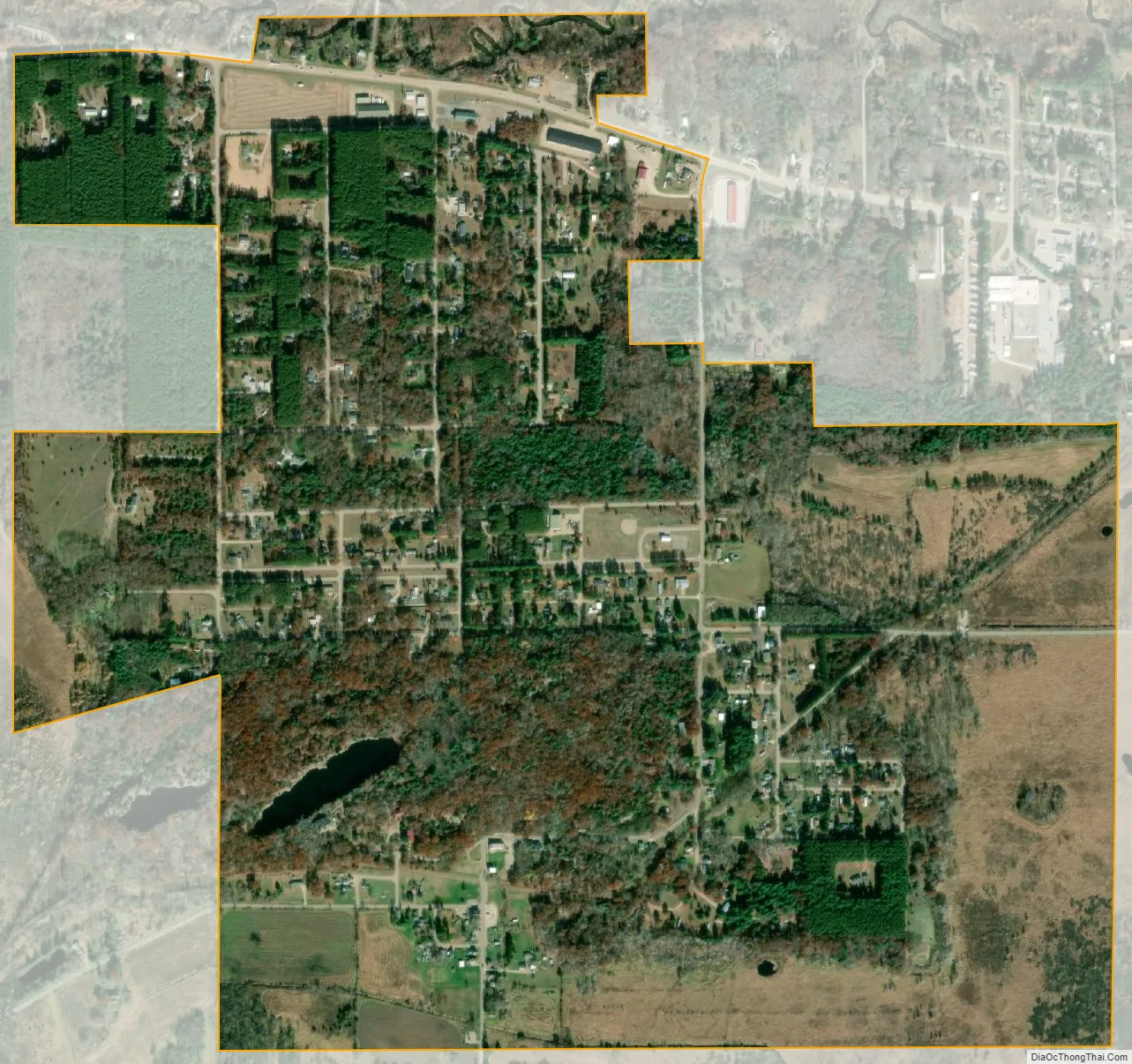
Lohrville city Satellite Map
Geography
Lohrville is located at 44°2′19″N 89°7′17″W / 44.03861°N 89.12139°W / 44.03861; -89.12139 (44.038700, -89.121266).
According to the United States Census Bureau, the village has a total area of 1.24 square miles (3.21 km), of which, 1.23 square miles (3.19 km) of it is land and 0.01 square miles (0.03 km) is water.
See also
Map of Wisconsin State and its subdivision:- Adams
- Ashland
- Barron
- Bayfield
- Brown
- Buffalo
- Burnett
- Calumet
- Chippewa
- Clark
- Columbia
- Crawford
- Dane
- Dodge
- Door
- Douglas
- Dunn
- Eau Claire
- Florence
- Fond du Lac
- Forest
- Grant
- Green
- Green Lake
- Iowa
- Iron
- Jackson
- Jefferson
- Juneau
- Kenosha
- Kewaunee
- La Crosse
- Lafayette
- Lake Michigan
- Lake Superior
- Langlade
- Lincoln
- Manitowoc
- Marathon
- Marinette
- Marquette
- Menominee
- Milwaukee
- Monroe
- Oconto
- Oneida
- Outagamie
- Ozaukee
- Pepin
- Pierce
- Polk
- Portage
- Price
- Racine
- Richland
- Rock
- Rusk
- Saint Croix
- Sauk
- Sawyer
- Shawano
- Sheboygan
- Taylor
- Trempealeau
- Vernon
- Vilas
- Walworth
- Washburn
- Washington
- Waukesha
- Waupaca
- Waushara
- Winnebago
- Wood
- Alabama
- Alaska
- Arizona
- Arkansas
- California
- Colorado
- Connecticut
- Delaware
- District of Columbia
- Florida
- Georgia
- Hawaii
- Idaho
- Illinois
- Indiana
- Iowa
- Kansas
- Kentucky
- Louisiana
- Maine
- Maryland
- Massachusetts
- Michigan
- Minnesota
- Mississippi
- Missouri
- Montana
- Nebraska
- Nevada
- New Hampshire
- New Jersey
- New Mexico
- New York
- North Carolina
- North Dakota
- Ohio
- Oklahoma
- Oregon
- Pennsylvania
- Rhode Island
- South Carolina
- South Dakota
- Tennessee
- Texas
- Utah
- Vermont
- Virginia
- Washington
- West Virginia
- Wisconsin
- Wyoming